
The Reserves at Meadow Wood
2513-2517 Woodhill Dr,
Fort Mitchell, KY 41017
$1,195 - $1,395
1-2 Beds
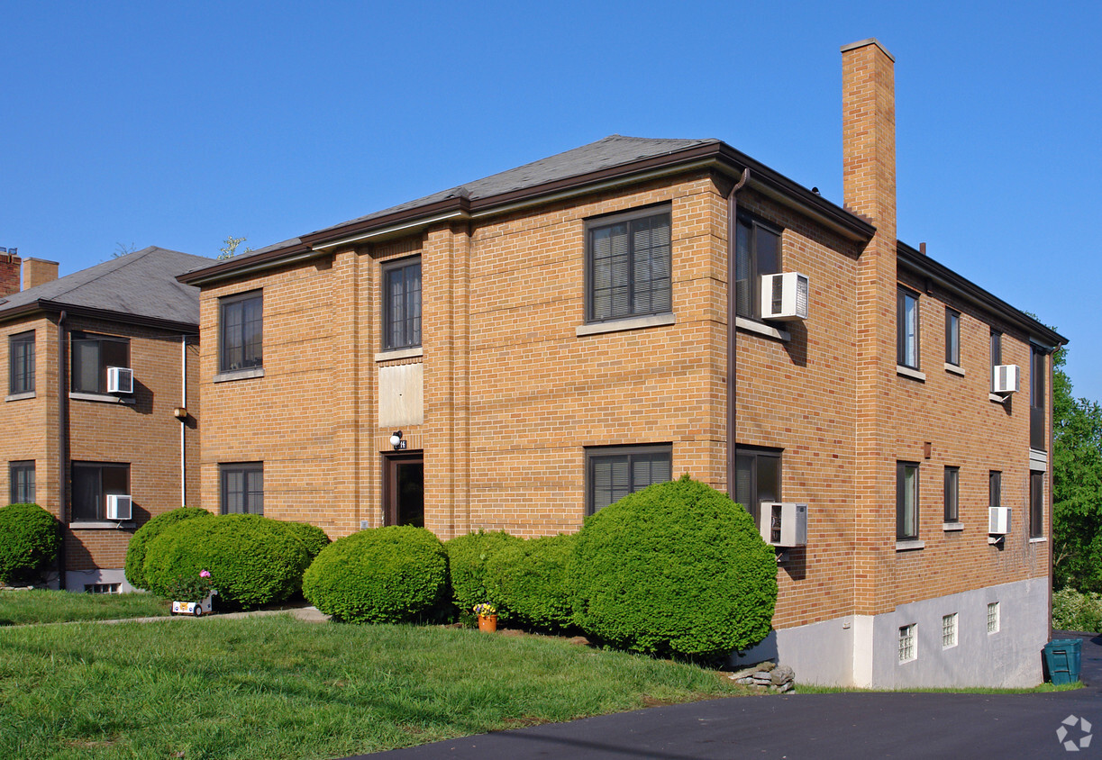
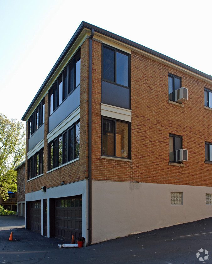
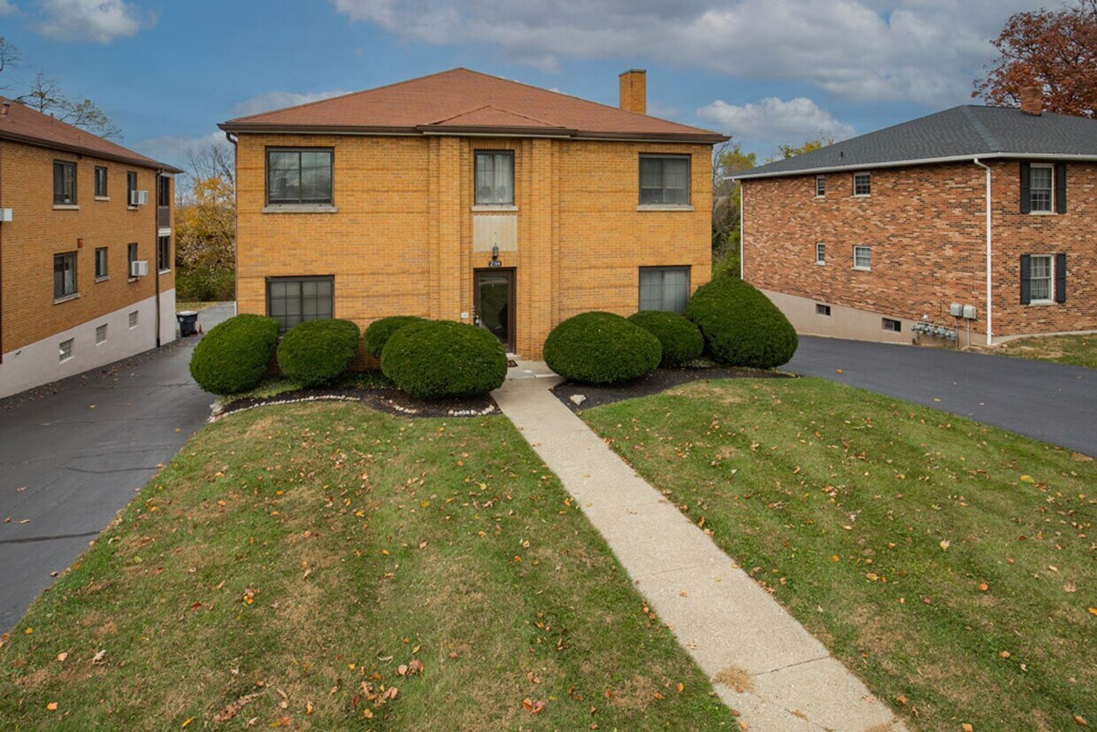

2314-2316 Dixie Hwy offers a combination of quality and design. This community is located in the Kenton County area of Fort Mitchell. The professional leasing team will assist you in finding the perfect apartment. It's time to find your new home. Contact or stop by the 2314-2316 Dixie Hwy leasing office to schedule a tour.
2314-2316 Dixie Hwy is an apartment community located in Kenton County and the 41017 ZIP Code. This area is served by the Beechwood Independent attendance zone.
Fort Mitchell, Kentucky, sits just five miles southwest of Cincinnati in Kenton County, making it a close-in community with strong ties to one of the Midwest's most recognized metro areas. The city has deep roots, having served as the site of Civil War fortifications built for the Defense of Cincinnati and named after General Ormsby M. Mitchel. Today, Fort Mitchell is home to the one-of-a-kind Vent Haven Museum, the world's only ventriloquist museum, and draws residents to community events like the Annual Fourth of July Parade. If you're browsing apartments for rent in Fort Mitchell, you'll find a small-city atmosphere that keeps you close to big-city conveniences.
Renters in Fort Mitchell can choose from garden-style apartment communities, condos, and townhomes spread across a compact four-square-mile area. The city's tree-lined streets and residential character give it a relaxed pace, while nearby Devou Park offers walking trails and open green space for outdoor recreation.
Learn more about living in Fort Mitchell| Colleges & Universities | Distance | ||
|---|---|---|---|
| Colleges & Universities | Distance | ||
| Drive: | 6 min | 2.4 mi | |
| Drive: | 15 min | 8.6 mi | |
| Drive: | 15 min | 9.5 mi | |
| Drive: | 22 min | 12.6 mi |


Transportation options available in Fort Mitchell include The Banks Station - 2Nd & Main, located 5.4 miles from 2314-2316 Dixie Hwy. 2314-2316 Dixie Hwy is near Cincinnati/Northern Kentucky International, located 7.9 miles or 20 minutes away.
| Transit / Subway | Distance | ||
|---|---|---|---|
| Transit / Subway | Distance | ||
| Drive: | 9 min | 5.4 mi | |
| Drive: | 9 min | 5.5 mi | |
| Drive: | 9 min | 5.6 mi | |
| Drive: | 10 min | 5.7 mi | |
| Drive: | 10 min | 5.8 mi |
| Commuter Rail | Distance | ||
|---|---|---|---|
| Commuter Rail | Distance | ||
|
|
Drive: | 12 min | 6.5 mi |
| Airports | Distance | ||
|---|---|---|---|
| Airports | Distance | ||
|
Cincinnati/Northern Kentucky International
|
Drive: | 20 min | 7.9 mi |
Scores provided by
Traffic
-Airport
-Businesses
-Scores provided by
HowLoud What is a Sound Score Rating? A Sound Score Rating aggregates noise caused by vehicle traffic, airplane traffic and local sources. How It WorksTime and distance from 2314-2316 Dixie Hwy.
| Shopping Centers | Distance | ||
|---|---|---|---|
| Shopping Centers | Distance | ||
| Walk: | 8 min | 0.4 mi | |
| Walk: | 12 min | 0.6 mi | |
| Walk: | 20 min | 1.1 mi |
| Parks and Recreation | Distance | ||
|---|---|---|---|
| Parks and Recreation | Distance | ||
|
John G. & Phyllis W. Smale Riverfront Park
|
Drive: | 9 min | 5.5 mi |
|
Newport Aquarium
|
Drive: | 12 min | 6.6 mi |
|
Wilson Commons
|
Drive: | 12 min | 7.6 mi |
|
Imago Earth Center
|
Drive: | 15 min | 8.8 mi |
|
Embshoff Woods
|
Drive: | 18 min | 10.4 mi |
| Hospitals | Distance | ||
|---|---|---|---|
| Hospitals | Distance | ||
| Drive: | 7 min | 3.1 mi | |
| Drive: | 7 min | 3.9 mi | |
| Drive: | 10 min | 6.5 mi |
| Military Bases | Distance | ||
|---|---|---|---|
| Military Bases | Distance | ||
| Drive: | 78 min | 60.0 mi | |
| Drive: | 84 min | 65.0 mi | |
| Drive: | 86 min | 68.3 mi |
What Are Walk Score®, Transit Score®, and Bike Score® Ratings?
Walk Score® measures the walkability of any address. Transit Score® measures access to public transit. Bike Score® measures the bikeability of any address.
What is a Sound Score Rating?
A Sound Score Rating aggregates noise caused by vehicle traffic, airplane traffic and local sources.

2314-2316 Dixie Hwy
Fort Mitchell, KY 41017


