$3,095 / Month
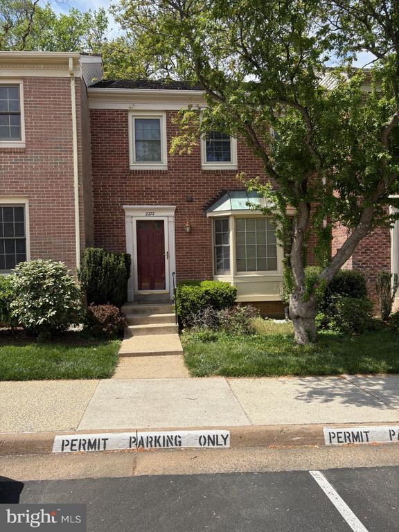
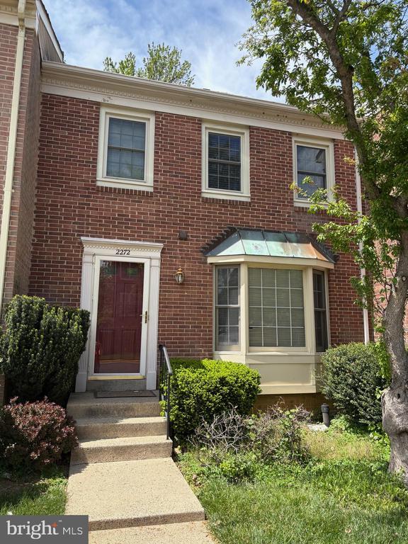
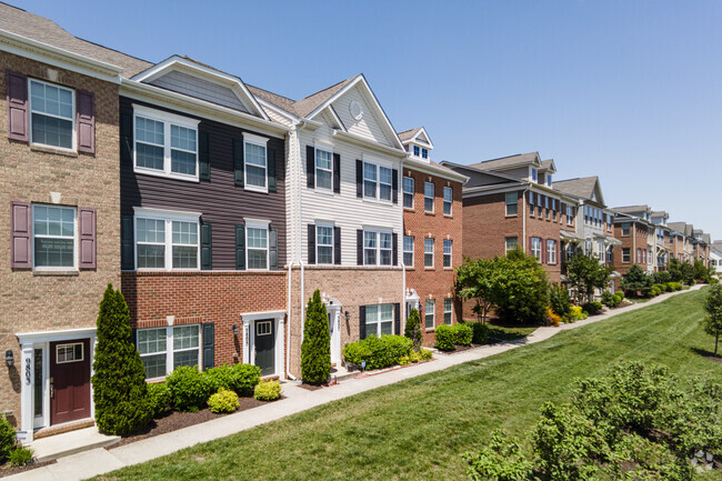
2272 Cartbridge Rd
Falls Church, VA 22043
Today
Favorites
703-216-4981
-
Bedrooms
3
-
Bathrooms
2
-
Square Feet
--
-
Available
Available Now
Highlights
- Colonial Architecture
- 1 Fireplace
- Forced Air Heating and Cooling System
2272 Cartbridge Rd

Favorites
About This Home
Available Now
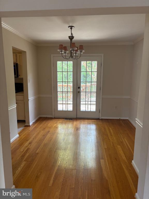
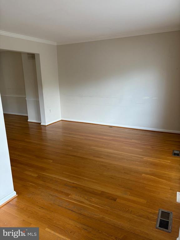
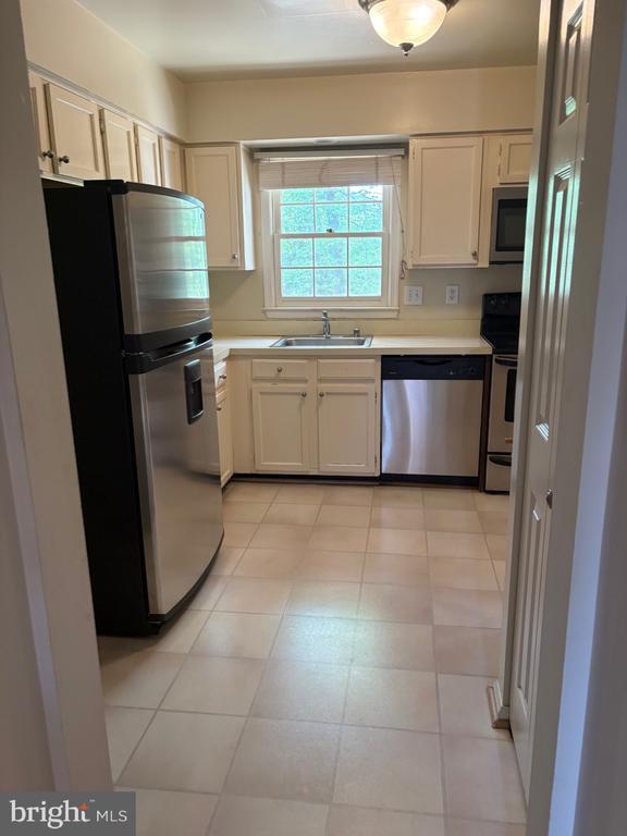
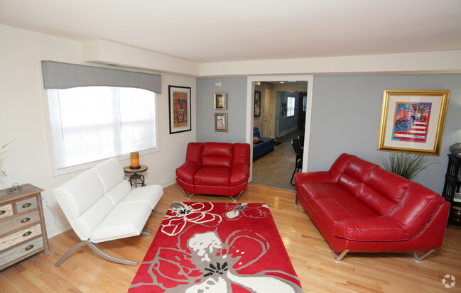
Welcome home to Cartbridge Road in Idylwood Station. Convenient to Rt. 7, Rt. 66 and 495. Located a mile from the West Falls Church Metro. This is the idea location for commuting, everyday needs and entertainment . Very close to Tyson's Corner, Seven Corners, Mosaic District and other shopping. This home is ready for it's next tenant. BRAND New carpet in basement, freshly painted, kitchen cabinets painted, new hardware and toilet in the bathroom and new bedroom closet door. The rear deck was newly painted. Tenant pays all utilities.
2272 Cartbridge Rd is a townhome located in Fairfax County and the 22043 ZIP Code. This area is served by the Fairfax County Public Schools attendance zone.
* Price shown is base rent and may not include non-optional fees and utilities.
Price, availability, fees, and any applicable rent special are subject to change without notice.
* Square footage definitions vary. Displayed square footage is approximate.
Home Details
Home Type
Interior Unit Townhome
Year Built
Built in 1982
Bedrooms and Bathrooms
3 Bathrooms
3 Bedrooms
Finished Basement
Connecting Stairway
Rear Basement Entry
Home Design
Colonial Architecture
Aluminum Siding
Slab Foundation
Interior Spaces
1 Fireplace
1,528 Sq Ft Home
Property has 3 Levels
Kitchen
Stove
Built-In Microwave
Dishwasher
Disposal
Laundry
Dryer
Laundry in unit
Washer
Listing and Financial Details
Security Deposit $3,200
12-Month Min and 36-Month Max Lease Term
Available 4/21/25
Assessor Parcel Number 0403 30 0014
Tenant pays for electricity, fireplace/flue cleaning, gas, gutter cleaning, lawn/tree/shrub care, light bulbs/filters/fuses/alarm care, all utilities, water, frozen waterpipe damage
Rent includes parking, trash removal, snow removal
No Smoking Allowed
Residential Lease
Lot Details
1,430 Sq Ft Lot
Parking
Unassigned Parking
Schools
Shrevewood Elementary School
Kilmer Middle School
Marshall High School
Utilities
Forced Air Heating and Cooling System
Natural Gas Water Heater
Vented Exhaust Fan
Community Details
Overview
No Home Owners Association
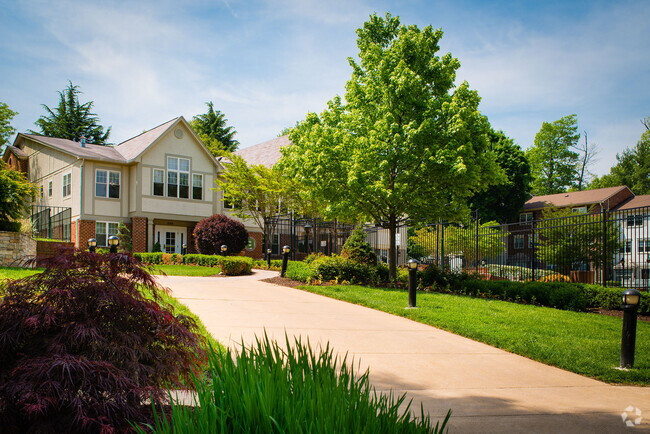
Idylwood Station Subdivision
Pet Policy
No Pets Allowed
Contact
- Listed by Jennifer Toothman | Long & Foster Real Estate, Inc.
- Phone Number
- Contact
-
Source
 Bright MLS, Inc.
Copyright © 2025 Bright MLS, Inc.
Location
Get Directions
Amenities
- Fireplace
- Dishwasher
- Basement
Outstanding tacos and quality education may seem like an odd pair, but it sure does work for Pimmit Hills! Taco Bamba is a staple to living in Pimmit Hills with its quick and delicious tacos that are food truck style, so be sure to check it out after you find you perfect apartment. And don’t forget about the quality public schools in Fairfax County Public Schools, along with various high-ranking private schools.
This upscale neighborhood boasts a premier location just 13 miles west of Washington D.C. with various apartment rentals. The nation’s capital is at your fingertips when you live in this quaint neighborhood. You can visit the Smithsonian National Zoo, admire the Washington Monument, or even tour the White House! And if you’re interested in visiting other neighboring areas for work or play, this neighborhood is completely commuter-friendly, as it’s surrounded by major interstates.
Learn more about living in Pimmit Hills
Education
| Colleges & Universities | Distance | ||
|---|---|---|---|
| Colleges & Universities | Distance | ||
| Drive: | 12 min | 5.5 mi | |
| Drive: | 12 min | 6.5 mi | |
| Drive: | 12 min | 7.1 mi | |
| Drive: | 18 min | 8.8 mi |
2272 Cartbridge Rd is within 12 minutes or 5.5 miles from Marymount University. It is also near George Mason Univ., Arlington and NOVA, Annandale Campus.
Schools


Public Elementary School
Grades PK-6
664 Students
Attendance Zone
Public Middle School
Grades 7-8
1,148 Students
Attendance Zone
Public High School
Grades 9-12
2,109 Students
Attendance Zone
Private Elementary & Middle School
Grades PK-8
435 Students
Nearby
Private Elementary & Middle School
Grades K-8
Nearby
Private Middle & High School
Grades 6-12
Nearby
School data provided by
 The GreatSchools Rating helps parents compare schools within a state based on a variety of school quality indicators and provides a helpful picture of how effectively each school serves all of its students. Ratings are on a scale of 1 (below average) to 10 (above average) and can include test scores, college readiness, academic progress, advanced courses, equity, discipline and attendance data. We also advise parents to visit schools, consider other information on school performance and programs, and consider family needs as part of the school selection process.
View GreatSchools Rating Methodology
View GreatSchools Rating Methodology
Transportation options available in Falls Church include Mclean, Silver Line Center Platform, located 2.6 miles from 2272 Cartbridge Rd. 2272 Cartbridge Rd is near Ronald Reagan Washington Ntl, located 13.1 miles or 22 minutes away, and Washington Dulles International, located 17.0 miles or 31 minutes away.
| Transit / Subway | Distance | ||
|---|---|---|---|
| Transit / Subway | Distance | ||
| Drive: | 6 min | 2.6 mi | |
| Drive: | 6 min | 3.0 mi | |
| Drive: | 7 min | 3.2 mi | |
| Drive: | 11 min | 7.1 mi | |
| Drive: | 13 min | 7.7 mi |
| Commuter Rail | Distance | ||
|---|---|---|---|
| Commuter Rail | Distance | ||
|
|
Drive: | 18 min | 10.6 mi |
|
|
Drive: | 18 min | 10.8 mi |
|
|
Drive: | 19 min | 11.8 mi |
|
|
Drive: | 23 min | 12.9 mi |
|
|
Drive: | 24 min | 14.1 mi |
| Airports | Distance | ||
|---|---|---|---|
| Airports | Distance | ||
|
Ronald Reagan Washington Ntl
|
Drive: | 22 min | 13.1 mi |
|
Washington Dulles International
|
Drive: | 31 min | 17.0 mi |
Time and distance from 2272 Cartbridge Rd.
| Shopping Centers | Distance | ||
|---|---|---|---|
| Shopping Centers | Distance | ||
| Walk: | 12 min | 0.7 mi | |
| Walk: | 13 min | 0.7 mi | |
| Walk: | 20 min | 1.1 mi |
2272 Cartbridge Rd has 3 shopping centers within 1.1 miles, which is about a 20-minute walk. The miles and minutes will be for the farthest away property.
| Parks and Recreation | Distance | ||
|---|---|---|---|
| Parks and Recreation | Distance | ||
|
W&OD Trail
|
Drive: | 5 min | 2.8 mi |
|
Benjamin Banneker Park
|
Drive: | 6 min | 3.3 mi |
|
Parkhurst Park
|
Drive: | 9 min | 4.3 mi |
|
Upton Hill Regional Park
|
Drive: | 10 min | 4.8 mi |
|
Rock Spring Park
|
Drive: | 9 min | 4.8 mi |
2272 Cartbridge Rd has 5 parks within 4.8 miles, including W&OD Trail, Benjamin Banneker Park, and Parkhurst Park.
| Hospitals | Distance | ||
|---|---|---|---|
| Hospitals | Distance | ||
| Drive: | 10 min | 4.5 mi | |
| Drive: | 8 min | 4.5 mi | |
| Drive: | 8 min | 4.6 mi |
2272 Cartbridge Rd has 3 hospitals within 4.6 miles, the nearest is Dominion Hospital which is 4.5 miles away and a 10 minute drive.
| Military Bases | Distance | ||
|---|---|---|---|
| Military Bases | Distance | ||
| Drive: | 17 min | 8.7 mi |
2272 Cartbridge Rd is 8.7 miles and a 17 minute drive from Fort Myer.
You May Also Like
Similar Rentals Nearby


What Are Walk Score®, Transit Score®, and Bike Score® Ratings?
Walk Score® measures the walkability of any address. Transit Score® measures access to public transit. Bike Score® measures the bikeability of any address.
What is a Sound Score Rating?
A Sound Score Rating aggregates noise caused by vehicle traffic, airplane traffic and local sources

2272 Cartbridge Rd
Falls Church, VA 22043