
Isle House
39 Bruton St,
San Francisco, CA 94130
$3,090 - $7,635
Studio - 3 Beds

This walkable neighborhood is ideal for outdoor enthusiasts. Take a quick stroll to Lake Merritt to enjoy the scenic views and the friendly ambiance. The Bonsai Garden, Cleveland Cascade, Lake Merritt Amphitheatre, and Snow Park are perfect adventure opportunities. Surrounding this prime location are plenty of delicious restaurants and convenience stores. You don't have to go too far to get what you need in this Oakland gem.From the outside, this classic building is true to its vintage origins, however, the inside is revamped with modern amenities and chic updates. These charming apartments feature stainless steel kitchen appliances, hardwood floors, and large closets.
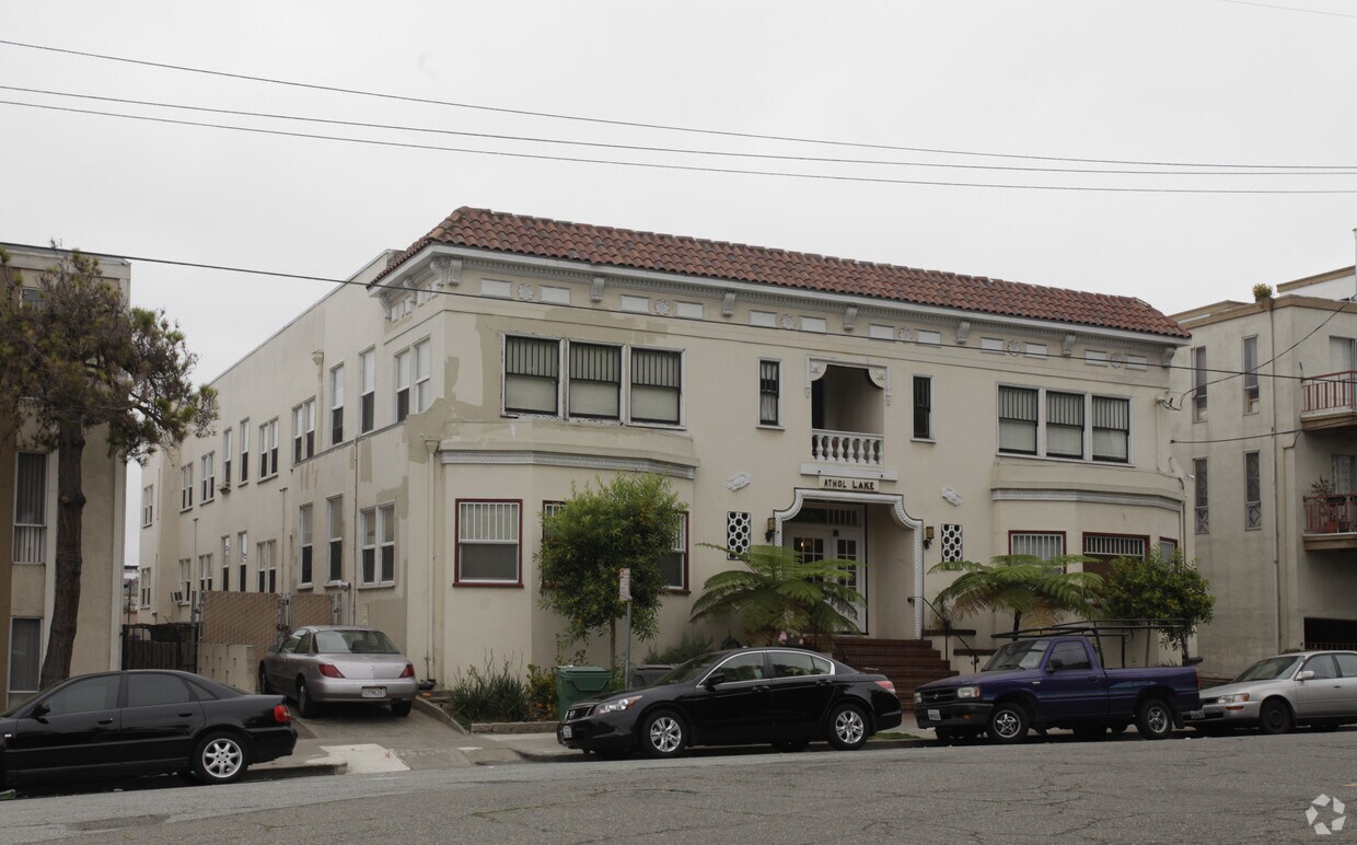
226 Athol is an apartment community located in Alameda County and the 94606 ZIP Code. This area is served by the Oakland Unified attendance zone.
Unique Features
Dishwasher
Hardwood Floors
Walk-In Closets
Microwave
Cleveland Heights is a quiet neighborhood nestled along the eastern shore of Lake Merritt, providing residents with easy access to over three miles of waterfront parks. Work out on the steps at Cleveland Cascade, view the lake at Pine Knoll Park, or visit the Pergola at Lake Merritt for a yoga class. Cleveland Heights has a variety of rental options available including apartments, condos, townhomes, and Mediterranean-style houses. The neighborhood is mainly residential, but there are restaurants and coffee shops scattered throughout the area. Cleveland Heights is also directly south of Grand Lake, which is known for its dynamic dining scene. For even more options for shopping, dining, and entertainment, Cleveland Heights is just two miles from Downtown Oakland.
Learn more about living in Cleveland Heights| Colleges & Universities | Distance | ||
|---|---|---|---|
| Colleges & Universities | Distance | ||
| Drive: | 3 min | 1.2 mi | |
| Drive: | 3 min | 1.3 mi | |
| Drive: | 7 min | 2.7 mi | |
| Drive: | 8 min | 3.0 mi |


Transportation options available in Oakland include Lake Merritt Station, located 1.2 miles from 226 Athol. 226 Athol is near Metro Oakland International, located 8.9 miles or 15 minutes away, and San Francisco International, located 24.3 miles or 38 minutes away.
| Transit / Subway | Distance | ||
|---|---|---|---|
| Transit / Subway | Distance | ||
|
|
Drive: | 3 min | 1.2 mi |
|
|
Drive: | 3 min | 1.3 mi |
|
|
Drive: | 3 min | 1.3 mi |
|
|
Drive: | 3 min | 1.7 mi |
|
|
Drive: | 10 min | 5.8 mi |
| Commuter Rail | Distance | ||
|---|---|---|---|
| Commuter Rail | Distance | ||
|
|
Drive: | 4 min | 1.5 mi |
|
|
Drive: | 10 min | 5.4 mi |
|
|
Drive: | 13 min | 7.4 mi |
| Drive: | 19 min | 11.9 mi | |
| Drive: | 20 min | 12.0 mi |
| Airports | Distance | ||
|---|---|---|---|
| Airports | Distance | ||
|
Metro Oakland International
|
Drive: | 15 min | 8.9 mi |
|
San Francisco International
|
Drive: | 38 min | 24.3 mi |
Time and distance from 226 Athol.
| Shopping Centers | Distance | ||
|---|---|---|---|
| Shopping Centers | Distance | ||
| Walk: | 2 min | 0.1 mi | |
| Drive: | 3 min | 1.5 mi | |
| Drive: | 4 min | 1.5 mi |
| Parks and Recreation | Distance | ||
|---|---|---|---|
| Parks and Recreation | Distance | ||
|
Oakland Museum of California
|
Walk: | 15 min | 0.8 mi |
|
Juan Bautista de Anza National Historic Trail
|
Walk: | 18 min | 1.0 mi |
|
Lakeside Park
|
Walk: | 19 min | 1.0 mi |
|
Rotary Nature Center
|
Drive: | 4 min | 1.4 mi |
|
Lakeside Park Garden Center
|
Drive: | 4 min | 1.4 mi |
| Hospitals | Distance | ||
|---|---|---|---|
| Hospitals | Distance | ||
| Drive: | 4 min | 1.7 mi | |
| Drive: | 6 min | 2.4 mi | |
| Drive: | 7 min | 2.9 mi |
| Military Bases | Distance | ||
|---|---|---|---|
| Military Bases | Distance | ||
| Drive: | 12 min | 4.5 mi | |
| Drive: | 13 min | 4.9 mi |
What Are Walk Score®, Transit Score®, and Bike Score® Ratings?
Walk Score® measures the walkability of any address. Transit Score® measures access to public transit. Bike Score® measures the bikeability of any address.
What is a Sound Score Rating?
A Sound Score Rating aggregates noise caused by vehicle traffic, airplane traffic and local sources
226 Athol Ave
Oakland, CA 94606


