
1213 Walnut
1213 Walnut St,
Philadelphia, PA 19107
$1,950 - $7,055
Studio - 2 Beds
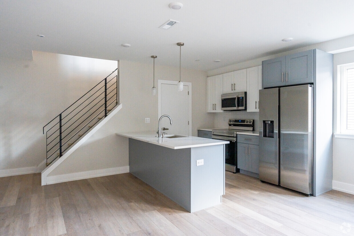
Welcome to 2215 N 7th Street - a beautiful collection of 2, 3 and 4 bedroom luxury apartments conveniently located minutes away from Temple University, Fishtown, and Northern Liberties. This 13-unit building offers several unique layouts, upgraded finishes throughout and a massive communal roof deck with skyline views. Each unit features two toned, shaker cabinetry, Quartz countertops, LVP flooring, upgraded stainless steel appliances and offer large windows allowing in for tons of natural light.
2215 N 7th St is an apartment community located in Philadelphia County and the 19133 ZIP Code. This area is served by the The School District of Philadelphia attendance zone.
Not to be confused with Northeast Philadelphia, North Philadelphia East encompasses the smaller subsets of Ludlow, Yorktown, West Kensington, Poplar, and Callowhill. This composite area runs from the Vine Street Expressway, stretching north to Erie Avenue. Broad Street acts as its eastern border, and the western edge runs a jagged line separating North Philadelphia East from the nearby Kensington, Port Richmond, and Fishtown neighborhoods. With such a long stretch of city, the neighborhood offers a diverse blend of important city landmarks, such as renowned musical venues the Electric Factory and Union Transfer, and Temple University, North Philadelphia's premiere site of higher learning.
Learn more about living in North Philadelphia EastCompare neighborhood and city base rent averages by bedroom.
| North Philadelphia East | Philadelphia, PA | |
|---|---|---|
| Studio | $1,498 | $1,433 |
| 1 Bedroom | $1,707 | $1,786 |
| 2 Bedrooms | $2,085 | $2,227 |
| 3 Bedrooms | $2,793 | $2,919 |
| Colleges & Universities | Distance | ||
|---|---|---|---|
| Colleges & Universities | Distance | ||
| Drive: | 4 min | 1.5 mi | |
| Drive: | 4 min | 1.5 mi | |
| Drive: | 7 min | 3.0 mi | |
| Drive: | 9 min | 3.0 mi |


Transportation options available in Philadelphia include Susquehanna-Dauphin, located 0.7 mile from 2215 N 7th St. 2215 N 7th St is near Philadelphia International, located 14.5 miles or 26 minutes away, and Trenton Mercer, located 32.9 miles or 50 minutes away.
| Transit / Subway | Distance | ||
|---|---|---|---|
| Transit / Subway | Distance | ||
|
|
Walk: | 12 min | 0.7 mi |
|
|
Drive: | 3 min | 1.2 mi |
|
|
Drive: | 4 min | 1.2 mi |
|
|
Drive: | 4 min | 1.4 mi |
|
|
Drive: | 4 min | 1.6 mi |
| Commuter Rail | Distance | ||
|---|---|---|---|
| Commuter Rail | Distance | ||
|
|
Walk: | 11 min | 0.6 mi |
|
|
Walk: | 20 min | 1.0 mi |
|
|
Walk: | 20 min | 1.1 mi |
|
|
Drive: | 5 min | 1.5 mi |
|
|
Drive: | 5 min | 2.1 mi |
| Airports | Distance | ||
|---|---|---|---|
| Airports | Distance | ||
|
Philadelphia International
|
Drive: | 26 min | 14.5 mi |
|
Trenton Mercer
|
Drive: | 50 min | 32.9 mi |
Scores provided by
Traffic
-Airport
-Businesses
-Scores provided by
HowLoud What is a Sound Score Rating? A Sound Score Rating aggregates noise caused by vehicle traffic, airplane traffic and local sources. How It WorksTime and distance from 2215 N 7th St.
| Shopping Centers | Distance | ||
|---|---|---|---|
| Shopping Centers | Distance | ||
| Walk: | 11 min | 0.6 mi | |
| Drive: | 3 min | 1.2 mi | |
| Drive: | 5 min | 1.6 mi |
| Parks and Recreation | Distance | ||
|---|---|---|---|
| Parks and Recreation | Distance | ||
|
Wagner Free Institute of Science
|
Drive: | 5 min | 1.6 mi |
|
Edgar Allan Poe Nat'l Historic Site
|
Drive: | 5 min | 2.1 mi |
|
The Academy of Natural Sciences
|
Drive: | 8 min | 3.5 mi |
|
Fels Planetarium
|
Drive: | 8 min | 3.9 mi |
|
Franklin Institute
|
Drive: | 8 min | 4.0 mi |
| Hospitals | Distance | ||
|---|---|---|---|
| Hospitals | Distance | ||
| Drive: | 4 min | 1.6 mi | |
| Drive: | 5 min | 1.8 mi | |
| Drive: | 6 min | 2.3 mi |
| Military Bases | Distance | ||
|---|---|---|---|
| Military Bases | Distance | ||
| Drive: | 17 min | 8.9 mi | |
| Drive: | 38 min | 17.9 mi | |
| Drive: | 38 min | 19.1 mi |
What Are Walk Score®, Transit Score®, and Bike Score® Ratings?
Walk Score® measures the walkability of any address. Transit Score® measures access to public transit. Bike Score® measures the bikeability of any address.
What is a Sound Score Rating?
A Sound Score Rating aggregates noise caused by vehicle traffic, airplane traffic and local sources.

2215 N 7th St
Philadelphia, PA 19133


