
$2,195 / Month
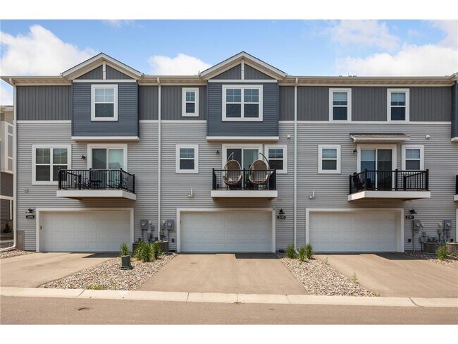
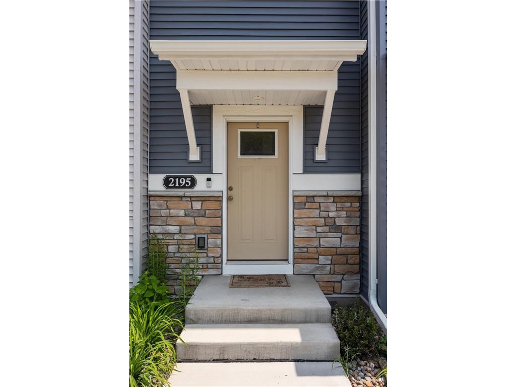
2195 Gateway Curv
North Saint Paul, MN 55109
2 Weeks Ago
Favorites
2195 Gateway Curv

Favorites
Check Back Soon for Upcoming Availability
| Beds | Baths | Average SF |
|---|---|---|
| 3 Bedrooms 3 Bedrooms 3 Br | 3 Baths 3 Baths 3 Ba | 2,082 SF |
Fees and Policies
The fees below are based on community-supplied data and may exclude additional fees and utilities.
- Parking
-
Covered--
-
Garage--
About This Property
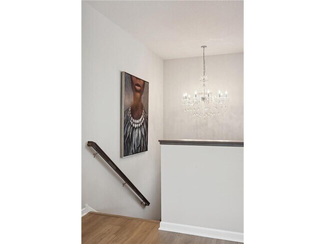
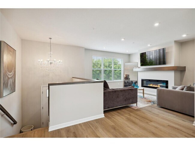
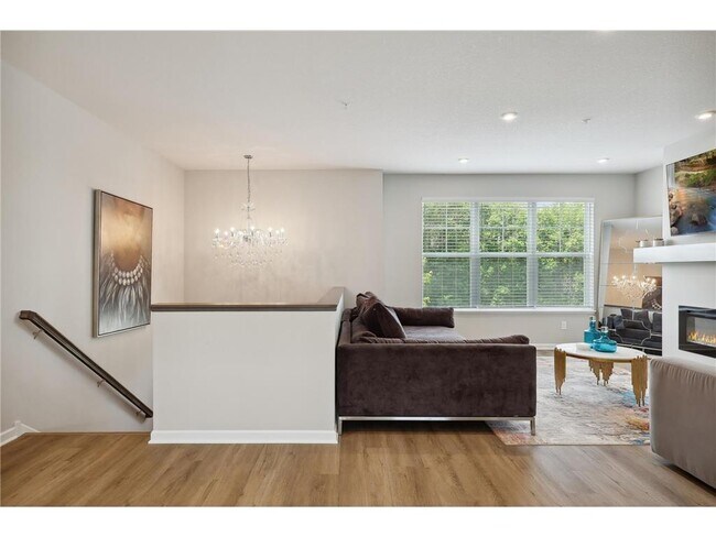
M/I built, like-new townhome, association maintained, in a great location in McKnight Townhome neighborhood. Home features; enameled wood cabinets, luxury vinyl flooring, large kitchen island, workout/exercise room, upper level laundry, 3 bedrooms upstairs. Modern electric fireplace in living room. $2295 12-month lease, $2195 18 months, 24 month , Tenant pays utilities, Owner to pay association and community assessments.
2195 Gateway Curv is a townhome located in Ramsey County and the 55109 ZIP Code. This area is served by the North St Paul-Maplewood School Dist attendance zone.
Townhome Features
Washer/Dryer
Air Conditioning
Dishwasher
Walk-In Closets
- Washer/Dryer
- Air Conditioning
- Heating
- Fireplace
- Sprinkler System
- Dishwasher
- Island Kitchen
- Eat-in Kitchen
- Microwave
- Range
- Refrigerator
- Dining Room
- Basement
- Walk-In Closets
- Deck
Location
Get Directions
Thanks to some odd geography, Maplewood has something of a split personality. This first-ring St. Paul suburb can be described as being shaped like a frying pan. The main business and residential area lies primarily to the north and east of St. Paul, while the chief amenities, such as the community center and an indoor mall, lie in the "pan." South Maplewood, or the "pan handle," runs south along Interstate 494 and has fewer business amenities. Residents of this area tend to shop in bordering Woodbury, since it takes a good half hour to get from the southern tip of Maplewood to the main northern business district.
Meanwhile, Oakdale lies between the two sections, just east of Maplewood's pan handle and north of Woodbury. This young suburb is a quiet bedroom community with a scattering of business districts. Cornfields make up its eastern portion, giving the area a distinctly rural vibe, even though it's just 10 minutes outside of downtown St. Paul.
Learn more about living in Maplewood-OakdaleBelow are rent ranges for similar nearby apartments
| Beds | Average Size | Lowest | Typical | Premium |
|---|---|---|---|---|
| Studio Studio Studio | 587 Sq Ft | $899 | $1,322 | $1,975 |
| 1 Bed 1 Bed 1 Bed | 720-721 Sq Ft | $846 | $1,552 | $2,994 |
| 2 Beds 2 Beds 2 Beds | 1008-1011 Sq Ft | $822 | $1,853 | $3,412 |
| 3 Beds 3 Beds 3 Beds | 1336-1343 Sq Ft | $1,204 | $2,434 | $3,534 |
| 4 Beds 4 Beds 4 Beds | 1778-1789 Sq Ft | $830 | $2,121 | $3,600 |
Amenities
- Washer/Dryer
- Air Conditioning
- Heating
- Fireplace
- Sprinkler System
- Dishwasher
- Island Kitchen
- Eat-in Kitchen
- Microwave
- Range
- Refrigerator
- Dining Room
- Basement
- Walk-In Closets
- Deck
Education
| Colleges & Universities | Distance | ||
|---|---|---|---|
| Colleges & Universities | Distance | ||
| Drive: | 6 min | 3.5 mi | |
| Drive: | 12 min | 6.2 mi | |
| Drive: | 16 min | 10.3 mi | |
| Drive: | 16 min | 10.5 mi |
2195 Gateway Curv is within 6 minutes or 3.5 miles from Century College. It is also near Metropolitan State University and Saint Paul College.
Schools


Public Elementary School
Grades PK-5
412 Students
Nearby
Public Elementary School
Grades PK-5
403 Students
Attendance Zone
Public Middle School
Grades 6-8
557 Students
Attendance Zone
Public High School
Grades 9-12
1,594 Students
Attendance Zone
Private Elementary, Middle & High School
Grades PK-12
466 Students
Nearby
School data provided by
 The GreatSchools Rating helps parents compare schools within a state based on a variety of school quality indicators and provides a helpful picture of how effectively each school serves all of its students. Ratings are on a scale of 1 (below average) to 10 (above average) and can include test scores, college readiness, academic progress, advanced courses, equity, discipline and attendance data. We also advise parents to visit schools, consider other information on school performance and programs, and consider family needs as part of the school selection process.
View GreatSchools Rating Methodology
Data provided by GreatSchools.org © 2025. All rights reserved.
View GreatSchools Rating Methodology
Data provided by GreatSchools.org © 2025. All rights reserved.
Transportation options available in North Saint Paul include Union Depot Station, located 7.3 miles from 2195 Gateway Curv. 2195 Gateway Curv is near Minneapolis-St Paul International/Wold-Chamberlain, located 17.4 miles or 29 minutes away.
| Transit / Subway | Distance | ||
|---|---|---|---|
| Transit / Subway | Distance | ||
| Drive: | 14 min | 7.3 mi | |
| Drive: | 15 min | 7.4 mi | |
| Drive: | 16 min | 7.6 mi | |
| Drive: | 14 min | 9.3 mi | |
| Drive: | 15 min | 9.5 mi |
| Commuter Rail | Distance | ||
|---|---|---|---|
| Commuter Rail | Distance | ||
|
|
Drive: | 15 min | 7.3 mi |
|
|
Drive: | 26 min | 16.3 mi |
|
|
Drive: | 24 min | 17.1 mi |
|
|
Drive: | 34 min | 25.3 mi |
|
|
Drive: | 36 min | 26.9 mi |
| Airports | Distance | ||
|---|---|---|---|
| Airports | Distance | ||
|
Minneapolis-St Paul International/Wold-Chamberlain
|
Drive: | 29 min | 17.4 mi |
Time and distance from 2195 Gateway Curv.
| Shopping Centers | Distance | ||
|---|---|---|---|
| Shopping Centers | Distance | ||
| Walk: | 19 min | 1.0 mi | |
| Drive: | 4 min | 1.2 mi | |
| Drive: | 4 min | 1.7 mi |
2195 Gateway Curv has 3 shopping centers within 1.7 miles, which is about a 4-minute walk. The miles and minutes will be for the farthest away property.
| Parks and Recreation | Distance | ||
|---|---|---|---|
| Parks and Recreation | Distance | ||
|
Keller Regional Park
|
Drive: | 9 min | 3.5 mi |
|
Maplewood Nature Center
|
Drive: | 8 min | 4.0 mi |
|
Phalen Park
|
Drive: | 10 min | 4.7 mi |
|
Phelan Regional Park
|
Drive: | 11 min | 4.9 mi |
|
Arlington/Arkwright Park
|
Drive: | 12 min | 6.2 mi |
2195 Gateway Curv has 5 parks within 6.2 miles, including Keller Regional Park, Maplewood Nature Center, and Phelan Regional Park.
| Hospitals | Distance | ||
|---|---|---|---|
| Hospitals | Distance | ||
| Drive: | 7 min | 3.4 mi | |
| Drive: | 14 min | 9.1 mi | |
| Drive: | 14 min | 9.2 mi |
2195 Gateway Curv has 3 hospitals within 9.2 miles, the nearest is Healtheast St. John's Hospital which is 3.4 miles away and a 7 minute drive.
| Military Bases | Distance | ||
|---|---|---|---|
| Military Bases | Distance | ||
| Drive: | 28 min | 16.2 mi |
2195 Gateway Curv is 16.2 miles and a 28 minute drive from Fort Snelling Military Reservation.
You May Also Like
Similar Rentals Nearby


What Are Walk Score®, Transit Score®, and Bike Score® Ratings?
Walk Score® measures the walkability of any address. Transit Score® measures access to public transit. Bike Score® measures the bikeability of any address.
What is a Sound Score Rating?
A Sound Score Rating aggregates noise caused by vehicle traffic, airplane traffic and local sources
2195 Gateway Curv
North Saint Paul, MN 55109