
Vanguard
1001 Marshall Ave,
Cincinnati, OH 45219
Studio - 5 Beds $749 - $1,479

Freshly renovated apartments in front of Christ Hospital, close to the UC Area/ Clifton Area and public transit. Parking available. Owner takes care of , sewage, trash tenant takes care of electric, gas and rent.
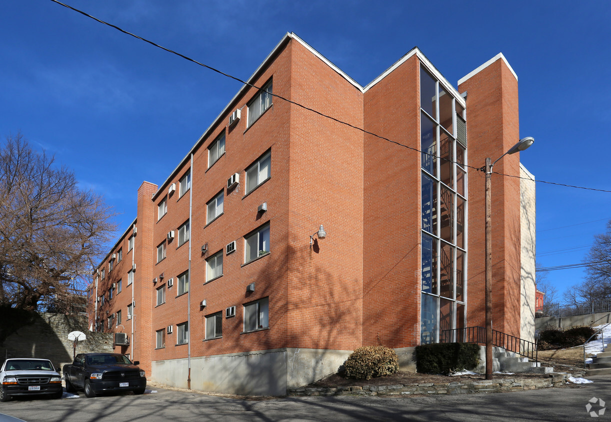
2058 Auburn Ave is an apartment community located in Hamilton County and the 45219 ZIP Code. This area is served by the Cincinnati Public Schools attendance zone.
Laundry Facilities
Elevator
Renters Insurance Program
Online Services
Air Conditioning
Hardwood Floors
Granite Countertops
Refrigerator
The Cincinnati neighborhood of Mount Auburn sits north of downtown and west of Interstate 71. The neighborhood, originally a hilltop escape from the crowded conditions of lower Downtown Cincinnati, gained national recognition as a historic district in 1973. The well-known community contains beautiful mansions dating back to 1819, including the home of former President William Howard Taft.
The community contains beautiful mansions formerly owned by a host of prominent residents. A number of historic buildings and sites dot the area, including the Mount Auburn Young Ladies Institute. The neighborhood also features the beloved ice cream parlor Graeter's Confectionary, as well as Christ Hospital.
Learn more about living in Mount Auburn| Colleges & Universities | Distance | ||
|---|---|---|---|
| Colleges & Universities | Distance | ||
| Drive: | 4 min | 1.3 mi | |
| Drive: | 5 min | 1.6 mi | |
| Drive: | 10 min | 3.4 mi | |
| Drive: | 11 min | 3.9 mi |


Transportation options available in Cincinnati include Race & Liberty Station, located 0.9 mile from 2058 Auburn Ave. 2058 Auburn Ave is near Cincinnati/Northern Kentucky International, located 16.2 miles or 30 minutes away.
| Transit / Subway | Distance | ||
|---|---|---|---|
| Transit / Subway | Distance | ||
| Walk: | 18 min | 0.9 mi | |
| Drive: | 4 min | 1.2 mi | |
| Drive: | 4 min | 1.2 mi | |
| Drive: | 4 min | 1.3 mi | |
| Drive: | 4 min | 1.3 mi |
| Commuter Rail | Distance | ||
|---|---|---|---|
| Commuter Rail | Distance | ||
|
|
Drive: | 7 min | 2.4 mi |
| Airports | Distance | ||
|---|---|---|---|
| Airports | Distance | ||
|
Cincinnati/Northern Kentucky International
|
Drive: | 30 min | 16.2 mi |
Time and distance from 2058 Auburn Ave.
| Shopping Centers | Distance | ||
|---|---|---|---|
| Shopping Centers | Distance | ||
| Drive: | 5 min | 1.6 mi | |
| Drive: | 6 min | 1.7 mi | |
| Drive: | 6 min | 3.0 mi |
| Parks and Recreation | Distance | ||
|---|---|---|---|
| Parks and Recreation | Distance | ||
|
William H. Taft National Historic Site
|
Walk: | 1 min | 0.1 mi |
|
Krohn Conservatory
|
Drive: | 4 min | 1.5 mi |
|
Eden Park
|
Drive: | 5 min | 1.6 mi |
|
Trailside Nature Center
|
Drive: | 5 min | 1.7 mi |
|
Theodore M. Berry Friendship Park
|
Drive: | 6 min | 2.2 mi |
| Hospitals | Distance | ||
|---|---|---|---|
| Hospitals | Distance | ||
| Walk: | 1 min | 0.1 mi | |
| Drive: | 4 min | 1.5 mi | |
| Drive: | 4 min | 1.6 mi |
| Military Bases | Distance | ||
|---|---|---|---|
| Military Bases | Distance | ||
| Drive: | 71 min | 52.5 mi | |
| Drive: | 77 min | 57.5 mi | |
| Drive: | 79 min | 60.8 mi |
What Are Walk Score®, Transit Score®, and Bike Score® Ratings?
Walk Score® measures the walkability of any address. Transit Score® measures access to public transit. Bike Score® measures the bikeability of any address.
What is a Sound Score Rating?
A Sound Score Rating aggregates noise caused by vehicle traffic, airplane traffic and local sources
2058 Auburn Ave
Cincinnati, OH 45219


