
Hanover Soma West
1140 Harrison St,
San Francisco, CA 94103
$3,475 - $8,729 Total Monthly Price
Studio - 3 Beds

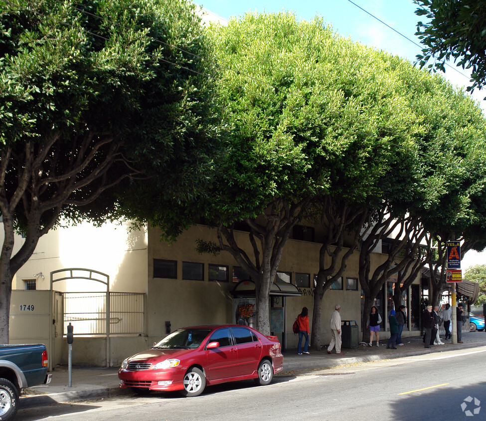
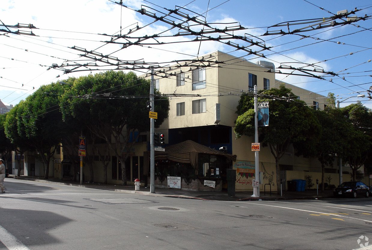
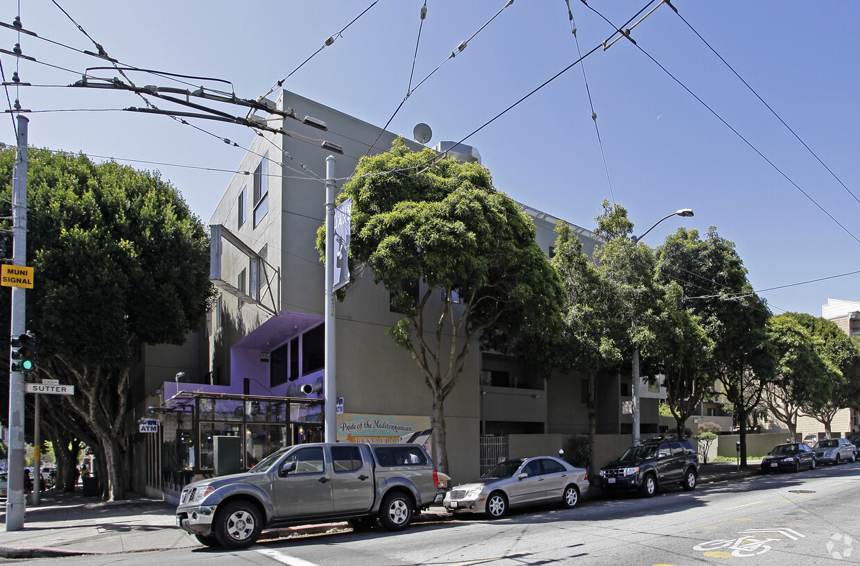
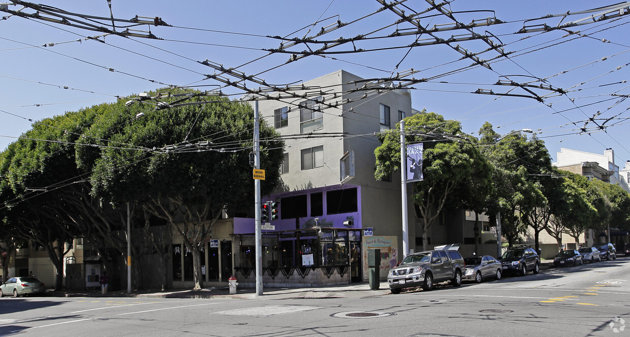
At 2045 Sutter St, you've discovered your new place. Located at 2045 Sutter St. in San Francisco, this community is an ideal place to live. Come for a visit to check out the apartment floorplan options. The leasing staff is ready and waiting for you to visit. Come be a part of 2045 Sutter St. Contact or drop by the leasing office to check the current floorplan availability.
2045 Sutter St is an apartment community located in San Francisco County and the 94115 ZIP Code. This area is served by the San Francisco Unified School District attendance zone.
Lower Pacific Heights is a vibrant San Francisco neighborhood situated between Pacific Heights, Japantown, the Fillmore District, and Laurel Heights. Formerly known as Upper Fillmore, Lower Pacific Heights offers residents a wide variety of apartments, condos, and houses available for rent, many of which boast scenic views due to the neighborhood’s hilly environment.
Lower Pacific Heights is regarded for its walkable layout, with many rentals situated within easy walking distance of the diverse restaurants, shops, coffeehouses, and bars that line Fillmore Street, the community’s main commercial thoroughfare. The neighborhood’s central locale is a major part of its allure, providing quick access to Union Square, the University of San Francisco, the Financial District, several prominent medical centers, tech employers, landmarks, and more.
Learn more about living in Lower Pacific HeightsCompare neighborhood and city base rent averages by bedroom.
| Lower Pacific Heights | San Francisco, CA | |
|---|---|---|
| Studio | $2,650 | $2,562 |
| 1 Bedroom | $3,047 | $3,386 |
| 2 Bedrooms | $4,455 | $4,646 |
| 3 Bedrooms | $5,590 | $5,814 |
| Colleges & Universities | Distance | ||
|---|---|---|---|
| Colleges & Universities | Distance | ||
| Walk: | 6 min | 0.3 mi | |
| Drive: | 4 min | 1.5 mi | |
| Drive: | 5 min | 1.6 mi | |
| Drive: | 7 min | 2.3 mi |


Transportation options available in San Francisco include Van Ness And California, located 0.9 mile from 2045 Sutter St. 2045 Sutter St is near San Francisco International, located 14.7 miles or 24 minutes away, and Metro Oakland International, located 20.7 miles or 34 minutes away.
| Transit / Subway | Distance | ||
|---|---|---|---|
| Transit / Subway | Distance | ||
|
|
Walk: | 17 min | 0.9 mi |
|
|
Walk: | 20 min | 1.0 mi |
|
|
Drive: | 3 min | 1.1 mi |
|
|
Drive: | 3 min | 1.2 mi |
| Drive: | 4 min | 1.4 mi |
| Commuter Rail | Distance | ||
|---|---|---|---|
| Commuter Rail | Distance | ||
| Drive: | 7 min | 3.8 mi | |
| Drive: | 13 min | 6.9 mi | |
| Drive: | 19 min | 10.3 mi | |
| Drive: | 18 min | 11.3 mi | |
|
|
Drive: | 23 min | 12.3 mi |
| Airports | Distance | ||
|---|---|---|---|
| Airports | Distance | ||
|
San Francisco International
|
Drive: | 24 min | 14.7 mi |
|
Metro Oakland International
|
Drive: | 34 min | 20.7 mi |
Scores provided by
Traffic
-Airport
-Businesses
-Scores provided by
HowLoud What is a Sound Score Rating? A Sound Score Rating aggregates noise caused by vehicle traffic, airplane traffic and local sources. How It WorksTime and distance from 2045 Sutter St.
| Shopping Centers | Distance | ||
|---|---|---|---|
| Shopping Centers | Distance | ||
| Walk: | 5 min | 0.3 mi | |
| Walk: | 14 min | 0.7 mi |
| Parks and Recreation | Distance | ||
|---|---|---|---|
| Parks and Recreation | Distance | ||
|
Buena Vista Park
|
Drive: | 6 min | 1.9 mi |
|
Conservatory of Flowers
|
Drive: | 5 min | 2.1 mi |
|
Exploratorium
|
Drive: | 5 min | 2.1 mi |
|
San Francisco Maritime National Historical Park
|
Drive: | 6 min | 2.4 mi |
|
Randall Museum
|
Drive: | 7 min | 2.4 mi |
| Hospitals | Distance | ||
|---|---|---|---|
| Hospitals | Distance | ||
| Walk: | 13 min | 0.7 mi | |
| Walk: | 15 min | 0.8 mi | |
| Drive: | 3 min | 1.2 mi |
| Military Bases | Distance | ||
|---|---|---|---|
| Military Bases | Distance | ||
| Drive: | 12 min | 4.1 mi | |
| Drive: | 13 min | 4.5 mi | |
| Drive: | 16 min | 6.8 mi |
Pets Allowed Fitness Center In Unit Washer & Dryer Walk-In Closets Stainless Steel Appliances Hardwood Floors EV Charging
What Are Walk Score®, Transit Score®, and Bike Score® Ratings?
Walk Score® measures the walkability of any address. Transit Score® measures access to public transit. Bike Score® measures the bikeability of any address.
What is a Sound Score Rating?
A Sound Score Rating aggregates noise caused by vehicle traffic, airplane traffic and local sources.
2045 Sutter St
San Francisco, CA 94115


