
Fourth and U
2020 4th St,
Berkeley, CA 94710
$2,481 - $3,484
1-2 Beds

Bedrooms
Studio - 3 bd
Bathrooms
1 ba
Square Feet
286 - 832 sq ft
NOW LEASING FOR FALL 2025!!!2028 Dwight Way is a medium sized property located near the corner of Dwight Way and Shattuck Ave. It is walking distance from the Downtown Berkeley BART station, shops, restaurants and UC Berkeley. It has 13 units and a gated parking garage underneath. There is a coin laundry and elevator from the garage level to all floors. WALK SCORE: 92 OUT OF 100 - WALKER'S PARADISEBIKE SCORE: 99 OUT OF 100 - BIKER'S PARADISE
NOW LEASING FOR FALL 2025!!!2028 Dwight Way is a medium sized property located near the corner of Dwight Way and Shattuck Ave. It is walking distance from the Downtown Berkeley BART station, shops, restaurants and UC Berkeley. It has 13 units and a gated parking garage underneath. There is a coin laundry and elevator from the garage level to all floors. WALK SCORE: 92 OUT OF 100 - WALKER'S PARADISEBIKE SCORE: 99 OUT OF 100 - BIKER'S PARADISE
2028 Dwight Way is an apartment community located in Alameda County and the 94704 ZIP Code. This area is served by the Berkeley Unified attendance zone.
Unique Features
Hardwood Floors
Granite Countertops
Microwave
Refrigerator
Located just minutes from Downtown Berkeley, South Berkeley encompasses part of historic Rancho San Antonio. Today, it has become a mecca for sports as well as cool apartments. The Ashby Stage is a great place to see a show, and it’s down the road from the Berkeley Bowl supermarket. Adeline Street is where you’ll find most restaurants, nightlife, and Ashby BART Station.
Grove Park offers an array of outdoor amenities to locals including sports courts and a playground. When you live in South Berkeley, you’re close to the University of California, Berkeley and five miles from Oakland.
Learn more about living in South Berkeley| Colleges & Universities | Distance | ||
|---|---|---|---|
| Colleges & Universities | Distance | ||
| Walk: | 10 min | 0.5 mi | |
| Drive: | 6 min | 1.7 mi | |
| Drive: | 9 min | 3.2 mi | |
| Drive: | 12 min | 4.8 mi |


Transportation options available in Berkeley include Downtown Berkeley Station, located 0.5 mile from 2028 Dwight Way. 2028 Dwight Way is near Metro Oakland International, located 13.9 miles or 24 minutes away, and San Francisco International, located 23.9 miles or 39 minutes away.
| Transit / Subway | Distance | ||
|---|---|---|---|
| Transit / Subway | Distance | ||
|
|
Walk: | 9 min | 0.5 mi |
|
|
Walk: | 9 min | 0.5 mi |
|
|
Walk: | 16 min | 0.8 mi |
|
|
Drive: | 5 min | 1.8 mi |
|
|
Drive: | 5 min | 1.9 mi |
| Commuter Rail | Distance | ||
|---|---|---|---|
| Commuter Rail | Distance | ||
|
|
Drive: | 7 min | 2.5 mi |
|
|
Drive: | 7 min | 2.6 mi |
|
|
Drive: | 12 min | 5.6 mi |
| Drive: | 17 min | 8.9 mi | |
| Drive: | 21 min | 11.5 mi |
| Airports | Distance | ||
|---|---|---|---|
| Airports | Distance | ||
|
Metro Oakland International
|
Drive: | 24 min | 13.9 mi |
|
San Francisco International
|
Drive: | 39 min | 23.9 mi |
Time and distance from 2028 Dwight Way.
| Shopping Centers | Distance | ||
|---|---|---|---|
| Shopping Centers | Distance | ||
| Walk: | 4 min | 0.2 mi | |
| Walk: | 14 min | 0.8 mi | |
| Drive: | 6 min | 2.0 mi |
| Parks and Recreation | Distance | ||
|---|---|---|---|
| Parks and Recreation | Distance | ||
|
Habitot Children's Museum
|
Walk: | 7 min | 0.4 mi |
|
People's Park
|
Walk: | 12 min | 0.7 mi |
|
UC Berkeley Museum of Paleontology
|
Walk: | 15 min | 0.8 mi |
|
Essig Museum of Entomology
|
Walk: | 15 min | 0.8 mi |
|
University and Jepson Herbaria
|
Walk: | 15 min | 0.8 mi |
| Hospitals | Distance | ||
|---|---|---|---|
| Hospitals | Distance | ||
| Drive: | 3 min | 1.2 mi | |
| Drive: | 6 min | 2.0 mi | |
| Drive: | 8 min | 3.1 mi |
| Military Bases | Distance | ||
|---|---|---|---|
| Military Bases | Distance | ||
| Drive: | 13 min | 4.3 mi | |
| Drive: | 18 min | 6.7 mi |
What Are Walk Score®, Transit Score®, and Bike Score® Ratings?
Walk Score® measures the walkability of any address. Transit Score® measures access to public transit. Bike Score® measures the bikeability of any address.
What is a Sound Score Rating?
A Sound Score Rating aggregates noise caused by vehicle traffic, airplane traffic and local sources
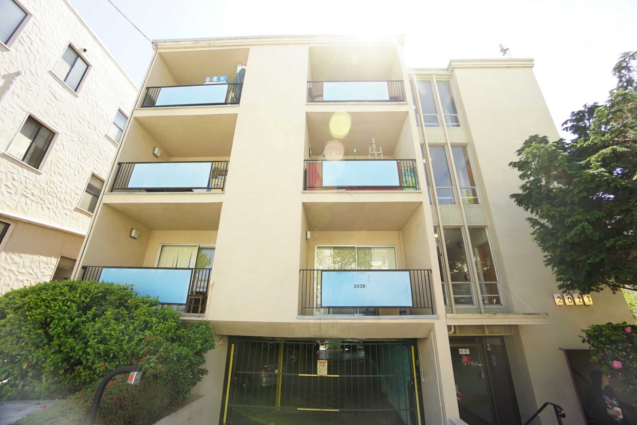
2028 Dwight Way
Berkeley, CA 94704


