
Williamsburg
200 W Galbraith Rd,
Cincinnati, OH 45215
$718 - $3,185
Studio - 3 Beds
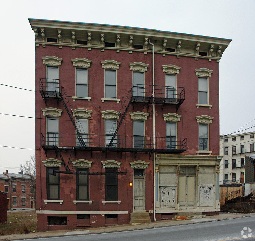

2017 Vine St offers a combination of quality and comfort. The prime Vine St. location in the 45202 Zip code of Cincinnati makes a popular place for you to move to. Schedule a time to check out the apartment floorplan options. Here at this community, the leasing team is ready and waiting to help you find your perfect floorplan. Your new home awaits you at 2017 Vine St. Stop by the leasing office to talk about leasing your next apartment.
2017 Vine St is an apartment community located in Hamilton County and the 45202 ZIP Code. This area is served by the Cincinnati Public Schools attendance zone.
In Clifton there’s plenty to do and see. The rolling hills, lush parks and green spaces, hip shopping, and affordable apartments create a vibrancy in Clifton that can’t be ignored.
In addition to its active art scene, the neighborhood is encompassing of Mount Storm Park, Edgewood Grove Park, and the Cincinnati State Technical and Community College. Locals enjoy the direct access to Interstate 75, making commutes in and around the city a breeze.
Clifton is just north of the 90-acre Burnet Woods Park and the University of Cincinnati campus. When you have a craving for something sweet or savory, head on over to the Clifton Gaslight District for every kind of cuisine imaginable. Clifton sits atop a hill overlooking the Northside, and Ludlow Avenue has been dubbed Cincinnati’s first “Main Street.
Learn more about living in CliftonCompare neighborhood and city base rent averages by bedroom.
| Clifton | Cincinnati, OH | |
|---|---|---|
| Studio | $827 | $1,066 |
| 1 Bedroom | $968 | $1,145 |
| 2 Bedrooms | $1,371 | $1,434 |
| 3 Bedrooms | $1,374 | $1,752 |
| Colleges & Universities | Distance | ||
|---|---|---|---|
| Colleges & Universities | Distance | ||
| Drive: | 4 min | 1.3 mi | |
| Drive: | 4 min | 1.7 mi | |
| Drive: | 10 min | 3.6 mi | |
| Drive: | 11 min | 3.8 mi |


Transportation options available in Cincinnati include Brewery District Station - Elm & Henry, located 0.2 mile from 2017 Vine St. 2017 Vine St is near Cincinnati/Northern Kentucky International, located 15.4 miles or 30 minutes away.
| Transit / Subway | Distance | ||
|---|---|---|---|
| Transit / Subway | Distance | ||
| Walk: | 4 min | 0.2 mi | |
| Walk: | 5 min | 0.3 mi | |
| Walk: | 7 min | 0.4 mi | |
| Walk: | 9 min | 0.5 mi | |
| Walk: | 10 min | 0.5 mi |
| Commuter Rail | Distance | ||
|---|---|---|---|
| Commuter Rail | Distance | ||
|
|
Drive: | 6 min | 1.7 mi |
| Airports | Distance | ||
|---|---|---|---|
| Airports | Distance | ||
|
Cincinnati/Northern Kentucky International
|
Drive: | 30 min | 15.4 mi |
Scores provided by
Traffic
-Airport
-Businesses
-Scores provided by
HowLoud What is a Sound Score Rating? A Sound Score Rating aggregates noise caused by vehicle traffic, airplane traffic and local sources. How It WorksTime and distance from 2017 Vine St.
| Shopping Centers | Distance | ||
|---|---|---|---|
| Shopping Centers | Distance | ||
| Walk: | 18 min | 1.0 mi | |
| Drive: | 5 min | 1.4 mi | |
| Drive: | 6 min | 2.5 mi |
| Parks and Recreation | Distance | ||
|---|---|---|---|
| Parks and Recreation | Distance | ||
|
William H. Taft National Historic Site
|
Walk: | 14 min | 0.8 mi |
|
Duke Energy Children's Museum
|
Drive: | 6 min | 1.7 mi |
|
OMNIMAX Theater
|
Drive: | 6 min | 1.7 mi |
|
Museum of Natural History and Science
|
Drive: | 6 min | 1.7 mi |
|
Cincinnati History Museum
|
Drive: | 6 min | 1.8 mi |
| Hospitals | Distance | ||
|---|---|---|---|
| Hospitals | Distance | ||
| Walk: | 16 min | 0.9 mi | |
| Drive: | 4 min | 1.7 mi | |
| Drive: | 4 min | 1.9 mi |
| Military Bases | Distance | ||
|---|---|---|---|
| Military Bases | Distance | ||
| Drive: | 71 min | 52.5 mi | |
| Drive: | 77 min | 57.6 mi | |
| Drive: | 79 min | 60.9 mi |
What Are Walk Score®, Transit Score®, and Bike Score® Ratings?
Walk Score® measures the walkability of any address. Transit Score® measures access to public transit. Bike Score® measures the bikeability of any address.
What is a Sound Score Rating?
A Sound Score Rating aggregates noise caused by vehicle traffic, airplane traffic and local sources.


