

$4,900
Total Monthly Price
12 Month Lease
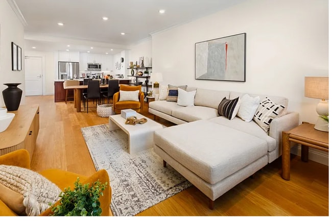
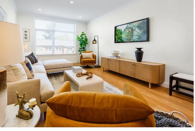
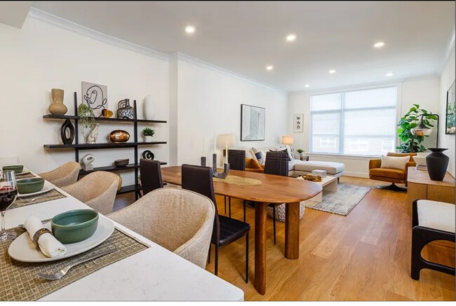
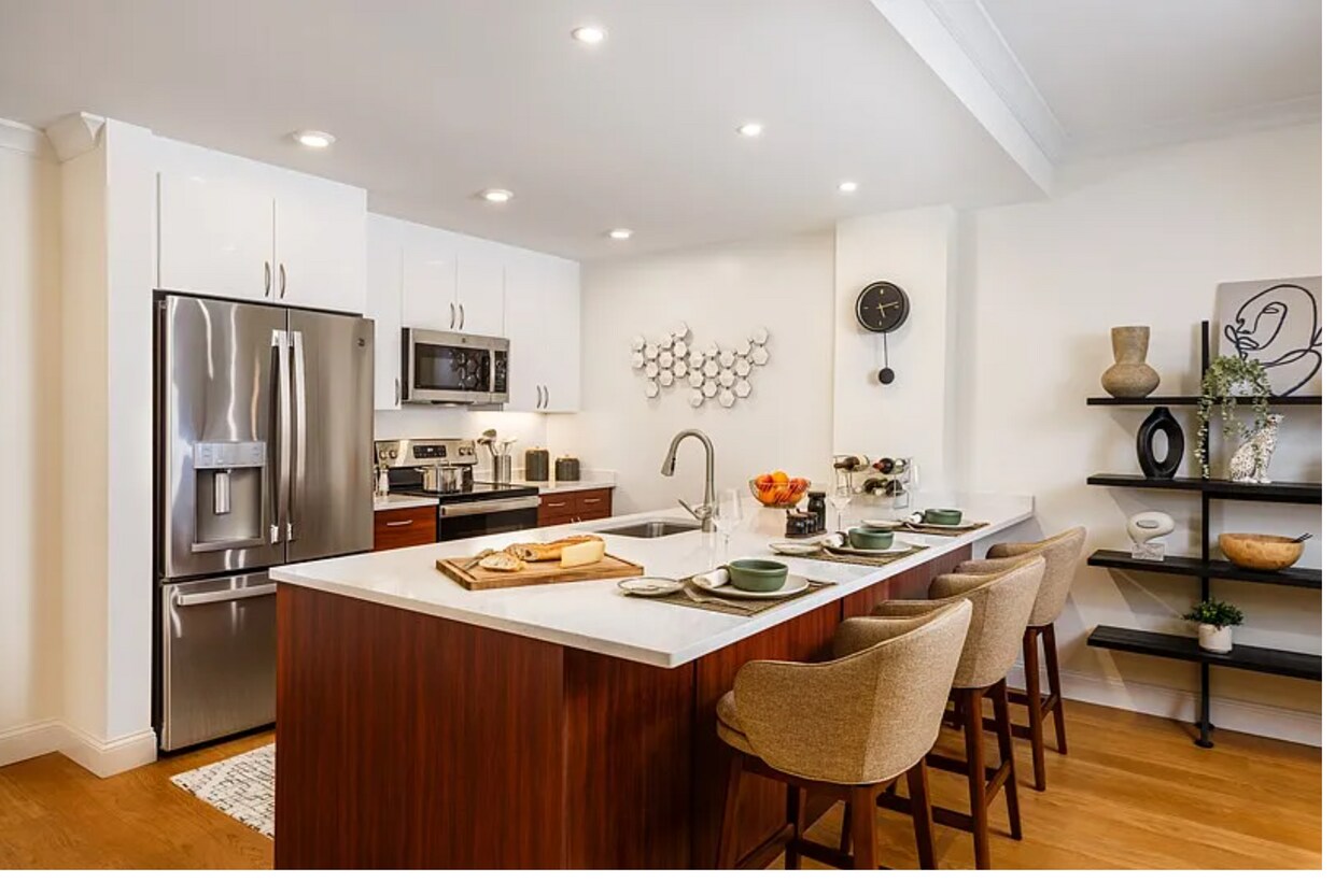
201 Sherman Rd Unit 342
Chestnut Hill, MA 02467
Favorites
617-675-4809
-
Bedrooms
2
-
Bathrooms
2
-
Square Feet
1,250 sq ft
-
Available
Available Aug 1
Highlight
- Pets Allowed
201 Sherman Rd Unit 342

Favorites
About This Home
12 Month Lease,
$4,900 deposit,
Available Aug 1
No Broker fee ! Available Now or as late as 09/01/2026 | In unit laundry Spacious 2-bedroom, 2-bathroom unit in Chestnut Hill’s desirable Sherman Road neighborhood. This updated home offers a bright, open layout with a well-equipped kitchen, generous storage, and in-unit laundry. Conveniently located near local shops, dining, and public transit options, providing an ideal blend of suburban charm and city accessibility. Transportation Bus: 37 Corey St opp Mount Benedict Cemetery (0.50 mi) Bus: 51 Independence Dr @ Sherman Rd (0.21 mi)
201 Sherman Rd is an apartment community located in Suffolk County and the 02467 ZIP Code. This area is served by the Boston Public Schools attendance zone.
* Price shown is total price based on community-supplied monthly required fees. Excludes user-selected optional fees and variable or usage-based fees and required charges due at or prior to move-in or at move-out. Price, availability, fees, and any applicable rent special are subject to change without notice.
* Square footage definitions vary. Displayed square footage is approximate.
Apartment Features
Washer/Dryer
Air Conditioning
Dishwasher
Kitchen
- Washer/Dryer
- Air Conditioning
- Dishwasher
- Kitchen
Fees and Policies
The fees listed below are community-provided and may exclude utilities or add-ons. All payments are made directly to the property and are non-refundable unless otherwise specified.
- Dogs Allowed
-
Fees not specified
- Cats Allowed
-
Fees not specified
Details
Utilities Included
-
Trash Removal
Property Information
-
4 units
Contact
- Phone Number
- Contact
Location
Get Directions
One of the more upscale communities in the Boston area, Chestnut Hill apartments deliver a stylish lifestyle and a beautiful atmosphere. Boston College’s campus is the main landmark on the northeast corner of the village, and the school’s museums, libraries, and other resources add considerable intellectual capital to the broader community—of course, Eagles games are quite popular as well. The shopping center known as “The Street” on Boylston Street provides a trendy retail experience in a unique setting. The area is loaded with parks and green spaces, particularly Hancock Woods in the south, Webster Conservation Area in the west, and Chestnut Hill Reservoir in the north.
Learn more about living in Chestnut Hill
Education
| Colleges & Universities | Distance | ||
|---|---|---|---|
| Colleges & Universities | Distance | ||
| Drive: | 11 min | 4.7 mi | |
| Drive: | 10 min | 4.8 mi | |
| Drive: | 10 min | 5.1 mi | |
| Drive: | 11 min | 5.5 mi |
201 Sherman Rd Unit 342 is within 10 minutes or 4.8 miles from Boston College. It is also near Boston College, Brighton and MCPHS University, Boston.
Schools


Public Elementary School
Grades PK-5
150 Students
Attendance Zone
Public Elementary & Middle School
Grades PK-8
524 Students
Attendance Zone
Public Middle & High School
Grades 6-12
450 Students
Attendance Zone
Public Middle School
Grades 6-8
321 Students
Attendance Zone
Public High School
Grades 12
475 Students
Attendance Zone
Public High School
Grades 12
392 Students
Attendance Zone
Private Elementary, Middle & High School
Grades PK-12
416 Students
Nearby
Private Elementary & Middle School
Grades PK-8
Nearby
School data provided by
 The GreatSchools Rating helps parents compare schools within a state based on a variety of school quality indicators and provides a helpful picture of how effectively each school serves all of its students. Ratings are on a scale of 1 (below average) to 10 (above average) and can include test scores, college readiness, academic progress, advanced courses, equity, discipline and attendance data. We also advise parents to visit schools, consider other information on school performance and programs, and consider family needs as part of the school selection process.
View GreatSchools Rating Methodology
Data provided by GreatSchools.org © 2026. All rights reserved.
View GreatSchools Rating Methodology
Data provided by GreatSchools.org © 2026. All rights reserved.
Transportation options available in Chestnut Hill include Chestnut Hill Station, located 2.8 miles from 201 Sherman Rd Unit 342. 201 Sherman Rd Unit 342 is near General Edward Lawrence Logan International, located 11.7 miles or 24 minutes away.
| Transit / Subway | Distance | ||
|---|---|---|---|
| Transit / Subway | Distance | ||
|
|
Drive: | 6 min | 2.8 mi |
|
|
Drive: | 7 min | 3.5 mi |
|
|
Drive: | 7 min | 3.6 mi |
|
|
Drive: | 8 min | 3.7 mi |
|
|
Drive: | 9 min | 4.3 mi |
| Commuter Rail | Distance | ||
|---|---|---|---|
| Commuter Rail | Distance | ||
|
|
Drive: | 5 min | 1.8 mi |
|
|
Drive: | 5 min | 2.1 mi |
|
|
Drive: | 6 min | 2.2 mi |
|
|
Drive: | 7 min | 3.1 mi |
|
|
Drive: | 7 min | 3.6 mi |
| Airports | Distance | ||
|---|---|---|---|
| Airports | Distance | ||
|
General Edward Lawrence Logan International
|
Drive: | 24 min | 11.7 mi |
Getting Around
 What do Walkability, Transit, Drivability, and Bikeability mean?
Walkability measures the walking distance to day-to-day needs.
Transit measures access to public transportation.
Drivability measures congestion, parking availability, and access to major roads.
Bikeability measures the suitability for cycling.
How It Works
What do Walkability, Transit, Drivability, and Bikeability mean?
Walkability measures the walking distance to day-to-day needs.
Transit measures access to public transportation.
Drivability measures congestion, parking availability, and access to major roads.
Bikeability measures the suitability for cycling.
How It Works
Moderately Walkable
Walkability
60
/ 100
Some Public Transit
Transit
40
/ 100
Moderately Drivable
Drivability
70
/ 100
Moderately Bikeable
Bikeability
60
/ 100
Scores provided by
Active
Soundscore™
77
/ 100
Traffic
BusyAirport
CalmBusinesses
CalmScores provided by
HowLoud What is a Sound Score Rating? A Sound Score Rating aggregates noise caused by vehicle traffic, airplane traffic and local sources. How It WorksTime and distance from 201 Sherman Rd Unit 342.
| Shopping Centers | Distance | ||
|---|---|---|---|
| Shopping Centers | Distance | ||
| Walk: | 6 min | 0.4 mi | |
| Drive: | 5 min | 1.9 mi | |
| Drive: | 5 min | 2.0 mi |
201 Sherman Rd Unit 342 has 3 shopping centers within 2.0 miles, which is about a 5-minute drive. The miles and minutes will be for the farthest away property.
| Parks and Recreation | Distance | ||
|---|---|---|---|
| Parks and Recreation | Distance | ||
|
Brook Farm Historic Site
|
Drive: | 4 min | 2.0 mi |
|
Arnold Arboretum of Harvard University
|
Drive: | 5 min | 2.2 mi |
|
Frederick Law Olmsted National Historic Site
|
Drive: | 6 min | 3.0 mi |
|
Hammond Pond Reservation
|
Drive: | 6 min | 3.2 mi |
|
Cutler Park Reservation
|
Drive: | 8 min | 4.0 mi |
201 Sherman Rd Unit 342 has 5 parks within 4.0 miles, including Brook Farm Historic Site, Arnold Arboretum of Harvard University, and Frederick Law Olmsted National Historic Site.
| Hospitals | Distance | ||
|---|---|---|---|
| Hospitals | Distance | ||
| Walk: | 10 min | 0.5 mi | |
| Drive: | 5 min | 2.6 mi | |
| Drive: | 8 min | 3.4 mi |
201 Sherman Rd Unit 342 has 3 hospitals within 3.4 miles, the nearest is Bournewood Hospital which is 0.5 mile away and a 10 minute walk.
| Military Bases | Distance | ||
|---|---|---|---|
| Military Bases | Distance | ||
| Drive: | 24 min | 13.5 mi | |
| Drive: | 31 min | 17.9 mi | |
| Drive: | 48 min | 26.6 mi |
201 Sherman Rd Unit 342 has 3 military bases within 26.6 miles, the nearest is US Military Reservation which is 13.5 miles away and a 24 minute drive.
Amenities
- Washer/Dryer
- Air Conditioning
- Dishwasher
- Kitchen
201 Sherman Rd Unit 342 Photos
201 Sherman Rd
Chestnut Hill, MA 02467