
$5,700 / Month
2009 Pine St
San Francisco, CA 94115
2 Weeks Ago
Favorites
2009 Pine St

Favorites
Check Back Soon for Upcoming Availability
| Beds | Baths | Average SF |
|---|---|---|
| 4 Bedrooms 4 Bedrooms 4 Br | 2 Baths 2 Baths 2 Ba | 1,800 SF |
Fees and Policies
The fees below are based on community-supplied data and may exclude additional fees and utilities.
- Parking
-
Surface Lot--
-
Garage--
About This Property
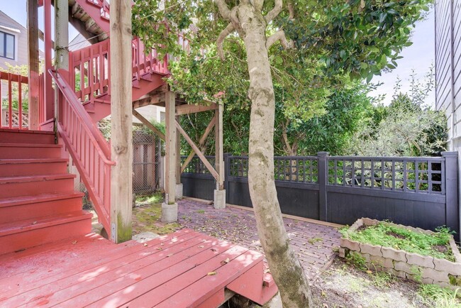
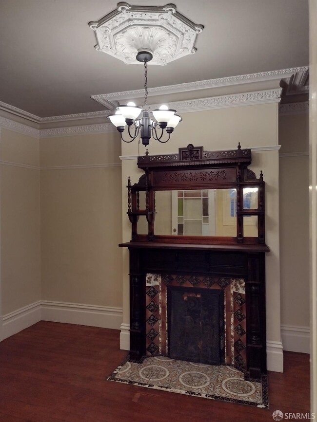
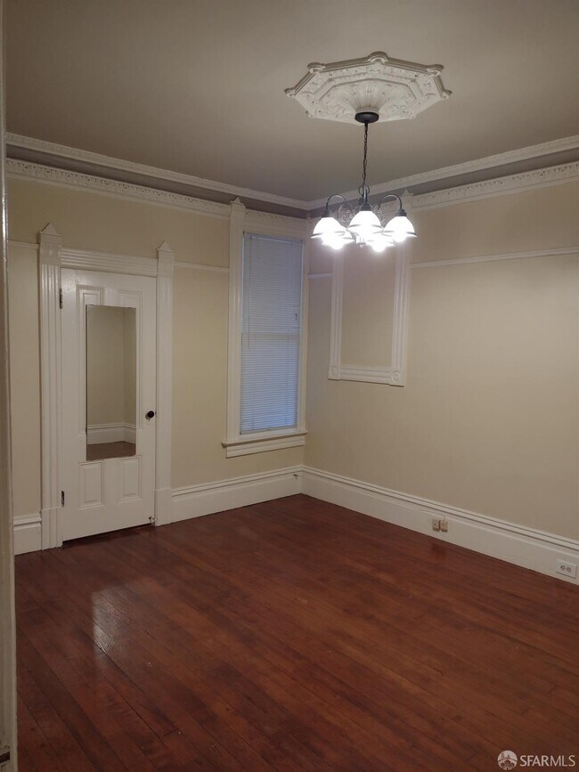
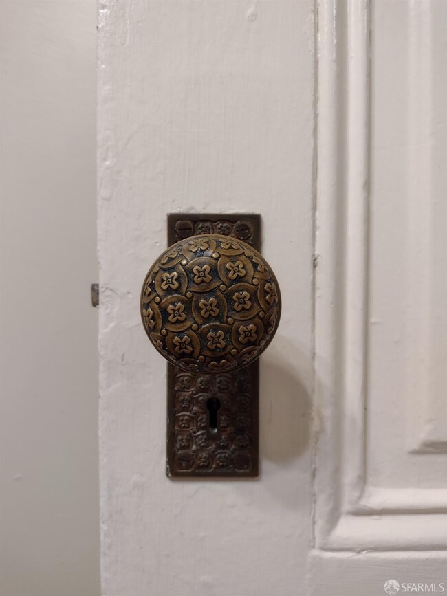
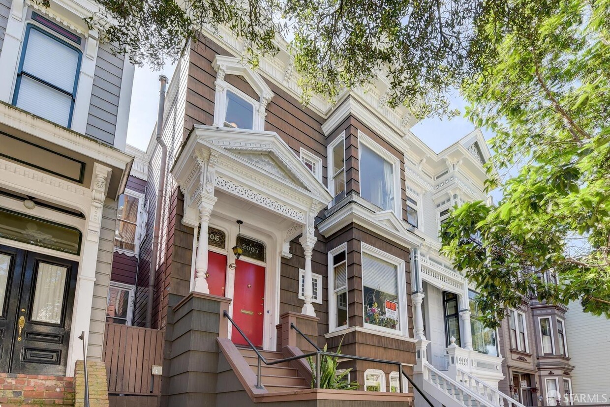
In-between Lower Pacific Heights and Japantown in San Francisco you will find several historic pre-1906 Victorian buildings. On the first level of a circa 1880's home is a gorgeous full floor flat. This spacious unit features 4 large bedrooms and 2 full bathrooms. The kitchen and baths have been updated while period details can still be found throughout the home. An in unit laundry room provides fabulous southern views and there is a backyard shared amongst the intimate 3 unit building.
2009 Pine St is an apartment community located in San Francisco County and the 94115 ZIP Code.
Features
Air Conditioning
Hardwood Floors
Tub/Shower
Smoke Free
- Air Conditioning
- Smoke Free
- Tub/Shower
- Sprinkler System
- Oven
- Range
- Breakfast Nook
- Hardwood Floors
- Carpet
- Patio
Location
Get Directions
Lower Pacific Heights is a vibrant San Francisco neighborhood situated between Pacific Heights, Japantown, the Fillmore District, and Laurel Heights. Formerly known as Upper Fillmore, Lower Pacific Heights offers residents a wide variety of apartments, condos, and houses available for rent, many of which boast scenic views due to the neighborhood’s hilly environment.
Lower Pacific Heights is regarded for its walkable layout, with many rentals situated within easy walking distance of the diverse restaurants, shops, coffeehouses, and bars that line Fillmore Street, the community’s main commercial thoroughfare. The neighborhood’s central locale is a major part of its allure, providing quick access to Union Square, the University of San Francisco, the Financial District, several prominent medical centers, tech employers, landmarks, and more.
Learn more about living in Lower Pacific HeightsBelow are rent ranges for similar nearby apartments
Amenities
- Air Conditioning
- Smoke Free
- Tub/Shower
- Sprinkler System
- Oven
- Range
- Breakfast Nook
- Hardwood Floors
- Carpet
- Patio
Education
| Colleges & Universities | Distance | ||
|---|---|---|---|
| Colleges & Universities | Distance | ||
| Walk: | 14 min | 0.7 mi | |
| Drive: | 4 min | 1.4 mi | |
| Drive: | 5 min | 1.9 mi | |
| Drive: | 6 min | 2.1 mi |
2009 Pine St is within 14 minutes or 0.7 mile from UC San Francisco, Mount Zion. It is also near Academy of Art University and University of San Francisco.
Transportation options available in San Francisco include Van Ness And California, located 0.5 mile from 2009 Pine St. 2009 Pine St is near San Francisco International, located 14.8 miles or 24 minutes away, and Metro Oakland International, located 20.6 miles or 33 minutes away.
| Transit / Subway | Distance | ||
|---|---|---|---|
| Transit / Subway | Distance | ||
|
|
Walk: | 9 min | 0.5 mi |
|
|
Walk: | 12 min | 0.6 mi |
|
|
Walk: | 14 min | 0.7 mi |
|
|
Walk: | 17 min | 0.9 mi |
|
|
Drive: | 3 min | 1.1 mi |
| Commuter Rail | Distance | ||
|---|---|---|---|
| Commuter Rail | Distance | ||
| Drive: | 7 min | 2.6 mi | |
| Drive: | 8 min | 2.7 mi | |
| Drive: | 9 min | 4.1 mi | |
| Drive: | 9 min | 4.2 mi | |
| Drive: | 13 min | 6.9 mi |
| Airports | Distance | ||
|---|---|---|---|
| Airports | Distance | ||
|
San Francisco International
|
Drive: | 24 min | 14.8 mi |
|
Metro Oakland International
|
Drive: | 33 min | 20.6 mi |
Time and distance from 2009 Pine St.
| Shopping Centers | Distance | ||
|---|---|---|---|
| Shopping Centers | Distance | ||
| Walk: | 6 min | 0.3 mi | |
| Walk: | 9 min | 0.5 mi | |
| Drive: | 5 min | 1.6 mi |
2009 Pine St has 3 shopping centers within 1.6 miles, which is about a 5-minute walk. The miles and minutes will be for the farthest away property.
| Parks and Recreation | Distance | ||
|---|---|---|---|
| Parks and Recreation | Distance | ||
|
Children's Creativity Museum
|
Drive: | 6 min | 2.0 mi |
|
San Francisco Maritime National Historical Park
|
Drive: | 6 min | 2.1 mi |
|
Buena Vista Park
|
Drive: | 6 min | 2.1 mi |
|
Exploratorium
|
Drive: | 5 min | 2.2 mi |
|
Randall Museum
|
Drive: | 7 min | 2.6 mi |
2009 Pine St has 5 parks within 2.6 miles, including San Francisco Maritime National Historical Park, Children's Creativity Museum, and Exploratorium.
| Hospitals | Distance | ||
|---|---|---|---|
| Hospitals | Distance | ||
| Walk: | 12 min | 0.6 mi | |
| Walk: | 13 min | 0.7 mi | |
| Drive: | 4 min | 1.4 mi |
2009 Pine St has 3 hospitals within 1.4 miles, the nearest is California Pacific Medical Center - Van Ness Campus which is 0.6 mile away and a 12 minute walk.
| Military Bases | Distance | ||
|---|---|---|---|
| Military Bases | Distance | ||
| Drive: | 12 min | 4.3 mi | |
| Drive: | 13 min | 4.7 mi | |
| Drive: | 16 min | 6.7 mi |
2009 Pine St has 3 military bases within 6.7 miles, the nearest is East Fort Miley which is 4.3 miles away and a 12 minute drive.
You May Also Like
Similar Rentals Nearby


What Are Walk Score®, Transit Score®, and Bike Score® Ratings?
Walk Score® measures the walkability of any address. Transit Score® measures access to public transit. Bike Score® measures the bikeability of any address.
What is a Sound Score Rating?
A Sound Score Rating aggregates noise caused by vehicle traffic, airplane traffic and local sources
2009 Pine St
San Francisco, CA 94115