$1,400
/ Month
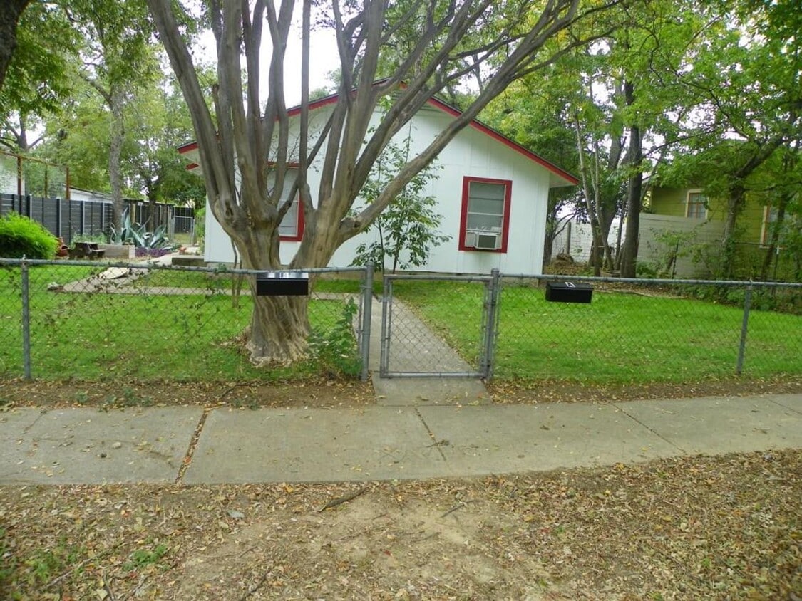
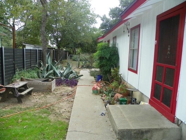
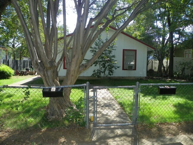
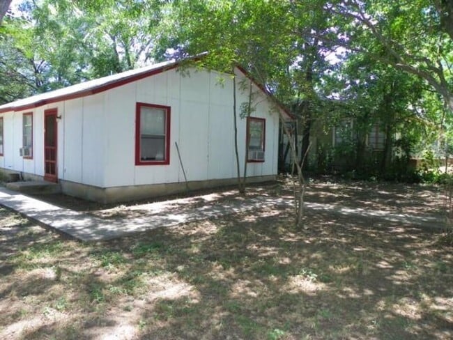
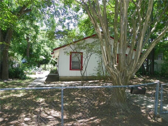
2007 E 16th St Unit A
Austin, TX 78702
Today
Favorites
512-363-7877
-
Bedrooms
2
-
Bathrooms
1
-
Square Feet
700 sq ft
-
Available
Available Now
2007 E 16th St Unit A

Favorites
A small, east side neighborhood with a hipster vibe, Chestnut is an affordable Austin neighborhood that’s about a mile from the University of Texas at Austin campus. Chestnut residents can hop aboard the MetroRail at M L King Jr Station and quickly get to work or school. Chestnut is located between Martin Luther King Jr Boulevard and East 12th Street, extending from Chicon Street east to Airport Boulevard.
One of the neighborhood’s quirkier features is the Museum of Natural & Artificial Ephemerata, an in-home, family-run museum of quirky collections. Tours are available with a suggested donation, where you’ll enjoy themed exhibitions as well as traveling exhibitions. Another unique landmark, the Coleto Moonlight Tower, is a historical light tower located on the corner of 13 Street and Coleto Street. Built in 1894, 31 ltowers lit up Austin and stood 164 feet tall. Today, only a few remain.
Learn more about living in Chestnut
Education
| Colleges & Universities | Distance | ||
|---|---|---|---|
| Colleges & Universities | Distance | ||
| Drive: | 3 min | 1.3 mi | |
| Drive: | 3 min | 1.4 mi | |
| Drive: | 4 min | 2.2 mi | |
| Drive: | 9 min | 4.6 mi |
2007 E 16th St Unit A is within 3 minutes or 1.3 miles from University of Texas at Austin. It is also near Austin C.C., Eastview Campus and Austin C.C., Rio Grande Campus.
Transportation options available in Austin include M L King Jr Station, located 0.7 mile from 2007 E 16th St Unit A. 2007 E 16th St Unit A is near Austin-Bergstrom International, located 10.8 miles or 21 minutes away.
| Transit / Subway | Distance | ||
|---|---|---|---|
| Transit / Subway | Distance | ||
| Walk: | 13 min | 0.7 mi | |
| Drive: | 4 min | 1.6 mi | |
| Drive: | 4 min | 2.1 mi | |
| Drive: | 7 min | 4.6 mi | |
| Drive: | 10 min | 5.5 mi |
| Commuter Rail | Distance | ||
|---|---|---|---|
| Commuter Rail | Distance | ||
|
|
Drive: | 8 min | 3.4 mi |
|
|
Drive: | 39 min | 32.6 mi |
|
|
Drive: | 44 min | 35.6 mi |
| Airports | Distance | ||
|---|---|---|---|
| Airports | Distance | ||
|
Austin-Bergstrom International
|
Drive: | 21 min | 10.8 mi |
Time and distance from 2007 E 16th St Unit A.
| Shopping Centers | Distance | ||
|---|---|---|---|
| Shopping Centers | Distance | ||
| Drive: | 3 min | 1.2 mi | |
| Drive: | 2 min | 1.4 mi | |
| Drive: | 4 min | 1.6 mi |
2007 E 16th St Unit A has 3 shopping centers within 1.6 miles, which is about a 4-minute drive. The miles and minutes will be for the farthest away property.
| Parks and Recreation | Distance | ||
|---|---|---|---|
| Parks and Recreation | Distance | ||
|
Boggy Creek Greenbelt
|
Walk: | 17 min | 0.9 mi |
|
Texas Memorial Museum
|
Drive: | 4 min | 1.4 mi |
|
Thinkery
|
Drive: | 5 min | 2.6 mi |
|
Elisabet Ney Museum
|
Drive: | 7 min | 2.7 mi |
|
Shoal Creek Greenbelt Park
|
Drive: | 6 min | 2.9 mi |
2007 E 16th St Unit A has 5 parks within 2.9 miles, including Boggy Creek Greenbelt, Texas Memorial Museum, and Thinkery.
| Hospitals | Distance | ||
|---|---|---|---|
| Hospitals | Distance | ||
| Walk: | 20 min | 1.1 mi | |
| Drive: | 2 min | 1.2 mi | |
| Drive: | 3 min | 1.4 mi |
2007 E 16th St Unit A has 3 hospitals within 1.4 miles, the nearest is Austin Lakes Hospital which is 1.1 miles away and a 20 minute walk.
| Military Bases | Distance | ||
|---|---|---|---|
| Military Bases | Distance | ||
| Drive: | 82 min | 67.5 mi | |
| Drive: | 90 min | 73.5 mi |
2007 E 16th St Unit A is 67.5 miles from Randolph Air Force Base, and is convenient to other military bases, including Fort Hood.
You May Also Like
Similar Rentals Nearby


What Are Walk Score®, Transit Score®, and Bike Score® Ratings?
Walk Score® measures the walkability of any address. Transit Score® measures access to public transit. Bike Score® measures the bikeability of any address.
What is a Sound Score Rating?
A Sound Score Rating aggregates noise caused by vehicle traffic, airplane traffic and local sources

2007 E 16th St
Austin, TX 78702