$1,450
/ Month
2007 Conestoga Trail
Austin, TX 78744
Favorites
2007 Conestoga Trail

Favorites
Check Back Soon for Upcoming Availability
| Beds | Baths | Average SF |
|---|---|---|
| 2 Bedrooms 2 Bedrooms 2 Br | 1 Bath 1 Bath 1 Ba | 903 SF |
Fees and Policies
The fees listed below are community-provided and may exclude utilities or add-ons. All payments are made directly to the property and are non-refundable unless otherwise specified.
- Dogs Allowed
-
Fees not specified
-
Weight limit--
-
Pet Limit--
About This Property
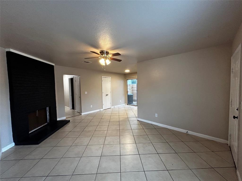
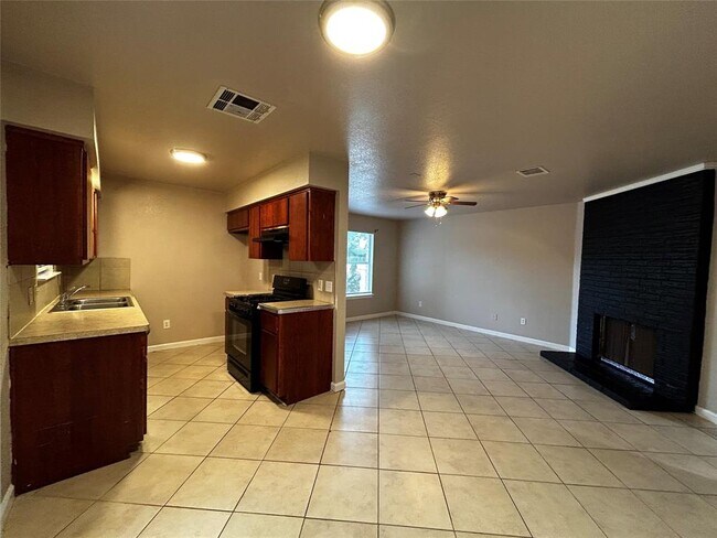
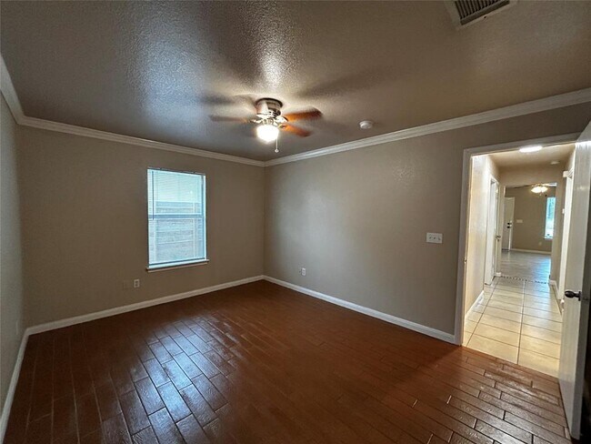
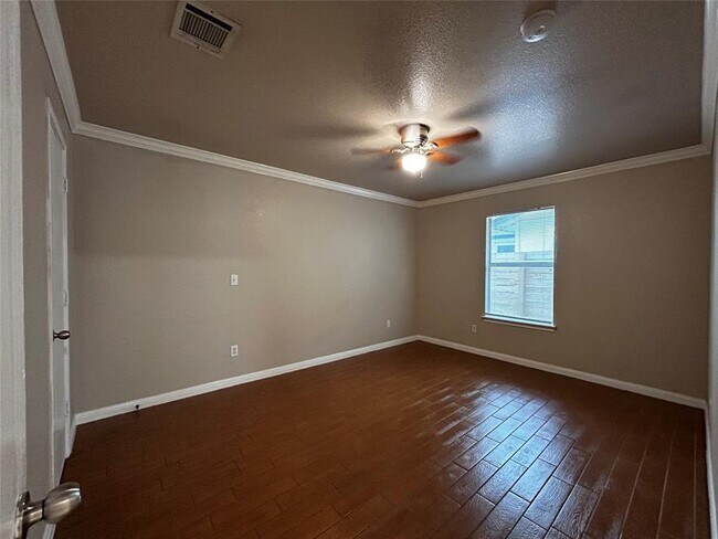
TWO bedrooms, ONE bath, ONE car garage. All tile flooring through out. Corner lot duplex within walking distance to elementary school and just a short drive away from downtown Austin.
2007 Conestoga Trail is a townhome located in Travis County and the 78744 ZIP Code. This area is served by the Austin Independent School District attendance zone.
Townhome Features
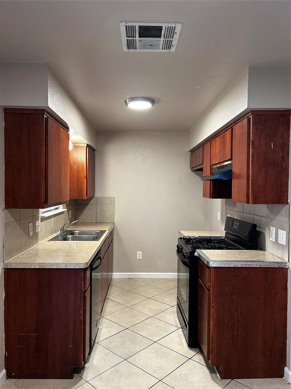
- Dishwasher
- Disposal
- Tile Floors
2007 Conestoga Trail,
Austin,
TX
78744
On the west side of McKinney Falls State Park along I-35 is where you’ll find Franklin Park, a charming suburban community that’s been housing renters since the 1970s. The neighborhood is dominated by ranch-style homes, some of which have received charming renovations as this part of Austin explodes with prospective tenants.
On Franklin Park’s southern border is the Williamson Creek Greenbelt, which snakes for miles throughout south Austin. The nearby state park puts further emphasis on how much this area values its green space. There are a number of fantastic, specialized schools that serve the area, making Franklin Park ideal for families. And with the Downtown Austin just six miles away, you’ll never be too far from the conveniences of the city.
Learn more about living in Franklin ParkBelow are rent ranges for similar nearby apartments
Amenities
- Dishwasher
- Disposal
- Tile Floors
Education
| Colleges & Universities | Distance | ||
|---|---|---|---|
| Colleges & Universities | Distance | ||
| Drive: | 6 min | 2.8 mi | |
| Drive: | 7 min | 3.8 mi | |
| Drive: | 11 min | 5.6 mi | |
| Drive: | 11 min | 7.3 mi |
2007 Conestoga Trail is within 6 minutes or 2.8 miles from Austin C.C., South Austin. It is also near St. Edward's University and Austin C.C., Riverside Campus.
Schools


Public Elementary School
Grades PK-5
527 Students
Attendance Zone
Public Middle School
Grades 6-8
223 Students
Attendance Zone
Public High School
Grades 9-12
1,137 Students
Attendance Zone
Private Elementary & Middle School
Grades PK-8
103 Students
Nearby
Private Middle & High School
Grades 6-12
Nearby
School data provided by
 The GreatSchools Rating helps parents compare schools within a state based on a variety of school quality indicators and provides a helpful picture of how effectively each school serves all of its students. Ratings are on a scale of 1 (below average) to 10 (above average) and can include test scores, college readiness, academic progress, advanced courses, equity, discipline and attendance data. We also advise parents to visit schools, consider other information on school performance and programs, and consider family needs as part of the school selection process.
View GreatSchools Rating Methodology
Data provided by GreatSchools.org © 2026. All rights reserved.
View GreatSchools Rating Methodology
Data provided by GreatSchools.org © 2026. All rights reserved.
Transportation options available in Austin include Downtown Station, located 5.6 miles from 2007 Conestoga Trail. 2007 Conestoga Trail is near Austin-Bergstrom International, located 8.7 miles or 19 minutes away.
| Transit / Subway | Distance | ||
|---|---|---|---|
| Transit / Subway | Distance | ||
| Drive: | 8 min | 5.6 mi | |
| Drive: | 9 min | 6.3 mi | |
| Drive: | 12 min | 7.9 mi | |
| Drive: | 15 min | 10.3 mi |
| Commuter Rail | Distance | ||
|---|---|---|---|
| Commuter Rail | Distance | ||
|
|
Drive: | 12 min | 7.3 mi |
|
|
Drive: | 32 min | 26.2 mi |
|
|
Drive: | 51 min | 41.3 mi |
| Airports | Distance | ||
|---|---|---|---|
| Airports | Distance | ||
|
Austin-Bergstrom International
|
Drive: | 19 min | 8.7 mi |
Walkability Near 2007 Conestoga Trail Austin, TX 78744
Getting Around
 What do Walkability, Transit, Drivability, and Bikeability mean?
Walkability measures the walking distance to day-to-day needs.
Transit measures access to public transportation.
Drivability measures congestion, parking availability, and access to major roads.
Bikeability measures the suitability for cycling.
How It Works
What do Walkability, Transit, Drivability, and Bikeability mean?
Walkability measures the walking distance to day-to-day needs.
Transit measures access to public transportation.
Drivability measures congestion, parking availability, and access to major roads.
Bikeability measures the suitability for cycling.
How It Works
Fairly Walkable
Walkability
50
/ 100
Some Public Transit
Transit
40
/ 100
Exceptionally Drivable
Drivability
90
/ 100
Fairly Bikeable
Bikeability
50
/ 100
Scores provided by
-
Soundscore™
-
/ 100
Traffic
-Airport
-Businesses
-Scores provided by
HowLoud What is a Sound Score Rating? A Sound Score Rating aggregates noise caused by vehicle traffic, airplane traffic and local sources. How It WorksTime and distance from 2007 Conestoga Trail.
| Shopping Centers | Distance | ||
|---|---|---|---|
| Shopping Centers | Distance | ||
| Walk: | 7 min | 0.4 mi | |
| Walk: | 12 min | 0.7 mi | |
| Walk: | 16 min | 0.9 mi |
2007 Conestoga Trail has 3 shopping centers within 0.9 mile, which is about a 16-minute walk. The miles and minutes will be for the farthest away property.
| Parks and Recreation | Distance | ||
|---|---|---|---|
| Parks and Recreation | Distance | ||
|
Onion Creek Greenbelt Park
|
Drive: | 7 min | 2.7 mi |
|
Goat Cave Nature Preserve
|
Drive: | 7 min | 3.1 mi |
|
Blunn Creek Nature Preserve
|
Drive: | 7 min | 4.0 mi |
|
Lady Bird Lake
|
Drive: | 8 min | 5.1 mi |
|
McKinney Falls State Park
|
Drive: | 13 min | 5.6 mi |
2007 Conestoga Trail has 5 parks within 5.6 miles, including Onion Creek Greenbelt Park, Blunn Creek Nature Preserve, and Goat Cave Nature Preserve.
| Hospitals | Distance | ||
|---|---|---|---|
| Hospitals | Distance | ||
| Drive: | 5 min | 2.6 mi | |
| Drive: | 7 min | 3.8 mi | |
| Drive: | 7 min | 4.1 mi |
2007 Conestoga Trail has 3 hospitals within 4.1 miles, the nearest is Austin Oaks Hospital which is 2.6 miles away and a 5 minute drive.
| Military Bases | Distance | ||
|---|---|---|---|
| Military Bases | Distance | ||
| Drive: | 75 min | 61.2 mi | |
| Drive: | 82 min | 71.4 mi | |
| Drive: | 103 min | 88.6 mi |
2007 Conestoga Trail has 3 military bases within 88.6 miles, the nearest is Randolph Air Force Base which is 61.2 miles away and a 75 minute drive.
You May Also Like
Similar Rentals Nearby
-
-
2 Beds$2,755+Total Monthly PriceTotal Monthly Price NewPrices include base rent and required monthly fees of $79. Variable costs based on usage may apply.Base Rent:2 Beds$2,675+
Pets Allowed In Unit Washer & Dryer Clubhouse Package Service Elevator EV Charging Rooftop Deck
-
-
-
2 Beds$2,305+3 Beds$3,032+Total Monthly PriceTotal Monthly Price NewPrices include base rent and required monthly fees of $193. Variable costs based on usage may apply.Base Rent:2 Beds$2,111+3 Beds$2,838+2 Months Free
Pets Allowed Fitness Center Pool Package Service Gated Online Services
-
-
1 / 48
 2 Beds$1,981+3 Beds$2,639+Total Monthly PriceTotal Monthly Price NewPrices include base rent and required monthly fees of $49. Variable costs based on usage may apply.Base Rent:2 Beds$1,931+3 Beds$2,589+3 Months Free
Pets Allowed Fitness Center Pool Clubhouse EV Charging Yard Walk-Up
-
-
2 Beds$1,212+Total Monthly PriceTotal Monthly Price NewPrices include base rent and required monthly fees of $62. Variable costs based on usage may apply.Base Rent:2 Beds$1,150+Specials
Fitness Center Pool Dishwasher In Unit Washer & Dryer
-


What Are Walk Score®, Transit Score®, and Bike Score® Ratings?
Walk Score® measures the walkability of any address. Transit Score® measures access to public transit. Bike Score® measures the bikeability of any address.
What is a Sound Score Rating?
A Sound Score Rating aggregates noise caused by vehicle traffic, airplane traffic and local sources.

2007 Conestoga Trail
Austin, TX 78744