$1,250
/ Month
2 Poplar St
Cincinnati, OH 45216
2 Weeks Ago
|
Edit
Favorites
2 Poplar St
Favorites
Check Back Soon for Upcoming Availability
| Beds | Baths | Average SF |
|---|---|---|
| 2 Bedrooms 2 Bedrooms 2 Br | 1 Bath 1 Bath 1 Ba | 1,100 SF |
Fees and Policies
The fees listed below are community-provided and may exclude utilities or add-ons. All payments are made directly to the property and are non-refundable unless otherwise specified.
Details
Utilities Included
-
Water
-
Trash Removal
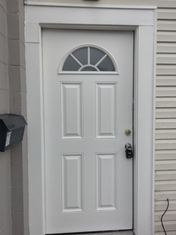
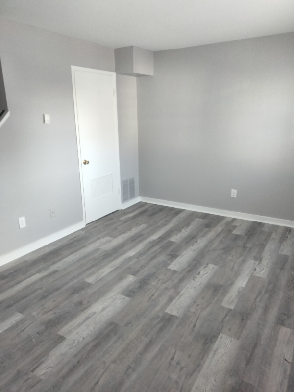
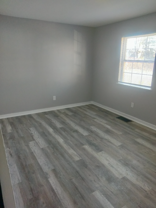
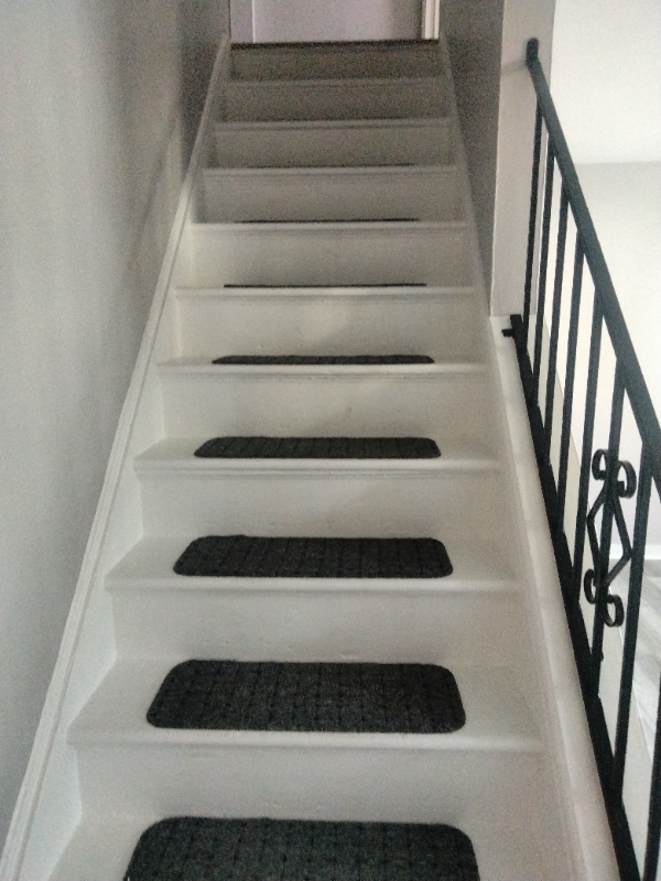
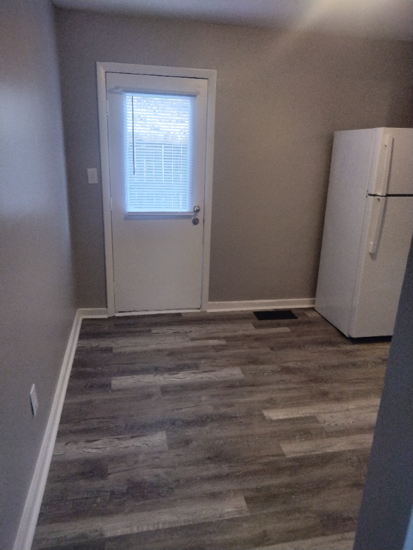
About This Property
Property Id: 1627656 Beautiful newly renovated townhouse with central air, new vinyl flooring, new fixtures, countertop, sinks and updated appliances. Quiet three building complex sitting on a cul-de-sac next to a large open field. Unit includes an enclosed patio, on site laundry and off street parking. Landlord pays water and trash. Tenant needs first month, last month, and deposit to move into unit = $3750.00. Not approved for Section 8.
2 Poplar St is a townhome located in Hamilton County and the 45216 ZIP Code. This area is served by the St Bernard-Elmwood Place City School District attendance zone.
Townhome Features
Refrigerator
Oven
Vinyl Flooring
Cable Ready
- Cable Ready
- Oven
- Refrigerator
- Vinyl Flooring
2 Poplar St,
Cincinnati,
OH
45216
Cincinnati sits on the northern bank of the Ohio River, where rolling hills meet a city that helped establish the Midwest long before other major metros existed. Settled in 1788, the Queen City sits west of the Appalachian Mountains and combines historic culture with urban living.
Today, neighborhoods like Over-the-Rhine, Hyde Park, and Mount Adams each bring a distinct character to city life. Over-the-Rhine is packed with restored 19th-century architecture, Findlay Market, and Music Hall. Mount Adams perches beside Eden Park with stunning river views, while Hyde Park Square draws locals and tourists alike with local cafes and walkable streets.
Renters will find a wide range of housing options across the city, from converted lofts and townhouses in Over-the-Rhine to sleek high-rise apartment communities along the riverfront at The Banks. Clifton and Oakley offer everything from charming older buildings to newer developments with modern amenities.
Learn more about living in CincinnatiBelow are rent ranges for similar nearby apartments
Amenities
- Cable Ready
- Oven
- Refrigerator
- Vinyl Flooring
Expenses
Utilities Included
Water, Trash Removal
Included
Education
| Colleges & Universities | Distance | ||
|---|---|---|---|
| Colleges & Universities | Distance | ||
| Drive: | 8 min | 3.5 mi | |
| Drive: | 9 min | 4.7 mi | |
| Drive: | 9 min | 4.8 mi | |
| Drive: | 12 min | 5.4 mi |
2 Poplar St is within 8 minutes or 3.5 miles from Xavier University. It is also near Univ. of Cincinnati, Medical and University of Cincinnati.
Schools

Public Elementary School
Grades PK-5
132 Students
Attendance Zone
Public Middle & High School
Grades 6-12
356 Students
Attendance Zone
Private Elementary & Middle School
Grades K-8
307 Students
Nearby
Private High School
Grades 9-12
1,529 Students
Nearby
School data provided by
 The GreatSchools Rating helps parents compare schools within a state based on a variety of school quality indicators and provides a helpful picture of how effectively each school serves all of its students. Ratings are on a scale of 1 (below average) to 10 (above average) and can include test scores, college readiness, academic progress, advanced courses, equity, discipline and attendance data. We also advise parents to visit schools, consider other information on school performance and programs, and consider family needs as part of the school selection process.
View GreatSchools Rating Methodology
Data provided by GreatSchools.org © 2026. All rights reserved.
View GreatSchools Rating Methodology
Data provided by GreatSchools.org © 2026. All rights reserved.
Transportation options available in Cincinnati include Brewery District Station - Elm & Henry, located 7.7 miles from 2 Poplar St. 2 Poplar St is near Cincinnati/Northern Kentucky International, located 21.7 miles or 36 minutes away.
| Transit / Subway | Distance | ||
|---|---|---|---|
| Transit / Subway | Distance | ||
| Drive: | 12 min | 7.7 mi | |
| Drive: | 12 min | 7.8 mi | |
| Drive: | 12 min | 7.8 mi | |
| Drive: | 12 min | 7.9 mi | |
| Drive: | 13 min | 8.0 mi |
| Commuter Rail | Distance | ||
|---|---|---|---|
| Commuter Rail | Distance | ||
|
|
Drive: | 11 min | 7.6 mi |
| Airports | Distance | ||
|---|---|---|---|
| Airports | Distance | ||
|
Cincinnati/Northern Kentucky International
|
Drive: | 36 min | 21.7 mi |
Walkability Near 2 Poplar St Cincinnati, OH 45216
Getting Around
 What do Walkability, Transit, Drivability, and Bikeability mean?
Walkability measures the walking distance to day-to-day needs.
Transit measures access to public transportation.
Drivability measures congestion, parking availability, and access to major roads.
Bikeability measures the suitability for cycling.
How It Works
What do Walkability, Transit, Drivability, and Bikeability mean?
Walkability measures the walking distance to day-to-day needs.
Transit measures access to public transportation.
Drivability measures congestion, parking availability, and access to major roads.
Bikeability measures the suitability for cycling.
How It Works
Somewhat Walkable
Walkability
30
/ 100
Limited Public Transit
Transit
20
/ 100
Exceptionally Drivable
Drivability
100
/ 100
Not Bikeable
Bikeability
0
/ 100
Scores provided by
-
Soundscore™
-
/ 100
Traffic
-Airport
-Businesses
-Scores provided by
HowLoud What is a Sound Score Rating? A Sound Score Rating aggregates noise caused by vehicle traffic, airplane traffic and local sources. How It WorksTime and distance from 2 Poplar St.
| Shopping Centers | Distance | ||
|---|---|---|---|
| Shopping Centers | Distance | ||
| Drive: | 6 min | 3.0 mi | |
| Drive: | 8 min | 3.7 mi | |
| Drive: | 8 min | 4.1 mi |
2 Poplar St has 3 shopping centers within 4.1 miles, which is about a 8-minute drive. The miles and minutes will be for the farthest away property.
| Parks and Recreation | Distance | ||
|---|---|---|---|
| Parks and Recreation | Distance | ||
|
Avon Woods Natural Area/Preserve
|
Drive: | 4 min | 2.3 mi |
|
Caldwell Preserve
|
Drive: | 8 min | 4.0 mi |
|
French Park
|
Drive: | 12 min | 5.5 mi |
|
Buttercup Valley
|
Drive: | 11 min | 6.5 mi |
|
LaBoiteaux Woods
|
Drive: | 14 min | 6.7 mi |
2 Poplar St has 5 parks within 6.7 miles, including Caldwell Preserve, Avon Woods Natural Area/Preserve, and French Park.
| Hospitals | Distance | ||
|---|---|---|---|
| Hospitals | Distance | ||
| Drive: | 5 min | 3.0 mi | |
| Drive: | 9 min | 4.6 mi | |
| Drive: | 10 min | 5.7 mi |
2 Poplar St has 3 hospitals within 5.7 miles, the nearest is Summit Behavioral Healthcare which is 3.0 miles away and a 5 minute drive.
| Military Bases | Distance | ||
|---|---|---|---|
| Military Bases | Distance | ||
| Drive: | 64 min | 49.6 mi | |
| Drive: | 70 min | 54.7 mi | |
| Drive: | 72 min | 58.0 mi |
2 Poplar St has 3 military bases within 58.0 miles, the nearest is Gentile Air Force Station which is 49.6 miles away and a 64 minute drive.
You May Also Like
Similar Rentals Nearby
-
-
-
-
-
-
-
-
-
1 / 18

-


What Are Walk Score®, Transit Score®, and Bike Score® Ratings?
Walk Score® measures the walkability of any address. Transit Score® measures access to public transit. Bike Score® measures the bikeability of any address.
What is a Sound Score Rating?
A Sound Score Rating aggregates noise caused by vehicle traffic, airplane traffic and local sources.

2 Poplar St
Cincinnati, OH 45216