
$2,800 / Month
2 A St Unit 142 A Street
Hayward, CA 94541
2 Weeks Ago
Favorites
2 A St Unit 142 A Street

Favorites
Check Back Soon for Upcoming Availability
| Beds | Baths | Average SF |
|---|---|---|
| 2 Bedrooms 2 Bedrooms 2 Br | 2.5 Baths 2.5 Baths 2.5 Ba | 1,200 SF |
Fees and Policies
The fees below are based on community-supplied data and may exclude additional fees and utilities.
- Parking
-
Garage--
Details
Utilities Included
-
Water
About This Property
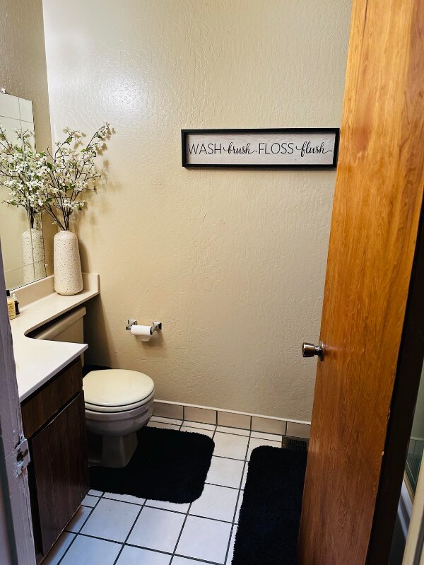
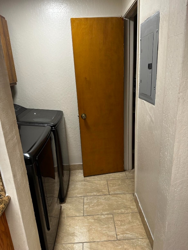
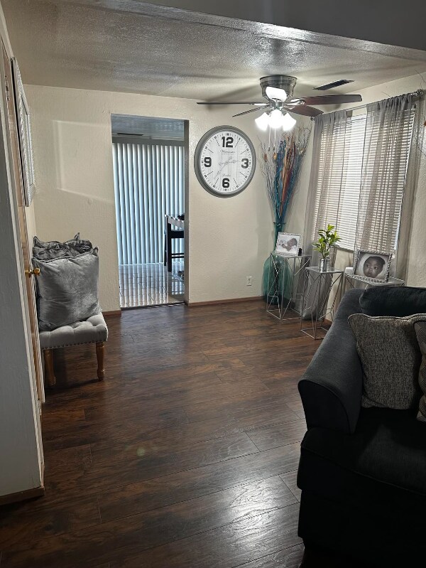
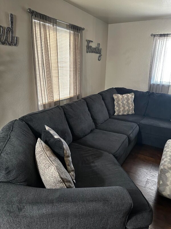
Property Id: 1424590 Townhouse layout Two large bedroom including master bedroom Half bath downside Private Backyard with Patio Central location Walking distance to Bart Station and Amtrak Walking distance to shopping complex including Costco Easy access to 880 & 580 Freeway
2 A St is an apartment community located in Alameda County and the 94541 ZIP Code.
Features
Dishwasher
Refrigerator
Disposal
Freezer
- Dishwasher
- Disposal
- Oven
- Refrigerator
- Freezer
- Tile Floors
- Fenced Lot
- Lawn
Location
Get Directions
South of Oakland and north of Hayward lies the dreamily named Cherryland, an unincorporated community of quiet residential streets and lush parks. Clues to its namesake dot the neighborhood's streets, from Cherry Way to Blossom Way. The San Lorenzo Creek connects the area via water to the San Francisco Bay, cementing its place in the greater East Bay region.
Learn more about living in CherrylandBelow are rent ranges for similar nearby apartments
Amenities
- Dishwasher
- Disposal
- Oven
- Refrigerator
- Freezer
- Tile Floors
- Fenced Lot
- Lawn
Expenses
Utilities Included
Water
Included
Education
| Colleges & Universities | Distance | ||
|---|---|---|---|
| Colleges & Universities | Distance | ||
| Drive: | 8 min | 3.1 mi | |
| Drive: | 8 min | 4.0 mi | |
| Drive: | 20 min | 11.9 mi | |
| Drive: | 17 min | 13.0 mi |
2 A St Unit 142 A Street is within 8 minutes or 3.1 miles from Cal State East Bay. It is also near Chabot College and Mills College.
Transportation options available in Hayward include Hayward Station, located 0.9 mile from 2 A St Unit 142 A Street. 2 A St Unit 142 A Street is near Metro Oakland International, located 9.6 miles or 14 minutes away, and San Francisco International, located 23.3 miles or 30 minutes away.
| Transit / Subway | Distance | ||
|---|---|---|---|
| Transit / Subway | Distance | ||
|
|
Walk: | 16 min | 0.9 mi |
|
|
Drive: | 7 min | 3.5 mi |
|
|
Drive: | 8 min | 4.1 mi |
|
|
Drive: | 10 min | 5.4 mi |
|
|
Drive: | 10 min | 6.9 mi |
| Commuter Rail | Distance | ||
|---|---|---|---|
| Commuter Rail | Distance | ||
|
|
Walk: | 3 min | 0.2 mi |
| Walk: | 3 min | 0.2 mi | |
| Drive: | 16 min | 10.3 mi | |
| Drive: | 17 min | 10.5 mi | |
| Drive: | 24 min | 16.2 mi |
| Airports | Distance | ||
|---|---|---|---|
| Airports | Distance | ||
|
Metro Oakland International
|
Drive: | 14 min | 9.6 mi |
|
San Francisco International
|
Drive: | 30 min | 23.3 mi |
Time and distance from 2 A St Unit 142 A Street.
| Shopping Centers | Distance | ||
|---|---|---|---|
| Shopping Centers | Distance | ||
| Walk: | 17 min | 0.9 mi | |
| Walk: | 19 min | 1.0 mi | |
| Drive: | 3 min | 1.3 mi |
2 A St Unit 142 A Street has 3 shopping centers within 1.3 miles, which is about a 3-minute walk. The miles and minutes will be for the farthest away property.
| Parks and Recreation | Distance | ||
|---|---|---|---|
| Parks and Recreation | Distance | ||
|
Sulphur Creek Nature Center
|
Drive: | 7 min | 2.6 mi |
|
Don Castro Regional Recreation Area
|
Drive: | 8 min | 3.6 mi |
|
Lake Chabot Regional Park
|
Drive: | 11 min | 5.0 mi |
|
Hayward Regional Shoreline
|
Drive: | 13 min | 5.3 mi |
|
Hayward Shoreline Interpretive Center
|
Drive: | 11 min | 5.4 mi |
2 A St Unit 142 A Street has 5 parks within 5.4 miles, including Sulphur Creek Nature Center, Don Castro Regional Recreation Area, and Lake Chabot Regional Park.
| Hospitals | Distance | ||
|---|---|---|---|
| Hospitals | Distance | ||
| Drive: | 7 min | 3.7 mi | |
| Drive: | 7 min | 4.5 mi | |
| Drive: | 9 min | 5.9 mi |
2 A St Unit 142 A Street has 3 hospitals within 5.9 miles, the nearest is St. Rose Hospital which is 3.7 miles away and a 7 minute drive.
| Military Bases | Distance | ||
|---|---|---|---|
| Military Bases | Distance | ||
| Drive: | 26 min | 17.0 mi | |
| Drive: | 27 min | 17.2 mi |
2 A St Unit 142 A Street is 17.0 miles from Alameda/US Naval Air Station Alameda, and is convenient to other military bases, including Alameda/US Naval Air Station San Francisco.
You May Also Like
Similar Rentals Nearby


What Are Walk Score®, Transit Score®, and Bike Score® Ratings?
Walk Score® measures the walkability of any address. Transit Score® measures access to public transit. Bike Score® measures the bikeability of any address.
What is a Sound Score Rating?
A Sound Score Rating aggregates noise caused by vehicle traffic, airplane traffic and local sources
2 A St
Hayward, CA 94541