$2,850
Total Monthly Price
12 Month Lease
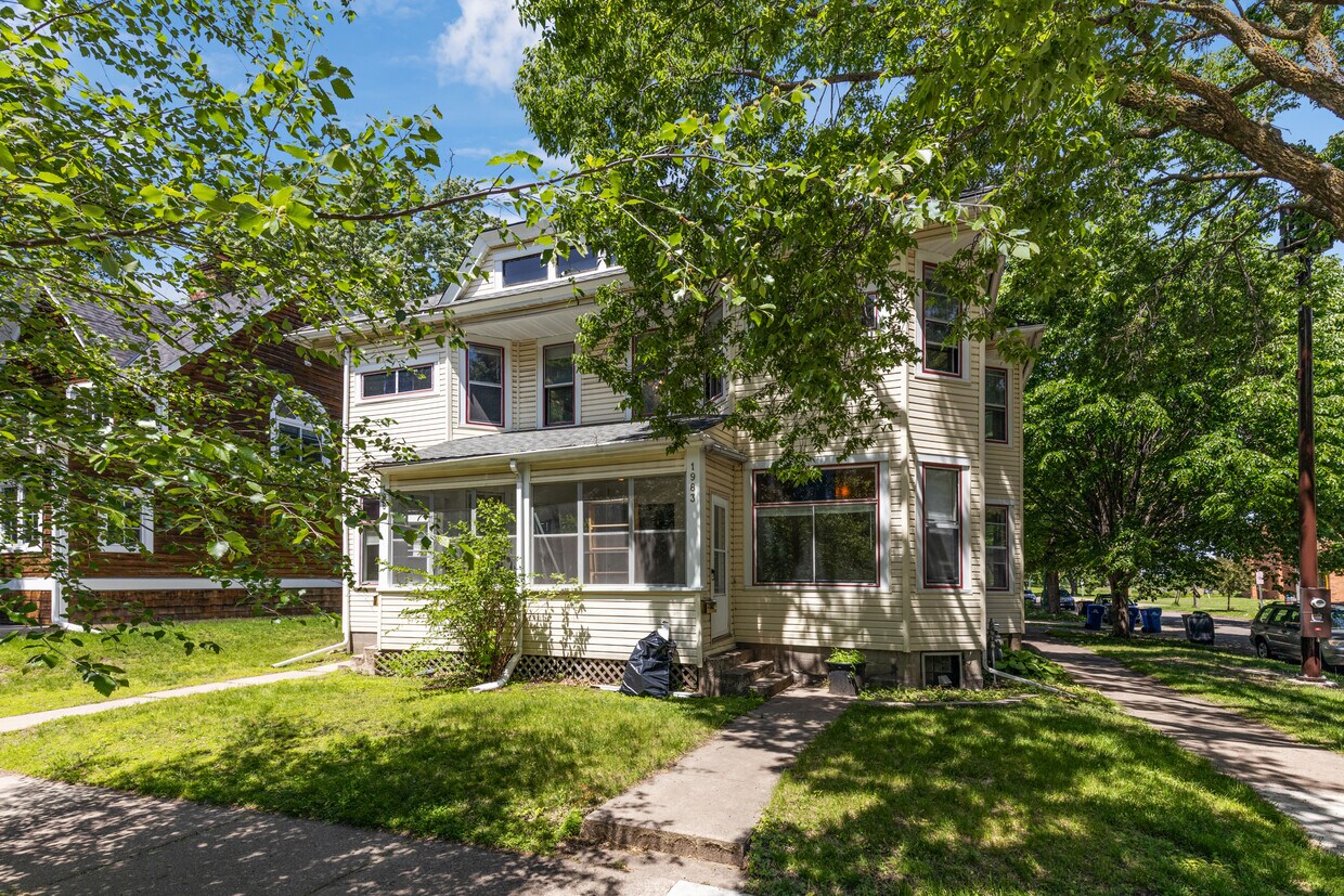
1983 Iglehart Ave
Saint Paul, MN 55104
Today
|
Edit
Favorites
-
Bedrooms
5
-
Bathrooms
2
-
Square Feet
2,410 sq ft
-
Available
Available Jun 1
Highlight
- Pets Allowed
1983 Iglehart Ave

Favorites
About This Home
12 Month Lease,
$1,425 deposit,
Available Jun 1
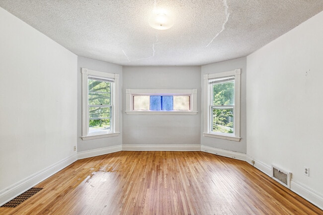
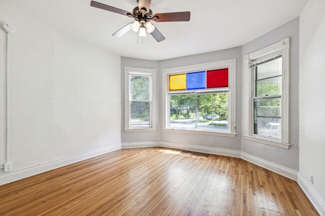
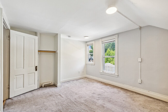
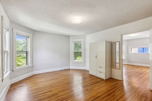
1983 — Spacious Side-by-Side Duplex Near St. Thomas University This incredible side-by-side duplex offers extra-large bedrooms, tons of storage, and huge open living areas — perfect for groups or families who want plenty of space to spread out and relax. The layout features bright, oversized windows, spacious common areas ideal for entertaining, and private bedrooms with ample closet space. Located just minutes from St. Thomas University and several other nearby colleges, this home offers the ideal blend of comfort and convenience. Enjoy easy access to campus, coffee shops, restaurants, and everything the neighborhood has to offer. Don’t miss this rare find — huge bedrooms, unbeatable location, and tons of room to live comfortably! Available for June move-in.
1983 Iglehart Ave is a house located in Ramsey County and the 55104 ZIP Code. This area is served by the St. Paul Public attendance zone.
* Price shown is total price based on community-supplied monthly required fees. Excludes user-selected optional fees and variable or usage-based fees and required charges due at or prior to move-in or at move-out. Price, availability, fees, and any applicable rent special are subject to change without notice.
* Square footage definitions vary. Displayed square footage is approximate.
House Features
- Washer/Dryer
Fees and Policies
The fees listed below are community-provided and may exclude utilities or add-ons. All payments are made directly to the property and are non-refundable unless otherwise specified.
- Dogs Allowed
-
Fees not specified
- Cats Allowed
-
Fees not specified
- Parking
-
Garage--
Contact
- Contact
Location
Get Directions
Along the shore of the Mississippi River, Merriam Park West offers riverfront parks, a large golf course, and quaint local restaurants just minutes from downtown Saint Paul, Minnesota. Stop on in at Izzy’s Ice Cream Café, or grab a treat at Black Coffee and Waffle Bar. Local businesses thrive alongside riverfront community spaces like Shadow Falls Park, a picturesque nature preserve.
The University of Saint Thomas resides on the south end of town, and the neighborhood offers a blend of private and public schools, churches, and every day conveniences. Situated just five miles southeast of Minneapolis and seven miles northeast of the Minneapolis-Saint Paul International Airport, this neighborhood is in a premier location for commuting, shopping, dining, and entertainment.
Learn more about living in Merriam Park West
Education
| Colleges & Universities | Distance | ||
|---|---|---|---|
| Colleges & Universities | Distance | ||
| Walk: | 17 min | 0.9 mi | |
| Drive: | 3 min | 1.5 mi | |
| Drive: | 3 min | 1.7 mi | |
| Drive: | 6 min | 2.4 mi |
1983 Iglehart Ave is within 17 minutes or 0.9 mile from Univ. of St Thomas, St. Paul. It is also near Concordia Univ.-Saint Paul and Macalester College.
Schools


Public Elementary School
Grades PK-5
372 Students
Attendance Zone
Public Elementary School
Grades PK-5
266 Students
Nearby
Public Middle School
Grades 6-8
559 Students
Attendance Zone
Public High School
Grades 9-12
1,691 Students
Attendance Zone
Private Elementary & Middle School
Grades PK-8
186 Students
Nearby
Private Middle & High School
Grades 7-12
Nearby
School data provided by
 The GreatSchools Rating helps parents compare schools within a state based on a variety of school quality indicators and provides a helpful picture of how effectively each school serves all of its students. Ratings are on a scale of 1 (below average) to 10 (above average) and can include test scores, college readiness, academic progress, advanced courses, equity, discipline and attendance data. We also advise parents to visit schools, consider other information on school performance and programs, and consider family needs as part of the school selection process.
View GreatSchools Rating Methodology
Data provided by GreatSchools.org © 2026. All rights reserved.
View GreatSchools Rating Methodology
Data provided by GreatSchools.org © 2026. All rights reserved.
Transportation options available in Saint Paul include Fairview Ave Station, located 0.7 mile from 1983 Iglehart Ave. 1983 Iglehart Ave is near Minneapolis-St Paul International/Wold-Chamberlain, located 7.4 miles or 15 minutes away.
| Transit / Subway | Distance | ||
|---|---|---|---|
| Transit / Subway | Distance | ||
| Walk: | 14 min | 0.7 mi | |
| Drive: | 3 min | 1.5 mi | |
| Drive: | 4 min | 1.6 mi | |
| Drive: | 4 min | 1.9 mi | |
| Drive: | 5 min | 2.3 mi |
| Commuter Rail | Distance | ||
|---|---|---|---|
| Commuter Rail | Distance | ||
|
|
Drive: | 10 min | 5.5 mi |
|
|
Drive: | 13 min | 6.3 mi |
|
|
Drive: | 22 min | 14.9 mi |
|
|
Drive: | 31 min | 23.7 mi |
|
|
Drive: | 33 min | 25.3 mi |
| Airports | Distance | ||
|---|---|---|---|
| Airports | Distance | ||
|
Minneapolis-St Paul International/Wold-Chamberlain
|
Drive: | 15 min | 7.4 mi |
Time and distance from 1983 Iglehart Ave.
| Shopping Centers | Distance | ||
|---|---|---|---|
| Shopping Centers | Distance | ||
| Drive: | 4 min | 1.6 mi | |
| Drive: | 3 min | 1.6 mi | |
| Drive: | 4 min | 1.8 mi |
1983 Iglehart Ave has 3 shopping centers within 1.8 miles, which is about a 4-minute drive. The miles and minutes will be for the farthest away property.
| Parks and Recreation | Distance | ||
|---|---|---|---|
| Parks and Recreation | Distance | ||
|
Macalester College Observatory
|
Drive: | 3 min | 1.7 mi |
|
Newell Park
|
Drive: | 4 min | 1.9 mi |
|
Brackett Park
|
Drive: | 5 min | 2.0 mi |
|
Longfellow Park
|
Drive: | 6 min | 2.4 mi |
|
Tower Hill Park
|
Drive: | 6 min | 2.7 mi |
1983 Iglehart Ave has 5 parks within 2.7 miles, including Newell Park, Macalester College Observatory, and Brackett Park.
| Hospitals | Distance | ||
|---|---|---|---|
| Hospitals | Distance | ||
| Drive: | 6 min | 3.7 mi | |
| Drive: | 11 min | 4.2 mi | |
| Drive: | 11 min | 5.7 mi |
1983 Iglehart Ave has 3 hospitals within 5.7 miles, the nearest is University of Minnesota Medical Center, Fairview which is 3.7 miles away and a 6 minute drive.
| Military Bases | Distance | ||
|---|---|---|---|
| Military Bases | Distance | ||
| Drive: | 14 min | 6.2 mi |
1983 Iglehart Ave is 6.2 miles and a 14 minute drive from Fort Snelling Military Reservation.
Amenities
- Washer/Dryer
1983 Iglehart Ave Photos
What Are Walk Score®, Transit Score®, and Bike Score® Ratings?
Walk Score® measures the walkability of any address. Transit Score® measures access to public transit. Bike Score® measures the bikeability of any address.
What is a Sound Score Rating?
A Sound Score Rating aggregates noise caused by vehicle traffic, airplane traffic and local sources

1983 Iglehart Ave
Saint Paul, MN 55104