$820
/ Month
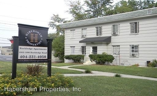
1982-1990 Rockledge Rd NE
Atlanta, GA 30324
2 Weeks Ago
|
Edit
Favorites
1982-1990 Rockledge Rd NE

Favorites
Check Back Soon for Upcoming Availability
| Beds | Baths | Average SF |
|---|---|---|
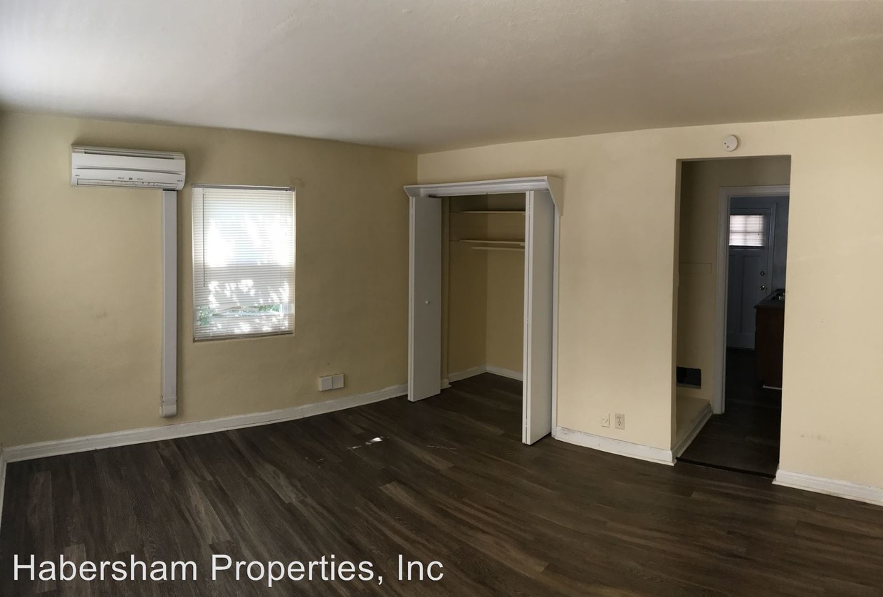
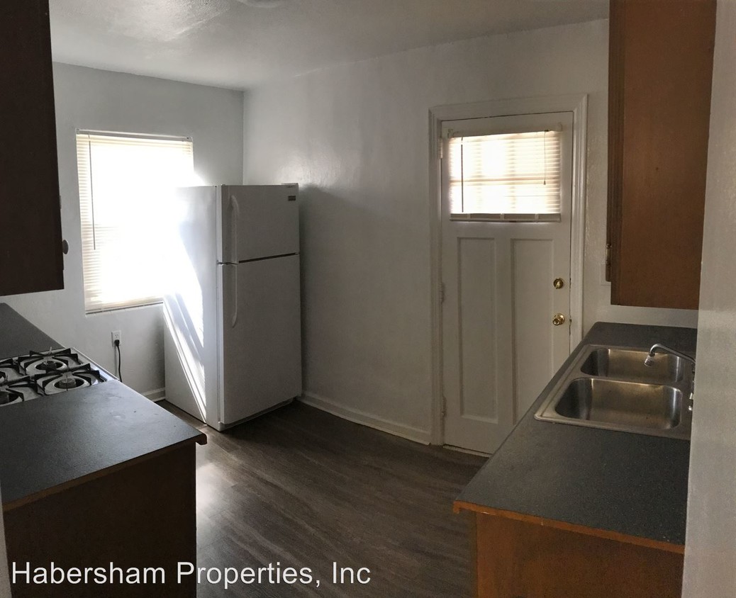
| Studio Studio 0 Br | 1 Bath 1 Bath 1 Ba | 480 SF |
About This Property
(404) 231-4050 - The Rockledge - You will not be able to find a better in town deal. This property is sandwiched in between Buckhead and Midtown, and is on the MARTA bus line. This spacious studio apartment puts you in the middle of town for a fraction of the price of other apartments! Come take a look today! (RLNE3414085)
1982-1990 Rockledge Rd Ne is an apartment community located in Fulton County and the 30324 ZIP Code.
1982-1990 Rockledge Rd NE,
Atlanta,
GA
30324
Inside this multicultural neighborhood is a blend of established and new apartments. Lindridge-Martin Manor is extremely diverse, and easily accessible to Buckhead and Midtown Atlanta. Residents can hop aboard the MARTA train at Lindbergh Center Station. Cheshire Bridge Road is the place for shops and restaurants – Taqueria Del Sol and Landmark Diner are in walking distance of your apartment.
Residents have easy access to Interstate 85, plus the shops at Cheshire Square. Morningside Nature Preserve is close, a great destination for jogging near the river. The shops at Ansley Mall are 10 minutes away.
Learn more about living in Lindridge-Martin ManorBelow are rent ranges for similar nearby apartments
Education
| Colleges & Universities | Distance | ||
|---|---|---|---|
| Colleges & Universities | Distance | ||
| Drive: | 8 min | 3.0 mi | |
| Drive: | 9 min | 4.2 mi | |
| Drive: | 9 min | 4.2 mi | |
| Drive: | 10 min | 4.5 mi |
1982-1990 Rockledge Rd NE is within 8 minutes or 3.0 miles from Emory University, Briarcliff. It is also near Georgia Tech and Emory University.
Transportation options available in Atlanta include Lindbergh Center, located 1.2 miles from 1982-1990 Rockledge Rd NE. 1982-1990 Rockledge Rd NE is near Hartsfield - Jackson Atlanta International, located 15.1 miles or 24 minutes away.
| Transit / Subway | Distance | ||
|---|---|---|---|
| Transit / Subway | Distance | ||
|
|
Drive: | 3 min | 1.2 mi |
|
|
Drive: | 6 min | 2.6 mi |
|
|
Drive: | 6 min | 2.6 mi |
|
|
Drive: | 6 min | 3.3 mi |
|
|
Drive: | 6 min | 3.6 mi |
| Commuter Rail | Distance | ||
|---|---|---|---|
| Commuter Rail | Distance | ||
|
|
Drive: | 5 min | 2.3 mi |
| Airports | Distance | ||
|---|---|---|---|
| Airports | Distance | ||
|
Hartsfield - Jackson Atlanta International
|
Drive: | 24 min | 15.1 mi |
Walkability Near 1982-1990 Rockledge Rd NE Atlanta, GA 30324
Getting Around
 What do Walkability, Transit, Drivability, and Bikeability mean?
Walkability measures the walking distance to day-to-day needs.
Transit measures access to public transportation.
Drivability measures congestion, parking availability, and access to major roads.
Bikeability measures the suitability for cycling.
How It Works
What do Walkability, Transit, Drivability, and Bikeability mean?
Walkability measures the walking distance to day-to-day needs.
Transit measures access to public transportation.
Drivability measures congestion, parking availability, and access to major roads.
Bikeability measures the suitability for cycling.
How It Works
Moderately Walkable
Walkability
60
/ 100
Some Public Transit
Transit
40
/ 100
Exceptionally Drivable
Drivability
90
/ 100
Fairly Bikeable
Bikeability
40
/ 100
Scores provided by
Active
Soundscore™
69
/ 100
Traffic
BusyAirport
CalmBusinesses
ActiveScores provided by
HowLoud What is a Sound Score Rating? A Sound Score Rating aggregates noise caused by vehicle traffic, airplane traffic and local sources. How It WorksTime and distance from 1982-1990 Rockledge Rd NE.
| Shopping Centers | Distance | ||
|---|---|---|---|
| Shopping Centers | Distance | ||
| Walk: | 7 min | 0.4 mi | |
| Walk: | 18 min | 1.0 mi | |
| Walk: | 19 min | 1.0 mi |
1982-1990 Rockledge Rd NE has 3 shopping centers within 1.0 mile, which is about a 19-minute walk. The miles and minutes will be for the farthest away property.
| Parks and Recreation | Distance | ||
|---|---|---|---|
| Parks and Recreation | Distance | ||
|
Atlanta Botanical Garden
|
Drive: | 3 min | 1.4 mi |
|
Atlanta BeltLine Eastside Trail
|
Drive: | 5 min | 2.0 mi |
|
Piedmont Park
|
Drive: | 6 min | 2.4 mi |
|
Atlanta History Center
|
Drive: | 7 min | 3.2 mi |
|
Georgia Conservancy
|
Drive: | 8 min | 4.1 mi |
1982-1990 Rockledge Rd NE has 5 parks within 4.1 miles, including Atlanta Botanical Garden, Piedmont Park, and Atlanta BeltLine Eastside Trail.
| Hospitals | Distance | ||
|---|---|---|---|
| Hospitals | Distance | ||
| Drive: | 8 min | 3.4 mi | |
| Drive: | 9 min | 3.8 mi | |
| Drive: | 7 min | 4.5 mi |
1982-1990 Rockledge Rd NE has 3 hospitals within 4.5 miles, the nearest is WellStar Atlanta Medical Center which is 3.4 miles away and a 8 minute drive.
| Military Bases | Distance | ||
|---|---|---|---|
| Military Bases | Distance | ||
| Drive: | 18 min | 10.0 mi | |
| Drive: | 28 min | 16.3 mi |
1982-1990 Rockledge Rd NE is 10.0 miles from Fort McPherson, and is convenient to other military bases, including Dobbins Air Force Base.
You May Also Like
Similar Rentals Nearby
-
-
-
-
-
-
-
-
1 Bed$1,619+2 Beds$2,023+3 Beds$2,423+Total Monthly PriceTotal Monthly Price NewPrices include base rent and required monthly fees of $124. Variable costs based on usage may apply.Base Rent:1 Bed$1,495+2 Beds$1,899+3 Beds$2,299+Specials
Pets Allowed Fitness Center Pool Dishwasher In Unit Washer & Dryer Balcony EV Charging
-
-


What Are Walk Score®, Transit Score®, and Bike Score® Ratings?
Walk Score® measures the walkability of any address. Transit Score® measures access to public transit. Bike Score® measures the bikeability of any address.
What is a Sound Score Rating?
A Sound Score Rating aggregates noise caused by vehicle traffic, airplane traffic and local sources.

1982-1990 Rockledge Rd NE
Atlanta, GA 30324