$2,650 / Month
1969 Pacific St Unit 8
Brooklyn, NY 11233
2 Weeks Ago
Favorites
1969 Pacific St Unit 8

Favorites
Check Back Soon for Upcoming Availability
| Beds | Baths | Average SF |
|---|---|---|
| 4 Bedrooms 4 Bedrooms 4 Br | 1.5 Baths 1.5 Baths 1.5 Ba | — |
Fees and Policies
The fees below are based on community-supplied data and may exclude additional fees and utilities.
- Dogs Allowed
-
Fees not specified
- Cats Allowed
-
Fees not specified
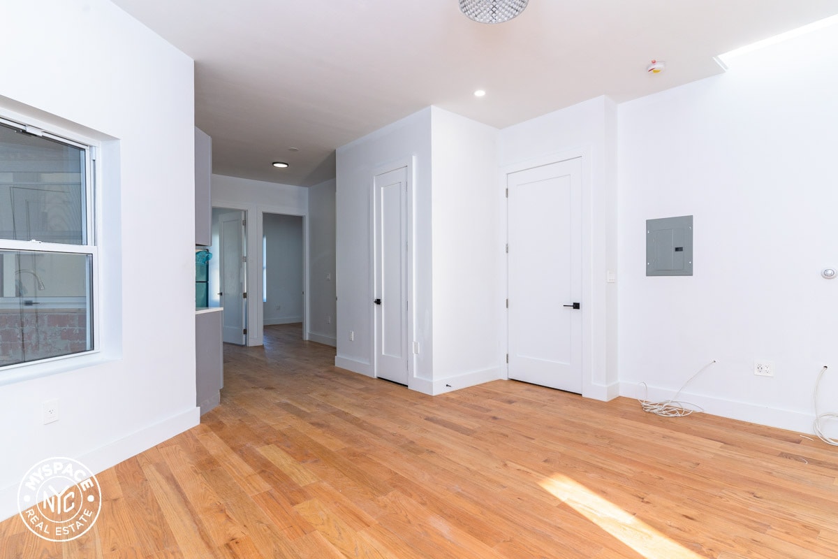
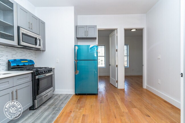
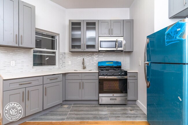
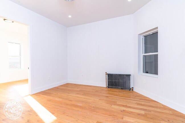
About This Property
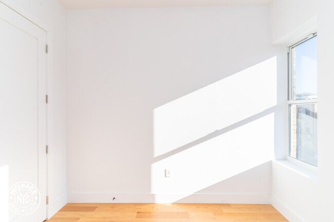
Reside in a gorgeous 4 bed / 1.5 bath apartment with stainless steel appliances, hardwood floors, natural sunlight, modern features, and easy access to trains. To live in Crown Heights is to live in convenience and a diverse community. Enjoy the luxury of having access to most train lines like the 2,3,4,5 and C, or switch to any letter train at Atlantic terminal. Enjoy a short walk to Brooklyn Museum, Prospect Park, and Botanic Garden. Crown Heights offers a number of local restaurants and bars like Chavela's, Dutch Boy, Cent'Anni, Drink Lounge, 99 Rogers, Mayfield, Cafe Rue Dix, Glady's and more! Easy commute to Manhattan & easy access to the rest of Brooklyn's hottest neighborhoods.Closest Subway Station: A-C at Ralph Ave Station
1969 Pacific St is an apartment community located in Kings County and the 11233 ZIP Code.
Features
- Hardwood Floors
Location
Get Directions
Crown Heights is a central neighborhood in New York’s bustling borough of Brooklyn. Just minutes from the Brooklyn Botanic Garden and the Brooklyn Museum, Crown Heights’ residents have convenient access to some of Brooklyn’s greatest attractions.
Take the whole family to the Brooklyn Children’s Museum to explore the world’s first children’s museum, opened in 1899. Many community parks are available in the neighborhood, such as St. Johns Park, equipped with ball fields, basketball courts, and a recreation center. Enjoy a handcrafted burger paired with a craft beer at Boeuf & Bun, an upbeat local spot in Crown Heights. There’s a variety of apartments and condos available for rent in this central Brooklyn neighborhood.
Learn more about living in Crown HeightsBelow are rent ranges for similar nearby apartments
| Beds | Average Size | Lowest | Typical | Premium |
|---|---|---|---|---|
| Studio Studio Studio | 447-456 Sq Ft | $2,300 | $2,982 | $3,927 |
| 1 Bed 1 Bed 1 Bed | 538-546 Sq Ft | $1,650 | $3,375 | $4,751 |
| 2 Beds 2 Beds 2 Beds | 741 Sq Ft | $3,000 | $4,454 | $15,810 |
| 3 Beds 3 Beds 3 Beds | 1138 Sq Ft | $1,480 | $4,225 | $7,000 |
| 4 Beds 4 Beds 4 Beds | 288 Sq Ft | $1,000 | $2,263 | $9,995 |
Amenities
- Hardwood Floors
Education
| Colleges & Universities | Distance | ||
|---|---|---|---|
| Colleges & Universities | Distance | ||
| Drive: | 8 min | 2.5 mi | |
| Drive: | 9 min | 2.9 mi | |
| Drive: | 8 min | 3.1 mi | |
| Drive: | 10 min | 3.6 mi |
1969 Pacific St Unit 8 is within 8 minutes or 2.5 miles from Medgar Evers College, CUNY. It is also near Pratt Institute and Saint Joseph's Coll, Brooklyn.
Transportation options available in Brooklyn include Ralph Avenue, located 0.3 mile from 1969 Pacific St Unit 8. 1969 Pacific St Unit 8 is near LaGuardia, located 10.0 miles or 23 minutes away, and John F Kennedy International, located 10.0 miles or 20 minutes away.
| Transit / Subway | Distance | ||
|---|---|---|---|
| Transit / Subway | Distance | ||
|
|
Walk: | 5 min | 0.3 mi |
|
|
Walk: | 11 min | 0.6 mi |
|
|
Walk: | 19 min | 1.0 mi |
|
|
Drive: | 4 min | 1.2 mi |
|
|
Drive: | 5 min | 1.6 mi |
| Commuter Rail | Distance | ||
|---|---|---|---|
| Commuter Rail | Distance | ||
|
|
Drive: | 4 min | 1.6 mi |
|
|
Drive: | 6 min | 1.8 mi |
|
|
Drive: | 9 min | 3.2 mi |
|
|
Drive: | 18 min | 5.7 mi |
|
|
Drive: | 19 min | 5.9 mi |
| Airports | Distance | ||
|---|---|---|---|
| Airports | Distance | ||
|
LaGuardia
|
Drive: | 23 min | 10.0 mi |
|
John F Kennedy International
|
Drive: | 20 min | 10.0 mi |
Time and distance from 1969 Pacific St Unit 8.
| Shopping Centers | Distance | ||
|---|---|---|---|
| Shopping Centers | Distance | ||
| Drive: | 4 min | 1.4 mi | |
| Drive: | 5 min | 1.8 mi | |
| Drive: | 9 min | 3.4 mi |
1969 Pacific St Unit 8 has 3 shopping centers within 3.4 miles, which is about a 9-minute drive. The miles and minutes will be for the farthest away property.
| Parks and Recreation | Distance | ||
|---|---|---|---|
| Parks and Recreation | Distance | ||
|
St. John's Park
|
Walk: | 14 min | 0.8 mi |
|
Brooklyn Children's Museum
|
Drive: | 5 min | 1.4 mi |
|
Betsy Head Memorial Playground
|
Drive: | 6 min | 1.9 mi |
|
Wingate Park
|
Drive: | 8 min | 2.4 mi |
|
Hattie Carthan Garden
|
Drive: | 9 min | 2.8 mi |
1969 Pacific St Unit 8 has 5 parks within 2.8 miles, including St. John's Park, Brooklyn Children's Museum, and Betsy Head Memorial Playground.
| Hospitals | Distance | ||
|---|---|---|---|
| Hospitals | Distance | ||
| Walk: | 15 min | 0.8 mi | |
| Drive: | 5 min | 1.7 mi | |
| Drive: | 6 min | 2.3 mi |
1969 Pacific St Unit 8 has 3 hospitals within 2.3 miles, the nearest is Interfaith Medical Center which is 0.8 mile away and a 15 minute walk.
| Military Bases | Distance | ||
|---|---|---|---|
| Military Bases | Distance | ||
| Drive: | 21 min | 8.3 mi | |
| Drive: | 25 min | 9.4 mi |
1969 Pacific St Unit 8 is 8.3 miles from Governors Island Support Center, and is convenient to other military bases, including US Coast Guard Heliport.
You May Also Like
Similar Rentals Nearby


What Are Walk Score®, Transit Score®, and Bike Score® Ratings?
Walk Score® measures the walkability of any address. Transit Score® measures access to public transit. Bike Score® measures the bikeability of any address.
What is a Sound Score Rating?
A Sound Score Rating aggregates noise caused by vehicle traffic, airplane traffic and local sources

1969 Pacific St
Brooklyn, NY 11233