
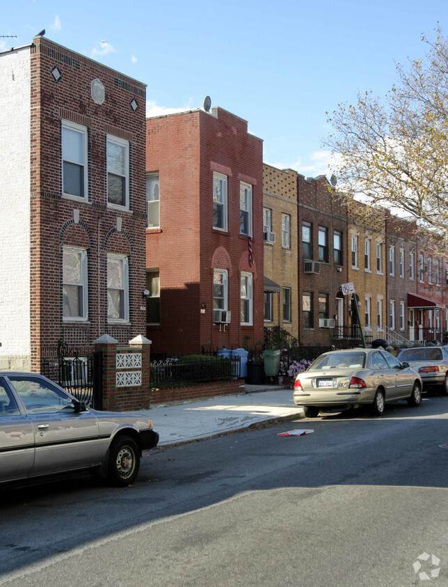
1966 59th St
1966 59th St,
Brooklyn,
NY
11204
2 Weeks Ago
Favorites
1966 59th St
Favorites
Check Back Soon for Upcoming Availability
| Beds | Baths | Average SF | Availability |
|---|---|---|---|
| 1 Bedroom 1 Bedroom 1 Br | 1 Bath 1 Bath 1 Ba | — | Not Available |
| 2 Bedrooms 2 Bedrooms 2 Br | 1 Bath 1 Bath 1 Ba | — | Not Available |
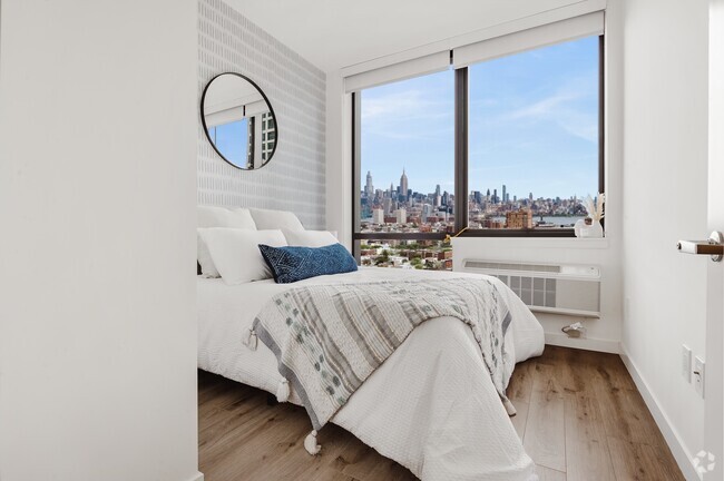
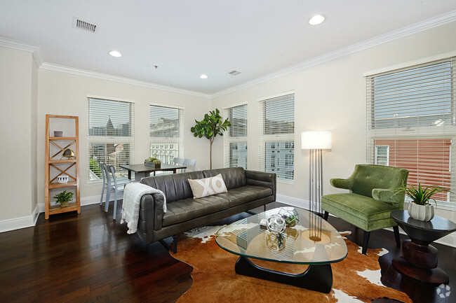
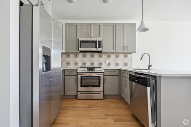
About 1966 59th St Brooklyn, NY 11204
At 1966 59th St in Brooklyn, find your new home. The 11204 location in Brooklyn has so much to offer its residents. Come for a visit to check out the current floorplan options. The community staff is ready to help you find your perfect new apartment. Contact us or drop by to find out current pricing and make your move to 1966 59th St.
1966 59th St is an apartment community located in Kings County and the 11204 ZIP Code. This area is served by the New York City Geographic District #20 attendance zone.
Fees and Policies
Details
Property Information
-
Built in 1931
-
4 units/2 stories
Location
Get Directions
The tiny town of Mapleton is almost completely residential, offering a few local stores here and there. Mapleton boasts a diverse, yet tight-knit community with a family-friendly atmosphere. Most rentals in the area are attached or semi-attached buildings offering various apartments and condos for those looking to rent in a safe Brooklyn neighborhood.
Mapleton is known for its library, good public and private schools, and upgraded community park. Gravesend Park offers playgrounds, baseball fields, tennis courts, and basketball courts. This is perfect for families in the area looking for outdoor recreational fun!
Mapleton houses Washington Cemetery, one of the largest Jewish cemeteries in Brooklyn. It offers numerous subway and bus stations, making commuting as simple as possible.
Learn more about living in MapletonBelow are rent ranges for similar nearby apartments
Education
| Colleges & Universities | Distance | ||
|---|---|---|---|
| Colleges & Universities | Distance | ||
| Drive: | 9 min | 2.7 mi | |
| Drive: | 11 min | 4.4 mi | |
| Drive: | 13 min | 5.6 mi | |
| Drive: | 15 min | 6.2 mi |
1966 59th St is within 9 minutes or 2.7 miles from Brooklyn College. It is also near Medgar Evers College, CUNY and Kingsborough Community College.
Schools


Public Elementary School
Grades PK-5
507 Students
Attendance Zone
Public Middle School
Grades 6-8
1,367 Students
Attendance Zone
Public High School
Grades 9-12
3,213 Students
Attendance Zone
Private Elementary, Middle & High School
Grades PK-12
539 Students
Nearby
Private Elementary & Middle School
Grades K-9
Nearby
Private Elementary School
Grades PK-6
447 Students
Nearby
School data provided by
 The GreatSchools Rating helps parents compare schools within a state based on a variety of school quality indicators and provides a helpful picture of how effectively each school serves all of its students. Ratings are on a scale of 1 (below average) to 10 (above average) and can include test scores, college readiness, academic progress, advanced courses, equity, discipline and attendance data. We also advise parents to visit schools, consider other information on school performance and programs, and consider family needs as part of the school selection process.
View GreatSchools Rating Methodology
View GreatSchools Rating Methodology
Transportation options available in Brooklyn include 20 Avenue (N Line), located 0.3 mile from 1966 59th St. 1966 59th St is near John F Kennedy International, located 14.5 miles or 27 minutes away, and Newark Liberty International, located 20.2 miles or 35 minutes away.
| Transit / Subway | Distance | ||
|---|---|---|---|
| Transit / Subway | Distance | ||
|
|
Walk: | 5 min | 0.3 mi |
|
|
Walk: | 10 min | 0.5 mi |
|
|
Walk: | 11 min | 0.6 mi |
|
|
Walk: | 11 min | 0.6 mi |
|
|
Walk: | 12 min | 0.7 mi |
| Commuter Rail | Distance | ||
|---|---|---|---|
| Commuter Rail | Distance | ||
|
|
Drive: | 15 min | 5.6 mi |
|
|
Drive: | 14 min | 5.7 mi |
|
|
Drive: | 15 min | 7.5 mi |
|
|
Drive: | 18 min | 8.2 mi |
|
|
Drive: | 20 min | 8.8 mi |
| Airports | Distance | ||
|---|---|---|---|
| Airports | Distance | ||
|
John F Kennedy International
|
Drive: | 27 min | 14.5 mi |
|
Newark Liberty International
|
Drive: | 35 min | 20.2 mi |
Time and distance from 1966 59th St.
| Shopping Centers | Distance | ||
|---|---|---|---|
| Shopping Centers | Distance | ||
| Walk: | 20 min | 1.1 mi | |
| Drive: | 5 min | 1.6 mi | |
| Drive: | 5 min | 2.0 mi |
1966 59th St has 3 shopping centers within 2.0 miles, which is about a 5-minute walk. The miles and minutes will be for the farthest away property.
| Parks and Recreation | Distance | ||
|---|---|---|---|
| Parks and Recreation | Distance | ||
|
Sunset Park
|
Drive: | 8 min | 3.1 mi |
|
Dyker Beach Park
|
Drive: | 8 min | 3.2 mi |
|
Calvert Vaux Park
|
Drive: | 8 min | 3.5 mi |
|
Owl's Head Park
|
Drive: | 10 min | 3.8 mi |
|
Leon S. Kaiser Park
|
Drive: | 10 min | 4.1 mi |
1966 59th St has 5 parks within 4.1 miles, including Sunset Park, Dyker Beach Park, and Calvert Vaux Park.
| Hospitals | Distance | ||
|---|---|---|---|
| Hospitals | Distance | ||
| Drive: | 6 min | 2.0 mi | |
| Drive: | 7 min | 3.0 mi | |
| Drive: | 9 min | 3.8 mi |
1966 59th St has 3 hospitals within 3.8 miles, the nearest is Maimonides Medical Center which is 2.0 miles away and a 6 minute drive.
| Military Bases | Distance | ||
|---|---|---|---|
| Military Bases | Distance | ||
| Drive: | 10 min | 3.7 mi | |
| Drive: | 18 min | 8.3 mi |
1966 59th St is 3.7 miles from Fort Hamilton, and is convenient to other military bases, including Naval Station NY Stapleton Site.
You May Also Like
What neighborhood is the property located in?
1966 59th St Brooklyn, NY 11204 is in Mapleton in the city of Brooklyn. Here you’ll find three shopping centers within 2.0 miles of the property. Five parks are within 4.1 miles, including Sunset Park, Dyker Beach Park, and Calvert Vaux Park.
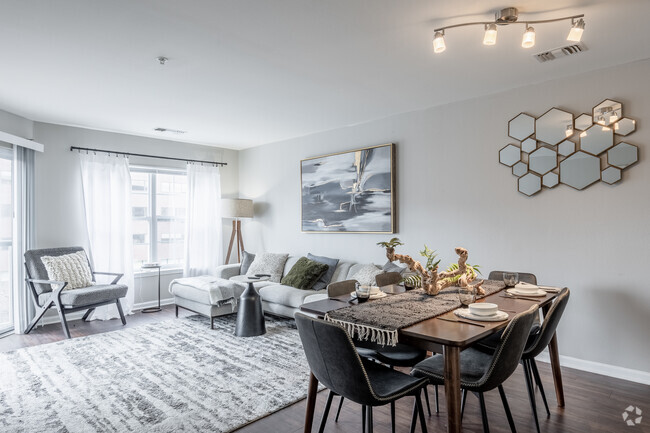
Similar Rentals Nearby


What Are Walk Score®, Transit Score®, and Bike Score® Ratings?
Walk Score® measures the walkability of any address. Transit Score® measures access to public transit. Bike Score® measures the bikeability of any address.
What is a Sound Score Rating?
A Sound Score Rating aggregates noise caused by vehicle traffic, airplane traffic and local sources
1966 59th St
Brooklyn, NY 11204
Responded To This Review