
Vanguard
1001 Marshall Ave,
Cincinnati, OH 45219
Studio - 5 Beds $683 - $1,479
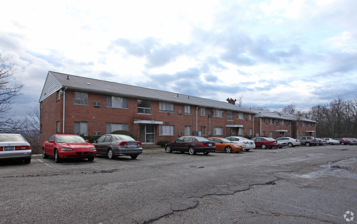
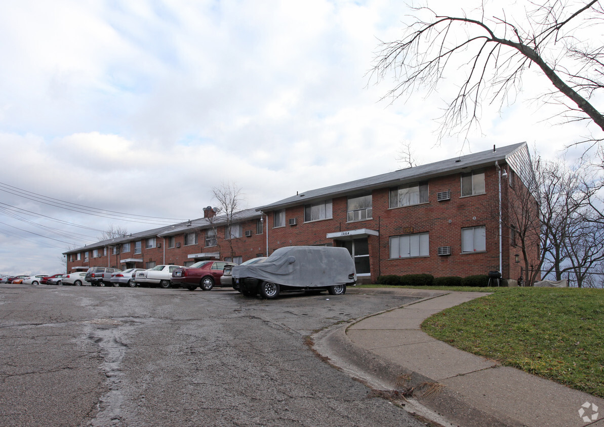

Find your new home at 1964-1970 Westwood Northern Blvd. You'll find this community in the Millvale area of Cincinnati. Offering 0 to 1 bedroom apartments, your new home is ready for you. The professional leasing staff is excited to help you find your ideal place. Drop by the leasing office to discuss your new apartment and see 1964-1970 Westwood Northern Blvd.
1964-1970 Westwood Northern Blvd is an apartment community located in Hamilton County and the 45225 ZIP Code. This area is served by the Cincinnati Public Schools attendance zone.
Refrigerator
Tub/Shower
Oven
Range
Cincinnati’s Central Business District, also known as Downtown Cincinnati, offers the convenience and amenities that living in an urban setting provides, while still offering a small, welcoming community. Located along the banks of the Ohio River, Downtown Cincinnati houses an array of apartments, townhouses, condos, and lofts in proximity to retailers, restaurants, bars, and world-class entertainment venues.
Direct highway access makes it easy for residents to commute to other areas of the city and to northern Kentucky. Downtown also offers an excellent public transportation system. The city’s skyscrapers house several Fortune 500 companies, including Kroger and Fifth Third Bank, making the area a great choice for aspiring professionals. Downtown offers a thriving arts scene, two stadiums (the Great American Ball Park and Paul Brown Stadium), several museums, and numerous annual events.
Learn more about living in Downtown Cincinnati| Colleges & Universities | Distance | ||
|---|---|---|---|
| Colleges & Universities | Distance | ||
| Drive: | 8 min | 2.8 mi | |
| Drive: | 7 min | 3.0 mi | |
| Drive: | 8 min | 3.5 mi | |
| Drive: | 15 min | 5.6 mi |


Transportation options available in Cincinnati include Brewery District Station, Elm & Henry, located 3.8 miles from 1964-1970 Westwood Northern Blvd. 1964-1970 Westwood Northern Blvd is near Cincinnati/Northern Kentucky International, located 17.8 miles or 32 minutes away.
| Transit / Subway | Distance | ||
|---|---|---|---|
| Transit / Subway | Distance | ||
| Drive: | 8 min | 3.8 mi | |
| Drive: | 8 min | 3.9 mi | |
| Drive: | 9 min | 3.9 mi | |
| Drive: | 9 min | 4.0 mi | |
| Drive: | 9 min | 4.1 mi |
| Commuter Rail | Distance | ||
|---|---|---|---|
| Commuter Rail | Distance | ||
|
|
Drive: | 8 min | 3.7 mi |
| Airports | Distance | ||
|---|---|---|---|
| Airports | Distance | ||
|
Cincinnati/Northern Kentucky International
|
Drive: | 32 min | 17.8 mi |
Time and distance from 1964-1970 Westwood Northern Blvd.
| Shopping Centers | Distance | ||
|---|---|---|---|
| Shopping Centers | Distance | ||
| Drive: | 3 min | 1.4 mi | |
| Drive: | 5 min | 2.0 mi | |
| Drive: | 8 min | 3.1 mi |
| Parks and Recreation | Distance | ||
|---|---|---|---|
| Parks and Recreation | Distance | ||
|
Mt. Airy Forest
|
Drive: | 7 min | 2.8 mi |
|
Burnet Woods
|
Drive: | 7 min | 2.8 mi |
|
Trailside Nature Center
|
Drive: | 7 min | 2.9 mi |
|
Cincinnati Zoo and Botanical Garden
|
Drive: | 8 min | 3.5 mi |
|
Buttercup Valley
|
Drive: | 9 min | 3.6 mi |
| Hospitals | Distance | ||
|---|---|---|---|
| Hospitals | Distance | ||
| Drive: | 5 min | 2.3 mi | |
| Drive: | 8 min | 3.5 mi | |
| Drive: | 9 min | 3.7 mi |
| Military Bases | Distance | ||
|---|---|---|---|
| Military Bases | Distance | ||
| Drive: | 70 min | 53.4 mi | |
| Drive: | 76 min | 58.5 mi | |
| Drive: | 79 min | 61.8 mi |
What Are Walk Score®, Transit Score®, and Bike Score® Ratings?
Walk Score® measures the walkability of any address. Transit Score® measures access to public transit. Bike Score® measures the bikeability of any address.
What is a Sound Score Rating?
A Sound Score Rating aggregates noise caused by vehicle traffic, airplane traffic and local sources

1964-1970 Westwood Northern Blvd
Cincinnati, OH 45225


