
The Vitagraph
1277 E 14th St,
Brooklyn, NY 11230
1-3 Beds $2,709 - $4,134

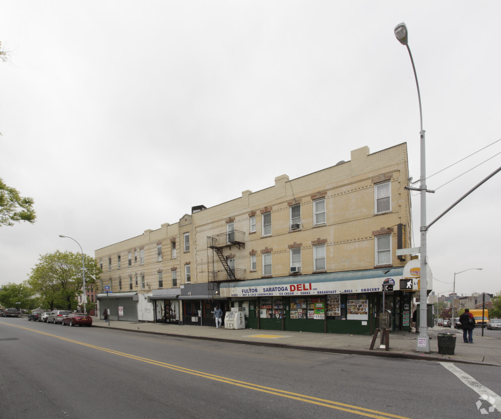

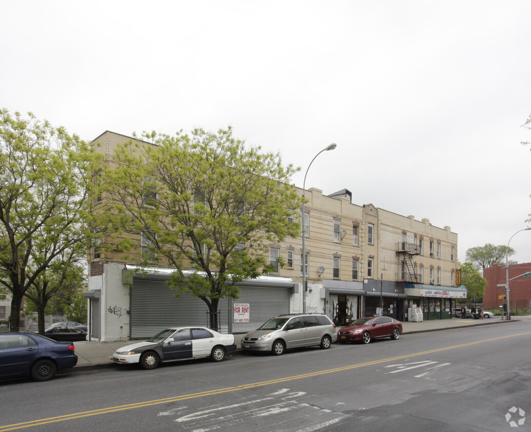
Meet your new place at 1959-1961 Fulton St in Brooklyn. This community can be found at 1959-1961 Fulton St. in Brooklyn. The leasing staff is ready for you to come take a tour. Come by to check out the current floorplan options. At 1959-1961 Fulton St you're new apartment awaits.
1959-1961 Fulton St is an apartment community located in Kings County and the 11233 ZIP Code. This area is served by the New York City Geographic District #16 attendance zone.
Bedford-Stuyvesant, often shortened to Bed-Stuy, sits in north central Brooklyn, touting plenty of classic brownstones along tree-lined streets. Bed-Stuy is revered for its historic architecture, containing one of the highest concentrations of Victorian properties in all of New York City.
Residents enjoy a strong sense of community in Bed-Stuy along with an array of diverse eateries, cafes, and bodegas. Herbert Von King Park lies at the center of the neighborhood, exuding a lively town-square atmosphere with an outdoor amphitheater, Cultural Arts Center, and athletic facilities. Convenience to public transportation and I-278 makes commuting and traveling from Bed-Stuy a breeze.
Learn more about living in Bedford-Stuyvesant| Colleges & Universities | Distance | ||
|---|---|---|---|
| Colleges & Universities | Distance | ||
| Drive: | 9 min | 3.0 mi | |
| Drive: | 9 min | 3.0 mi | |
| Drive: | 8 min | 3.2 mi | |
| Drive: | 10 min | 3.8 mi |


Transportation options available in Brooklyn include Rockaway Avenue (A,C Line), located 0.2 mile from 1959-1961 Fulton St. 1959-1961 Fulton St is near LaGuardia, located 8.7 miles or 20 minutes away, and John F Kennedy International, located 9.3 miles or 18 minutes away.
| Transit / Subway | Distance | ||
|---|---|---|---|
| Transit / Subway | Distance | ||
|
|
Walk: | 4 min | 0.2 mi |
|
|
Walk: | 5 min | 0.3 mi |
|
|
Walk: | 11 min | 0.6 mi |
| Walk: | 11 min | 0.6 mi | |
|
|
Walk: | 11 min | 0.6 mi |
| Commuter Rail | Distance | ||
|---|---|---|---|
| Commuter Rail | Distance | ||
|
|
Walk: | 17 min | 0.9 mi |
|
|
Drive: | 6 min | 2.0 mi |
|
|
Drive: | 9 min | 3.3 mi |
|
|
Drive: | 16 min | 5.6 mi |
|
|
Drive: | 14 min | 6.1 mi |
| Airports | Distance | ||
|---|---|---|---|
| Airports | Distance | ||
|
LaGuardia
|
Drive: | 20 min | 8.7 mi |
|
John F Kennedy International
|
Drive: | 18 min | 9.3 mi |
Time and distance from 1959-1961 Fulton St.
| Shopping Centers | Distance | ||
|---|---|---|---|
| Shopping Centers | Distance | ||
| Drive: | 6 min | 1.7 mi | |
| Drive: | 5 min | 2.3 mi | |
| Drive: | 6 min | 2.5 mi |
| Parks and Recreation | Distance | ||
|---|---|---|---|
| Parks and Recreation | Distance | ||
|
St. John's Park
|
Drive: | 4 min | 1.2 mi |
|
Betsy Head Memorial Playground
|
Drive: | 4 min | 1.2 mi |
|
Highland Park Childrens Garden
|
Drive: | 4 min | 1.7 mi |
|
Brooklyn Children's Museum
|
Drive: | 6 min | 1.8 mi |
|
Highland Park and Ridgewood Reservoir
|
Drive: | 4 min | 2.0 mi |
| Hospitals | Distance | ||
|---|---|---|---|
| Hospitals | Distance | ||
| Drive: | 3 min | 1.2 mi | |
| Drive: | 5 min | 1.9 mi | |
| Drive: | 7 min | 2.0 mi |
| Military Bases | Distance | ||
|---|---|---|---|
| Military Bases | Distance | ||
| Drive: | 21 min | 8.5 mi | |
| Drive: | 24 min | 9.4 mi |
What Are Walk Score®, Transit Score®, and Bike Score® Ratings?
Walk Score® measures the walkability of any address. Transit Score® measures access to public transit. Bike Score® measures the bikeability of any address.
What is a Sound Score Rating?
A Sound Score Rating aggregates noise caused by vehicle traffic, airplane traffic and local sources
1959-1961 Fulton St
Brooklyn, NY 11233


