
$625
/ Month
1950 Goodman Ave
Cincinnati, OH 45239
2 Weeks Ago
|
Edit
Favorites
1950 Goodman Ave

Favorites
Check Back Soon for Upcoming Availability
| Beds | Baths | Average SF |
|---|---|---|
| 1 Bedroom 1 Bedroom 1 Br | 1 Bath 1 Bath 1 Ba | — |
About This Property
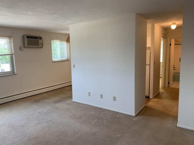
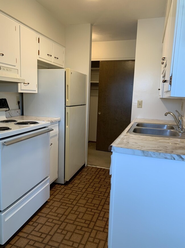
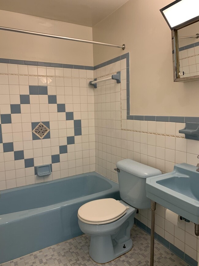
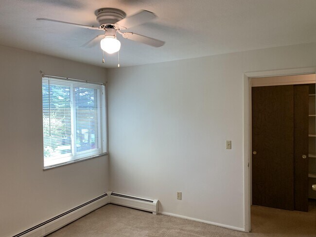
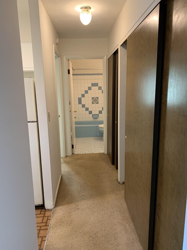
A beautiful freshly updated one bedroom apartment in the revitalizing area of North College Hill. Prime location, close to new developments and shops. Apartment features electric included, coin operated laundry, tile bathroom and new carpet. Available NOW. Building under new management. No Pets No Smoking No Section 8 No Felonies No Evictions 600 or higher credit score (negotiable) Proof of income at 3 times monthly rent (1,875)
1950 Goodman Ave is a townhome located in Hamilton County and the 45239 ZIP Code. This area is served by the North College Hill City attendance zone.
1950 Goodman Ave,
Cincinnati,
OH
45239
Cincinnati sits on the northern bank of the Ohio River, where rolling hills meet a city that helped establish the Midwest long before other major metros existed. Settled in 1788, the Queen City sits west of the Appalachian Mountains and combines historic culture with urban living.
Today, neighborhoods like Over-the-Rhine, Hyde Park, and Mount Adams each bring a distinct character to city life. Over-the-Rhine is packed with restored 19th-century architecture, Findlay Market, and Music Hall. Mount Adams perches beside Eden Park with stunning river views, while Hyde Park Square draws locals and tourists alike with local cafes and walkable streets.
Renters will find a wide range of housing options across the city, from converted lofts and townhouses in Over-the-Rhine to sleek high-rise apartment communities along the riverfront at The Banks. Clifton and Oakley offer everything from charming older buildings to newer developments with modern amenities.
Learn more about living in Cincinnati
Education
| Colleges & Universities | Distance | ||
|---|---|---|---|
| Colleges & Universities | Distance | ||
| Drive: | 18 min | 6.3 mi | |
| Drive: | 19 min | 8.1 mi | |
| Drive: | 21 min | 8.5 mi | |
| Drive: | 20 min | 10.8 mi |
1950 Goodman Ave is within 18 minutes or 6.3 miles from Cincinnati State. It is also near University of Cincinnati and Univ. of Cincinnati, Medical.
Schools


Public Elementary & Middle School
Grades K-8
Nearby
Public Elementary School
Grades PK-5
Attendance Zone
Public High School
Grades 9-12
Attendance Zone
Private Elementary & Middle School
Grades PK-8
Nearby
Private High School
Grades 9-12
Nearby
School data provided by
 The GreatSchools Rating helps parents compare schools within a state based on a variety of school quality indicators and provides a helpful picture of how effectively each school serves all of its students. Ratings are on a scale of 1 (below average) to 10 (above average) and can include test scores, college readiness, academic progress, advanced courses, equity, discipline and attendance data. We also advise parents to visit schools, consider other information on school performance and programs, and consider family needs as part of the school selection process.
View GreatSchools Rating Methodology
Data provided by GreatSchools.org © 2026. All rights reserved.
View GreatSchools Rating Methodology
Data provided by GreatSchools.org © 2026. All rights reserved.
Transportation options available in Cincinnati include Brewery District Station - Elm & Henry, located 8.8 miles from 1950 Goodman Ave. 1950 Goodman Ave is near Cincinnati/Northern Kentucky International, located 22.8 miles or 44 minutes away.
| Transit / Subway | Distance | ||
|---|---|---|---|
| Transit / Subway | Distance | ||
| Drive: | 20 min | 8.8 mi | |
| Drive: | 20 min | 8.9 mi | |
| Drive: | 20 min | 8.9 mi | |
| Drive: | 20 min | 9.0 mi | |
| Drive: | 21 min | 9.1 mi |
| Commuter Rail | Distance | ||
|---|---|---|---|
| Commuter Rail | Distance | ||
|
|
Drive: | 19 min | 8.7 mi |
| Airports | Distance | ||
|---|---|---|---|
| Airports | Distance | ||
|
Cincinnati/Northern Kentucky International
|
Drive: | 44 min | 22.8 mi |
Walkability Near 1950 Goodman Ave Cincinnati, OH 45239
Getting Around
 What do Walkability, Transit, Drivability, and Bikeability mean?
Walkability measures the walking distance to day-to-day needs.
Transit measures access to public transportation.
Drivability measures congestion, parking availability, and access to major roads.
Bikeability measures the suitability for cycling.
How It Works
What do Walkability, Transit, Drivability, and Bikeability mean?
Walkability measures the walking distance to day-to-day needs.
Transit measures access to public transportation.
Drivability measures congestion, parking availability, and access to major roads.
Bikeability measures the suitability for cycling.
How It Works
Fairly Walkable
Walkability
50
/ 100
Limited Public Transit
Transit
30
/ 100
Very Drivable
Drivability
80
/ 100
Somewhat Bikeable
Bikeability
30
/ 100
Scores provided by
Active
Soundscore™
75
/ 100
Traffic
ActiveAirport
CalmBusinesses
ActiveScores provided by
HowLoud What is a Sound Score Rating? A Sound Score Rating aggregates noise caused by vehicle traffic, airplane traffic and local sources. How It WorksTime and distance from 1950 Goodman Ave.
| Shopping Centers | Distance | ||
|---|---|---|---|
| Shopping Centers | Distance | ||
| Walk: | 12 min | 0.6 mi | |
| Walk: | 15 min | 0.8 mi | |
| Walk: | 16 min | 0.8 mi |
1950 Goodman Ave has 3 shopping centers within 0.8 mile, which is about a 16-minute walk. The miles and minutes will be for the farthest away property.
| Parks and Recreation | Distance | ||
|---|---|---|---|
| Parks and Recreation | Distance | ||
|
LaBoiteaux Woods
|
Drive: | 8 min | 2.6 mi |
|
Farbach-Werner Nature Preserve
|
Drive: | 7 min | 2.8 mi |
|
Mt. Airy Forest
|
Drive: | 11 min | 3.7 mi |
|
Buttercup Valley
|
Drive: | 10 min | 3.7 mi |
|
Winton Woods Park
|
Drive: | 14 min | 5.2 mi |
1950 Goodman Ave has 5 parks within 5.2 miles, including LaBoiteaux Woods, Farbach-Werner Nature Preserve, and Mt. Airy Forest.
| Hospitals | Distance | ||
|---|---|---|---|
| Hospitals | Distance | ||
| Drive: | 13 min | 4.9 mi | |
| Drive: | 12 min | 6.8 mi | |
| Drive: | 17 min | 7.3 mi |
1950 Goodman Ave has 3 hospitals within 7.3 miles, the nearest is Mercy Health - West Hospital which is 4.9 miles away and a 13 minute drive.
| Military Bases | Distance | ||
|---|---|---|---|
| Military Bases | Distance | ||
| Drive: | 67 min | 51.1 mi | |
| Drive: | 73 min | 56.2 mi | |
| Drive: | 75 min | 59.5 mi |
1950 Goodman Ave has 3 military bases within 59.5 miles, the nearest is Gentile Air Force Station which is 51.1 miles away and a 67 minute drive.
You May Also Like
Similar Rentals Nearby


What Are Walk Score®, Transit Score®, and Bike Score® Ratings?
Walk Score® measures the walkability of any address. Transit Score® measures access to public transit. Bike Score® measures the bikeability of any address.
What is a Sound Score Rating?
A Sound Score Rating aggregates noise caused by vehicle traffic, airplane traffic and local sources.
1950 Goodman Ave
Cincinnati, OH 45239