

$1,500 / Month
1930 NW 52nd St Unit 1930
Miami, FL 33142
1 Day Ago
Favorites
213-898-2028
-
Bedrooms
1
-
Bathrooms
1
-
Square Feet
1,355 sq ft
-
Available
Available Now
1930 NW 52nd St Unit 1930

Favorites
About This Home
Available Now
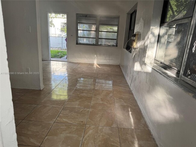
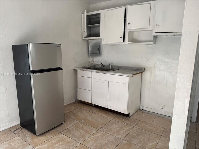
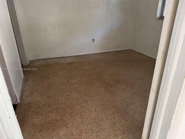
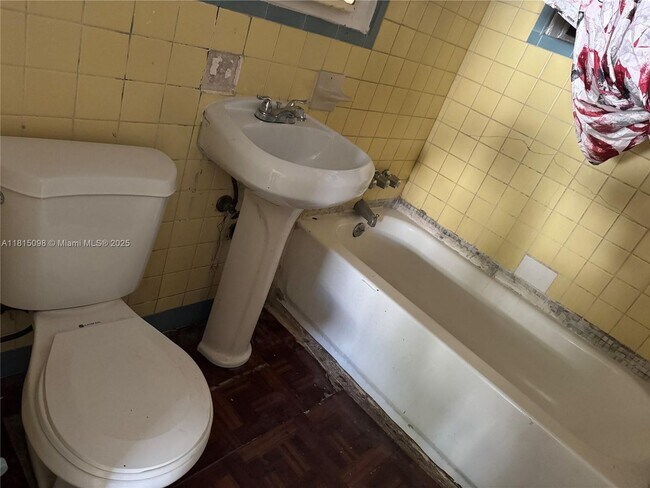
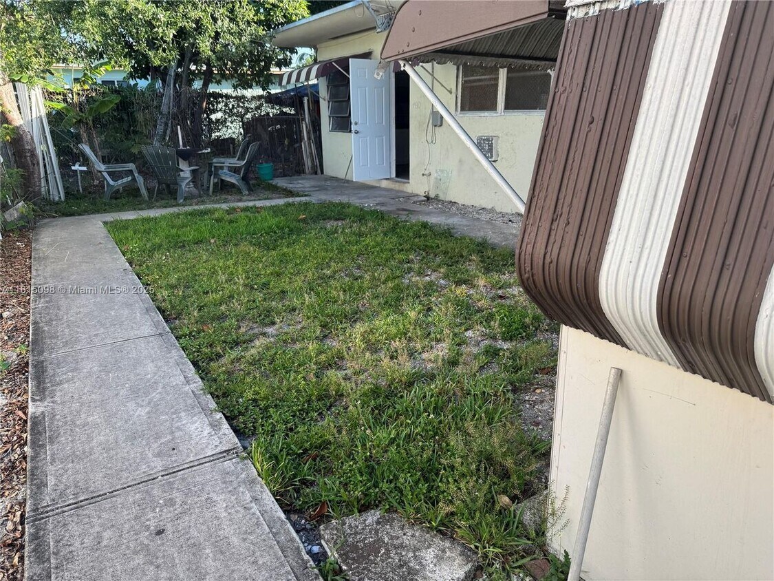
---- SCHEDULE A SHOWING ONLINE AT: ---- Welcome to your serene one-bedroom unit nestled in a quiet neighborhood, perfect for those seeking tranquility without sacrificing convenience. This charming home boasts a lovely outdoor space, complete with a barbecue area, ideal for hosting summer gatherings under the shade of majestic mango trees. Enjoy the ease of living with rent that includes lawn maintenance, garbage removal, and water, allowing you to focus on relaxation. Located just moments away from schools, bus routes, and parks, this
1930 NW 52nd St is a condo located in Miami/Dade County and the 33142 ZIP Code.
* Price shown is base rent and may not include non-optional fees and utilities.
Price, availability, fees, and any applicable rent special are subject to change without notice.
* Square footage definitions vary. Displayed square footage is approximate.
Contact
- Listed by Leasing Coordinator
- Phone Number
- Contact
Location
Get Directions
Liberty City is a Miami neighborhood on the rise that’s just six miles north of downtown. Here, you’ll find a hardworking, close-knit community that enjoys a slightly lower cost of living than the rest of the Miami area to the south. The neighborhood’s location directly west of Interstate 95 makes it convenient for the commuting crowd. A vibrant dining scene can be found in Liberty City. Creole food, Jamaican food, seafood, Thai, and so much more makes this area an unsung foodie’s hotspot. With Downtown Miami so close, living in Liberty City puts you close to all the action without the bigger price tags of living closer to the dazzling beaches.
Learn more about living in Liberty City
Education
| Colleges & Universities | Distance | ||
|---|---|---|---|
| Colleges & Universities | Distance | ||
| Drive: | 7 min | 3.1 mi | |
| Drive: | 7 min | 3.2 mi | |
| Drive: | 10 min | 5.3 mi | |
| Drive: | 11 min | 5.5 mi |
1930 NW 52nd St Unit 1930 is within 7 minutes or 3.1 miles from Miami Dade College, Medical. It is also near Univ. of Miami, Uhealth and AI Miami.
Transportation options available in Miami include School Board, located 4.6 miles from 1930 NW 52nd St Unit 1930. 1930 NW 52nd St Unit 1930 is near Miami International, located 7.7 miles or 18 minutes away, and Fort Lauderdale/Hollywood International, located 21.0 miles or 31 minutes away.
| Transit / Subway | Distance | ||
|---|---|---|---|
| Transit / Subway | Distance | ||
|
|
Drive: | 10 min | 4.6 mi |
|
Miami Intl Airport Ground Level
|
Drive: | 10 min | 4.7 mi |
|
Airport Station
|
Drive: | 12 min | 4.7 mi |
|
|
Drive: | 10 min | 4.9 mi |
|
|
Drive: | 9 min | 5.1 mi |
| Commuter Rail | Distance | ||
|---|---|---|---|
| Commuter Rail | Distance | ||
|
|
Walk: | 14 min | 0.7 mi |
|
|
Drive: | 3 min | 1.6 mi |
|
|
Drive: | 4 min | 2.0 mi |
|
|
Drive: | 6 min | 3.1 mi |
|
|
Drive: | 9 min | 4.8 mi |
| Airports | Distance | ||
|---|---|---|---|
| Airports | Distance | ||
|
Miami International
|
Drive: | 18 min | 7.7 mi |
|
Fort Lauderdale/Hollywood International
|
Drive: | 31 min | 21.0 mi |
Time and distance from 1930 NW 52nd St Unit 1930.
| Shopping Centers | Distance | ||
|---|---|---|---|
| Shopping Centers | Distance | ||
| Walk: | 15 min | 0.8 mi | |
| Walk: | 17 min | 0.9 mi | |
| Drive: | 4 min | 1.9 mi |
1930 NW 52nd St Unit 1930 has 3 shopping centers within 1.9 miles, which is about a 4-minute walk. The miles and minutes will be for the farthest away property.
| Parks and Recreation | Distance | ||
|---|---|---|---|
| Parks and Recreation | Distance | ||
|
Miami Children's Museum
|
Drive: | 12 min | 6.5 mi |
|
Jungle Island
|
Drive: | 13 min | 6.9 mi |
|
The Barnacle Historic State Park
|
Drive: | 15 min | 7.4 mi |
|
Miami Science Museum - Closed
|
Drive: | 13 min | 7.5 mi |
|
Vizcaya Museum and Gardens
|
Drive: | 14 min | 7.7 mi |
1930 NW 52nd St Unit 1930 has 5 parks within 7.7 miles, including Miami Children's Museum, Jungle Island, and Miami Science Museum - Closed.
| Hospitals | Distance | ||
|---|---|---|---|
| Hospitals | Distance | ||
| Drive: | 5 min | 2.6 mi | |
| Drive: | 7 min | 3.1 mi | |
| Drive: | 7 min | 3.6 mi |
1930 NW 52nd St Unit 1930 has 3 hospitals within 3.6 miles, the nearest is Douglas Gardens Hospital which is 2.6 miles away and a 5 minute drive.
You May Also Like
Similar Rentals Nearby


What Are Walk Score®, Transit Score®, and Bike Score® Ratings?
Walk Score® measures the walkability of any address. Transit Score® measures access to public transit. Bike Score® measures the bikeability of any address.
What is a Sound Score Rating?
A Sound Score Rating aggregates noise caused by vehicle traffic, airplane traffic and local sources
1930 NW 52nd St
Miami, FL 33142