
Baxter on Broadway
4901 Broadway,
Oakland, CA 94611
$2,208 - $3,319 Total Monthly Price
Studio - 3 Beds

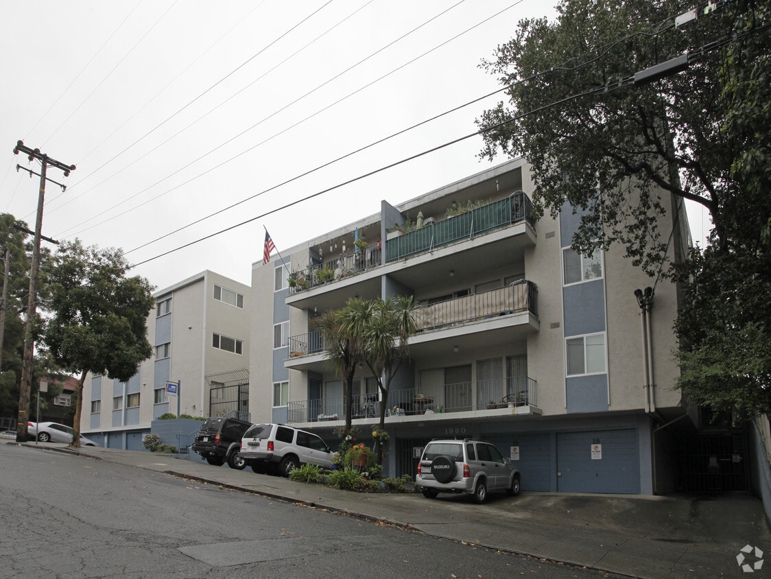

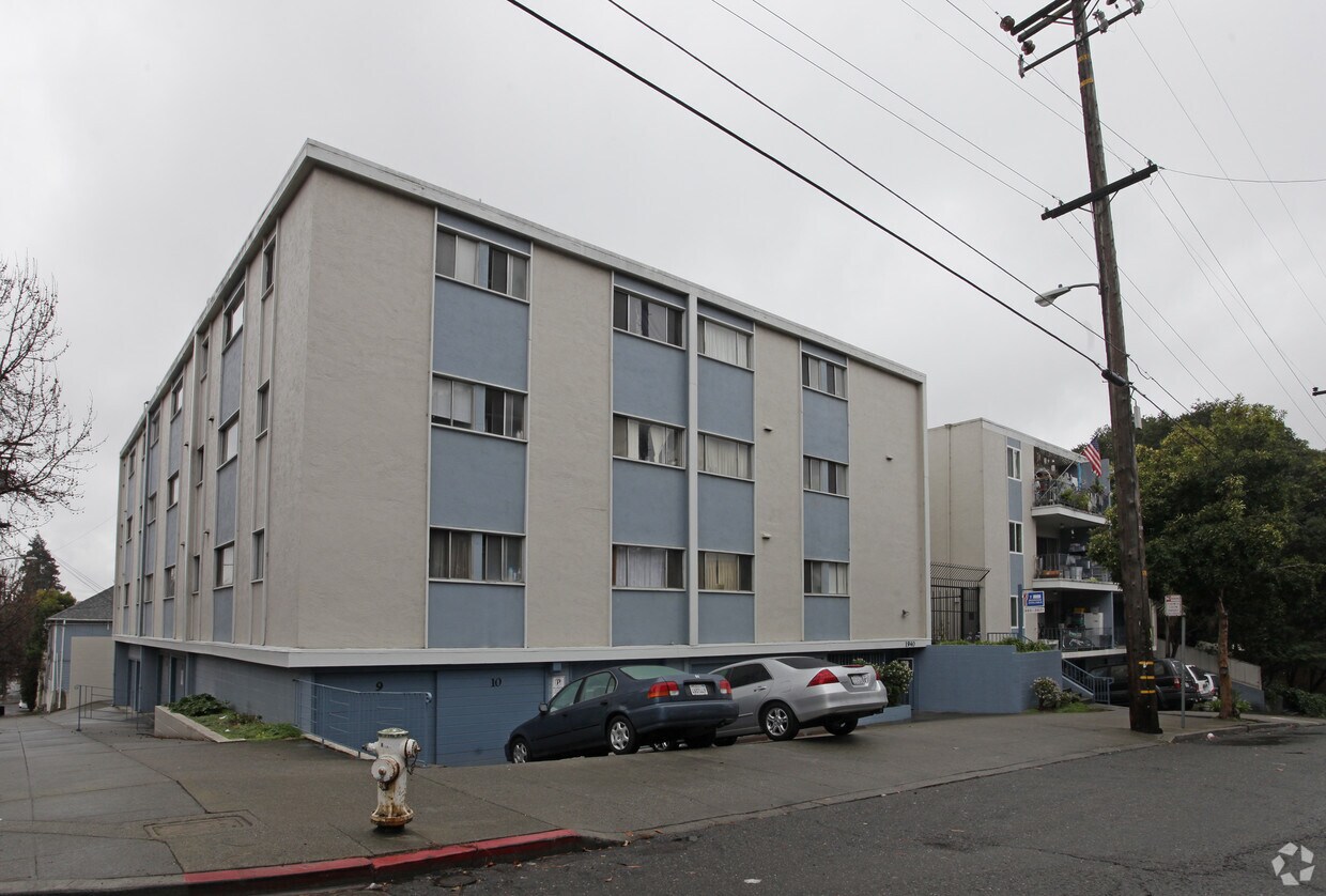
1930-1940 7th Ave is ready for your visit. The prime 7th Ave location in the 94606 Zip code of Oakland is a great place to move to. The professional community team is waiting to show you all that this community has in store. Be sure to come for a visit to check out the current floorplan options. Contact us or stop by today.
1930-1940 7th Ave is an apartment community located in Alameda County and the 94606 ZIP Code. This area is served by the Oakland Unified School District attendance zone.
Refrigerator
Heating
Oven
Kitchen
East of Lake Merritt and Lakeside Park is the urban community of Ivy Hill. Residents of this residential neighborhood enjoy the convenient access to two parks: FM Smith and Park Boulevard Plaza. With the latter being the largest, Park Boulevard Plaza consists of expansive green space and a horse statue. A playground can be found at FM Smith, as well as an outdoor basketball court.
Residents enjoy the vibrant nightlife at Ivy Hills’ bars. AC Transit has a couple of bus lines that run in the community, so residents can get from one place to another quickly. A number of eateries and local businesses encompass Ivy Hill. Locals are just minutes from Interstate 580, Interstate 880, Laney College, and Oakland Museum of California.
Learn more about living in Ivy HillCompare neighborhood and city base rent averages by bedroom.
| Ivy Hill | Oakland, CA | |
|---|---|---|
| Studio | $1,469 | $1,704 |
| 1 Bedroom | $1,477 | $2,101 |
| 2 Bedrooms | $2,111 | $2,706 |
| 3 Bedrooms | $3,299 | $3,263 |
| Colleges & Universities | Distance | ||
|---|---|---|---|
| Colleges & Universities | Distance | ||
| Drive: | 3 min | 1.2 mi | |
| Drive: | 4 min | 1.7 mi | |
| Drive: | 8 min | 3.1 mi | |
| Drive: | 8 min | 3.4 mi |


Transportation options available in Oakland include Lake Merritt Station, located 1.5 miles from 1930-1940 7th Ave. 1930-1940 7th Ave is near Metro Oakland International, located 8.5 miles or 14 minutes away, and San Francisco International, located 25.6 miles or 38 minutes away.
| Transit / Subway | Distance | ||
|---|---|---|---|
| Transit / Subway | Distance | ||
|
|
Drive: | 4 min | 1.5 mi |
|
|
Drive: | 4 min | 1.7 mi |
|
|
Drive: | 4 min | 2.0 mi |
|
|
Drive: | 5 min | 2.5 mi |
|
|
Drive: | 11 min | 6.2 mi |
| Commuter Rail | Distance | ||
|---|---|---|---|
| Commuter Rail | Distance | ||
|
|
Drive: | 5 min | 1.9 mi |
| Drive: | 11 min | 6.6 mi | |
|
|
Drive: | 12 min | 8.2 mi |
| Drive: | 20 min | 13.2 mi | |
| Drive: | 27 min | 17.8 mi |
| Airports | Distance | ||
|---|---|---|---|
| Airports | Distance | ||
|
Metro Oakland International
|
Drive: | 14 min | 8.5 mi |
|
San Francisco International
|
Drive: | 38 min | 25.6 mi |
Scores provided by
Traffic
ActiveAirport
CalmBusinesses
ActiveScores provided by
HowLoud What is a Sound Score Rating? A Sound Score Rating aggregates noise caused by vehicle traffic, airplane traffic and local sources. How It WorksTime and distance from 1930-1940 7th Ave.
| Shopping Centers | Distance | ||
|---|---|---|---|
| Shopping Centers | Distance | ||
| Walk: | 8 min | 0.5 mi | |
| Drive: | 4 min | 1.6 mi | |
| Drive: | 4 min | 1.8 mi |
| Parks and Recreation | Distance | ||
|---|---|---|---|
| Parks and Recreation | Distance | ||
|
Juan Bautista de Anza National Historic Trail
|
Drive: | 3 min | 1.3 mi |
|
Oakland Museum of California
|
Drive: | 4 min | 1.4 mi |
|
Lakeside Park
|
Drive: | 4 min | 1.4 mi |
|
Rotary Nature Center
|
Drive: | 5 min | 1.8 mi |
|
Lakeside Park Garden Center
|
Drive: | 5 min | 1.8 mi |
| Hospitals | Distance | ||
|---|---|---|---|
| Hospitals | Distance | ||
| Drive: | 4 min | 1.6 mi | |
| Drive: | 6 min | 2.6 mi | |
| Drive: | 7 min | 3.6 mi |
| Military Bases | Distance | ||
|---|---|---|---|
| Military Bases | Distance | ||
| Drive: | 12 min | 4.9 mi | |
| Drive: | 14 min | 5.3 mi |
Pets Allowed Fitness Center In Unit Washer & Dryer Stainless Steel Appliances Business Center Package Service Elevator
What Are Walk Score®, Transit Score®, and Bike Score® Ratings?
Walk Score® measures the walkability of any address. Transit Score® measures access to public transit. Bike Score® measures the bikeability of any address.
What is a Sound Score Rating?
A Sound Score Rating aggregates noise caused by vehicle traffic, airplane traffic and local sources.
1930-1940 7th Ave
Oakland, CA 94606


