
$1,250
/ Month
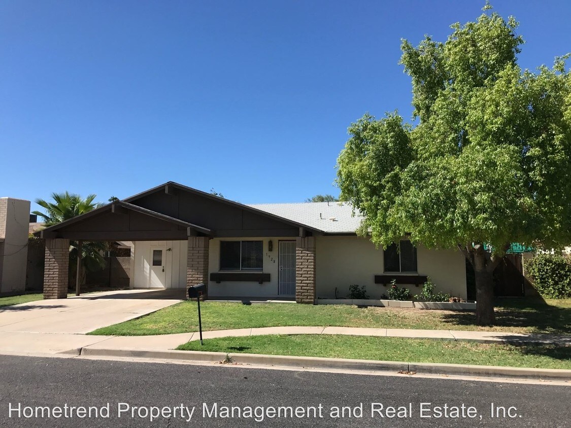
1928 S Los Altos
Mesa, AZ 85202
2 Weeks Ago
|
Edit
Favorites
1928 S Los Altos

Favorites
Check Back Soon for Upcoming Availability
| Beds | Baths | Average SF |
|---|---|---|
| 3 Bedrooms 3 Bedrooms 3 Br | 2 Baths 2 Baths 2 Ba | 1,348 SF |
About This Property
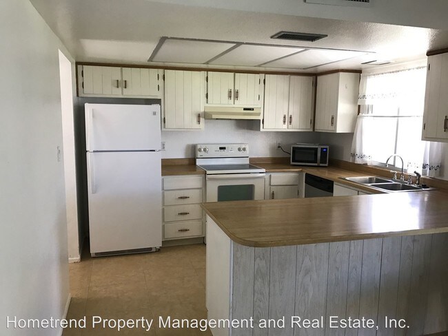
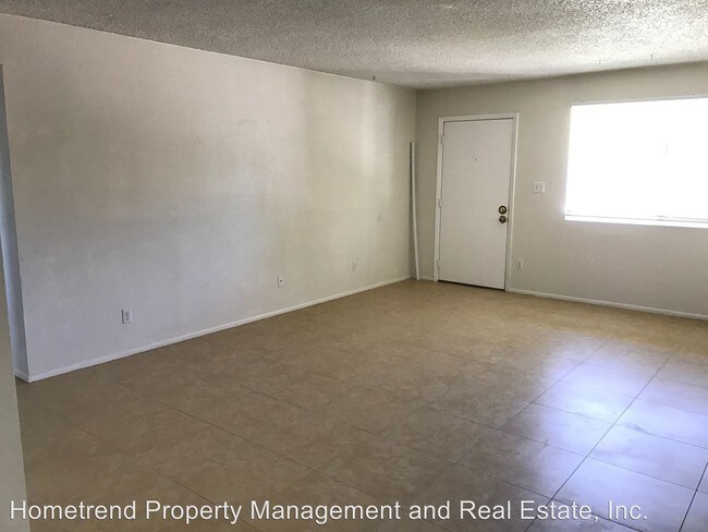
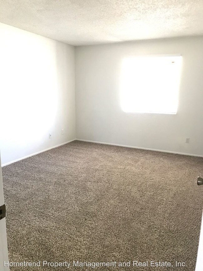
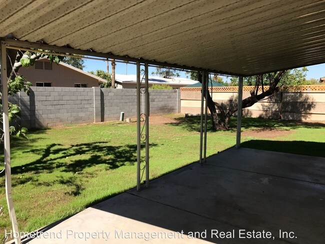
(480) 650-4173 - Dobson Ranch 3/2 Home - Offering a 3 bedroom, 2 bathroom home in the desirable Dobson Ranch with brand new tile in the living areas and new carpet in the bedrooms. Good size backyard with newly planted winter rye. Home comes with access to Dobson Ranch amenities including pools, tennis courts, fishing, and more. Minutes from US 60, shopping, restaurants and MCC. (RLNE3595442)
1928 S Los Altos is a house located in Maricopa County and the 85202 ZIP Code. This area is served by the Mesa Unified School District attendance zone.
1928 S Los Altos,
Mesa,
AZ
85202
Situated about 15 miles southeast of Downtown Phoenix, Dobson Ranch is a charming community of single-family homes, condos, and townhomes designed around peaceful lakes. Dobson Ranch boasts the convenience of a suburb with the charm and character of a small town.
Residents find what they need at several sizable shopping centers in the neighborhood while enjoying a strong sense of community at the municipal complex, local parks, schools, churches, and organizations. Quick access to Highway 101 and Superstition Freeway makes getting around from Dobson Ranch a breeze.
Learn more about living in DobsonBelow are rent ranges for similar nearby apartments
| Beds | Average Size | Lowest | Typical | Premium |
|---|---|---|---|---|
| Studio Studio Studio | 391 Sq Ft | $900 | $1,106 | $2,010 |
| 1 Bed 1 Bed 1 Bed | 690-691 Sq Ft | $995 | $4,884 | $185,653 |
| 2 Beds 2 Beds 2 Beds | 1009 Sq Ft | $1,146 | $1,687 | $2,500 |
| 3 Beds 3 Beds 3 Beds | 1538 Sq Ft | $1,695 | $2,759 | $5,000 |
| 4 Beds 4 Beds 4 Beds | 2192 Sq Ft | $1,998 | $3,721 | $5,740 |
Education
| Colleges & Universities | Distance | ||
|---|---|---|---|
| Colleges & Universities | Distance | ||
| Drive: | 4 min | 1.2 mi | |
| Drive: | 5 min | 2.4 mi | |
| Drive: | 11 min | 5.7 mi | |
| Drive: | 10 min | 5.7 mi |
1928 S Los Altos is within 4 minutes or 1.2 miles from Mesa C.C., Southern and Dobson. It is also near Alverno College and Benedictine University.
Schools


Public Elementary School
Grades PK-5
446 Students
Attendance Zone
Public Elementary School
Grades PK-5
501 Students
Nearby
Public Middle School
Grades 6-8
597 Students
Attendance Zone
Public High School
Grades 9-12
2,284 Students
Attendance Zone
Private Elementary School
Grades K-5
Nearby
Private Elementary & Middle School
Grades PK-8
Nearby
Private Middle & High School
Grades 7-12
Nearby
School data provided by
 The GreatSchools Rating helps parents compare schools within a state based on a variety of school quality indicators and provides a helpful picture of how effectively each school serves all of its students. Ratings are on a scale of 1 (below average) to 10 (above average) and can include test scores, college readiness, academic progress, advanced courses, equity, discipline and attendance data. We also advise parents to visit schools, consider other information on school performance and programs, and consider family needs as part of the school selection process.
View GreatSchools Rating Methodology
Data provided by GreatSchools.org © 2026. All rights reserved.
View GreatSchools Rating Methodology
Data provided by GreatSchools.org © 2026. All rights reserved.
Transportation options available in Mesa include Sycamore/Main Street, located 3.0 miles from 1928 S Los Altos. 1928 S Los Altos is near Phoenix Sky Harbor International, located 11.5 miles or 18 minutes away, and Phoenix-Mesa Gateway, located 18.1 miles or 27 minutes away.
| Transit / Subway | Distance | ||
|---|---|---|---|
| Transit / Subway | Distance | ||
|
|
Drive: | 6 min | 3.0 mi |
|
|
Drive: | 6 min | 3.4 mi |
|
|
Drive: | 7 min | 3.8 mi |
|
|
Drive: | 7 min | 3.9 mi |
|
|
Drive: | 8 min | 4.3 mi |
| Commuter Rail | Distance | ||
|---|---|---|---|
| Commuter Rail | Distance | ||
|
|
Drive: | 38 min | 28.9 mi |
| Airports | Distance | ||
|---|---|---|---|
| Airports | Distance | ||
|
Phoenix Sky Harbor International
|
Drive: | 18 min | 11.5 mi |
|
Phoenix-Mesa Gateway
|
Drive: | 27 min | 18.1 mi |
Walkability Near 1928 S Los Altos Mesa, AZ 85202
Getting Around
 What do Walkability, Transit, Drivability, and Bikeability mean?
Walkability measures the walking distance to day-to-day needs.
Transit measures access to public transportation.
Drivability measures congestion, parking availability, and access to major roads.
Bikeability measures the suitability for cycling.
How It Works
What do Walkability, Transit, Drivability, and Bikeability mean?
Walkability measures the walking distance to day-to-day needs.
Transit measures access to public transportation.
Drivability measures congestion, parking availability, and access to major roads.
Bikeability measures the suitability for cycling.
How It Works
Moderately Walkable
Walkability
60
/ 100
Limited Public Transit
Transit
30
/ 100
Exceptionally Drivable
Drivability
90
/ 100
Fairly Bikeable
Bikeability
50
/ 100
Scores provided by
-
Soundscore™
-
/ 100
Traffic
-Airport
-Businesses
-Scores provided by
HowLoud What is a Sound Score Rating? A Sound Score Rating aggregates noise caused by vehicle traffic, airplane traffic and local sources. How It WorksTime and distance from 1928 S Los Altos.
| Shopping Centers | Distance | ||
|---|---|---|---|
| Shopping Centers | Distance | ||
| Walk: | 4 min | 0.2 mi | |
| Walk: | 7 min | 0.4 mi | |
| Walk: | 7 min | 0.4 mi |
1928 S Los Altos has 3 shopping centers within 0.4 mile, which is about a 7-minute walk. The miles and minutes will be for the farthest away property.
| Parks and Recreation | Distance | ||
|---|---|---|---|
| Parks and Recreation | Distance | ||
|
i.d.e.a. Museum
|
Drive: | 9 min | 5.0 mi |
|
Arizona Museum of Natural History
|
Drive: | 10 min | 5.3 mi |
|
ASU Center for Meteorite Studies
|
Drive: | 12 min | 6.0 mi |
|
Desert Arboretum Park
|
Drive: | 12 min | 6.6 mi |
|
Papago Park
|
Drive: | 15 min | 8.3 mi |
1928 S Los Altos has 5 parks within 8.3 miles, including i.d.e.a. Museum, Arizona Museum of Natural History, and ASU Center for Meteorite Studies.
| Hospitals | Distance | ||
|---|---|---|---|
| Hospitals | Distance | ||
| Walk: | 20 min | 1.0 mi | |
| Drive: | 6 min | 4.0 mi | |
| Drive: | 8 min | 4.4 mi |
1928 S Los Altos has 3 hospitals within 4.4 miles, the nearest is Banner Desert Medical Center which is 1.0 miles away and a 20 minute walk.
| Military Bases | Distance | ||
|---|---|---|---|
| Military Bases | Distance | ||
| Drive: | 18 min | 12.2 mi | |
| Drive: | 48 min | 36.7 mi | |
| Drive: | 106 min | 87.7 mi |
1928 S Los Altos has 3 military bases within 87.7 miles, the nearest is Phoenix Sky Harbor Airport Air Guard Station which is 12.2 miles away and a 18 minute drive.
You May Also Like
Similar Rentals Nearby
-
-
-
-
-
-
1 / 62
 3 Beds$2,551+Total Monthly PriceTotal Monthly Price NewPrices include base rent and required monthly fees of $56. Variable costs based on usage may apply.Base Rent:3 Beds$2,495+2 Months Free
Pets Allowed Fitness Center Pool Dishwasher Refrigerator Kitchen
-
-
-
-


What Are Walk Score®, Transit Score®, and Bike Score® Ratings?
Walk Score® measures the walkability of any address. Transit Score® measures access to public transit. Bike Score® measures the bikeability of any address.
What is a Sound Score Rating?
A Sound Score Rating aggregates noise caused by vehicle traffic, airplane traffic and local sources.
1928 S Los Altos
Mesa, AZ 85202