
$895
Total Monthly Price
12 Month Lease
1928 Feronia Ave Unit 3
Saint Paul, MN 55104
Today
|
Edit
Favorites
-
Bedrooms
1
-
Bathrooms
1
-
Square Feet
800 sq ft
-
Available
Available Now
Highlight
- Smoke Free
1928 Feronia Ave

Favorites
About This Home
12 Month Lease,
$895 deposit,
Available Now
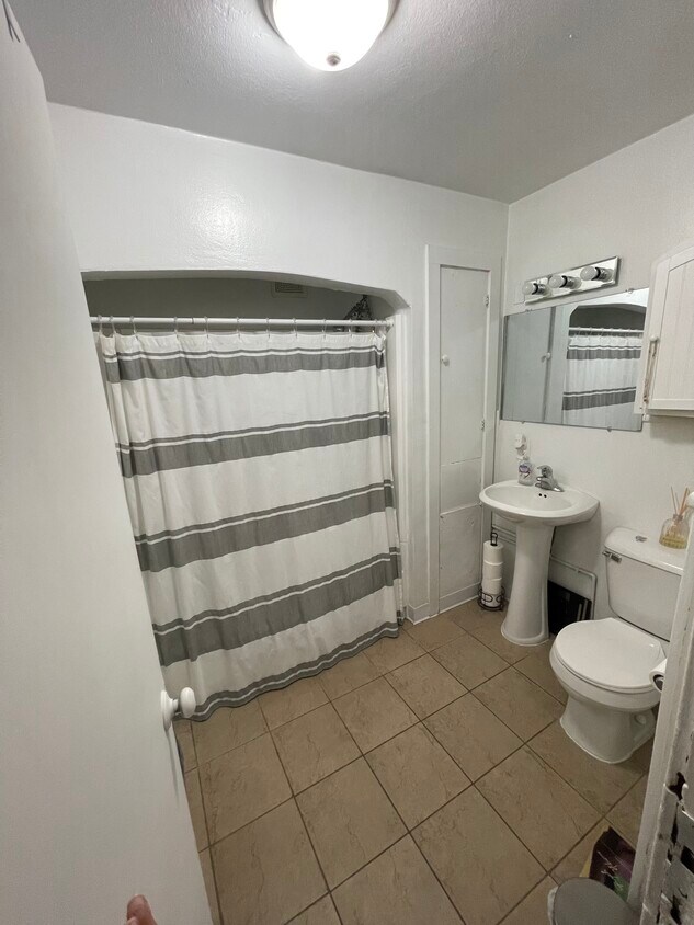
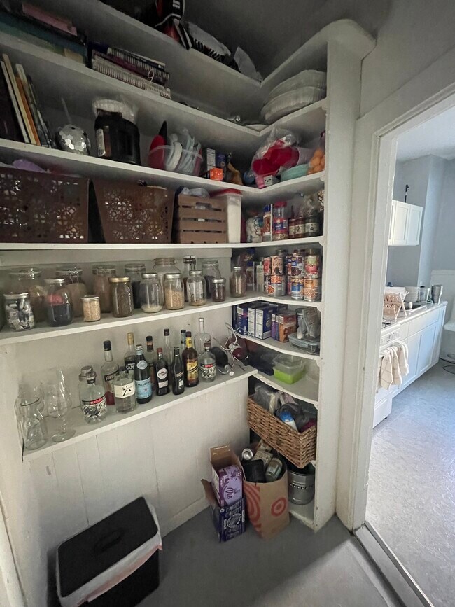
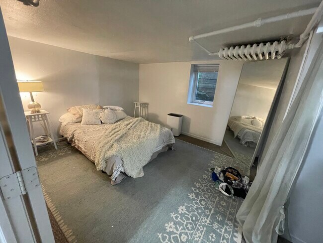
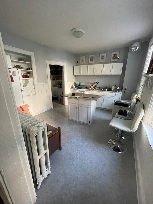
Spacious 1 bedroom, 1 bath apartment for rent. Recently renovated, St.Paul charm. Great location, Merriam Park - Lexington - Hamline neighborhood of Saint Paul, MN. Very close to Allianz field. Walking distance to the Light Rail. One alley parking spot. Rent: $895/month. Water and trash is included. Electric and gas paid by tenant. Looking for 12 month lease. Available now!
1928 Feronia Ave is a townhome located in Ramsey County and the 55104 ZIP Code. This area is served by the St. Paul Public attendance zone.
* Price shown is total price based on community-supplied monthly required fees. Excludes user-selected optional fees and variable or usage-based fees and required charges due at or prior to move-in or at move-out. Price, availability, fees, and any applicable rent special are subject to change without notice.
* Square footage definitions vary. Displayed square footage is approximate.
Townhome Features
- Smoke Free
Fees and Policies
The fees below are based on community-supplied data and may exclude additional fees and utilities.
- Parking
-
Street--
Details
Utilities Included
-
Water
-
Trash Removal
Property Information
-
4 units
Contact
- Contact
Location
Get Directions
Along the shore of the Mississippi River, Merriam Park West offers riverfront parks, a large golf course, and quaint local restaurants just minutes from downtown Saint Paul, Minnesota. Stop on in at Izzy’s Ice Cream Café, or grab a treat at Black Coffee and Waffle Bar. Local businesses thrive alongside riverfront community spaces like Shadow Falls Park, a picturesque nature preserve.
The University of Saint Thomas resides on the south end of town, and the neighborhood offers a blend of private and public schools, churches, and every day conveniences. Situated just five miles southeast of Minneapolis and seven miles northeast of the Minneapolis-Saint Paul International Airport, this neighborhood is in a premier location for commuting, shopping, dining, and entertainment.
Learn more about living in Merriam Park West
Education
| Colleges & Universities | Distance | ||
|---|---|---|---|
| Colleges & Universities | Distance | ||
| Drive: | 3 min | 1.4 mi | |
| Drive: | 4 min | 1.8 mi | |
| Drive: | 4 min | 2.0 mi | |
| Drive: | 6 min | 2.1 mi |
1928 Feronia Ave is within 3 minutes or 1.4 miles from Univ. of St Thomas, St. Paul. It is also near Hamline University and Concordia Univ.-Saint Paul.
Schools


Public Elementary School
Grades PK-5
303 Students
Attendance Zone
Public Elementary School
Grades PK-5
266 Students
Nearby
Public Middle School
Grades 6-8
538 Students
Attendance Zone
Public High School
Grades 9-12
1,078 Students
Attendance Zone
Private Elementary & Middle School
Grades PK-8
186 Students
Nearby
Private Middle & High School
Grades 7-12
Nearby
School data provided by
 The GreatSchools Rating helps parents compare schools within a state based on a variety of school quality indicators and provides a helpful picture of how effectively each school serves all of its students. Ratings are on a scale of 1 (below average) to 10 (above average) and can include test scores, college readiness, academic progress, advanced courses, equity, discipline and attendance data. We also advise parents to visit schools, consider other information on school performance and programs, and consider family needs as part of the school selection process.
View GreatSchools Rating Methodology
Data provided by GreatSchools.org © 2026. All rights reserved.
View GreatSchools Rating Methodology
Data provided by GreatSchools.org © 2026. All rights reserved.
Transportation options available in Saint Paul include Fairview Ave Station, located 0.3 mile from 1928 Feronia Ave. 1928 Feronia Ave is near Minneapolis-St Paul International/Wold-Chamberlain, located 7.8 miles or 17 minutes away.
| Transit / Subway | Distance | ||
|---|---|---|---|
| Transit / Subway | Distance | ||
| Walk: | 6 min | 0.3 mi | |
| Drive: | 3 min | 1.2 mi | |
| Drive: | 4 min | 1.3 mi | |
| Drive: | 3 min | 1.6 mi | |
| Drive: | 4 min | 1.8 mi |
| Commuter Rail | Distance | ||
|---|---|---|---|
| Commuter Rail | Distance | ||
|
|
Drive: | 11 min | 5.8 mi |
|
|
Drive: | 14 min | 6.1 mi |
|
|
Drive: | 22 min | 14.7 mi |
|
|
Drive: | 32 min | 23.2 mi |
|
|
Drive: | 33 min | 24.8 mi |
| Airports | Distance | ||
|---|---|---|---|
| Airports | Distance | ||
|
Minneapolis-St Paul International/Wold-Chamberlain
|
Drive: | 17 min | 7.8 mi |
Time and distance from 1928 Feronia Ave.
| Shopping Centers | Distance | ||
|---|---|---|---|
| Shopping Centers | Distance | ||
| Drive: | 4 min | 1.5 mi | |
| Drive: | 4 min | 1.7 mi | |
| Drive: | 4 min | 1.9 mi |
1928 Feronia Ave has 3 shopping centers within 1.9 miles, which is about a 4-minute drive. The miles and minutes will be for the farthest away property.
| Parks and Recreation | Distance | ||
|---|---|---|---|
| Parks and Recreation | Distance | ||
|
Newell Park
|
Drive: | 3 min | 1.7 mi |
|
Macalester College Observatory
|
Drive: | 4 min | 2.0 mi |
|
Tower Hill Park
|
Drive: | 6 min | 2.1 mi |
|
Brackett Park
|
Drive: | 6 min | 2.5 mi |
|
The Raptor Center - University of Minnesota
|
Drive: | 9 min | 3.1 mi |
1928 Feronia Ave has 5 parks within 3.1 miles, including Newell Park, Macalester College Observatory, and Tower Hill Park.
| Hospitals | Distance | ||
|---|---|---|---|
| Hospitals | Distance | ||
| Drive: | 7 min | 3.5 mi | |
| Drive: | 9 min | 4.8 mi | |
| Drive: | 9 min | 4.8 mi |
1928 Feronia Ave has 3 hospitals within 4.8 miles, the nearest is University of Minnesota Medical Center, Fairview which is 3.5 miles away and a 7 minute drive.
| Military Bases | Distance | ||
|---|---|---|---|
| Military Bases | Distance | ||
| Drive: | 15 min | 6.5 mi |
1928 Feronia Ave is 6.5 miles and a 15 minute drive from Fort Snelling Military Reservation.
Amenities
- Smoke Free
1928 Feronia Ave Photos
What Are Walk Score®, Transit Score®, and Bike Score® Ratings?
Walk Score® measures the walkability of any address. Transit Score® measures access to public transit. Bike Score® measures the bikeability of any address.
What is a Sound Score Rating?
A Sound Score Rating aggregates noise caused by vehicle traffic, airplane traffic and local sources

1928 Feronia Ave
Saint Paul, MN 55104