
Rogers Park Apartments
2000-2006 W Fargo Ave,
Chicago, IL 60645
$1,725 - $1,800
2 Beds
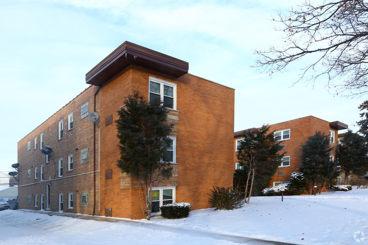

Experience Evanston living at 1919-1923 W Howard St. The location of this community is in Evanston on W. Howard St.. The leasing team is ready to help match you with your perfect new home. Come by to check out the apartment floorplan options. Visit 1919-1923 W Howard St today.
1919-1923 W Howard St is an apartment community located in Cook County and the 60202 ZIP Code. This area is served by the Evanston Central Consolidated School District 65 attendance zone.
Evanston sits on the western shore of Lake Michigan directly north of Chicago, holding its own as a full-fledged city rather than simply a suburb in the shadow of its neighbor. Northwestern University, founded in 1851 and one of the country's leading research institutions, anchors much of the city's identity and shapes its intellectual energy. The broader economy draws corporate leadership as well, and Evanston's independent commercial corridors reflect a city that takes its own character seriously.
Distinct neighborhoods give the city real variety. Downtown near Davis Street buzzes with independent shops and transit access, the Main-Dempster Mile carries a more relaxed, arts-forward feel, and Central Street offers a quieter, small-town atmosphere with specialty retailers and historic architecture throughout the Ridge Historic District. The lakefront is never far, with beaches, parks, and the 1873 Grosse Point Lighthouse adding genuine texture to daily life.
Learn more about living in Evanston| Colleges & Universities | Distance | ||
|---|---|---|---|
| Colleges & Universities | Distance | ||
| Drive: | 5 min | 2.7 mi | |
| Drive: | 8 min | 3.6 mi | |
| Drive: | 8 min | 3.8 mi | |
| Drive: | 9 min | 4.0 mi |


Transportation options available in Evanston include Howard Terminal, located 1.6 miles from 1919-1923 W Howard St. 1919-1923 W Howard St is near Chicago O'Hare International, located 13.1 miles or 24 minutes away, and Chicago Midway International, located 18.2 miles or 34 minutes away.
| Transit / Subway | Distance | ||
|---|---|---|---|
| Transit / Subway | Distance | ||
|
|
Drive: | 3 min | 1.6 mi |
|
|
Drive: | 3 min | 1.7 mi |
|
|
Drive: | 4 min | 1.9 mi |
|
|
Drive: | 5 min | 2.0 mi |
|
|
Drive: | 5 min | 2.7 mi |
| Commuter Rail | Distance | ||
|---|---|---|---|
| Commuter Rail | Distance | ||
|
|
Drive: | 5 min | 1.9 mi |
|
|
Drive: | 4 min | 2.0 mi |
| Drive: | 5 min | 2.9 mi | |
|
|
Drive: | 5 min | 3.0 mi |
|
|
Drive: | 7 min | 3.7 mi |
| Airports | Distance | ||
|---|---|---|---|
| Airports | Distance | ||
|
Chicago O'Hare International
|
Drive: | 24 min | 13.1 mi |
|
Chicago Midway International
|
Drive: | 34 min | 18.2 mi |
Scores provided by
Traffic
-Airport
-Businesses
-Scores provided by
HowLoud What is a Sound Score Rating? A Sound Score Rating aggregates noise caused by vehicle traffic, airplane traffic and local sources. How It WorksTime and distance from 1919-1923 W Howard St.
| Shopping Centers | Distance | ||
|---|---|---|---|
| Shopping Centers | Distance | ||
| Walk: | 10 min | 0.5 mi | |
| Walk: | 10 min | 0.6 mi | |
| Walk: | 11 min | 0.6 mi |
| Parks and Recreation | Distance | ||
|---|---|---|---|
| Parks and Recreation | Distance | ||
|
Rogers Park
|
Walk: | 12 min | 0.6 mi |
|
Pooch Park
|
Walk: | 20 min | 1.0 mi |
|
Channelside Park
|
Walk: | 21 min | 1.1 mi |
|
Touhy Park
|
Drive: | 4 min | 1.7 mi |
|
Warren Park
|
Drive: | 4 min | 1.9 mi |
| Hospitals | Distance | ||
|---|---|---|---|
| Hospitals | Distance | ||
| Drive: | 2 min | 1.2 mi | |
| Drive: | 6 min | 3.1 mi | |
| Drive: | 7 min | 4.0 mi |
| Military Bases | Distance | ||
|---|---|---|---|
| Military Bases | Distance | ||
| Drive: | 31 min | 17.2 mi | |
| Drive: | 37 min | 25.7 mi | |
| Drive: | 54 min | 34.8 mi |
What Are Walk Score®, Transit Score®, and Bike Score® Ratings?
Walk Score® measures the walkability of any address. Transit Score® measures access to public transit. Bike Score® measures the bikeability of any address.
What is a Sound Score Rating?
A Sound Score Rating aggregates noise caused by vehicle traffic, airplane traffic and local sources.

1919-1923 W Howard St
Evanston, IL 60202


