$3,400
/ Month
1901 N Adams St
Arlington, VA 22201
Today
|
Edit
Favorites
703-836-6116
-
Bedrooms
2
-
Bathrooms
2
-
Square Feet
--
-
Available
Available Dec 5
Highlights
- Fireplace
- Basement
1901 N Adams St

Favorites
About This Home
Available Dec 5
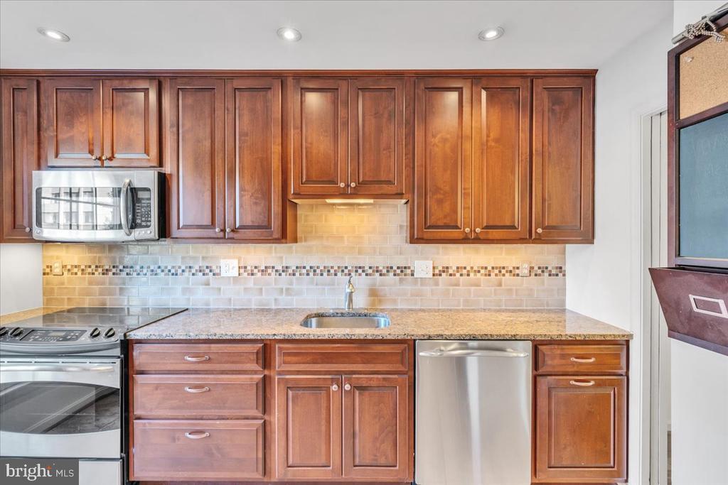
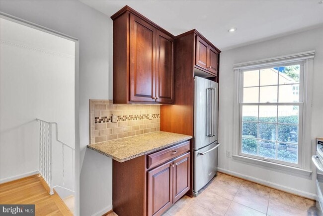
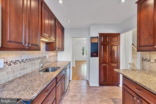
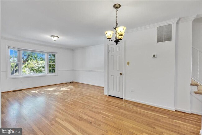
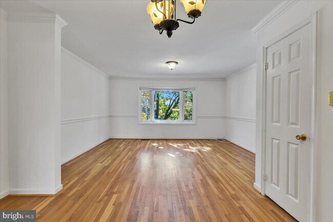
2BR / 2BA - 1,728 total sq. ft. $50 application fee NO move-in fees Pets allowed: cats and dogs, with a $600 pet deposit and $50 monthly pet fee per pet Tenant pays for electric and cable/internet only (current provider: Comcast) Blocks to Courthouse Metro One reserved parking space (#5), two guest spaces on a first-come, first-served basis, and plenty of street parking Nearby: Walgreens, Whole Foods, The Italian Store, Starbucks, and more. Filled with natural light, this property features large closets, generously sized rooms, and is exceptionally clean. This home offers the perfect blend of comfort, space, and a prime location for effortless urban living.
1901 N Adams St is a townhome located in Arlington County and the 22201 ZIP Code. This area is served by the Arlington County Public Schools attendance zone.
* Price shown is base rent. Excludes user-selected optional fees and variable or usage-based fees and required charges due at or prior to move-in or at move-out. Price, availability, fees, and any applicable rent special are subject to change without notice.
* Square footage definitions vary. Displayed square footage is approximate.
Townhome Features
- Fireplace
- Dishwasher
- Basement
Contact
- Listed by Aaron M Seekford | Arlington Realty, Inc.
- Phone Number
- Contact
-
Source
 Bright MLS, Inc.
Copyright © 2025 Bright MLS, Inc.
Location
Get Directions
Amenities
- Fireplace
- Dishwasher
- Basement
North Highland encompasses the thin sliver of residential land tucked between Fort Bennett Park and the Custis Memorial Parkway. The neighborhood belongs to the Rosslyn region, which in turn stands as an urban village in Arlington. Just three and a half miles west of Washington, DC, the tiny neighborhood provides working professionals with a safe haven to retreat after work. Residents include highly educated professionals and some families who both want to take advantage of excellent housing options and a wealth of employment opportunities both in neighboring areas and the city. Former and current residents say the area surpasses others for its stunning views and easy commute, but the active community in Rosslyn distinguishes it even further.
Learn more about living in North Highland
Education
| Colleges & Universities | Distance | ||
|---|---|---|---|
| Colleges & Universities | Distance | ||
| Drive: | 4 min | 1.4 mi | |
| Drive: | 6 min | 2.4 mi | |
| Drive: | 6 min | 2.6 mi | |
| Drive: | 7 min | 3.3 mi |
1901 N Adams St is within 4 minutes or 1.4 miles from George Mason Univ., Arlington. It is also near Georgetown University and Marymount University.
Schools


Public Elementary School
Grades PK-5
539 Students
Attendance Zone
Public Middle School
Grades 6-8
571 Students
Nearby
Public High School
Grades 9-12
2,715 Students
Attendance Zone
Private Elementary & Middle School
Grades PK-8
1,075 Students
Nearby
Private Elementary, Middle & High School
Grades 1-12
378 Students
Nearby
School data provided by
 The GreatSchools Rating helps parents compare schools within a state based on a variety of school quality indicators and provides a helpful picture of how effectively each school serves all of its students. Ratings are on a scale of 1 (below average) to 10 (above average) and can include test scores, college readiness, academic progress, advanced courses, equity, discipline and attendance data. We also advise parents to visit schools, consider other information on school performance and programs, and consider family needs as part of the school selection process.
View GreatSchools Rating Methodology
Data provided by GreatSchools.org © 2025. All rights reserved.
View GreatSchools Rating Methodology
Data provided by GreatSchools.org © 2025. All rights reserved.
Transportation options available in Arlington include Court House, Orange,Silver Line Center Platform, located 0.5 mile from 1901 N Adams St. 1901 N Adams St is near Ronald Reagan Washington Ntl, located 5.8 miles or 11 minutes away, and Washington Dulles International, located 23.7 miles or 38 minutes away.
| Transit / Subway | Distance | ||
|---|---|---|---|
| Transit / Subway | Distance | ||
| Walk: | 9 min | 0.5 mi | |
|
|
Drive: | 2 min | 1.1 mi |
|
|
Drive: | 3 min | 1.2 mi |
|
|
Drive: | 4 min | 1.5 mi |
|
|
Drive: | 5 min | 2.6 mi |
| Commuter Rail | Distance | ||
|---|---|---|---|
| Commuter Rail | Distance | ||
|
|
Drive: | 8 min | 4.4 mi |
|
|
Drive: | 9 min | 4.5 mi |
|
|
Drive: | 9 min | 4.5 mi |
|
|
Drive: | 10 min | 5.2 mi |
|
|
Drive: | 11 min | 5.4 mi |
| Airports | Distance | ||
|---|---|---|---|
| Airports | Distance | ||
|
Ronald Reagan Washington Ntl
|
Drive: | 11 min | 5.8 mi |
|
Washington Dulles International
|
Drive: | 38 min | 23.7 mi |
Time and distance from 1901 N Adams St.
| Shopping Centers | Distance | ||
|---|---|---|---|
| Shopping Centers | Distance | ||
| Walk: | 11 min | 0.6 mi | |
| Walk: | 14 min | 0.7 mi | |
| Walk: | 15 min | 0.8 mi |
1901 N Adams St has 3 shopping centers within 0.8 mile, which is about a 15-minute walk. The miles and minutes will be for the farthest away property.
| Parks and Recreation | Distance | ||
|---|---|---|---|
| Parks and Recreation | Distance | ||
|
Fort Bennett Park and Palisades Trail
|
Walk: | 11 min | 0.6 mi |
|
Fort C.F. Smith Park & Historic Site
|
Drive: | 3 min | 1.2 mi |
|
Cherry Valley Park
|
Drive: | 4 min | 1.5 mi |
|
David M. Brown Planetarium
|
Drive: | 5 min | 1.7 mi |
|
Theodore Roosevelt Island Park
|
Drive: | 7 min | 4.0 mi |
1901 N Adams St has 5 parks within 4.0 miles, including Fort Bennett Park and Palisades Trail, Fort C.F. Smith Park & Historic Site, and Cherry Valley Park.
| Hospitals | Distance | ||
|---|---|---|---|
| Hospitals | Distance | ||
| Drive: | 5 min | 2.4 mi | |
| Drive: | 6 min | 2.6 mi | |
| Drive: | 5 min | 2.6 mi |
1901 N Adams St has 3 hospitals within 2.6 miles, the nearest is Capital Hospice which is 2.4 miles away and a 5 minute drive.
| Military Bases | Distance | ||
|---|---|---|---|
| Military Bases | Distance | ||
| Drive: | 6 min | 2.7 mi | |
| Drive: | 8 min | 3.2 mi |
1901 N Adams St is 2.7 miles from Fort Myer, and is convenient to other military bases, including Naval Observatory.
You May Also Like
Similar Rentals Nearby


What Are Walk Score®, Transit Score®, and Bike Score® Ratings?
Walk Score® measures the walkability of any address. Transit Score® measures access to public transit. Bike Score® measures the bikeability of any address.
What is a Sound Score Rating?
A Sound Score Rating aggregates noise caused by vehicle traffic, airplane traffic and local sources

1901 N Adams St
Arlington, VA 22201