
Hazel National Landing
3030 S Potomac Ave,
Arlington, VA 22202
Studio - 2 Beds $2,135 - $6,599
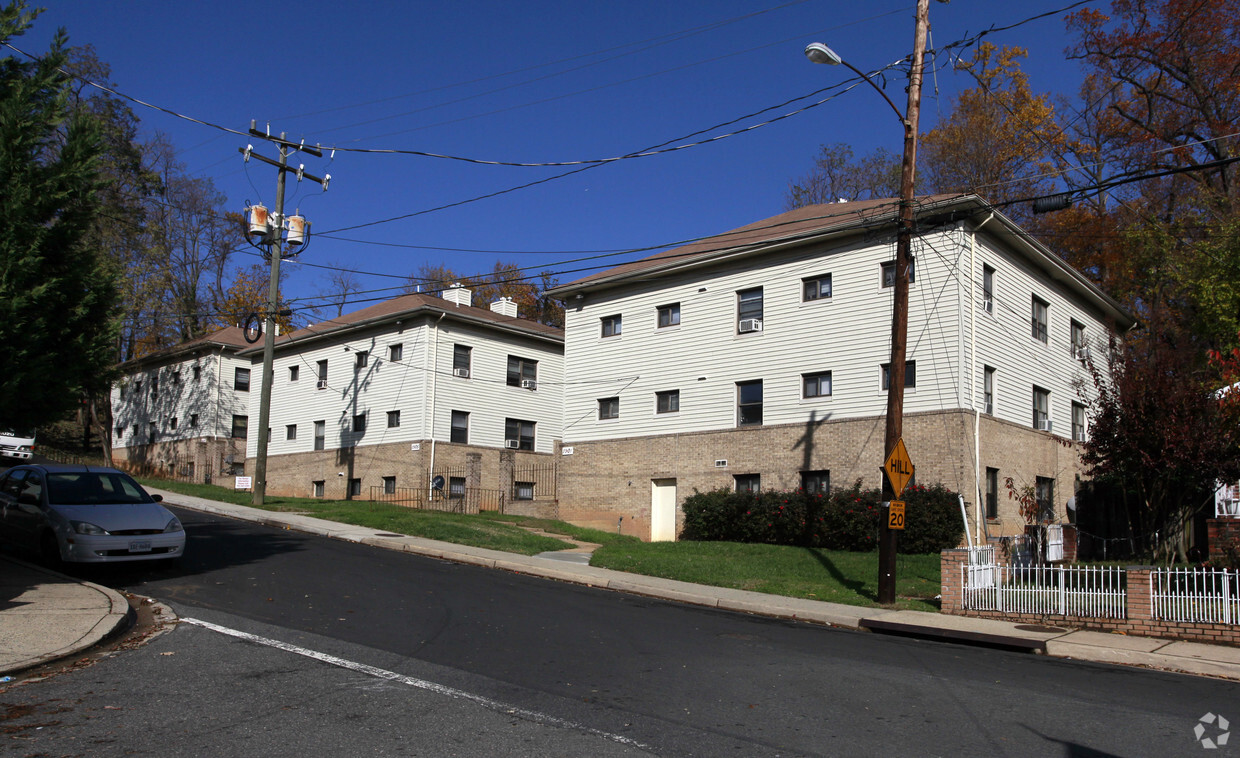
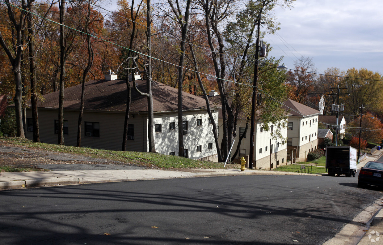
Experience Arlington living at 1901-1909 N Culpeper St. This community is located in the Glebewood area of Arlington. Choose from 1 to 2 bedroom apartments and then swing by for a tour. Let the professional leasing staff show you everything this community has to offer. Give us a call now to talk about renting your new apartment.
1901-1909 N Culpeper St is an apartment community located in Arlington County and the 22207 ZIP Code. This area is served by the Arlington County Public Schools attendance zone.
High Speed Internet Access
Refrigerator
Smoke Free
Heating
Located at the intersection of Lee Highway and Glebe Road, Glebewood is a small neighborhood teeming with character. Glebewood is almost exclusively residential, offering an array of apartments, townhomes, and houses in various architectural stylings for rent along tree-lined streets.
Glebewood is convenient to a variety of restaurants, shops, and amenities strewn along Lee Highway. The neighborhood also lies within easy commuting distance of Crystal City, Pentagon City, and Potomac Yard, as well as Downtown Washington, DC, which is just six miles east of Glebewood. The closest Metro stations to the community are Ballston-MU and Virginia Square Metro.
Learn more about living in Glebewood| Colleges & Universities | Distance | ||
|---|---|---|---|
| Colleges & Universities | Distance | ||
| Drive: | 3 min | 1.2 mi | |
| Drive: | 5 min | 1.6 mi | |
| Drive: | 11 min | 4.9 mi | |
| Drive: | 12 min | 5.8 mi |


Transportation options available in Arlington include Ballston-Mu, located 1.2 miles from 1901-1909 N Culpeper St. 1901-1909 N Culpeper St is near Ronald Reagan Washington Ntl, located 8.3 miles or 16 minutes away, and Washington Dulles International, located 21.3 miles or 36 minutes away.
| Transit / Subway | Distance | ||
|---|---|---|---|
| Transit / Subway | Distance | ||
|
|
Drive: | 3 min | 1.2 mi |
|
|
Drive: | 5 min | 1.7 mi |
|
|
Drive: | 5 min | 2.0 mi |
| Drive: | 7 min | 2.5 mi | |
|
|
Drive: | 7 min | 3.4 mi |
| Commuter Rail | Distance | ||
|---|---|---|---|
| Commuter Rail | Distance | ||
|
|
Drive: | 12 min | 6.9 mi |
|
|
Drive: | 13 min | 7.0 mi |
|
|
Drive: | 13 min | 7.0 mi |
|
|
Drive: | 14 min | 7.7 mi |
|
|
Drive: | 15 min | 7.9 mi |
| Airports | Distance | ||
|---|---|---|---|
| Airports | Distance | ||
|
Ronald Reagan Washington Ntl
|
Drive: | 16 min | 8.3 mi |
|
Washington Dulles International
|
Drive: | 36 min | 21.3 mi |
Time and distance from 1901-1909 N Culpeper St.
| Shopping Centers | Distance | ||
|---|---|---|---|
| Shopping Centers | Distance | ||
| Walk: | 5 min | 0.3 mi | |
| Walk: | 7 min | 0.4 mi | |
| Walk: | 9 min | 0.5 mi |
| Parks and Recreation | Distance | ||
|---|---|---|---|
| Parks and Recreation | Distance | ||
|
Lacey Woods Park
|
Walk: | 19 min | 1.0 mi |
|
David M. Brown Planetarium
|
Drive: | 4 min | 1.2 mi |
|
Cherry Valley Park
|
Drive: | 4 min | 1.2 mi |
|
Parkhurst Park
|
Drive: | 4 min | 1.4 mi |
|
Ballston Beaver Pond Park
|
Drive: | 9 min | 4.4 mi |
| Hospitals | Distance | ||
|---|---|---|---|
| Hospitals | Distance | ||
| Walk: | 10 min | 0.5 mi | |
| Walk: | 10 min | 0.6 mi | |
| Drive: | 8 min | 3.1 mi |
| Military Bases | Distance | ||
|---|---|---|---|
| Military Bases | Distance | ||
| Drive: | 10 min | 5.2 mi |
What Are Walk Score®, Transit Score®, and Bike Score® Ratings?
Walk Score® measures the walkability of any address. Transit Score® measures access to public transit. Bike Score® measures the bikeability of any address.
What is a Sound Score Rating?
A Sound Score Rating aggregates noise caused by vehicle traffic, airplane traffic and local sources

1901-1909 N Culpeper St
Arlington, VA 22207


