$700
/ Month
1866 N Uber St
Philadelphia, PA 19121
Today
|
Edit
Favorites
215-385-3901
-
Bedrooms
3
-
Bathrooms
1
-
Square Feet
1,200 sq ft
-
Available
Available Now
1866 N Uber St

Favorites
About This Home
$700 deposit,
Available Now
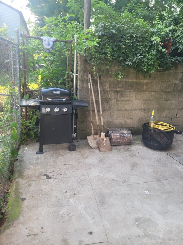
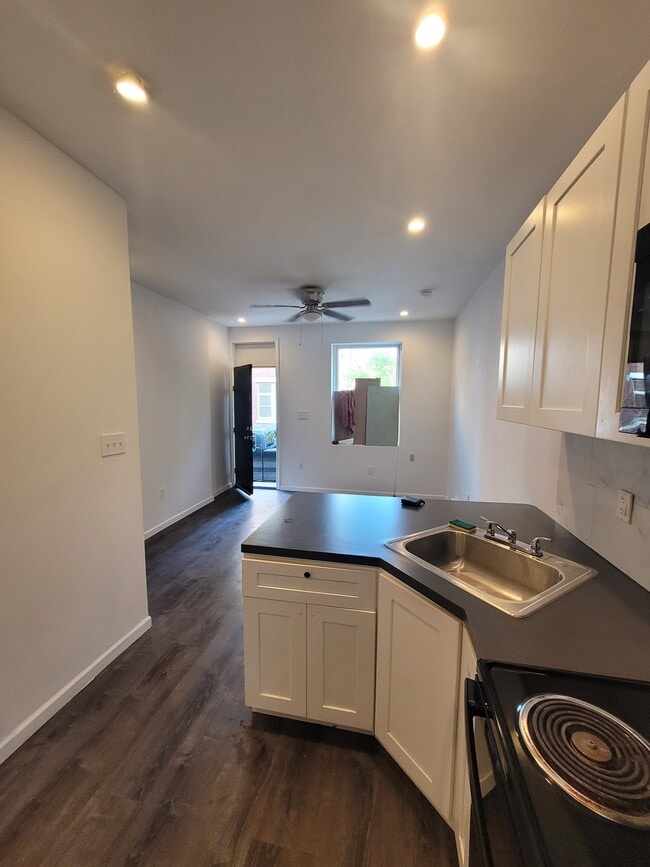
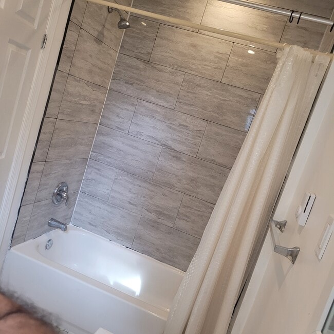
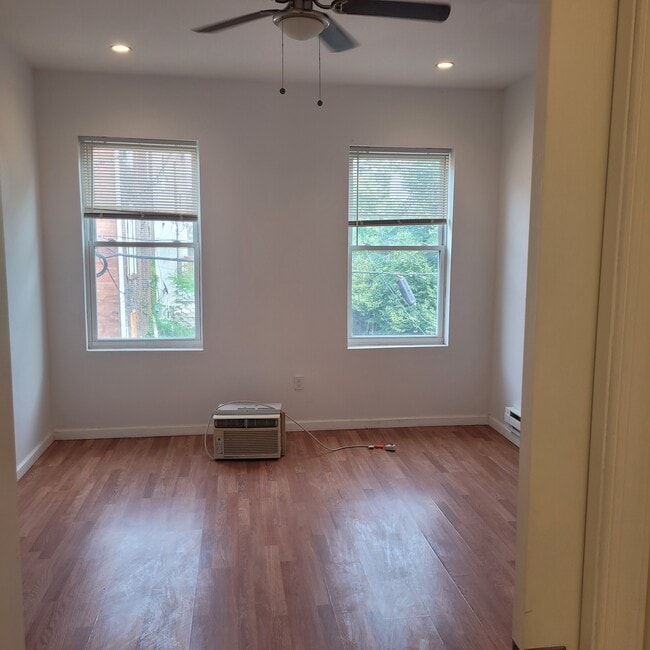
Amazing 3 bedroom, 1 bathroom house shared in Philadelphia. Amenities included: hardwood floors, updated kitchen, updated bathroom, washer dryer, laundry in building, and yard. tenant responsible for all utilities. Is not pet friendly. Date Available. Immediately.Section 8 vouchers and programs accepted. Please submit the form on this page or contact AAA Real Estate Properties Inc at to learn more. This property is managed by a responsible landlord using Avail landlord software.
1866 N Uber St is a townhome located in Philadelphia County and the 19121 ZIP Code. This area is served by the The School District of Philadelphia attendance zone.
* Price shown is base rent. Excludes user-selected optional fees and variable or usage-based fees and required charges due at or prior to move-in or at move-out. Price, availability, fees, and any applicable rent special are subject to change without notice.
* Square footage definitions vary. Displayed square footage is approximate.
Fees and Policies
The fees below are based on community-supplied data and may exclude additional fees and utilities.
-
One-Time Basics
-
Due at Move-In
-
Security Deposit - RefundableCharged per unit.$700
-
-
Due at Move-In
Property Fee Disclaimer: Based on community-supplied data and independent market research. Subject to change without notice. May exclude fees for mandatory or optional services and usage-based utilities.
Townhome Features
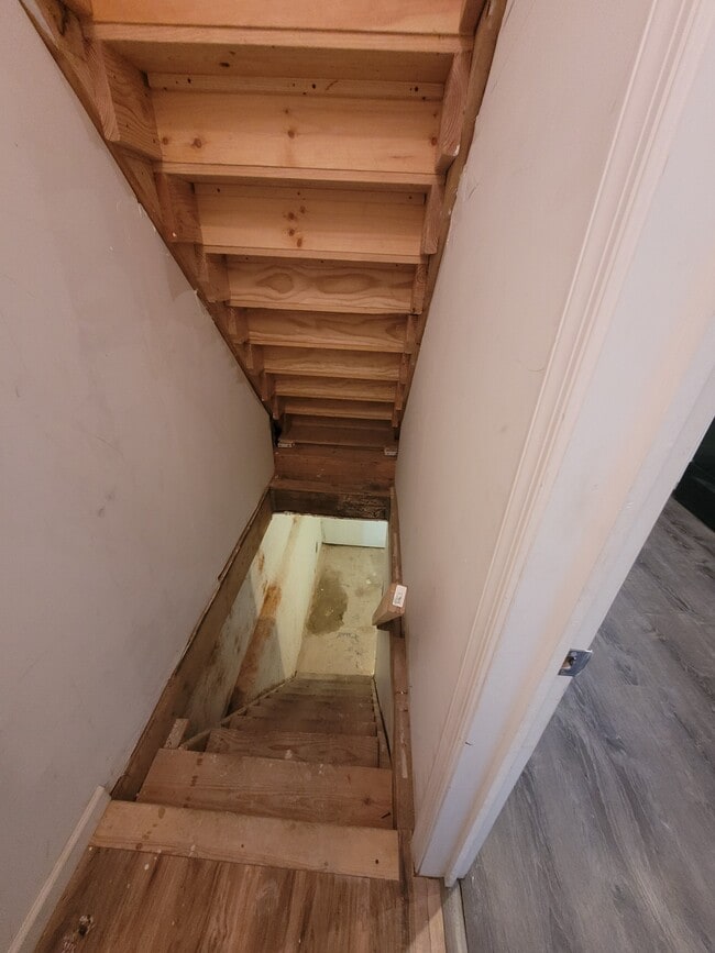
- Basement
Contact
- Listed by AAA
- Phone Number
- Contact
Location
Get Directions
Amenities
- Basement
Running alongside Fairmount Park, North Philadelphia West encompasses the area between Girard and Lehigh Avenues, west of Broad Street. There’s an incredible diversity of rentals here, including modern apartments that display incredible architecture and amenities to long-standing brick townhomes. Residents delight in the wealth of outdoor opportunities afforded by their proximity to the park, including the Sedgley Woods disc golf course, home of the city's innovative blend of ultimate Frisbee and classic golf. The neighborhood includes the smaller residential areas of Stanton, Brewerytown and Strawberry Mansion, and counts Girard College and Temple University among its academic landmarks.
Learn more about living in North Philadelphia West
Education
| Colleges & Universities | Distance | ||
|---|---|---|---|
| Colleges & Universities | Distance | ||
| Walk: | 12 min | 0.7 mi | |
| Drive: | 7 min | 1.9 mi | |
| Drive: | 6 min | 1.9 mi | |
| Drive: | 6 min | 2.2 mi |
1866 N Uber St is within 12 minutes or 0.7 mile from Temple University, Main Campus. It is also near C.C. of Philadelphia and Drexel Univ., Hahnemann.
Schools


Charter Elementary & Middle School
Grades K-8
581 Students
Attendance Zone
Public Elementary & Middle School
Grades PK-8
296 Students
Nearby
Public High School
Grades 9-12
203 Students
Attendance Zone
Private Elementary & Middle School
Grades K-8
Nearby
Private Elementary School
Grades PK-5
9 Students
Nearby
Private Elementary, Middle & High School
Grades 1-12
Nearby
School data provided by
 The GreatSchools Rating helps parents compare schools within a state based on a variety of school quality indicators and provides a helpful picture of how effectively each school serves all of its students. Ratings are on a scale of 1 (below average) to 10 (above average) and can include test scores, college readiness, academic progress, advanced courses, equity, discipline and attendance data. We also advise parents to visit schools, consider other information on school performance and programs, and consider family needs as part of the school selection process.
View GreatSchools Rating Methodology
Data provided by GreatSchools.org © 2026. All rights reserved.
View GreatSchools Rating Methodology
Data provided by GreatSchools.org © 2026. All rights reserved.
Transportation options available in Philadelphia include Cecil B Moore, located 0.7 mile from 1866 N Uber St. 1866 N Uber St is near Philadelphia International, located 14.6 miles or 27 minutes away, and Trenton Mercer, located 34.0 miles or 54 minutes away.
| Transit / Subway | Distance | ||
|---|---|---|---|
| Transit / Subway | Distance | ||
|
|
Walk: | 12 min | 0.7 mi |
| Walk: | 14 min | 0.7 mi | |
| Walk: | 15 min | 0.8 mi | |
|
|
Walk: | 16 min | 0.9 mi |
| Drive: | 4 min | 1.1 mi |
| Commuter Rail | Distance | ||
|---|---|---|---|
| Commuter Rail | Distance | ||
|
|
Drive: | 4 min | 1.2 mi |
|
|
Drive: | 4 min | 1.3 mi |
|
|
Drive: | 4 min | 1.5 mi |
|
|
Drive: | 6 min | 1.6 mi |
|
|
Drive: | 6 min | 1.7 mi |
| Airports | Distance | ||
|---|---|---|---|
| Airports | Distance | ||
|
Philadelphia International
|
Drive: | 27 min | 14.6 mi |
|
Trenton Mercer
|
Drive: | 54 min | 34.0 mi |
Time and distance from 1866 N Uber St.
| Shopping Centers | Distance | ||
|---|---|---|---|
| Shopping Centers | Distance | ||
| Walk: | 13 min | 0.7 mi | |
| Walk: | 17 min | 0.9 mi | |
| Drive: | 4 min | 1.2 mi |
1866 N Uber St has 3 shopping centers within 1.2 miles, which is about a 4-minute drive. The miles and minutes will be for the farthest away property.
| Parks and Recreation | Distance | ||
|---|---|---|---|
| Parks and Recreation | Distance | ||
|
Wagner Free Institute of Science
|
Walk: | 5 min | 0.3 mi |
|
The Academy of Natural Sciences
|
Drive: | 7 min | 2.1 mi |
|
Fels Planetarium
|
Drive: | 7 min | 2.2 mi |
|
Franklin Institute
|
Drive: | 7 min | 2.2 mi |
|
Edgar Allan Poe Nat'l Historic Site
|
Drive: | 7 min | 2.4 mi |
1866 N Uber St has 5 parks within 2.4 miles, including Wagner Free Institute of Science, Fels Planetarium, and The Academy of Natural Sciences.
| Hospitals | Distance | ||
|---|---|---|---|
| Hospitals | Distance | ||
| Drive: | 6 min | 1.9 mi | |
| Drive: | 6 min | 2.1 mi | |
| Drive: | 6 min | 2.2 mi |
1866 N Uber St has 3 hospitals within 2.2 miles, the nearest is Temple University Hospital which is 1.9 miles away and a 6 minute drive.
| Military Bases | Distance | ||
|---|---|---|---|
| Military Bases | Distance | ||
| Drive: | 17 min | 8.9 mi |
1866 N Uber St is 8.9 miles and a 17 minute drive from Philadelphia Naval Busi Center.
You May Also Like
Similar Rentals Nearby
-
-
-
-
-
-
-
-
-
1 / 24

-


What Are Walk Score®, Transit Score®, and Bike Score® Ratings?
Walk Score® measures the walkability of any address. Transit Score® measures access to public transit. Bike Score® measures the bikeability of any address.
What is a Sound Score Rating?
A Sound Score Rating aggregates noise caused by vehicle traffic, airplane traffic and local sources

1866 N Uber St
Philadelphia, PA 19121