
$2,300
/ Month
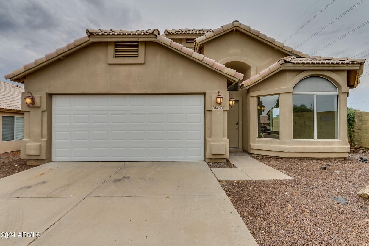
18450 N 31st St
Phoenix, AZ 85032
2 Weeks Ago
|
Edit
Favorites
18450 N 31st St

Favorites
Check Back Soon for Upcoming Availability
| Beds | Baths | Average SF |
|---|---|---|
| 3 Bedrooms 3 Bedrooms 3 Br | 2 Baths 2 Baths 2 Ba | 1,612 SF |
About This Property
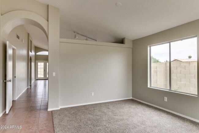
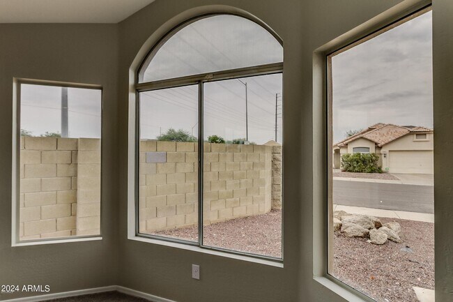
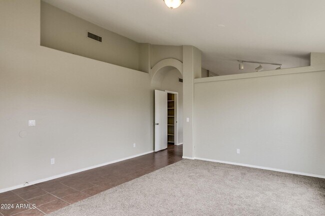
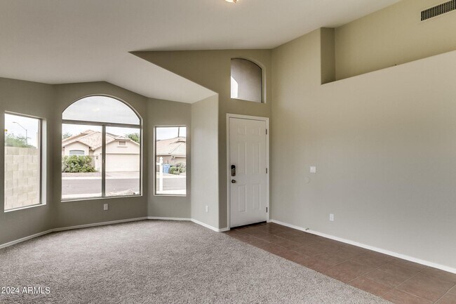
Come see this beautiful three-bedroom,two-bathroom home with a covered patio! Conversation flows easily from the open kitchen (with an island!) into the family room,where you can cozy up by the fireplace. Walking into the primary bedroom,you will notice an ensuite bathroom with a separate shower and tub. Enjoy close proximity to restaurants,the Center for Performing Arts,and Paradise Valley Golf Course.
18450 N 31st St is a house located in Maricopa County and the 85032 ZIP Code. This area is served by the Paradise Valley Unified District attendance zone.
18450 N 31st St,
Phoenix,
AZ
85032
Nestled in the heart of the Scottsdale-Phoenix area, Paradise Valley North is a peaceful desert oasis surrounded by mountains—Camelback Mountain lies to the south, Phoenix Mountain Preserve to the west, and McDowell Mountains to the east. Paradise Valley North is located in Maricopa County and is recognized for its deluxe golfing, luxury shopping centers, and ultra-posh restaurants. It’s a major tourism spot and has eight full-service resorts.
Paradise Valley North’s terrain is largely made up by Mummy Mountain. This community’s locale gives residents direct access to Camelback Mountain and Piestewa Peak. Paradise Valley North residents also have access to numerous parks like Roadrunner Park, Buffalo Ridge Park, and Paradise Valley Park. A bevy of golf and country clubs offer additional options for outdoor activities as well.
Retail delights abound at the Paradise Valley Mall as well as nearby Bell Towne Plaza and Desert Ridge Marketplace.
Learn more about living in Paradise Valley NorthBelow are rent ranges for similar nearby apartments
| Beds | Average Size | Lowest | Typical | Premium |
|---|---|---|---|---|
| Studio Studio Studio | 488-489 Sq Ft | $789 | $1,261 | $3,225 |
| 1 Bed 1 Bed 1 Bed | 697-698 Sq Ft | $795 | $1,495 | $6,055 |
| 2 Beds 2 Beds 2 Beds | 1006 Sq Ft | $895 | $1,903 | $9,100 |
| 3 Beds 3 Beds 3 Beds | 1469 Sq Ft | $1,167 | $2,734 | $15,000 |
| 4 Beds 4 Beds 4 Beds | 2426 Sq Ft | $1,350 | $5,413 | $20,000 |
Education
| Colleges & Universities | Distance | ||
|---|---|---|---|
| Colleges & Universities | Distance | ||
| Walk: | 11 min | 0.6 mi | |
| Drive: | 19 min | 10.2 mi | |
| Drive: | 19 min | 10.3 mi | |
| Drive: | 21 min | 11.6 mi |
18450 N 31st St is within 11 minutes or 0.6 mile from Paradise Valley Comm. Coll.. It is also near DeVry University, Arizona and Argosy University.
Schools


Public Elementary School
Grades PK-6
434 Students
Nearby
Public Elementary School
Grades PK-5
596 Students
Attendance Zone
Public Middle & High School
Grades 6-12
1,900 Students
Attendance Zone
Public Middle School
Grades 7-8
638 Students
Attendance Zone
Private Elementary, Middle & High School
Grades K-12
864 Students
Nearby
Private Elementary School
Grades PK-5
52 Students
Nearby
Private Elementary School
Grades K-6
34 Students
Nearby
Private High School
Grades 9-12
Nearby
School data provided by
 The GreatSchools Rating helps parents compare schools within a state based on a variety of school quality indicators and provides a helpful picture of how effectively each school serves all of its students. Ratings are on a scale of 1 (below average) to 10 (above average) and can include test scores, college readiness, academic progress, advanced courses, equity, discipline and attendance data. We also advise parents to visit schools, consider other information on school performance and programs, and consider family needs as part of the school selection process.
View GreatSchools Rating Methodology
Data provided by GreatSchools.org © 2026. All rights reserved.
View GreatSchools Rating Methodology
Data provided by GreatSchools.org © 2026. All rights reserved.
Transportation options available in Phoenix include 19Th Ave/Dunlap, located 9.7 miles from 18450 N 31st St. 18450 N 31st St is near Phoenix Sky Harbor International, located 19.4 miles or 27 minutes away, and Phoenix-Mesa Gateway, located 45.3 miles or 59 minutes away.
| Transit / Subway | Distance | ||
|---|---|---|---|
| Transit / Subway | Distance | ||
|
|
Drive: | 18 min | 9.7 mi |
|
|
Drive: | 19 min | 10.2 mi |
|
|
Drive: | 18 min | 11.2 mi |
|
|
Drive: | 19 min | 11.6 mi |
|
|
Drive: | 19 min | 12.5 mi |
| Airports | Distance | ||
|---|---|---|---|
| Airports | Distance | ||
|
Phoenix Sky Harbor International
|
Drive: | 27 min | 19.4 mi |
|
Phoenix-Mesa Gateway
|
Drive: | 59 min | 45.3 mi |
Walkability Near 18450 N 31st St Phoenix, AZ 85032
Getting Around
 What do Walkability, Transit, Drivability, and Bikeability mean?
Walkability measures the walking distance to day-to-day needs.
Transit measures access to public transportation.
Drivability measures congestion, parking availability, and access to major roads.
Bikeability measures the suitability for cycling.
How It Works
What do Walkability, Transit, Drivability, and Bikeability mean?
Walkability measures the walking distance to day-to-day needs.
Transit measures access to public transportation.
Drivability measures congestion, parking availability, and access to major roads.
Bikeability measures the suitability for cycling.
How It Works
Fairly Walkable
Walkability
40
/ 100
Limited Public Transit
Transit
30
/ 100
Exceptionally Drivable
Drivability
100
/ 100
Moderately Bikeable
Bikeability
60
/ 100
Scores provided by
-
Soundscore™
-
/ 100
Traffic
-Airport
-Businesses
-Scores provided by
HowLoud What is a Sound Score Rating? A Sound Score Rating aggregates noise caused by vehicle traffic, airplane traffic and local sources. How It WorksTime and distance from 18450 N 31st St.
| Shopping Centers | Distance | ||
|---|---|---|---|
| Shopping Centers | Distance | ||
| Walk: | 1 min | 0.1 mi | |
| Walk: | 15 min | 0.8 mi | |
| Drive: | 2 min | 1.2 mi |
18450 N 31st St has 3 shopping centers within 1.2 miles, which is about a 2-minute drive. The miles and minutes will be for the farthest away property.
| Parks and Recreation | Distance | ||
|---|---|---|---|
| Parks and Recreation | Distance | ||
|
Grovers Basin
|
Drive: | 3 min | 1.7 mi |
|
Arizona Horse Lover's Park
|
Drive: | 5 min | 2.8 mi |
|
Venturoso Park
|
Drive: | 6 min | 2.9 mi |
|
Turtle Rock Basin
|
Drive: | 6 min | 3.2 mi |
|
Reach 11 Recreation Area
|
Drive: | 8 min | 3.9 mi |
18450 N 31st St has 5 parks within 3.9 miles, including Grovers Basin, Arizona Horse Lover's Park, and Venturoso Park.
| Hospitals | Distance | ||
|---|---|---|---|
| Hospitals | Distance | ||
| Drive: | 4 min | 2.1 mi | |
| Drive: | 7 min | 4.9 mi | |
| Drive: | 11 min | 7.4 mi |
18450 N 31st St has 3 hospitals within 7.4 miles, the nearest is Abrazo Scottsdale Campus which is 2.1 miles away and a 4 minute drive.
| Military Bases | Distance | ||
|---|---|---|---|
| Military Bases | Distance | ||
| Drive: | 28 min | 19.2 mi | |
| Drive: | 36 min | 27.8 mi | |
| Drive: | 117 min | 90.8 mi |
18450 N 31st St has 3 military bases within 90.8 miles, the nearest is Phoenix Sky Harbor Airport Air Guard Station which is 19.2 miles away and a 28 minute drive.
You May Also Like
Similar Rentals Nearby
-
-
-
1 / 51

-
-
3 Beds$2,285+Total Monthly PriceTotal Monthly Price NewPrices include base rent and required monthly fees of $264. Variable costs based on usage may apply.Base Rent:3 Beds$2,021+2 Months Free
Pets Allowed Fitness Center Pool Dishwasher Walk-In Closets Stainless Steel Appliances
-
-
1 / 62
 3 Beds$2,551+Total Monthly PriceTotal Monthly Price NewPrices include base rent and required monthly fees of $56. Variable costs based on usage may apply.Base Rent:3 Beds$2,495+2 Months Free
Pets Allowed Fitness Center Pool Dishwasher Refrigerator Kitchen
-
-
-


What Are Walk Score®, Transit Score®, and Bike Score® Ratings?
Walk Score® measures the walkability of any address. Transit Score® measures access to public transit. Bike Score® measures the bikeability of any address.
What is a Sound Score Rating?
A Sound Score Rating aggregates noise caused by vehicle traffic, airplane traffic and local sources.
18450 N 31st St
Phoenix, AZ 85032