
Venue Residences
3688 Overland Ave,
Los Angeles, CA 90034
$2,695 - $5,995
Studio - 2 Beds

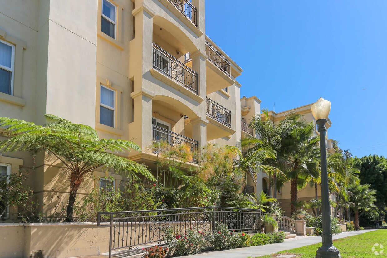
Located conveniently in Westwood, our community offers residential relaxation with a bustling restaurant and shopping district minutes away. Sophisticated features such as gourmet kitchens, hearty fireplaces and front-loading washer/dryers elevate these sprawling floor plans. Our interiors offer enough space for entertaining, dining, working and relaxing. With a comprehensive fitness center on site, our community supports our residents' active lifestyle. Experience elevated living at 1836 Parnell in Westwood!
1836 Parnell Avenue is an apartment community located in Los Angeles County and the 90025 ZIP Code. This area is served by the Los Angeles Unified Rocp School District attendance zone.
Lavadora/Secadora
Aire acondicionado
Lavavajillas
Microondas
Los Angeles sprawls across nearly 500 square miles between the Pacific Ocean and the San Gabriel Mountains, making it one of the few places where you can surf in the morning and hike through chaparral-covered hills by afternoon. Sunshine, open-air farmers markets, and a food scene that pulls from dozens of culinary traditions are a staple of living in the city.
Neighborhoods each have a distinct personality surrounding a particular focus, whether it be culture or nature. Westwood keeps residents close to entertainment at UCLA and the Hammer Museum's rotating art exhibitions. Koreatown is a cultural and food destination, known for authentic restaurants and shops paired with a bustling street energy and nightlife.
The city overflows with iconic landmarks, from natural to man-made. Griffith Park, one of the largest urban parks in the country, offers hiking trails, sweeping skyline views, and the iconic Griffith Observatory.
Learn more about living in Los Angeles| Colleges & Universities | Distance | ||
|---|---|---|---|
| Colleges & Universities | Distance | ||
| Drive: | 6 min | 2.0 mi | |
| Drive: | 8 min | 3.4 mi | |
| Drive: | 9 min | 3.5 mi | |
| Drive: | 9 min | 3.5 mi |


Transportation options available in Los Angeles include Westwood/Rancho Park, located 1.6 miles from 1836 Parnell Avenue. 1836 Parnell Avenue is near Los Angeles International, located 10.3 miles or 18 minutes away, and Bob Hope, located 18.7 miles or 28 minutes away.
| Transit / Subway | Distance | ||
|---|---|---|---|
| Transit / Subway | Distance | ||
|
|
Drive: | 4 min | 1.6 mi |
| Drive: | 4 min | 1.7 mi | |
|
|
Drive: | 6 min | 2.5 mi |
|
|
Drive: | 6 min | 2.6 mi |
|
|
Drive: | 9 min | 4.8 mi |
| Commuter Rail | Distance | ||
|---|---|---|---|
| Commuter Rail | Distance | ||
|
|
Drive: | 25 min | 13.0 mi |
|
|
Drive: | 27 min | 13.4 mi |
|
|
Drive: | 21 min | 13.5 mi |
|
|
Drive: | 22 min | 15.1 mi |
|
|
Drive: | 28 min | 18.7 mi |
| Airports | Distance | ||
|---|---|---|---|
| Airports | Distance | ||
|
Los Angeles International
|
Drive: | 18 min | 10.3 mi |
|
Bob Hope
|
Drive: | 28 min | 18.7 mi |
Scores provided by
Traffic
-Airport
-Businesses
-Scores provided by
HowLoud What is a Sound Score Rating? A Sound Score Rating aggregates noise caused by vehicle traffic, airplane traffic and local sources. How It WorksTime and distance from 1836 Parnell Avenue.
| Shopping Centers | Distance | ||
|---|---|---|---|
| Shopping Centers | Distance | ||
| Walk: | 9 min | 0.5 mi | |
| Walk: | 9 min | 0.5 mi | |
| Walk: | 15 min | 0.8 mi |
| Parks and Recreation | Distance | ||
|---|---|---|---|
| Parks and Recreation | Distance | ||
|
Mathias Botanical Garden
|
Drive: | 5 min | 1.8 mi |
|
Hannah Carter Japanese Garden
|
Drive: | 8 min | 3.2 mi |
|
Virginia Robinson Gardens
|
Drive: | 9 min | 3.4 mi |
|
Zimmer Children's Museum
|
Drive: | 9 min | 4.2 mi |
|
La Brea Tar Pits
|
Drive: | 10 min | 4.9 mi |
| Hospitals | Distance | ||
|---|---|---|---|
| Hospitals | Distance | ||
| Drive: | 6 min | 1.9 mi | |
| Drive: | 6 min | 2.0 mi | |
| Drive: | 9 min | 3.4 mi |
| Military Bases | Distance | ||
|---|---|---|---|
| Military Bases | Distance | ||
| Drive: | 18 min | 12.9 mi | |
| Drive: | 40 min | 29.6 mi | |
| Drive: | 43 min | 31.8 mi |
Pets Allowed In Unit Washer & Dryer Maintenance on site Heat Controlled Access Elevator
Pets Allowed Fitness Center Pool Maintenance on site High-Speed Internet Controlled Access EV Charging
What Are Walk Score®, Transit Score®, and Bike Score® Ratings?
Walk Score® measures the walkability of any address. Transit Score® measures access to public transit. Bike Score® measures the bikeability of any address.
What is a Sound Score Rating?
A Sound Score Rating aggregates noise caused by vehicle traffic, airplane traffic and local sources.
1836 Parnell Ave
Los Angeles, CA 90025


