
$2,150
/ Month
1816 State Rd.
Bensalem, PA 19020
Favorites
1816 State Rd.

Favorites
Check Back Soon for Upcoming Availability
| Beds | Baths | Average SF |
|---|---|---|
| 3 Bedrooms 3 Bedrooms 3 Br | 1 Bath 1 Bath 1 Ba | 2,200 SF |
Fees and Policies
The fees listed below are community-provided and may exclude utilities or add-ons. All payments are made directly to the property and are non-refundable unless otherwise specified.
- Dogs Allowed
-
Fees not specified
- Cats Allowed
-
Fees not specified
About This Property
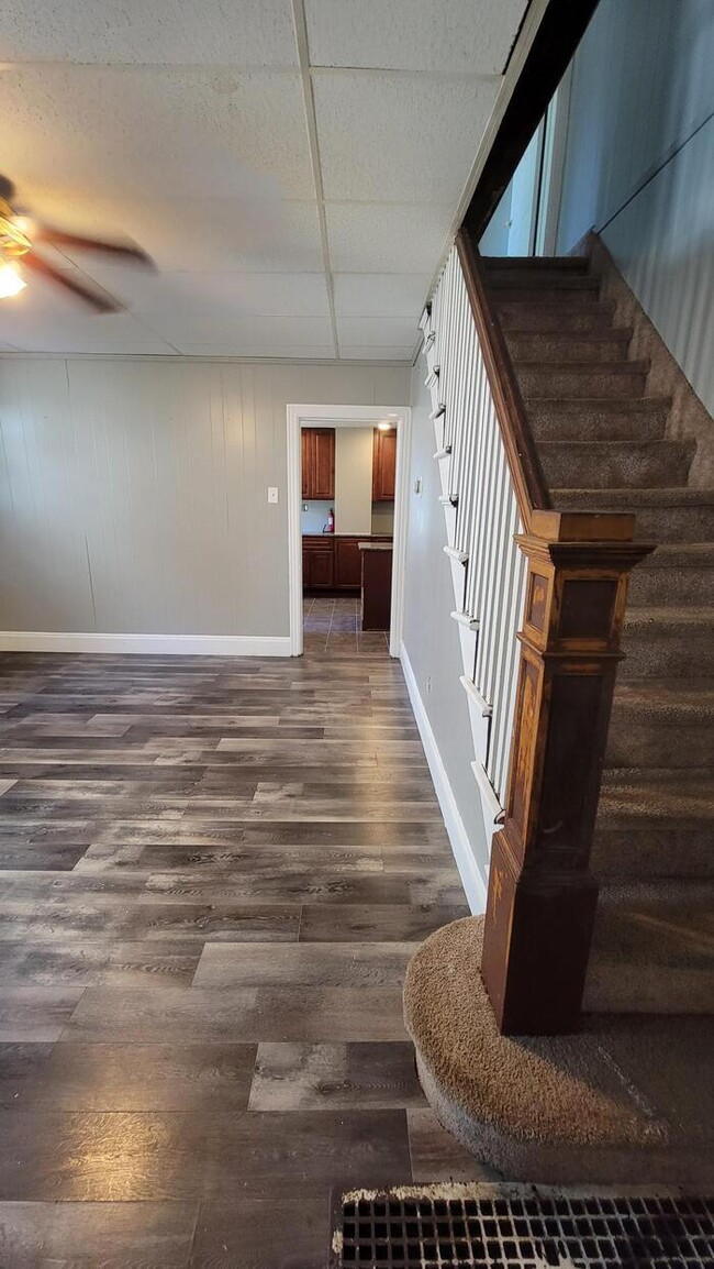
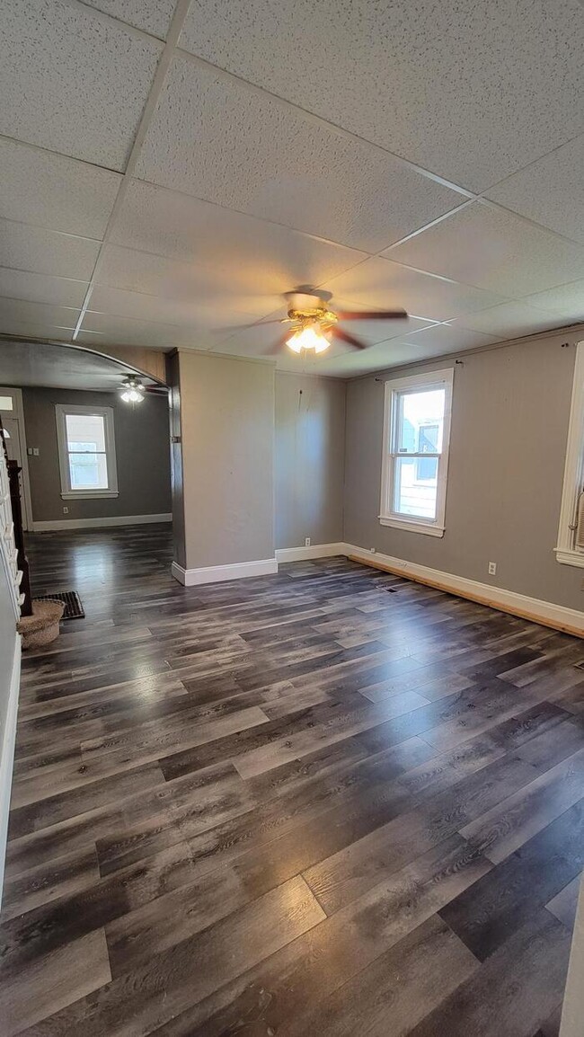
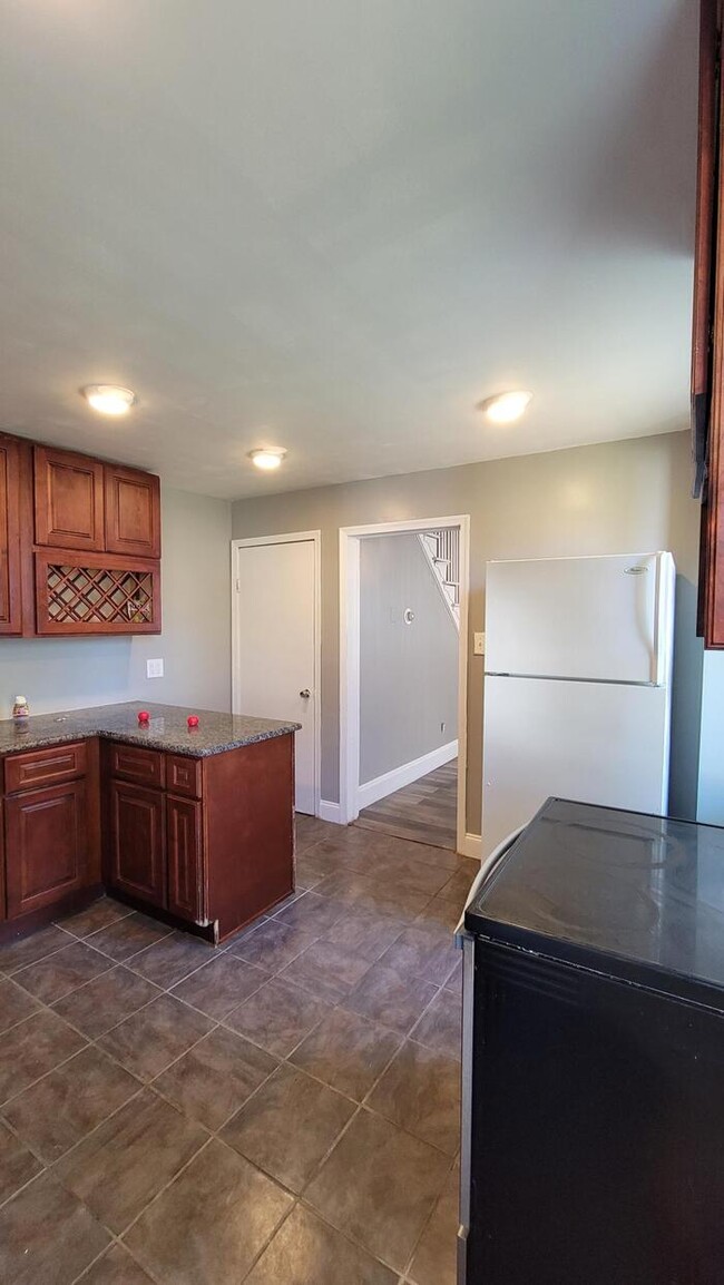
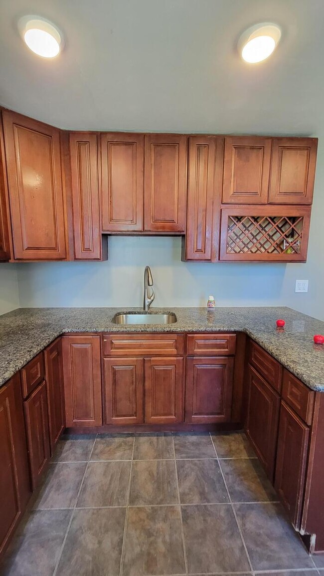
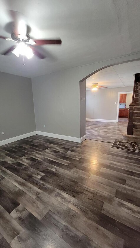
Rare opportunity to get into Bensalem school district WITH PETS ALLOWED. Twin home within walking distance of Cornwell Heights Train Station. This is a larger home approximately 1800 SQ FT. There is parking for 3 or more vehicles. Kitchen and bathroom are stunning. Kitchen features granite counter and tile flooring. ceiling fans, washer and dryer included. Forced hot air-no obnoxious radiators or baseboards. Has a backyard with fence for dogs. We work with section 8 and non profit. Please use the self showing feature by visiting https://homes.rently.com/homes-for-rent/properties/3680647?source=marketing and visit hope.tenantcloud.com to apply. This property allows self guided viewing without an appointment. Contact for details.
1816 State Rd. is a townhome located in Bucks County and the 19020 ZIP Code. This area is served by the Bensalem Township School District attendance zone.
1816 State Rd.,
Bensalem,
PA
19020
Home to an array of modern amenities and historic architecture, Bensalem is a charming community with a rich culture along the Delaware River. Located just 19 miles northeast of Philadelphia, residents can easily commute into the big city for work or leisure via Interstate 95.
Within Bensalem, residents will find a family-friendly atmosphere, great schools, and parks like Neshaminy State Park. Bensalem residents enjoy a variety of exciting activities including concerts at Penn Community Bank Amphitheater, nightlife at the Parx Casino, and horse-racing at Parx Racing. More amenities in Bensalem include retail destinations like Marketplace at Neshaminy and Neshaminy Mall. The rest of Bensalem’s tree-lined streets consist of residential avenues. Apartments and houses in the area range from affordable to upscale, so there’s something for every renter in Bensalem.
Learn more about living in Bensalem
Education
| Colleges & Universities | Distance | ||
|---|---|---|---|
| Colleges & Universities | Distance | ||
| Drive: | 5 min | 2.6 mi | |
| Drive: | 8 min | 4.2 mi | |
| Drive: | 23 min | 12.0 mi | |
| Drive: | 29 min | 16.2 mi |
1816 State Rd. is within 5 minutes or 2.6 miles from Holy Family University. It is also near C.C. of Philadelphia, NE Ctr and Penn State Abington.
Schools


Public Elementary & Middle School
Grades PK-8
821 Students
Nearby
Public Elementary School
Grades K-5
553 Students
Attendance Zone
Public Middle School
Grades 6-8
612 Students
Attendance Zone
Public High School
Grades 9-12
2,120 Students
Attendance Zone
Private Elementary & Middle School
Grades PK-8
207 Students
Nearby
Private High School
Grades 9-12
419 Students
Nearby
School data provided by
 The GreatSchools Rating helps parents compare schools within a state based on a variety of school quality indicators and provides a helpful picture of how effectively each school serves all of its students. Ratings are on a scale of 1 (below average) to 10 (above average) and can include test scores, college readiness, academic progress, advanced courses, equity, discipline and attendance data. We also advise parents to visit schools, consider other information on school performance and programs, and consider family needs as part of the school selection process.
View GreatSchools Rating Methodology
Data provided by GreatSchools.org © 2026. All rights reserved.
View GreatSchools Rating Methodology
Data provided by GreatSchools.org © 2026. All rights reserved.
Transportation options available in Bensalem include Burlington South, located 6.3 miles from 1816 State Rd.. 1816 State Rd. is near Trenton Mercer, located 19.5 miles or 29 minutes away, and Philadelphia International, located 24.6 miles or 39 minutes away.
| Transit / Subway | Distance | ||
|---|---|---|---|
| Transit / Subway | Distance | ||
|
|
Drive: | 13 min | 6.3 mi |
|
|
Drive: | 18 min | 9.5 mi |
|
|
Drive: | 23 min | 10.2 mi |
|
|
Drive: | 21 min | 11.9 mi |
|
|
Drive: | 22 min | 12.6 mi |
| Commuter Rail | Distance | ||
|---|---|---|---|
| Commuter Rail | Distance | ||
|
|
Walk: | 14 min | 0.8 mi |
|
|
Drive: | 3 min | 1.9 mi |
|
|
Drive: | 4 min | 2.2 mi |
|
|
Drive: | 7 min | 3.6 mi |
|
|
Drive: | 9 min | 4.8 mi |
| Airports | Distance | ||
|---|---|---|---|
| Airports | Distance | ||
|
Trenton Mercer
|
Drive: | 29 min | 19.5 mi |
|
Philadelphia International
|
Drive: | 39 min | 24.6 mi |
Walkability Near 1816 State Rd. Bensalem, PA 19020
Getting Around
 What do Walkability, Transit, Drivability, and Bikeability mean?
Walkability measures the walking distance to day-to-day needs.
Transit measures access to public transportation.
Drivability measures congestion, parking availability, and access to major roads.
Bikeability measures the suitability for cycling.
How It Works
What do Walkability, Transit, Drivability, and Bikeability mean?
Walkability measures the walking distance to day-to-day needs.
Transit measures access to public transportation.
Drivability measures congestion, parking availability, and access to major roads.
Bikeability measures the suitability for cycling.
How It Works
Fairly Walkable
Walkability
40
/ 100
Good Public Transit
Transit
60
/ 100
Exceptionally Drivable
Drivability
100
/ 100
Fairly Bikeable
Bikeability
40
/ 100
Scores provided by
-
Soundscore™
-
/ 100
Traffic
-Airport
-Businesses
-Scores provided by
HowLoud What is a Sound Score Rating? A Sound Score Rating aggregates noise caused by vehicle traffic, airplane traffic and local sources. How It WorksTime and distance from 1816 State Rd..
| Shopping Centers | Distance | ||
|---|---|---|---|
| Shopping Centers | Distance | ||
| Drive: | 4 min | 1.6 mi | |
| Drive: | 4 min | 1.9 mi | |
| Drive: | 5 min | 2.1 mi |
1816 State Rd. has 3 shopping centers within 2.1 miles, which is about a 5-minute drive. The miles and minutes will be for the farthest away property.
| Parks and Recreation | Distance | ||
|---|---|---|---|
| Parks and Recreation | Distance | ||
|
Neshaminy State Park
|
Drive: | 4 min | 2.2 mi |
|
Insectarium
|
Drive: | 11 min | 5.6 mi |
|
Benjamin Rush State Park
|
Drive: | 14 min | 6.2 mi |
|
Pennypack Park
|
Drive: | 13 min | 7.1 mi |
|
Amico Island Park
|
Drive: | 25 min | 13.7 mi |
1816 State Rd. has 5 parks within 13.7 miles, including Neshaminy State Park, Insectarium, and Benjamin Rush State Park.
| Hospitals | Distance | ||
|---|---|---|---|
| Hospitals | Distance | ||
| Drive: | 7 min | 3.4 mi | |
| Drive: | 8 min | 4.1 mi | |
| Drive: | 11 min | 5.7 mi |
1816 State Rd. has 3 hospitals within 5.7 miles, the nearest is Jefferson Torresdale Hospital which is 3.4 miles away and a 7 minute drive.
| Military Bases | Distance | ||
|---|---|---|---|
| Military Bases | Distance | ||
| Drive: | 24 min | 14.2 mi | |
| Drive: | 28 min | 16.2 mi | |
| Drive: | 30 min | 19.0 mi |
1816 State Rd. has 3 military bases within 19.0 miles, the nearest is Naval Air Development Center which is 14.2 miles away and a 24 minute drive.
You May Also Like
Similar Rentals Nearby
-
-
-
-
-
-
-
-
-
-
1 / 24


What Are Walk Score®, Transit Score®, and Bike Score® Ratings?
Walk Score® measures the walkability of any address. Transit Score® measures access to public transit. Bike Score® measures the bikeability of any address.
What is a Sound Score Rating?
A Sound Score Rating aggregates noise caused by vehicle traffic, airplane traffic and local sources.
1816 State Rd.
Bensalem, PA 19020