
$2,100
/ Month
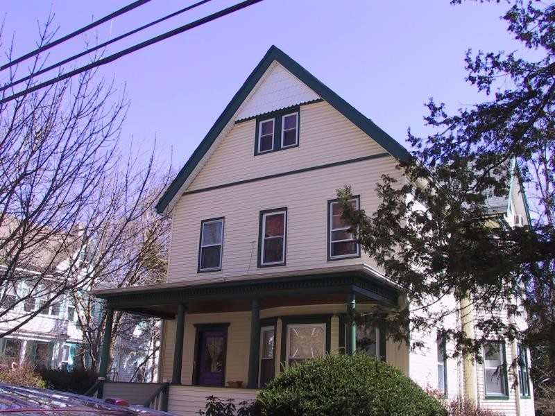
177 Ashland Ave Unit 2
Bloomfield, NJ 07003
2 Weeks Ago
|
Edit
Favorites
177 Ashland Ave Unit 2

Favorites
Check Back Soon for Upcoming Availability
| Beds | Baths | Average SF |
|---|---|---|
| 3 Bedrooms 3 Bedrooms 3 Br | 2 Baths 2 Baths 2 Ba | — |
Fees and Policies
The fees below are based on community-supplied data and may exclude additional fees and utilities.
About This Property
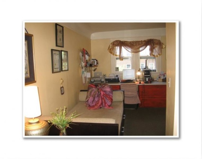
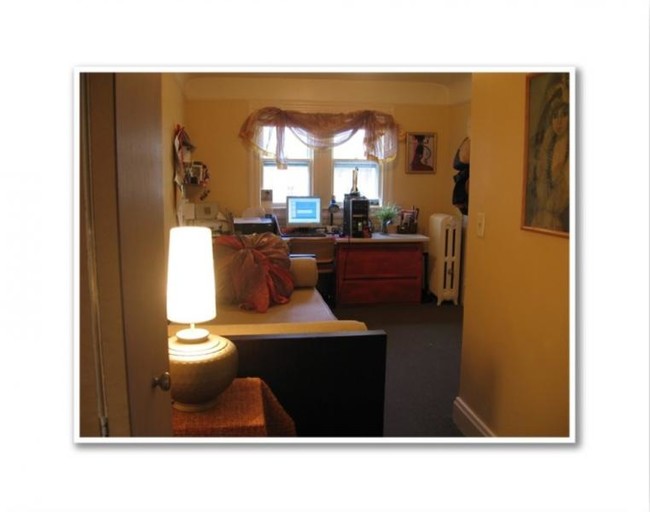
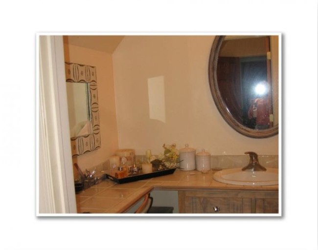
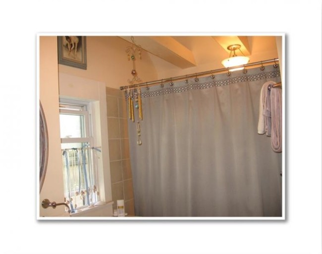
Beautiful 2 floor, 3 bedroom, 2 bath unit in quiet neighborhood near NY train and shopping, schools, parks, downtown.
177 Ashland Ave is an apartment community located in Essex County and the 07003 ZIP Code.
Features
- Air Conditioning
- Carpet
Location
Get Directions
Located 12 miles from Manhattan, Bloomfield combines small-town atmosphere with metropolitan accessibility. This Essex County township features established neighborhoods with housing options from classic single-family homes to contemporary apartment communities. The historic Bloomfield Green, anchored by the Presbyterian Church dating to 1794, serves as the town center. With two NJ Transit stations connecting to New York City and Newark, Bloomfield offers convenient transportation options for commuters. Current rental data shows one-bedroom apartments averaging $2,012, while three-bedroom units average $2,828.
Brookdale Park, spanning 77 acres, provides recreational opportunities with walking paths and athletic facilities. The downtown area near Bloomfield College features local shops and dining establishments. The Garden State Parkway and other major routes make commuting convenient from Bloomfield.
Learn more about living in Bloomfield
Amenities
- Air Conditioning
- Carpet
Education
| Colleges & Universities | Distance | ||
|---|---|---|---|
| Colleges & Universities | Distance | ||
| Walk: | 14 min | 0.8 mi | |
| Drive: | 8 min | 4.4 mi | |
| Drive: | 10 min | 4.6 mi | |
| Drive: | 10 min | 4.9 mi |
177 Ashland Ave Unit 2 is within 14 minutes or 0.8 mile from Bloomfield College. It is also near Rutgers, Newark Campus and N.J. Inst. of Technology.
Transportation options available in Bloomfield include Grove Street, located 1.7 miles from 177 Ashland Ave Unit 2. 177 Ashland Ave Unit 2 is near Newark Liberty International, located 10.3 miles or 18 minutes away, and LaGuardia, located 26.1 miles or 46 minutes away.
| Transit / Subway | Distance | ||
|---|---|---|---|
| Transit / Subway | Distance | ||
|
|
Drive: | 4 min | 1.7 mi |
|
|
Drive: | 5 min | 2.1 mi |
|
|
Drive: | 5 min | 2.3 mi |
|
|
Drive: | 6 min | 2.4 mi |
|
|
Drive: | 5 min | 2.6 mi |
| Commuter Rail | Distance | ||
|---|---|---|---|
| Commuter Rail | Distance | ||
|
|
Walk: | 10 min | 0.5 mi |
|
|
Walk: | 16 min | 0.9 mi |
|
|
Drive: | 4 min | 1.1 mi |
|
|
Drive: | 4 min | 1.6 mi |
|
|
Drive: | 6 min | 2.4 mi |
| Airports | Distance | ||
|---|---|---|---|
| Airports | Distance | ||
|
Newark Liberty International
|
Drive: | 18 min | 10.3 mi |
|
LaGuardia
|
Drive: | 46 min | 26.1 mi |
Time and distance from 177 Ashland Ave Unit 2.
| Shopping Centers | Distance | ||
|---|---|---|---|
| Shopping Centers | Distance | ||
| Drive: | 5 min | 1.7 mi | |
| Drive: | 4 min | 1.7 mi | |
| Drive: | 5 min | 2.1 mi |
177 Ashland Ave Unit 2 has 3 shopping centers within 2.1 miles, which is about a 5-minute drive. The miles and minutes will be for the farthest away property.
| Parks and Recreation | Distance | ||
|---|---|---|---|
| Parks and Recreation | Distance | ||
|
Edison National Historic Site
|
Drive: | 8 min | 2.8 mi |
|
Van Vleck House & Gardens
|
Drive: | 6 min | 3.0 mi |
|
Branch Brook Park
|
Drive: | 7 min | 3.3 mi |
|
Newark Museum and Dreyfuss Planetarium
|
Drive: | 9 min | 4.5 mi |
|
Presby Memorial Iris Gardens
|
Drive: | 10 min | 5.1 mi |
177 Ashland Ave Unit 2 has 5 parks within 5.1 miles, including Edison National Historic Site, Branch Brook Park, and Van Vleck House & Gardens.
| Hospitals | Distance | ||
|---|---|---|---|
| Hospitals | Distance | ||
| Drive: | 7 min | 3.6 mi | |
| Drive: | 9 min | 4.3 mi | |
| Drive: | 8 min | 4.4 mi |
177 Ashland Ave Unit 2 has 3 hospitals within 4.4 miles, the nearest is East Orange General Hospital which is 3.6 miles away and a 7 minute drive.
| Military Bases | Distance | ||
|---|---|---|---|
| Military Bases | Distance | ||
| Drive: | 23 min | 14.1 mi | |
| Drive: | 33 min | 16.1 mi | |
| Drive: | 39 min | 22.2 mi |
177 Ashland Ave Unit 2 has 3 military bases within 22.2 miles, the nearest is Military Ocean Terminal which is 14.1 miles away and a 23 minute drive.
You May Also Like
How do I access Social Services in New Jersey?
Statewide service is free, confidential, multilingual and always open. Three easy ways to reach Social Services in NJ: Dial 2-1-1; text your zip code to 898-211; or chat at https://www.nj211.org
Similar Rentals Nearby
-
-
-
-
-
-
-
-
-
-
1 / 22


What Are Walk Score®, Transit Score®, and Bike Score® Ratings?
Walk Score® measures the walkability of any address. Transit Score® measures access to public transit. Bike Score® measures the bikeability of any address.
What is a Sound Score Rating?
A Sound Score Rating aggregates noise caused by vehicle traffic, airplane traffic and local sources
177 Ashland Ave
Bloomfield, NJ 07003