
Fourth and U
2020 4th St,
Berkeley, CA 94710
$2,398 - $3,499
1-2 Beds
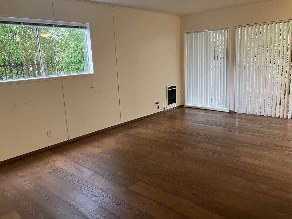

Discover your new home at 1733 Grant St in Berkeley, CA. This community is located in the North Berkeley area of Berkeley. The leasing team is ready for you to come see our property. Give us a call now to schedule your tour.
1733 Grant St is an apartment community located in Alameda County and the 94703 ZIP Code. This area is served by the Berkeley Unified School District attendance zone.
Dishwasher
Hardwood Floors
Refrigerator
Tub/Shower
Berkeley, California combines academic prestige with cultural diversity, centered around the University of California, Berkeley campus. The city offers various housing options, from historic craftsman homes in the Elmwood District to apartments in Downtown Berkeley, where one-bedroom units average $2,294 with a 0.7% annual increase. North Berkeley's food scene includes the acclaimed Chez Panisse restaurant, while the Berkeley Marina offers bay views and outdoor recreation. The Telegraph Avenue corridor features independent bookstores, cafes, and street vendors that reflect the city's character.
The Berkeley Hills provide sweeping San Francisco Bay views, with extensive trails throughout Tilden Regional Park. Residents enjoy green spaces like the Berkeley Rose Garden, offering peaceful settings within the city. The area's cultural scene includes the Berkeley Repertory Theatre, Berkeley Art Museum and Pacific Film Archive, and the Greek Theatre for outdoor performances.
Learn more about living in BerkeleyCompare neighborhood and city base rent averages by bedroom.
| North Berkeley | Berkeley, CA | |
|---|---|---|
| Studio | $2,025 | $2,097 |
| 1 Bedroom | $2,093 | $2,269 |
| 2 Bedrooms | $2,965 | $3,315 |
| 3 Bedrooms | $4,499 | $4,387 |
| Colleges & Universities | Distance | ||
|---|---|---|---|
| Colleges & Universities | Distance | ||
| Walk: | 12 min | 0.6 mi | |
| Drive: | 5 min | 1.5 mi | |
| Drive: | 12 min | 4.2 mi | |
| Drive: | 14 min | 5.7 mi |


Transportation options available in Berkeley include North Berkeley, located 0.5 mile from 1733 Grant St. 1733 Grant St is near Metro Oakland International, located 14.7 miles or 26 minutes away, and San Francisco International, located 25.1 miles or 40 minutes away.
| Transit / Subway | Distance | ||
|---|---|---|---|
| Transit / Subway | Distance | ||
|
|
Walk: | 8 min | 0.5 mi |
|
|
Walk: | 14 min | 0.7 mi |
|
|
Drive: | 5 min | 1.7 mi |
|
|
Drive: | 9 min | 3.1 mi |
|
|
Drive: | 11 min | 3.5 mi |
| Commuter Rail | Distance | ||
|---|---|---|---|
| Commuter Rail | Distance | ||
|
|
Drive: | 7 min | 2.4 mi |
| Drive: | 10 min | 3.7 mi | |
|
|
Drive: | 15 min | 6.4 mi |
| Drive: | 15 min | 7.8 mi | |
| Drive: | 22 min | 12.7 mi |
| Airports | Distance | ||
|---|---|---|---|
| Airports | Distance | ||
|
Metro Oakland International
|
Drive: | 26 min | 14.7 mi |
|
San Francisco International
|
Drive: | 40 min | 25.1 mi |
Scores provided by
Traffic
-Airport
-Businesses
-Scores provided by
HowLoud What is a Sound Score Rating? A Sound Score Rating aggregates noise caused by vehicle traffic, airplane traffic and local sources. How It WorksTime and distance from 1733 Grant St.
| Shopping Centers | Distance | ||
|---|---|---|---|
| Shopping Centers | Distance | ||
| Walk: | 11 min | 0.6 mi | |
| Walk: | 20 min | 1.0 mi | |
| Drive: | 3 min | 1.1 mi |
| Parks and Recreation | Distance | ||
|---|---|---|---|
| Parks and Recreation | Distance | ||
|
Habitot Children's Museum
|
Walk: | 15 min | 0.8 mi |
|
Cedar-Rose Park
|
Walk: | 16 min | 0.8 mi |
|
Live Oak Park
|
Walk: | 18 min | 1.0 mi |
|
Museum of Vertebrate Zoology
|
Drive: | 4 min | 1.1 mi |
|
UC Berkeley Museum of Paleontology
|
Drive: | 5 min | 1.3 mi |
| Hospitals | Distance | ||
|---|---|---|---|
| Hospitals | Distance | ||
| Drive: | 7 min | 2.3 mi | |
| Drive: | 9 min | 2.8 mi | |
| Drive: | 11 min | 4.2 mi |
| Military Bases | Distance | ||
|---|---|---|---|
| Military Bases | Distance | ||
| Drive: | 11 min | 3.6 mi | |
| Drive: | 19 min | 8.1 mi |
Pets Allowed Fitness Center In Unit Washer & Dryer Walk-In Closets Stainless Steel Appliances Hardwood Floors EV Charging
What Are Walk Score®, Transit Score®, and Bike Score® Ratings?
Walk Score® measures the walkability of any address. Transit Score® measures access to public transit. Bike Score® measures the bikeability of any address.
What is a Sound Score Rating?
A Sound Score Rating aggregates noise caused by vehicle traffic, airplane traffic and local sources.

1733 Grant St
Berkeley, CA 94703


