

$1,075 / Month
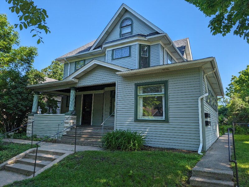
1685 W Taylor Ave
Saint Paul, MN 55104
2 Weeks Ago
Favorites
1685 W Taylor Ave

Favorites
Check Back Soon for Upcoming Availability
| Beds | Baths | Average SF |
|---|---|---|
| 2 Bedrooms 2 Bedrooms 2 Br | 1 Bath 1 Bath 1 Ba | 750 SF |
Fees and Policies
The fees below are based on community-supplied data and may exclude additional fees and utilities.
About This Property
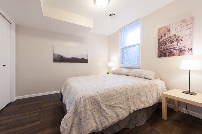
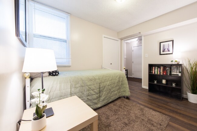
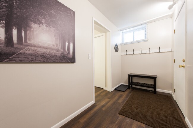
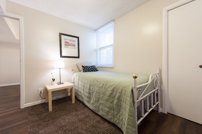
Property Id: 1206290 This quiet, charming 1 bed / 1 bath garden-level unit is located in a beautiful, quiet neighborhood just two blocks from Hamline University and Snelling Ave. bus-stop (which is now a super-fast A-line bus). Newell Park is just two blocks away and many restaurants, grocery stores, coffee shops, and breweries are nearby The unit itself has been freshly remodeled, features a newly tiled bathroom, eat-in kitchen with subway backsplashes, along with new flooring and paint and features large windows which let in a good amount of light All utilities bundled for additional $175 (heat, electric, water/sewer, trash, shoveling and mowing).
1685 W Taylor Ave is a house located in Ramsey County and the 55104 ZIP Code.
House Features
- Oven
- Refrigerator
- Freezer
- Lawn
Location
Get Directions
Bungalows and cottages sit side by side with older Victorians and neat brick apartment buildings in the neighborhood of Hamline-Midway, centrally located just a couple of miles west of downtown Saint Paul. Residents love how easily they can get around town, thanks to I-94 running at the south side of the neighborhood, the bicycle- and pedestrian-friendly streets, and the wealth of public transportation, including multiple bus lines and the Central Corridor Light Rail Line.
Hamline University sits in the neighborhood, and half a dozen local parks help make Hamline-Midway family-friendly. The Hamline Midway Coalition brings neighbors together to hold garage sales, sponsor spring and fall festivals at local elementary schools, and plan neighborhood-wide events, such as Grounds and Sounds, which brings out local musicians to showcase their talents.
Learn more about living in Hamline-MidwayBelow are rent ranges for similar nearby apartments
| Beds | Average Size | Lowest | Typical | Premium |
|---|---|---|---|---|
| Studio Studio Studio | 406 Sq Ft | $695 | $1,093 | $1,294 |
| 1 Bed 1 Bed 1 Bed | 610-613 Sq Ft | $850 | $1,449 | $1,899 |
| 2 Beds 2 Beds 2 Beds | 873-891 Sq Ft | $785 | $1,931 | $2,409 |
| 3 Beds 3 Beds 3 Beds | 1309-1315 Sq Ft | $1,349 | $2,226 | $3,195 |
| 4 Beds 4 Beds 4 Beds | 1738 Sq Ft | $1,905 | $2,386 | $2,885 |
Amenities
- Oven
- Refrigerator
- Freezer
- Lawn
Education
| Colleges & Universities | Distance | ||
|---|---|---|---|
| Colleges & Universities | Distance | ||
| Walk: | 9 min | 0.5 mi | |
| Drive: | 5 min | 2.0 mi | |
| Drive: | 5 min | 2.3 mi | |
| Drive: | 8 min | 2.6 mi |
1685 W Taylor Ave is within 9 minutes or 0.5 mile from Hamline University. It is also near Concordia Univ.-Saint Paul and Univ. of Minnesota, Saint Paul.
Transportation options available in Saint Paul include Snelling Ave Station, located 1.1 miles from 1685 W Taylor Ave. 1685 W Taylor Ave is near Minneapolis-St Paul International/Wold-Chamberlain, located 8.6 miles or 19 minutes away.
| Transit / Subway | Distance | ||
|---|---|---|---|
| Transit / Subway | Distance | ||
| Drive: | 3 min | 1.1 mi | |
| Drive: | 4 min | 1.2 mi | |
| Drive: | 4 min | 1.5 mi | |
| Drive: | 5 min | 2.0 mi | |
| Drive: | 6 min | 2.3 mi |
| Commuter Rail | Distance | ||
|---|---|---|---|
| Commuter Rail | Distance | ||
|
|
Drive: | 11 min | 5.8 mi |
|
|
Drive: | 16 min | 7.2 mi |
|
|
Drive: | 22 min | 14.0 mi |
|
|
Drive: | 31 min | 22.5 mi |
|
|
Drive: | 32 min | 24.1 mi |
| Airports | Distance | ||
|---|---|---|---|
| Airports | Distance | ||
|
Minneapolis-St Paul International/Wold-Chamberlain
|
Drive: | 19 min | 8.6 mi |
Time and distance from 1685 W Taylor Ave.
| Shopping Centers | Distance | ||
|---|---|---|---|
| Shopping Centers | Distance | ||
| Walk: | 15 min | 0.8 mi | |
| Drive: | 5 min | 1.6 mi | |
| Drive: | 6 min | 2.3 mi |
1685 W Taylor Ave has 3 shopping centers within 2.3 miles, which is about a 6-minute walk. The miles and minutes will be for the farthest away property.
| Parks and Recreation | Distance | ||
|---|---|---|---|
| Parks and Recreation | Distance | ||
|
Newell Park
|
Walk: | 6 min | 0.4 mi |
|
Como Park
|
Drive: | 4 min | 1.9 mi |
|
Marjorie McNeely Conservatory
|
Drive: | 6 min | 2.2 mi |
|
The Raptor Center - University of Minnesota
|
Drive: | 7 min | 2.4 mi |
|
Como Park Zoo
|
Drive: | 8 min | 2.7 mi |
1685 W Taylor Ave has 5 parks within 2.7 miles, including Newell Park, Como Park, and Marjorie McNeely Conservatory.
| Hospitals | Distance | ||
|---|---|---|---|
| Hospitals | Distance | ||
| Drive: | 9 min | 4.6 mi | |
| Drive: | 10 min | 4.6 mi | |
| Drive: | 10 min | 4.6 mi |
1685 W Taylor Ave has 3 hospitals within 4.6 miles, the nearest is University of Minnesota Medical Center, Fairview which is 4.6 miles away and a 9 minute drive.
| Military Bases | Distance | ||
|---|---|---|---|
| Military Bases | Distance | ||
| Drive: | 18 min | 7.4 mi |
1685 W Taylor Ave is 7.4 miles and a 18 minute drive from Fort Snelling Military Reservation.
You May Also Like
Similar Rentals Nearby


What Are Walk Score®, Transit Score®, and Bike Score® Ratings?
Walk Score® measures the walkability of any address. Transit Score® measures access to public transit. Bike Score® measures the bikeability of any address.
What is a Sound Score Rating?
A Sound Score Rating aggregates noise caused by vehicle traffic, airplane traffic and local sources
1685 W Taylor Ave
Saint Paul, MN 55104