
Williamsburg
200 W Galbraith Rd,
Cincinnati, OH 45215
$843 - $2,765
Studio - 3 Beds
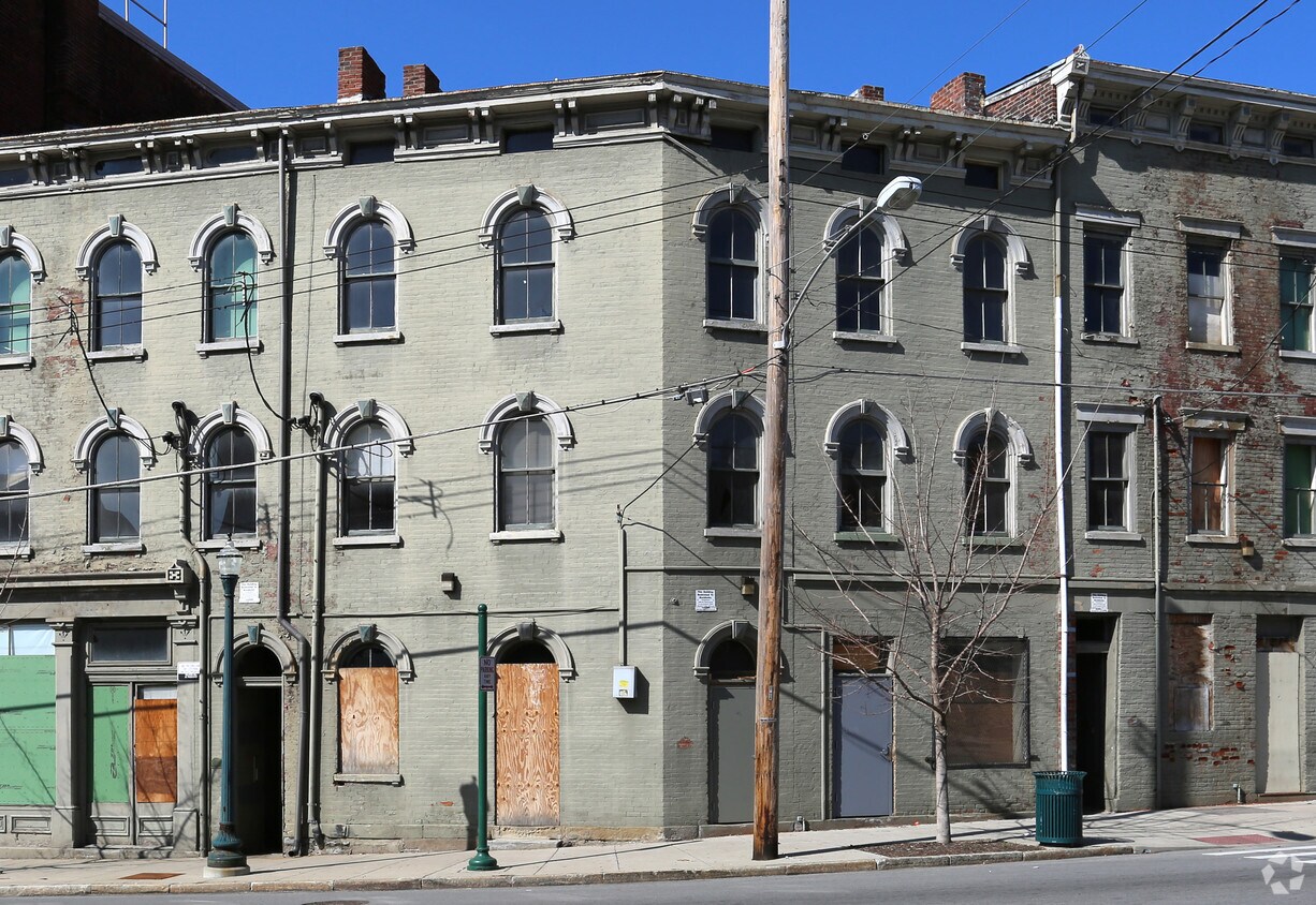


Discover a new place to live at 167 E McMicken Ave in Cincinnati. This community can be found in the 45202 area of Cincinnati. From amenities to availability, the team of leasing professionals will be ready to help you find your perfect place. Come by to check out the current floorplan options. Everything you need can be found at 167 E McMicken Ave. Contact or drop by the leasing office to check the current floorplan availability today.
167 E McMicken Ave is an apartment community located in Hamilton County and the 45202 ZIP Code. This area is served by the Cincinnati Public Schools attendance zone.
One of Cincinnati’s most exciting, up-and-coming neighborhoods, Over-the-Rhine has a rich heritage and diverse community. In fact, this neighborhood was one of the most densely populated areas in the country during the turn of the 20th century and is lined with well-preserved 19th-century buildings. Professionals, families, and more flock to Over-the-Rhine for its central location, big-city amenities, and abundant entertainment. This neighborhood is just a few short blocks from Downtown Cincinnati, making it easy for commuters to walk or bike to work. Unique restaurants, hip gastropubs, craft breweries, and boutiques line the streets of Over-the-Rhine’s Gateway District. This lively community has plenty to offer, and is home to Findlay Market, Washington Park, and Cincinnati Music Hall.
Learn more about living in Over-The RhineCompare neighborhood and city base rent averages by bedroom.
| Over-The Rhine | Cincinnati, OH | |
|---|---|---|
| Studio | $1,088 | $1,072 |
| 1 Bedroom | $1,146 | $1,134 |
| 2 Bedrooms | $1,701 | $1,422 |
| 3 Bedrooms | $2,021 | $1,733 |
| Colleges & Universities | Distance | ||
|---|---|---|---|
| Colleges & Universities | Distance | ||
| Drive: | 5 min | 1.8 mi | |
| Drive: | 6 min | 2.2 mi | |
| Drive: | 10 min | 3.7 mi | |
| Drive: | 10 min | 4.3 mi |


Transportation options available in Cincinnati include Race & Liberty Station, located 0.3 mile from 167 E McMicken Ave. 167 E McMicken Ave is near Cincinnati/Northern Kentucky International, located 15.1 miles or 29 minutes away.
| Transit / Subway | Distance | ||
|---|---|---|---|
| Transit / Subway | Distance | ||
| Walk: | 5 min | 0.3 mi | |
| Walk: | 6 min | 0.3 mi | |
| Walk: | 7 min | 0.4 mi | |
| Walk: | 8 min | 0.4 mi | |
| Walk: | 10 min | 0.5 mi |
| Commuter Rail | Distance | ||
|---|---|---|---|
| Commuter Rail | Distance | ||
|
|
Drive: | 5 min | 1.7 mi |
| Airports | Distance | ||
|---|---|---|---|
| Airports | Distance | ||
|
Cincinnati/Northern Kentucky International
|
Drive: | 29 min | 15.1 mi |
Scores provided by
Traffic
-Airport
-Businesses
-Scores provided by
HowLoud What is a Sound Score Rating? A Sound Score Rating aggregates noise caused by vehicle traffic, airplane traffic and local sources. How It WorksTime and distance from 167 E McMicken Ave.
| Shopping Centers | Distance | ||
|---|---|---|---|
| Shopping Centers | Distance | ||
| Walk: | 18 min | 0.9 mi | |
| Walk: | 18 min | 1.0 mi | |
| Drive: | 5 min | 2.5 mi |
| Parks and Recreation | Distance | ||
|---|---|---|---|
| Parks and Recreation | Distance | ||
|
William H. Taft National Historic Site
|
Walk: | 11 min | 0.6 mi |
|
Theodore M. Berry Friendship Park
|
Drive: | 4 min | 1.7 mi |
|
Duke Energy Children's Museum
|
Drive: | 5 min | 1.7 mi |
|
John G. & Phyllis W. Smale Riverfront Park
|
Drive: | 5 min | 1.7 mi |
|
Krohn Conservatory
|
Drive: | 4 min | 1.8 mi |
| Hospitals | Distance | ||
|---|---|---|---|
| Hospitals | Distance | ||
| Walk: | 14 min | 0.7 mi | |
| Drive: | 6 min | 2.3 mi | |
| Drive: | 6 min | 2.4 mi |
| Military Bases | Distance | ||
|---|---|---|---|
| Military Bases | Distance | ||
| Drive: | 72 min | 53.0 mi | |
| Drive: | 78 min | 58.1 mi | |
| Drive: | 80 min | 61.4 mi |
What Are Walk Score®, Transit Score®, and Bike Score® Ratings?
Walk Score® measures the walkability of any address. Transit Score® measures access to public transit. Bike Score® measures the bikeability of any address.
What is a Sound Score Rating?
A Sound Score Rating aggregates noise caused by vehicle traffic, airplane traffic and local sources.

167 E McMicken Ave
Cincinnati, OH 45202


