
Vanguard
1001 Marshall Ave,
Cincinnati, OH 45219
Studio - 5 Beds $749 - $1,479
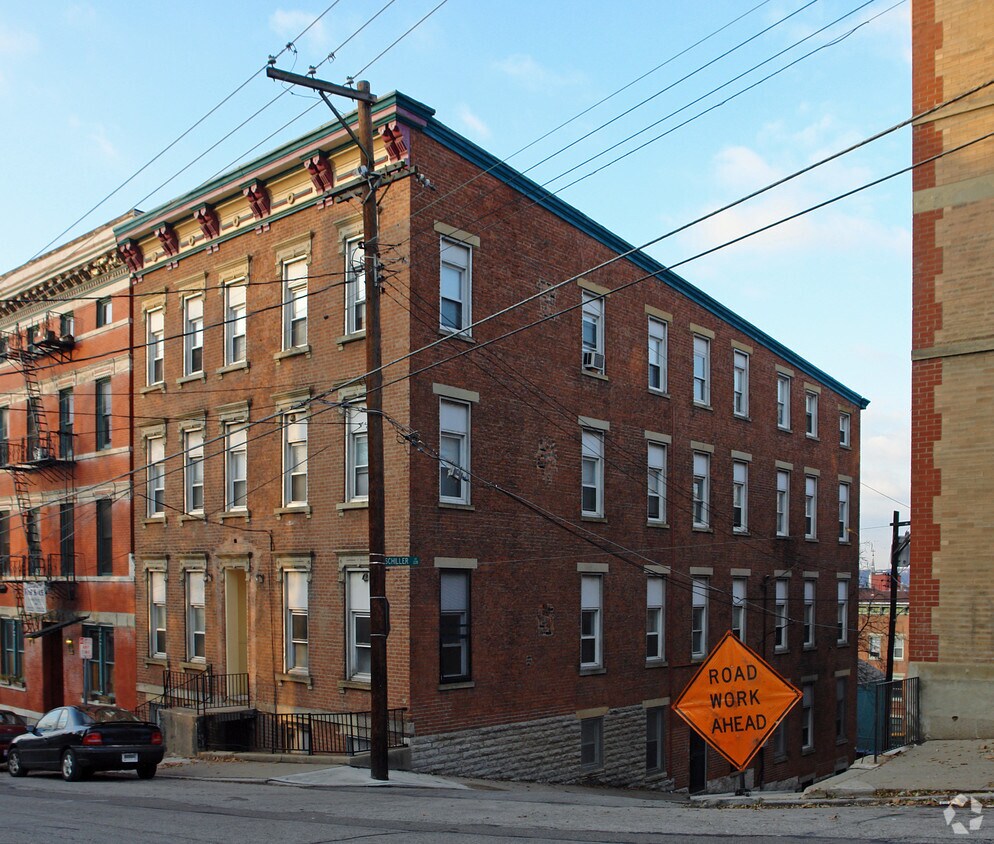
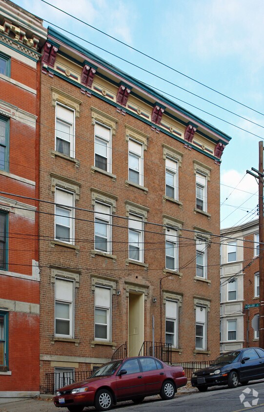

Meet a new place to live at 1641 Sycamore St in Cincinnati, OH. The location of this community is at 1641 Sycamore St. in the 45202 area of Cincinnati. From availability to location, the professional leasing team is ready to help match you with your perfect fit. Come by to see the available floorplan options. Get moving on finding your next place. Contact or stop by 1641 Sycamore St to talk about leasing your new apartment!
1641 Sycamore St is an apartment community located in Hamilton County and the 45202 ZIP Code. This area is served by the Cincinnati Public Schools attendance zone.
The Cincinnati neighborhood of Mount Auburn sits north of downtown and west of Interstate 71. The neighborhood, originally a hilltop escape from the crowded conditions of lower Downtown Cincinnati, gained national recognition as a historic district in 1973. The well-known community contains beautiful mansions dating back to 1819, including the home of former President William Howard Taft.
The community contains beautiful mansions formerly owned by a host of prominent residents. A number of historic buildings and sites dot the area, including the Mount Auburn Young Ladies Institute. The neighborhood also features the beloved ice cream parlor Graeter's Confectionary, as well as Christ Hospital.
Learn more about living in Mount Auburn| Colleges & Universities | Distance | ||
|---|---|---|---|
| Colleges & Universities | Distance | ||
| Drive: | 5 min | 1.9 mi | |
| Drive: | 6 min | 2.2 mi | |
| Drive: | 11 min | 3.8 mi | |
| Drive: | 11 min | 4.3 mi |


Transportation options available in Cincinnati include Race & Liberty Station, located 0.4 mile from 1641 Sycamore St. 1641 Sycamore St is near Cincinnati/Northern Kentucky International, located 15.2 miles or 30 minutes away.
| Transit / Subway | Distance | ||
|---|---|---|---|
| Transit / Subway | Distance | ||
| Walk: | 8 min | 0.4 mi | |
| Walk: | 8 min | 0.5 mi | |
| Walk: | 10 min | 0.5 mi | |
| Walk: | 10 min | 0.5 mi | |
| Walk: | 12 min | 0.6 mi |
| Commuter Rail | Distance | ||
|---|---|---|---|
| Commuter Rail | Distance | ||
|
|
Drive: | 6 min | 1.9 mi |
| Airports | Distance | ||
|---|---|---|---|
| Airports | Distance | ||
|
Cincinnati/Northern Kentucky International
|
Drive: | 30 min | 15.2 mi |
Time and distance from 1641 Sycamore St.
| Shopping Centers | Distance | ||
|---|---|---|---|
| Shopping Centers | Distance | ||
| Drive: | 3 min | 1.1 mi | |
| Drive: | 4 min | 1.2 mi | |
| Drive: | 5 min | 2.5 mi |
| Parks and Recreation | Distance | ||
|---|---|---|---|
| Parks and Recreation | Distance | ||
|
William H. Taft National Historic Site
|
Walk: | 9 min | 0.5 mi |
|
Theodore M. Berry Friendship Park
|
Drive: | 4 min | 1.7 mi |
|
Krohn Conservatory
|
Drive: | 4 min | 1.7 mi |
|
Eden Park
|
Drive: | 5 min | 1.9 mi |
|
John G. & Phyllis W. Smale Riverfront Park
|
Drive: | 6 min | 2.0 mi |
| Hospitals | Distance | ||
|---|---|---|---|
| Hospitals | Distance | ||
| Walk: | 11 min | 0.6 mi | |
| Drive: | 6 min | 1.9 mi | |
| Drive: | 6 min | 2.2 mi |
| Military Bases | Distance | ||
|---|---|---|---|
| Military Bases | Distance | ||
| Drive: | 72 min | 53.1 mi | |
| Drive: | 78 min | 58.1 mi | |
| Drive: | 81 min | 61.4 mi |
What Are Walk Score®, Transit Score®, and Bike Score® Ratings?
Walk Score® measures the walkability of any address. Transit Score® measures access to public transit. Bike Score® measures the bikeability of any address.
What is a Sound Score Rating?
A Sound Score Rating aggregates noise caused by vehicle traffic, airplane traffic and local sources

1641 Sycamore St
Cincinnati, OH 45202


