$2,250
/ Month
1626 Devil Ln
Woodbridge, VA 22192
Today
|
Edit
Favorites
-
Bedrooms
2
-
Bathrooms
2
-
Square Feet
--
Highlights
- Colonial Architecture
- Programmable Thermostat
- Brick Front
- Central Heating and Cooling System
1626 Devil Ln

Favorites
About This Home
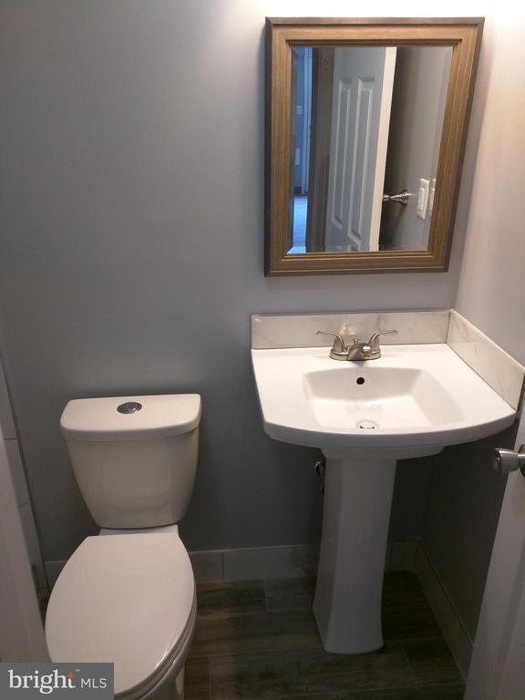
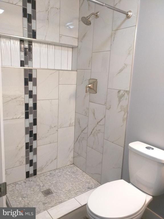
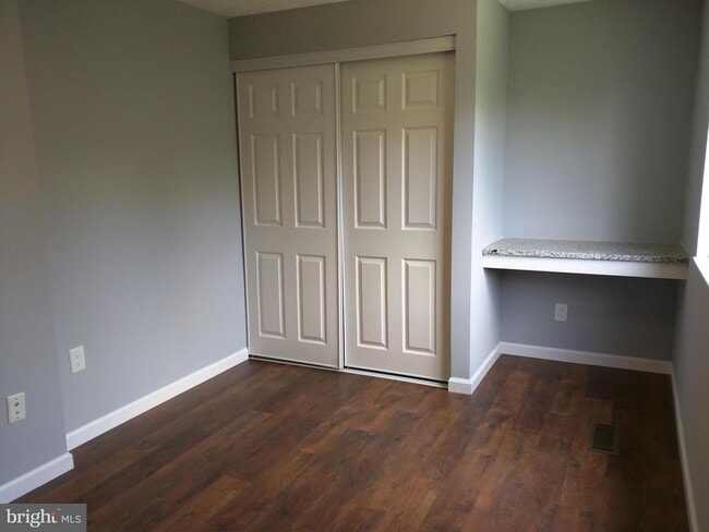
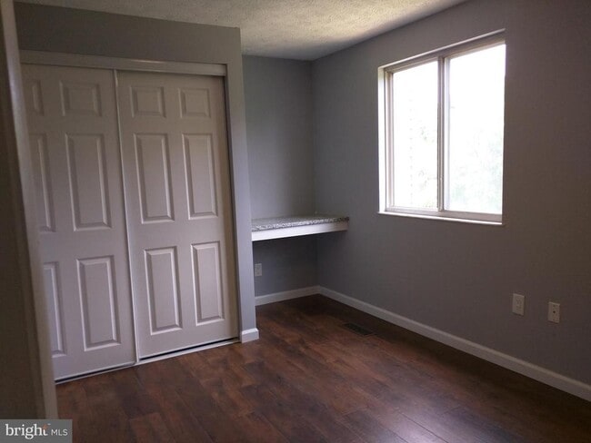
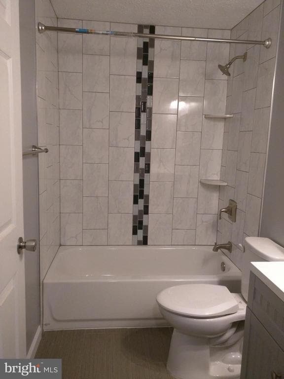
Professionally managed and very well kept 3 level-townhouse-condo, updated interiors, 2 bedrooms & 2 bathrooms. Convenient Occoquan/Lake Ridge location, minutes to I-95, Rt 123, Rt 1, VRE, commuter parking. 15 mins to Ft. Belvoir/Springfield areas. Updated kitchen, baths, floors, fixtures. Fenced in back yard. (2) assigned parking slots in front & visitor parking in rear. $50 app fee & one-month security deposit (minimal) required. Online RentSpree Application link: *** NO PETS is acceptable *** *** AVAILABLE IMMEDIATELY *** *** New, updated pictures are coming *** Interested Applicants can apply via the Rentspree link:
1626 Devil Ln is a townhome located in Prince William County and the 22192 ZIP Code. This area is served by the Prince William County Public Schools attendance zone.
* Price shown is base rent. Excludes user-selected optional fees and variable or usage-based fees and required charges due at or prior to move-in or at move-out. Price, availability, fees, and any applicable rent special are subject to change without notice.
* Square footage definitions vary. Displayed square footage is approximate.
Home Details
Home Type
Interior Unit Townhome
Year Built
Built in 1986
Bedrooms and Bathrooms
2 Main Level Bedrooms
2 Full Bathrooms
Home Design
Colonial Architecture
Brick Front
Aluminum Siding
Concrete Perimeter Foundation
Slab Foundation
Interior Spaces
1,335 Sq Ft Home
Property has 3 Levels
Listing and Financial Details
Security Deposit $2,250
12-Month Min and 24-Month Max Lease Term
Available 9/22/25
$50 Application Fee
Assessor Parcel Number 8392-69-2436.01
$250 Repair Deductible
No Smoking Allowed
Residential Lease
Parking
Parking Lot
Partially Finished Basement
Heated Basement
Walk-Out Basement
Basement Fills Entire Space Under The House
Basement Windows
Connecting Stairway
Rear Basement Entry
Utilities
Programmable Thermostat
Central Heating and Cooling System
Back Up Electric Heat Pump System
Electric Water Heater
Public Septic
Community Details
Overview
No Home Owners Association
Devils Reach Condo Community
Devils Reach Condos Subdivision
Pet Policy
No Pets Allowed
Contact
- Listed by Timothy T Mai | Westgate Realty Group, Inc.
-
Source
 Bright MLS, Inc.
Copyright © 2025 Bright MLS, Inc.
Location
Get Directions
Amenities
- Basement
Woodbridge, VA lies about 35 minutes outside of Washington D.C. and is a part of the Interstate 95 corridor. The area considered I-95 Woodbridge sits conveniently right off I-95 and encompasses a less dense, suburban part of the city that’s separated from the heart of Woodbridge by I-95, making it a breeze to get to the nearest attractions or for your daily work commute. The area surrounds itself with parks and lakes, making it ideal for outdoor activities. The Occoquan River runs through part of Woodbridge providing beautiful waterside scenery. In addition to the state of Virginia bursting with historical nods, Outer Woodbridge proves no different. Woodbridge is next to Historical Occoquan that boasts quaint restaurants and shops. Never be without something interesting to explore during your stay in the outskirts of Woodbridge.
Learn more about living in I-95 Woodbridge
Education
| Colleges & Universities | Distance | ||
|---|---|---|---|
| Colleges & Universities | Distance | ||
| Drive: | 12 min | 5.7 mi | |
| Drive: | 18 min | 10.3 mi | |
| Drive: | 24 min | 13.9 mi | |
| Drive: | 27 min | 17.4 mi |
1626 Devil Ln is within 12 minutes or 5.7 miles from NOVA, Woodbridge Campus. It is also near NOVA, Medical Edu. Campus and George Mason Univ., Fairfax.
Schools


Public Elementary School
Grades K-5
624 Students
Attendance Zone
Public Middle School
Grades 6-8
1,013 Students
Attendance Zone
Public High School
Grades 9-12
2,905 Students
Attendance Zone
Private Elementary & Middle School
Grades PK-8
489 Students
Nearby
Private Elementary School
Grades PK-6
130 Students
Nearby
Private High School
Grades 9-12
Nearby
School data provided by
 The GreatSchools Rating helps parents compare schools within a state based on a variety of school quality indicators and provides a helpful picture of how effectively each school serves all of its students. Ratings are on a scale of 1 (below average) to 10 (above average) and can include test scores, college readiness, academic progress, advanced courses, equity, discipline and attendance data. We also advise parents to visit schools, consider other information on school performance and programs, and consider family needs as part of the school selection process.
View GreatSchools Rating Methodology
Data provided by GreatSchools.org © 2025. All rights reserved.
View GreatSchools Rating Methodology
Data provided by GreatSchools.org © 2025. All rights reserved.
Transportation options available in Woodbridge include Franconia-Springfield, located 11.4 miles from 1626 Devil Ln. 1626 Devil Ln is near Ronald Reagan Washington Ntl, located 21.1 miles or 33 minutes away, and Washington Dulles International, located 29.5 miles or 52 minutes away.
| Transit / Subway | Distance | ||
|---|---|---|---|
| Transit / Subway | Distance | ||
|
|
Drive: | 19 min | 11.4 mi |
| Commuter Rail | Distance | ||
|---|---|---|---|
| Commuter Rail | Distance | ||
|
|
Drive: | 4 min | 1.7 mi |
|
|
Drive: | 11 min | 5.2 mi |
|
|
Drive: | 12 min | 5.7 mi |
|
|
Drive: | 12 min | 6.1 mi |
|
|
Drive: | 23 min | 12.9 mi |
| Airports | Distance | ||
|---|---|---|---|
| Airports | Distance | ||
|
Ronald Reagan Washington Ntl
|
Drive: | 33 min | 21.1 mi |
|
Washington Dulles International
|
Drive: | 52 min | 29.5 mi |
Time and distance from 1626 Devil Ln.
| Shopping Centers | Distance | ||
|---|---|---|---|
| Shopping Centers | Distance | ||
| Walk: | 14 min | 0.7 mi | |
| Walk: | 16 min | 0.8 mi | |
| Walk: | 20 min | 1.1 mi |
1626 Devil Ln has 3 shopping centers within 1.1 miles, which is about a 20-minute walk. The miles and minutes will be for the farthest away property.
| Parks and Recreation | Distance | ||
|---|---|---|---|
| Parks and Recreation | Distance | ||
|
Occoquan Bay National Wildlife Refuge
|
Drive: | 9 min | 3.1 mi |
|
Occoquan Regional Park
|
Drive: | 11 min | 3.8 mi |
|
Meadowood Recreation Area
|
Drive: | 13 min | 6.4 mi |
|
Sandy Run Regional Park
|
Drive: | 14 min | 6.5 mi |
|
Mason Neck State Park
|
Drive: | 22 min | 11.1 mi |
1626 Devil Ln has 5 parks within 11.1 miles, including Occoquan Bay National Wildlife Refuge, Occoquan Regional Park, and Meadowood Recreation Area.
| Hospitals | Distance | ||
|---|---|---|---|
| Hospitals | Distance | ||
| Drive: | 9 min | 4.4 mi | |
| Drive: | 17 min | 9.4 mi |
1626 Devil Ln is 4.4 miles from Sentara Northern Virginia Medical Center, and is convenient to other hospitals, including Fort Belvoir Community Hospital.
You May Also Like
Similar Rentals Nearby
-
-
-
-
-
-
-
-
-
-
1 / 45


What Are Walk Score®, Transit Score®, and Bike Score® Ratings?
Walk Score® measures the walkability of any address. Transit Score® measures access to public transit. Bike Score® measures the bikeability of any address.
What is a Sound Score Rating?
A Sound Score Rating aggregates noise caused by vehicle traffic, airplane traffic and local sources

1626 Devil Ln
Woodbridge, VA 22192