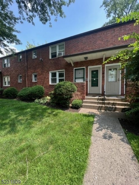
1 Bed, 1 Bath, 800 sq ft
1607 N Wood Ave
Roselle, NJ 07203

Check Back Soon for Upcoming Availability
| Beds | Baths | Average SF |
|---|---|---|
| 1 Bedroom 1 Bedroom 1 Br | 1 Bath 1 Bath 1 Ba | — |
About This Property
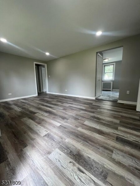
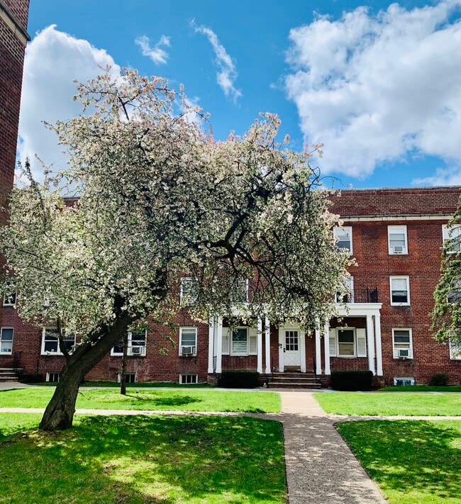
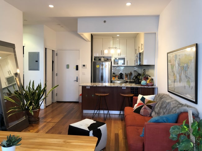
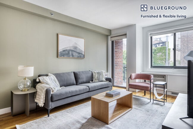
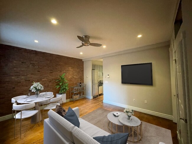
Condominio recién renovado en el primer piso en los condominios de madera en Roselle. Con una cocina actualizada con nuevos electrodomésticos de acero inoxidable y comedor en el área, sala de estar, baño y un dormitorio, esta unidad luminosa y acogedora seguro que impresionará. El alquiler incluye agua caliente y caliente. Garaje disponible por 100 USD adicionales al mes. Estacionamiento cerca de la unidad. Lavandería en las instalaciones Se requiere verificación de antecedentes y crédito, así como un cargo de agente inmobiliario de 1 mes y un depósito de garantía de 1,5 meses.
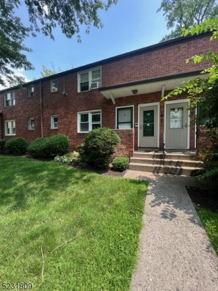
1607 N Wood Ave is a condo located in Union County and the 07203 ZIP Code. This area is served by the Roselle Public attendance zone.
Ideally located about 10 miles southwest of Newark and 18 miles from New York City, Roselle is a cozy borough for those looking for a quieter place to call home. First settled around 1664, Roselle was settled by farmers looking for better farmland. It was part of the first New Jersey settlement called Elizabethtown. The borough was officially incorporated in 1894 as Roselle.
Today, this terrific community features beautiful parks and great shopping. Warinanco Park, the borough's largest park, offers ball fields, a running track, a playground, pedal boats, an ice skating rink, a fitness trail, a bicycle path, fishing, a spray pool, tennis courts, picnic areas, and shuffleboard. Roselle's tree-lined streets are mainly residential, with a shopping district located between Westfield Avenue and West 1st Avenue.
Learn more about living in Roselle| Colleges & Universities | Distance | ||
|---|---|---|---|
| Colleges & Universities | Distance | ||
| Drive: | 10 min | 3.9 mi | |
| Drive: | 12 min | 4.2 mi | |
| Drive: | 12 min | 4.7 mi | |
| Drive: | 16 min | 8.8 mi |
 The GreatSchools Rating helps parents compare schools within a state based on a variety of school quality indicators and provides a helpful picture of how effectively each school serves all of its students. Ratings are on a scale of 1 (below average) to 10 (above average) and can include test scores, college readiness, academic progress, advanced courses, equity, discipline and attendance data. We also advise parents to visit schools, consider other information on school performance and programs, and consider family needs as part of the school selection process.
View GreatSchools Rating Methodology
Data provided by GreatSchools.org © 2026. All rights reserved.
Transportation options available in Roselle include 8Th Street Light Rail Station, located 10.4 miles from 1607 N Wood Ave. 1607 N Wood Ave is near Newark Liberty International, located 13.1 miles or 18 minutes away, and LaGuardia, located 31.8 miles or 51 minutes away.
| Transit / Subway | Distance | ||
|---|---|---|---|
| Transit / Subway | Distance | ||
| Drive: | 17 min | 10.4 mi | |
|
|
Drive: | 16 min | 10.9 mi |
|
|
Drive: | 17 min | 11.4 mi |
|
|
Drive: | 17 min | 11.4 mi |
|
|
Drive: | 19 min | 11.7 mi |
| Commuter Rail | Distance | ||
|---|---|---|---|
| Commuter Rail | Distance | ||
|
|
Drive: | 2 min | 1.3 mi |
|
|
Drive: | 6 min | 2.9 mi |
|
|
Drive: | 6 min | 3.0 mi |
|
|
Drive: | 7 min | 3.2 mi |
|
|
Drive: | 9 min | 4.1 mi |
| Airports | Distance | ||
|---|---|---|---|
| Airports | Distance | ||
|
Newark Liberty International
|
Drive: | 18 min | 13.1 mi |
|
LaGuardia
|
Drive: | 51 min | 31.8 mi |
Time and distance from 1607 N Wood Ave.
| Shopping Centers | Distance | ||
|---|---|---|---|
| Shopping Centers | Distance | ||
| Walk: | 6 min | 0.3 mi | |
| Walk: | 15 min | 0.8 mi | |
| Drive: | 2 min | 1.3 mi |
| Parks and Recreation | Distance | ||
|---|---|---|---|
| Parks and Recreation | Distance | ||
|
Hawk Rise Sanctuary
|
Drive: | 9 min | 3.7 mi |
|
William Miller Sperry Observatory
|
Drive: | 10 min | 4.0 mi |
|
Merrill Park
|
Drive: | 13 min | 5.4 mi |
|
Liberty State Park
|
Drive: | 13 min | 6.5 mi |
|
Staten Island Industrial Park
|
Drive: | 13 min | 7.9 mi |
| Hospitals | Distance | ||
|---|---|---|---|
| Hospitals | Distance | ||
| Drive: | 7 min | 2.9 mi | |
| Drive: | 10 min | 3.8 mi | |
| Drive: | 12 min | 8.5 mi |
| Military Bases | Distance | ||
|---|---|---|---|
| Military Bases | Distance | ||
| Drive: | 14 min | 5.1 mi | |
| Drive: | 12 min | 5.5 mi | |
| Drive: | 22 min | 14.7 mi |
You May Also Like
Statewide service is free, confidential, multilingual and always open. Three easy ways to reach Social Services in NJ: Dial 2-1-1; text your zip code to 898-211; or chat at https://www.nj211.org
Similar Rentals Nearby
-
$2,250Total Monthly PriceTotal Monthly Price NewPrices include all required monthly fees.Condo for Rent
-
$2,300Total Monthly PriceTotal Monthly Price NewPrices include all required monthly fees.Apartment for Rent
1 Bed, 1 Bath, 700 sq ft
-
$2,500Total Monthly PriceTotal Monthly Price NewPrices include all required monthly fees.Apartment for Rent
2 Beds, 1 Bath, 1,200 sq ft
-
$5,000Total Monthly PriceTotal Monthly Price NewPrices include all required monthly fees.Condo for Rent
2 Beds, 1.5 Baths, 1,356 sq ft
-
$3,400Total Monthly PriceTotal Monthly Price NewPrices include all required monthly fees.Condo for Rent
1 Bed, 1 Bath, 586 sq ft
-
-
-
-
-
What Are Walk Score®, Transit Score®, and Bike Score® Ratings?
Walk Score® measures the walkability of any address. Transit Score® measures access to public transit. Bike Score® measures the bikeability of any address.
What is a Sound Score Rating?
A Sound Score Rating aggregates noise caused by vehicle traffic, airplane traffic and local sources
