
1213 Walnut
1213 Walnut St,
Philadelphia, PA 19107
$2,350 - $5,739
Studio - 2 Beds
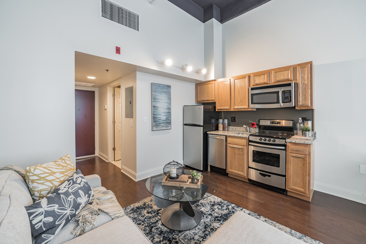
The apartments at 1600 Chestnut are modern/updated with great features like hardwood floors throughout, high ceilings, large windows, central heat/air, granite/stainless steel kitchens. Plus, free laundry along with a Wi-Fi /tv lounge on each floor, and a small fitness center on the 5th floor. Water is included; tenants pay their own electric. No front desk attendant.
1600 Chestnut is an apartment community located in Philadelphia County and the 19102 ZIP Code. This area is served by the The School District of Philadelphia attendance zone.
Fitness Center
Elevator
Lounge
Property Manager on Site
Air Conditioning
Dishwasher
High Speed Internet Access
Hardwood Floors
Center City West is a neighborhood within Center City, the downtown district of Philadelphia. This urban hub is one of Philadelphia's most desirable neighborhoods. The Center City West neighborhood encompasses some of the city's biggest attractions including the shopping, financial, and museum districts. It attracts its residents by not only hosting some of the city's leading institutions of art, science, and history, but also with its upscale restaurants and a booming nightlife. The options are endless: Laugh tears of joy at the Helium Comedy Club, have a shopping spree at the Shops at Liberty Place, or get a spectacular panoramic view 57 stories above the ground at the One Liberty Observation Deck. Nearby Rittenhouse Square is a popular spot for festivals and farmers markets while the Schuylkill Banks has excellent riverside running and biking trails with a view.
Learn more about living in Center City WestCompare neighborhood and city base rent averages by bedroom.
| Center City West | Philadelphia, PA | |
|---|---|---|
| Studio | $1,873 | $1,408 |
| 1 Bedroom | $2,552 | $1,765 |
| 2 Bedrooms | $3,869 | $2,205 |
| 3 Bedrooms | $4,689 | $2,932 |
| Colleges & Universities | Distance | ||
|---|---|---|---|
| Colleges & Universities | Distance | ||
| Walk: | 0 min | 0.0 mi | |
| Walk: | 11 min | 0.6 mi | |
| Walk: | 11 min | 0.6 mi | |
| Walk: | 12 min | 0.7 mi |


Transportation options available in Philadelphia include 15Th Street, located 0.2 mile from 1600 Chestnut. 1600 Chestnut is near Philadelphia International, located 10.0 miles or 21 minutes away, and Trenton Mercer, located 33.9 miles or 49 minutes away.
| Transit / Subway | Distance | ||
|---|---|---|---|
| Transit / Subway | Distance | ||
|
|
Walk: | 3 min | 0.2 mi |
| Walk: | 3 min | 0.2 mi | |
|
|
Walk: | 4 min | 0.2 mi |
| Walk: | 5 min | 0.3 mi | |
|
|
Walk: | 7 min | 0.4 mi |
| Commuter Rail | Distance | ||
|---|---|---|---|
| Commuter Rail | Distance | ||
|
|
Walk: | 6 min | 0.3 mi |
|
|
Walk: | 12 min | 0.6 mi |
|
|
Walk: | 18 min | 1.0 mi |
| Drive: | 5 min | 1.9 mi | |
|
|
Drive: | 7 min | 3.1 mi |
| Airports | Distance | ||
|---|---|---|---|
| Airports | Distance | ||
|
Philadelphia International
|
Drive: | 21 min | 10.0 mi |
|
Trenton Mercer
|
Drive: | 49 min | 33.9 mi |
Scores provided by
Traffic
BusyAirport
CalmBusinesses
BusyScores provided by
HowLoud What is a Sound Score Rating? A Sound Score Rating aggregates noise caused by vehicle traffic, airplane traffic and local sources. How It WorksTime and distance from 1600 Chestnut.
| Shopping Centers | Distance | ||
|---|---|---|---|
| Shopping Centers | Distance | ||
| Walk: | 1 min | 0.1 mi | |
| Walk: | 11 min | 0.6 mi | |
| Walk: | 13 min | 0.7 mi |
| Parks and Recreation | Distance | ||
|---|---|---|---|
| Parks and Recreation | Distance | ||
|
The Academy of Natural Sciences
|
Walk: | 10 min | 0.6 mi |
|
Franklin Institute
|
Walk: | 13 min | 0.7 mi |
|
Fels Planetarium
|
Walk: | 13 min | 0.7 mi |
|
Schuylkill River Park
|
Drive: | 4 min | 1.2 mi |
|
Independence National Historical Park
|
Drive: | 3 min | 1.5 mi |
| Hospitals | Distance | ||
|---|---|---|---|
| Hospitals | Distance | ||
| Walk: | 9 min | 0.5 mi | |
| Walk: | 11 min | 0.6 mi | |
| Walk: | 14 min | 0.7 mi |
| Military Bases | Distance | ||
|---|---|---|---|
| Military Bases | Distance | ||
| Drive: | 12 min | 4.9 mi |
What Are Walk Score®, Transit Score®, and Bike Score® Ratings?
Walk Score® measures the walkability of any address. Transit Score® measures access to public transit. Bike Score® measures the bikeability of any address.
What is a Sound Score Rating?
A Sound Score Rating aggregates noise caused by vehicle traffic, airplane traffic and local sources.

106 S 16th St
Philadelphia, PA 19102


