1535 Emily St
Philadelphia, PA 19145
-
Bedrooms
1
-
Bathrooms
1
-
Square Feet
--
-
Available
Available Sep 10
Highlights
- Furnished
- Hardwood Floors
- Fenced Lot

About This Home
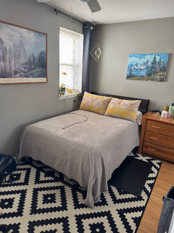
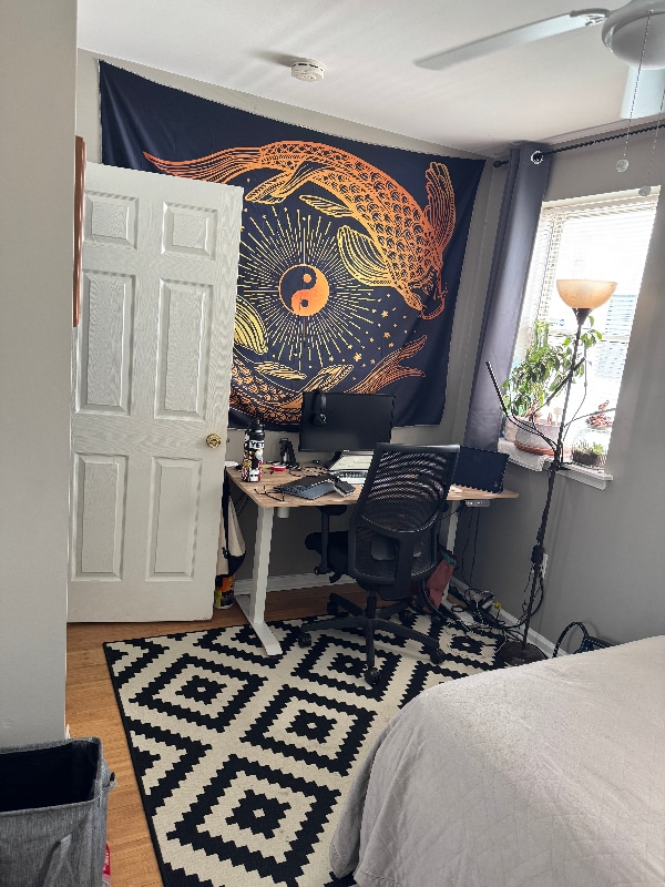
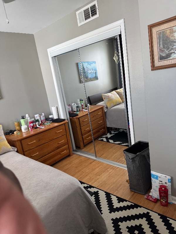
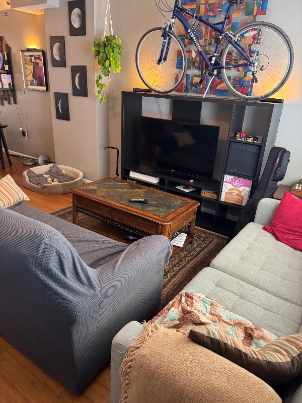
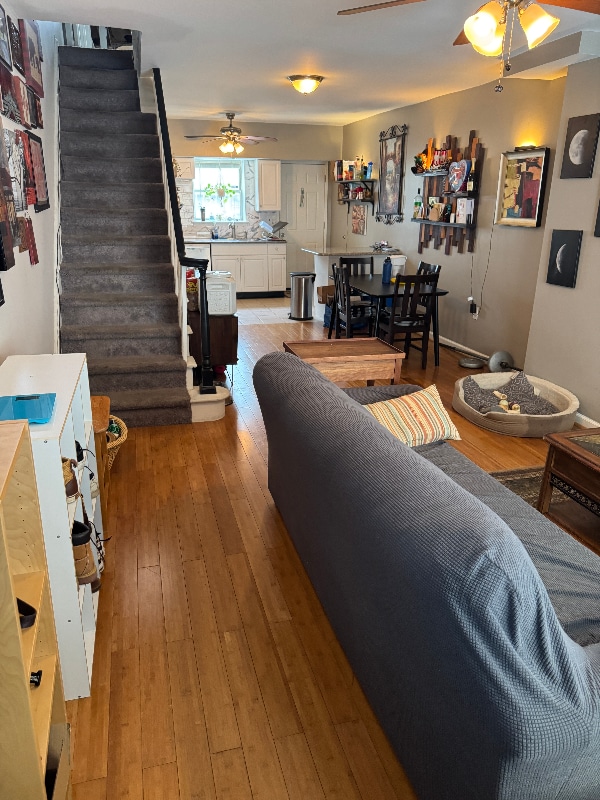
Property Id: 1988168 Fully furnished bedroom in 2 BR 1 BA rowhome on quiet street. Room is available beginning September 10 until December 10 with the option to sign on for a full lease term in December. BEDROOM AMENITIES: -Full sized bed -Wood dresser -Electronic standing desk -Closet space -Verizon Fios ethernet connection -Decor COMMUNAL AMENITIES: -Flat screen TV with Google Chromecast -Philips Hue Smart Lighting -Fully stocked kitchen (cutlery, spices, appliances, etc.) -Central A/C -In house washer/dryer -High speed WiFi -Outdoor sitting space -Basement storage LOCATION AMENITIES: -2 blocks from BSL -1 block from Bus Line 2 -4 blocks from East Passyunk -On narrow side street tucked away from city noise Please fill out tenant pre-screener for serious inquiries. There will be a very friendly medium-large dog living here through December.
1535 Emily St is a townhome located in Philadelphia County and the 19145 ZIP Code. This area is served by the The School District of Philadelphia attendance zone.
Townhome Features
Washer/Dryer
Dishwasher
Hardwood Floors
Microwave
- Washer/Dryer
- Dishwasher
- Disposal
- Microwave
- Oven
- Refrigerator
- Freezer
- Hardwood Floors
- Furnished
- Fenced Lot
Fees and Policies
The fees below are based on community-supplied data and may exclude additional fees and utilities.
- Dogs Allowed
-
Fees not specified
-
Weight limit--
-
Pet Limit--
Details
Utilities Included
-
Gas
-
Water
-
Electricity
Property Information
-
Furnished Units Available
Contact
- Phone Number
- Contact
-
Source

- Washer/Dryer
- Dishwasher
- Disposal
- Microwave
- Oven
- Refrigerator
- Freezer
- Hardwood Floors
- Furnished
- Fenced Lot
If it's cheesesteaks and sports that piqued your interest in Philadelphia, you're looking for the neighborhood of South Philadelphia West. At its southeastern tip, this area borders the Wells Fargo Center and the Lincoln Financial Field, home of the Flyers and Phillies respectively. Located south of Moore Street, between busy Broad St. and the Schuykill River, the area offers a range of densely packed urban shopping districts and a riverfront oasis, all within minutes of Center City.
Bordered by Interstate 76 and 95, South Philly West encompasses several neighborhoods and entertainment hotspots. There’s a little something for everyone here, from the urban amenities of Melrose and South Philly, to FDR Park and the nearby Philadelphia International Airport.
Learn more about living in South Philadelphia West| Colleges & Universities | Distance | ||
|---|---|---|---|
| Colleges & Universities | Distance | ||
| Drive: | 7 min | 2.3 mi | |
| Drive: | 6 min | 2.3 mi | |
| Drive: | 7 min | 2.8 mi | |
| Drive: | 8 min | 3.4 mi |


View GreatSchools Rating Methodology
Data provided by GreatSchools.org © 2025. All rights reserved.
Transportation options available in Philadelphia include Snyder, located 0.2 mile from 1535 Emily St. 1535 Emily St is near Philadelphia International, located 8.3 miles or 17 minutes away, and Trenton Mercer, located 35.6 miles or 54 minutes away.
| Transit / Subway | Distance | ||
|---|---|---|---|
| Transit / Subway | Distance | ||
|
|
Walk: | 4 min | 0.2 mi |
|
|
Walk: | 9 min | 0.5 mi |
|
|
Walk: | 14 min | 0.7 mi |
|
|
Walk: | 17 min | 0.9 mi |
|
|
Drive: | 4 min | 1.7 mi |
| Commuter Rail | Distance | ||
|---|---|---|---|
| Commuter Rail | Distance | ||
|
|
Drive: | 7 min | 2.3 mi |
|
|
Drive: | 7 min | 2.4 mi |
|
|
Drive: | 8 min | 3.1 mi |
| Drive: | 8 min | 4.0 mi | |
| Drive: | 10 min | 4.1 mi |
| Airports | Distance | ||
|---|---|---|---|
| Airports | Distance | ||
|
Philadelphia International
|
Drive: | 17 min | 8.3 mi |
|
Trenton Mercer
|
Drive: | 54 min | 35.6 mi |
Time and distance from 1535 Emily St.
| Shopping Centers | Distance | ||
|---|---|---|---|
| Shopping Centers | Distance | ||
| Walk: | 17 min | 0.9 mi | |
| Walk: | 18 min | 0.9 mi | |
| Drive: | 3 min | 1.2 mi |
| Parks and Recreation | Distance | ||
|---|---|---|---|
| Parks and Recreation | Distance | ||
|
Thaddeus Kosciuszko National Memorial
|
Drive: | 6 min | 2.0 mi |
|
Gloria Dei Church National Historic Site
|
Drive: | 5 min | 2.0 mi |
|
Franklin D. Roosevelt Park
|
Drive: | 7 min | 2.3 mi |
|
Schuylkill River Park
|
Drive: | 6 min | 2.4 mi |
|
Penn Museum
|
Drive: | 8 min | 4.0 mi |
| Hospitals | Distance | ||
|---|---|---|---|
| Hospitals | Distance | ||
| Walk: | 3 min | 0.2 mi | |
| Drive: | 7 min | 2.0 mi | |
| Drive: | 7 min | 2.2 mi |
| Military Bases | Distance | ||
|---|---|---|---|
| Military Bases | Distance | ||
| Drive: | 7 min | 2.7 mi |
1535 Emily St Photos
Nearby Apartments
Within 50 Miles of 1535 Emily St Philadelphia, PA 19145
-
RIVERMARK NORTHERN LIBERTIES
501 N Christopher Columbus Blvd
Philadelphia, PA 19123
1-3 Br $1,965-$5,414 3.0 mi
-
The Roe at Manayunk Apartments and Townhomes
172 Conarroe St
Philadelphia, PA 19127
1-3 Br $2,450-$3,450 7.6 mi
-
Kingswood Apartments & Townhomes
580 Lewis Rd
King of Prussia, PA 19406
1-3 Br $1,535-$4,290 14.6 mi
-
Brookshire Trace Townhomes
14040 Dana Ave
Philadelphia, PA 19116
1-2 Br $1,495-$1,640 16.7 mi
-
Townline Townhomes
75 Townline Way
Blue Bell, PA 19422
1-3 Br $1,845-$5,125 16.9 mi
-
Valley Run
2601 Carpenter Station Rd
Wilmington, DE 19810
1-3 Br $1,495-$2,575 17.2 mi
What Are Walk Score®, Transit Score®, and Bike Score® Ratings?
Walk Score® measures the walkability of any address. Transit Score® measures access to public transit. Bike Score® measures the bikeability of any address.
What is a Sound Score Rating?
A Sound Score Rating aggregates noise caused by vehicle traffic, airplane traffic and local sources
1535 Emily St
Philadelphia, PA 19145