$975
/ Month
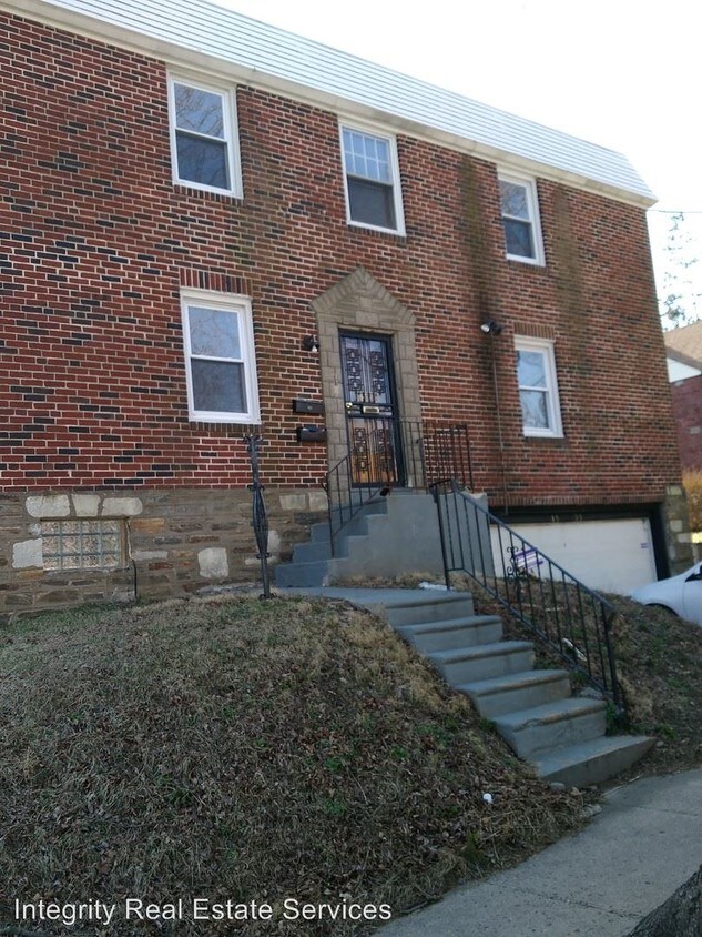
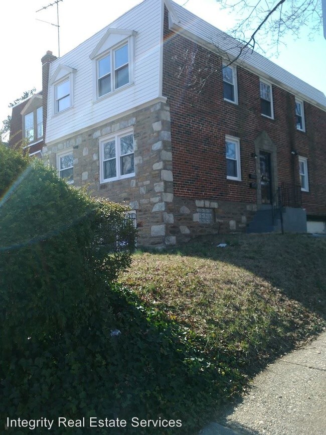
1535 E Mt Pleasant Ave
Philadelphia, PA 19150
Favorites
1535 E Mt Pleasant Ave

Favorites
Check Back Soon for Upcoming Availability
| Beds | Baths | Average SF |
|---|---|---|
| 2 Bedrooms 2 Bedrooms 2 Br | 1 Bath 1 Bath 1 Ba | — |
Fees and Policies
The fees listed below are community-provided and may exclude utilities or add-ons. All payments are made directly to the property and are non-refundable unless otherwise specified.
About This Property
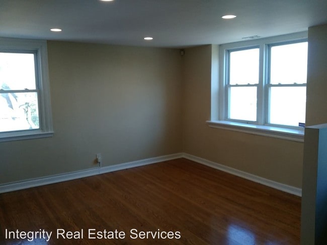
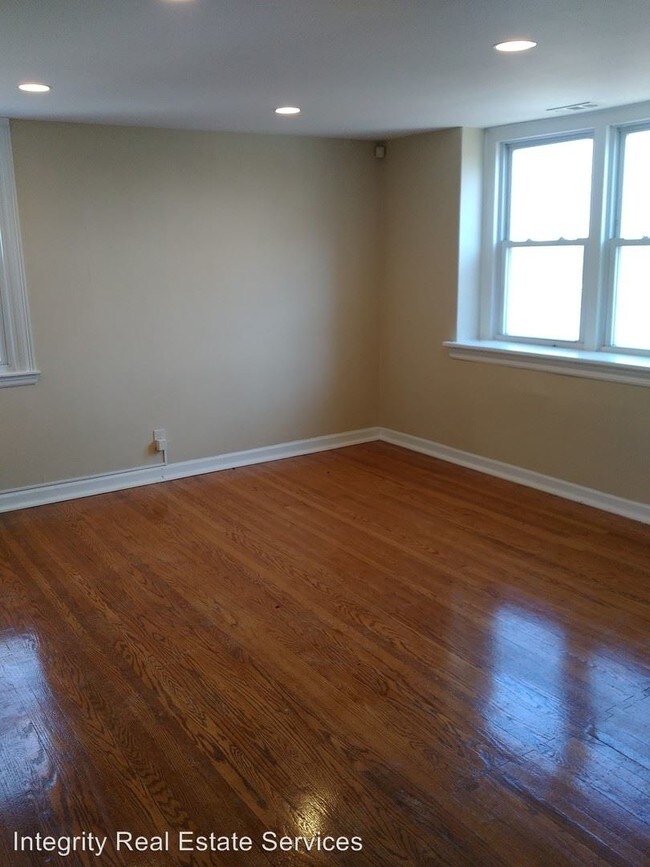
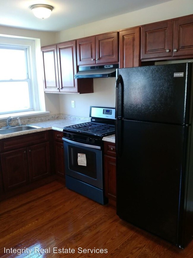
(215) 849-1111 - 2 Bedroom Apartment in Mt. Airy - 2 bedroom 2nd floor Duplex apartment in Mount Airy is ready to be rented.. Hardwood flooring throughout, Central Air and Washer and Dryer in unit, Additional storage space in basement for your convenience. Just a block away from cedarbrook mall. Minimum credit score 600 3 months to move in (first, last and security) Must net (bring home after taxes) 2x monthly rental amount (if 2 or more tenants, combined you have to net 3x monthly rental amount) $50 Application fee -per applicant $25 Application fee for anyone over 18 yrs old who will be living in the property but not on lease Can’t have any evictions No pets allowed No Pets Allowed (RLNE3078186) Pet policies: No Dogs Allowed, No Cats Allowed.
1535 E Mt Pleasant Ave is an apartment community located in Philadelphia County and the 19150 ZIP Code.
Unique Features
- No Dogs Allowed, No Cats Allowed
1535 E Mt Pleasant Ave,
Philadelphia,
PA
19150
Located in the northwestern stretches of Philadelphia, Cedarbrook-Stenton is a historic community boasting suburban amenities along with quick urban access. Cedarbrook-Stenton is primarily residential, offering an array of apartments, townhomes, and houses available for rent in a laid-back locale.
Shopping and dining options in the neighborhood are largely clustered on Cheltenham Avenue, including at popular venues like Cedarbrook Plaza Shopping Center and Greenleaf at Cheltenham. All that Center City Philadelphia has to offer is within close reach of the community via Septa’s Chestnut Hill East Line as well.
Learn more about living in Cedarbrook-StentonBelow are rent ranges for similar nearby apartments
| Beds | Average Size | Lowest | Typical | Premium |
|---|---|---|---|---|
| Studio Studio Studio | 734-749 Sq Ft | $750 | $1,300 | $3,000 |
| 1 Bed 1 Bed 1 Bed | 736-742 Sq Ft | $750 | $1,546 | $2,563 |
| 2 Beds 2 Beds 2 Beds | 976-988 Sq Ft | $1,195 | $1,984 | $4,248 |
| 3 Beds 3 Beds 3 Beds | 1360-1402 Sq Ft | $1,111 | $2,289 | $4,000 |
| 4 Beds 4 Beds 4 Beds | 2374-2440 Sq Ft | $1,995 | $2,936 | $3,500 |
Amenities
- No Dogs Allowed, No Cats Allowed
Education
| Colleges & Universities | Distance | ||
|---|---|---|---|
| Colleges & Universities | Distance | ||
| Drive: | 3 min | 1.3 mi | |
| Drive: | 6 min | 3.0 mi | |
| Drive: | 6 min | 3.1 mi | |
| Drive: | 9 min | 3.7 mi |
1535 E Mt Pleasant Ave is within 3 minutes or 1.3 miles from Arcadia University. It is also near C.C. of Philadelphia, NW Ctr and Salus University.
Transportation options available in Philadelphia include Olney Transit Center, located 3.4 miles from 1535 E Mt Pleasant Ave. 1535 E Mt Pleasant Ave is near Philadelphia International, located 21.0 miles or 38 minutes away, and Trenton Mercer, located 35.2 miles or 49 minutes away.
| Transit / Subway | Distance | ||
|---|---|---|---|
| Transit / Subway | Distance | ||
| Drive: | 7 min | 3.4 mi | |
| Drive: | 8 min | 3.6 mi | |
|
|
Drive: | 9 min | 4.1 mi |
|
|
Drive: | 9 min | 4.6 mi |
|
|
Drive: | 10 min | 5.0 mi |
| Commuter Rail | Distance | ||
|---|---|---|---|
| Commuter Rail | Distance | ||
|
|
Drive: | 4 min | 1.8 mi |
|
|
Drive: | 4 min | 1.9 mi |
|
|
Drive: | 5 min | 2.0 mi |
|
|
Drive: | 5 min | 2.3 mi |
|
|
Drive: | 6 min | 2.6 mi |
| Airports | Distance | ||
|---|---|---|---|
| Airports | Distance | ||
|
Philadelphia International
|
Drive: | 38 min | 21.0 mi |
|
Trenton Mercer
|
Drive: | 49 min | 35.2 mi |
Walkability Near 1535 E Mt Pleasant Ave Philadelphia, PA 19150
Getting Around
 What do Walkability, Transit, Drivability, and Bikeability mean?
Walkability measures the walking distance to day-to-day needs.
Transit measures access to public transportation.
Drivability measures congestion, parking availability, and access to major roads.
Bikeability measures the suitability for cycling.
How It Works
What do Walkability, Transit, Drivability, and Bikeability mean?
Walkability measures the walking distance to day-to-day needs.
Transit measures access to public transportation.
Drivability measures congestion, parking availability, and access to major roads.
Bikeability measures the suitability for cycling.
How It Works
Moderately Walkable
Walkability
70
/ 100
Good Public Transit
Transit
60
/ 100
Fairly Drivable
Drivability
50
/ 100
Fairly Bikeable
Bikeability
40
/ 100
Scores provided by
-
Soundscore™
-
/ 100
Traffic
-Airport
-Businesses
-Scores provided by
HowLoud What is a Sound Score Rating? A Sound Score Rating aggregates noise caused by vehicle traffic, airplane traffic and local sources. How It WorksTime and distance from 1535 E Mt Pleasant Ave.
| Shopping Centers | Distance | ||
|---|---|---|---|
| Shopping Centers | Distance | ||
| Walk: | 5 min | 0.3 mi | |
| Walk: | 6 min | 0.3 mi | |
| Walk: | 12 min | 0.6 mi |
1535 E Mt Pleasant Ave has 3 shopping centers within 0.6 mile, which is about a 12-minute walk. The miles and minutes will be for the farthest away property.
| Parks and Recreation | Distance | ||
|---|---|---|---|
| Parks and Recreation | Distance | ||
|
Awbury Arboretum
|
Drive: | 6 min | 3.0 mi |
|
Briar Bush Nature Center
|
Drive: | 10 min | 4.1 mi |
|
The Morris Arboretum
|
Drive: | 11 min | 4.6 mi |
|
Wissahickon Valley Park
|
Drive: | 8 min | 4.8 mi |
|
Wissahickon Environmental Center
|
Drive: | 10 min | 4.9 mi |
1535 E Mt Pleasant Ave has 5 parks within 4.9 miles, including Awbury Arboretum, The Morris Arboretum, and Briar Bush Nature Center.
| Hospitals | Distance | ||
|---|---|---|---|
| Hospitals | Distance | ||
| Drive: | 8 min | 3.4 mi | |
| Drive: | 8 min | 3.6 mi | |
| Drive: | 11 min | 5.1 mi |
1535 E Mt Pleasant Ave has 3 hospitals within 5.1 miles, the nearest is Chestnut Hill Hospital which is 3.4 miles away and a 8 minute drive.
| Military Bases | Distance | ||
|---|---|---|---|
| Military Bases | Distance | ||
| Drive: | 27 min | 11.2 mi | |
| Drive: | 23 min | 14.2 mi | |
| Drive: | 30 min | 18.1 mi |
1535 E Mt Pleasant Ave has 3 military bases within 18.1 miles, the nearest is Naval Air Development Center which is 11.2 miles away and a 27 minute drive.
You May Also Like
Similar Rentals Nearby


What Are Walk Score®, Transit Score®, and Bike Score® Ratings?
Walk Score® measures the walkability of any address. Transit Score® measures access to public transit. Bike Score® measures the bikeability of any address.
What is a Sound Score Rating?
A Sound Score Rating aggregates noise caused by vehicle traffic, airplane traffic and local sources.

1535 E Mt Pleasant Ave
Philadelphia, PA 19150