
Peninsula Pines Apartments
842-858 Antoinette Ln,
South San Francisco, CA 94080
$2,150 - $5,388
Studio - 2 Beds
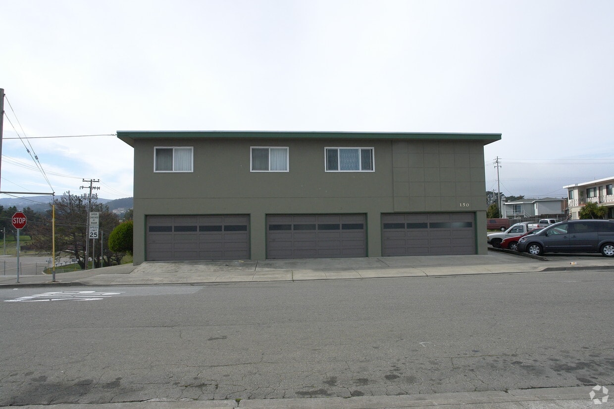
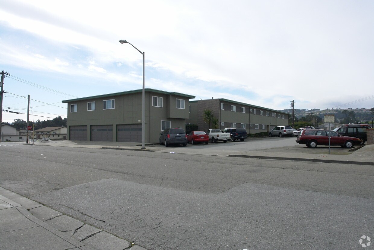

At 150 Ponderosa Rd in South San Francisco, experience great living. In a location on Ponderosa Rd. in South San Francisco's 94080 area, you can easily connect with a number of attractions found in the neighborhood. Make sure you to view the available floorplans. Here at this community, the professional leasing staff will be ready to help you find your perfect home. Contact us or drop by the leasing office to find out current pricing and make your move to 150 Ponderosa Rd.
150 Ponderosa Rd is an apartment community located in San Mateo County and the 94080 ZIP Code. This area is served by the South San Francisco Unified School District attendance zone.
Avalon is a cozy residential neighborhood along Interstate 280 in South San Francisco. The community is bordered to the north by California Golf Club of San Francisco and to the south by Golden Gate National Cemetery, giving the neighborhood a tranquil atmosphere. Ponderosa Elementary School and Baden High School are both located on the east side, with Los Cerritos Elementary and South San Francisco High School right across El Camino Real, making this a great location for those with school-age kids.
Residents enjoy close access to a handful of shopping centers, with the Shops at Tanforan mall offering up specialty shops, casual dining, and a multiplex movie theater. With the Interstate and San Francisco international Airport close at hand as well, it’s an ideal spot for commuters and frequent travelers.
Learn more about living in AvalonCompare neighborhood and city base rent averages by bedroom.
| Avalon | South San Francisco, CA | |
|---|---|---|
| Studio | - | $2,668 |
| 1 Bedroom | $2,681 | $3,254 |
| 2 Bedrooms | $3,509 | $3,783 |
| 3 Bedrooms | - | $4,467 |
| Colleges & Universities | Distance | ||
|---|---|---|---|
| Colleges & Universities | Distance | ||
| Drive: | 8 min | 4.1 mi | |
| Drive: | 13 min | 7.2 mi | |
| Drive: | 13 min | 7.6 mi | |
| Drive: | 19 min | 9.8 mi |


Transportation options available in South San Francisco include South San Francisco, located 1.5 miles from 150 Ponderosa Rd. 150 Ponderosa Rd is near San Francisco International, located 4.4 miles or 10 minutes away, and Metro Oakland International, located 29.9 miles or 44 minutes away.
| Transit / Subway | Distance | ||
|---|---|---|---|
| Transit / Subway | Distance | ||
|
|
Drive: | 3 min | 1.5 mi |
|
|
Drive: | 3 min | 1.5 mi |
| Drive: | 6 min | 3.0 mi | |
|
|
Drive: | 6 min | 3.2 mi |
|
|
Drive: | 8 min | 3.8 mi |
| Commuter Rail | Distance | ||
|---|---|---|---|
| Commuter Rail | Distance | ||
| Drive: | 3 min | 1.9 mi | |
| Drive: | 5 min | 2.3 mi | |
| Drive: | 9 min | 4.7 mi | |
| Drive: | 10 min | 6.5 mi | |
| Drive: | 12 min | 6.7 mi |
| Airports | Distance | ||
|---|---|---|---|
| Airports | Distance | ||
|
San Francisco International
|
Drive: | 10 min | 4.4 mi |
|
Metro Oakland International
|
Drive: | 44 min | 29.9 mi |
Scores provided by
Traffic
-Airport
-Businesses
-Scores provided by
HowLoud What is a Sound Score Rating? A Sound Score Rating aggregates noise caused by vehicle traffic, airplane traffic and local sources. How It WorksTime and distance from 150 Ponderosa Rd.
| Shopping Centers | Distance | ||
|---|---|---|---|
| Shopping Centers | Distance | ||
| Walk: | 1 min | 0.1 mi | |
| Walk: | 8 min | 0.5 mi | |
| Walk: | 11 min | 0.6 mi |
| Parks and Recreation | Distance | ||
|---|---|---|---|
| Parks and Recreation | Distance | ||
|
Pacifica State Beach
|
Drive: | 13 min | 7.2 mi |
|
Candlestick Point State Recreation Area
|
Drive: | 16 min | 7.6 mi |
|
San Bruno Mountain State Park
|
Drive: | 17 min | 7.6 mi |
|
San Francisco State Univ. Observatory
|
Drive: | 15 min | 7.9 mi |
|
San Pedro Valley Park
|
Drive: | 20 min | 9.4 mi |
| Hospitals | Distance | ||
|---|---|---|---|
| Hospitals | Distance | ||
| Walk: | 17 min | 0.9 mi | |
| Drive: | 7 min | 3.7 mi | |
| Drive: | 8 min | 4.7 mi |
| Military Bases | Distance | ||
|---|---|---|---|
| Military Bases | Distance | ||
| Drive: | 26 min | 11.8 mi | |
| Drive: | 27 min | 12.4 mi | |
| Drive: | 41 min | 24.5 mi |
Pets Allowed Fitness Center In Unit Washer & Dryer Walk-In Closets Stainless Steel Appliances Hardwood Floors EV Charging
Pets Allowed Fitness Center In Unit Washer & Dryer Stainless Steel Appliances Business Center Package Service Elevator
What Are Walk Score®, Transit Score®, and Bike Score® Ratings?
Walk Score® measures the walkability of any address. Transit Score® measures access to public transit. Bike Score® measures the bikeability of any address.
What is a Sound Score Rating?
A Sound Score Rating aggregates noise caused by vehicle traffic, airplane traffic and local sources.


