

$1,129
/ Month
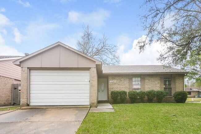
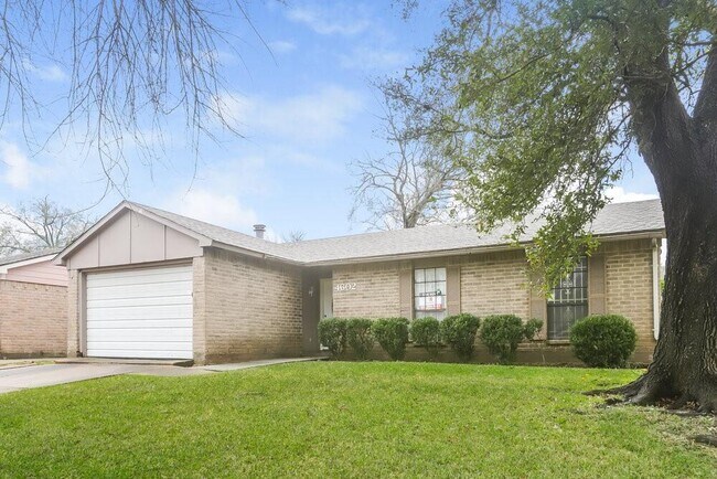
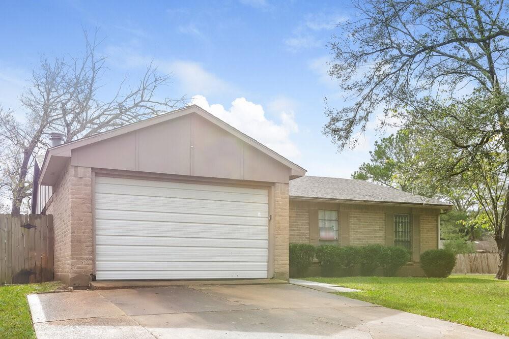
14602 Flair Dr
Houston, TX 77049
Favorites
-
Bedrooms
3
-
Bathrooms
2
-
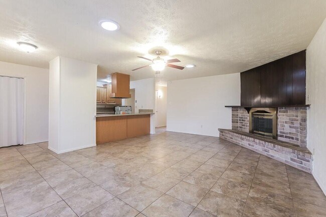
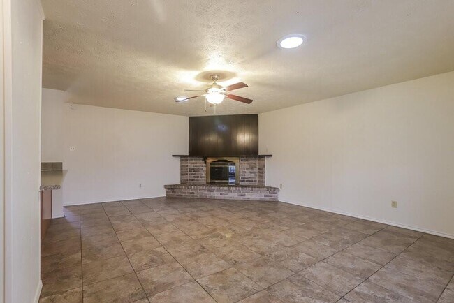
Square Feet
1,752 sq ft
14602 Flair Dr

Favorites
Contact
- Listed by Locayt
Location
Get Directions
Characterized by thick woods and a variety of home prices and styles, North Shore sits on top of the Houston Ship Channel east of Loop 610. Located a 19-minute drive and about 11 miles northeast of Downtown, this primarily residential area straddles Interstate 10.
A number of smaller communities make up this neighborhood, including Songwood, Holiday Forest, Wood Bayou, Cimarron, Home Owned Estates, Woodland Acres, Hidden Forest, and Greens Bayou. Many of these areas contain mid-century ranch-style homes.
The Galena Park and Houston Independent School Districts serve the area, with neighborhoods east of Greens Bayou and south of Market Street falling under Galena Park, while the rest lie in Houston ISD. North Shore residents enjoy close proximity to the sprawling Herman Brown Park, a major nature area and recreational facility.
Learn more about living in North Shore
Education
| Colleges & Universities | Distance | ||
|---|---|---|---|
| Colleges & Universities | Distance | ||
| Drive: | 6 min | 2.2 mi | |
| Drive: | 19 min | 12.1 mi | |
| Drive: | 25 min | 14.0 mi | |
| Drive: | 27 min | 15.5 mi |
14602 Flair Dr is within 6 minutes or 2.2 miles from San Jacinto College, North. It is also near Univ. of Houston, Downtown and University of Houston.
Transportation options available in Houston include Cesar Chavez / 67Th St Eb, located 10.9 miles from 14602 Flair Dr. 14602 Flair Dr is near William P Hobby, located 17.8 miles or 33 minutes away, and George Bush Intcntl/Houston, located 22.8 miles or 30 minutes away.
| Transit / Subway | Distance | ||
|---|---|---|---|
| Transit / Subway | Distance | ||
| Drive: | 18 min | 10.9 mi | |
| Drive: | 19 min | 11.0 mi | |
| Drive: | 19 min | 11.0 mi | |
| Drive: | 18 min | 11.1 mi | |
| Drive: | 19 min | 11.7 mi |
| Commuter Rail | Distance | ||
|---|---|---|---|
| Commuter Rail | Distance | ||
|
|
Drive: | 21 min | 12.8 mi |
| Airports | Distance | ||
|---|---|---|---|
| Airports | Distance | ||
|
William P Hobby
|
Drive: | 33 min | 17.8 mi |
|
George Bush Intcntl/Houston
|
Drive: | 30 min | 22.8 mi |
Getting Around
 What do Walkability, Transit, Drivability, and Bikeability mean?
Walkability measures the walking distance to day-to-day needs.
Transit measures access to public transportation.
Drivability measures congestion, parking availability, and access to major roads.
Bikeability measures the suitability for cycling.
How It Works
What do Walkability, Transit, Drivability, and Bikeability mean?
Walkability measures the walking distance to day-to-day needs.
Transit measures access to public transportation.
Drivability measures congestion, parking availability, and access to major roads.
Bikeability measures the suitability for cycling.
How It Works
Fairly Walkable
Walkability
40
/ 100
Minimal Public Transit
Transit
0
/ 100
Very Drivable
Drivability
80
/ 100
Somewhat Bikeable
Bikeability
30
/ 100
Scores provided by
-
Soundscore™
-
/ 100
Traffic
-Airport
-Businesses
-Scores provided by
HowLoud What is a Sound Score Rating? A Sound Score Rating aggregates noise caused by vehicle traffic, airplane traffic and local sources. How It WorksTime and distance from 14602 Flair Dr.
| Shopping Centers | Distance | ||
|---|---|---|---|
| Shopping Centers | Distance | ||
| Drive: | 3 min | 1.2 mi | |
| Drive: | 4 min | 1.6 mi | |
| Drive: | 4 min | 1.7 mi |
14602 Flair Dr has 3 shopping centers within 1.7 miles, which is about a 4-minute drive. The miles and minutes will be for the farthest away property.
| Parks and Recreation | Distance | ||
|---|---|---|---|
| Parks and Recreation | Distance | ||
|
Gene Green All-Inclusive Park
|
Drive: | 9 min | 3.7 mi |
|
Sheldon Lake State Park
|
Drive: | 17 min | 10.4 mi |
|
San Jacinto Battleground State Historic Site
|
Drive: | 29 min | 16.8 mi |
14602 Flair Dr has 3 parks within 16.8 miles, including Gene Green All-Inclusive Park, Sheldon Lake State Park, and San Jacinto Battleground State Historic Site.
| Hospitals | Distance | ||
|---|---|---|---|
| Hospitals | Distance | ||
| Drive: | 9 min | 4.2 mi |
14602 Flair Dr is 4.2 miles and a 9 minute drive from Ad Hospital East.
| Military Bases | Distance | ||
|---|---|---|---|
| Military Bases | Distance | ||
| Drive: | 43 min | 24.9 mi | |
| Drive: | 73 min | 54.6 mi |
14602 Flair Dr is 24.9 miles from Lyndon B Johnson Space Center, and is convenient to other military bases, including Pelican Spit Military Reservation.
You May Also Like
Similar Rentals Nearby


What Are Walk Score®, Transit Score®, and Bike Score® Ratings?
Walk Score® measures the walkability of any address. Transit Score® measures access to public transit. Bike Score® measures the bikeability of any address.
What is a Sound Score Rating?
A Sound Score Rating aggregates noise caused by vehicle traffic, airplane traffic and local sources.
14602 Flair Dr
Houston, TX 77049