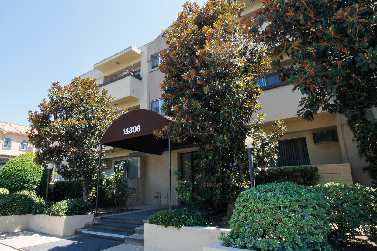
14306 Riverside Dr
14306 Riverside Dr,
Los Angeles,
CA
91423
-
Monthly Rent
$2,175 - $2,795
-
Bedrooms
1 - 2 bd
-
Bathrooms
1 - 2 ba
-
Square Feet
900 - 1,100 sq ft
Nestled just off Ventura Blvd, you'll be minutes from the Sherman Oaks Galleria, around the corner from Westfield Sherman Oaks Fashion Square Mall, trendy cafes, top-rated restaurants, and the brand new Trader Joe’s—perfect for easy grocery runs or a quick coffee stop. Plus, Whole Foods, Ralphs, and other essentials are just around the corner.
Highlights
- Security System
- Elevator
- Balcony
Pricing & Floor Plans
-
Unit 102price $2,175square feet 900availibility Now
-
Unit 102price $2,175square feet 900availibility Now
Fees and Policies
The fees listed below are community-provided and may exclude utilities or add-ons. All payments are made directly to the property and are non-refundable unless otherwise specified. Use the Cost Calculator to determine costs based on your needs.
-
One-Time Basics
-
Due at Application
-
Application Fee Per ApplicantCharged per applicant.$49
-
-
Due at Application
-
Covered
Property Fee Disclaimer: Based on community-supplied data and independent market research. Subject to change without notice. May exclude fees for mandatory or optional services and usage-based utilities.
Details
Utilities Included
-
Water
-
Trash Removal
Lease Options
-
12 mo
Property Information
-
Built in 1963
-
14 units/2 stories
About 14306 Riverside Dr Los Angeles, CA 91423
Nestled just off Ventura Blvd, you'll be minutes from the Sherman Oaks Galleria, around the corner from Westfield Sherman Oaks Fashion Square Mall, trendy cafes, top-rated restaurants, and the brand new Trader Joe’s—perfect for easy grocery runs or a quick coffee stop. Plus, Whole Foods, Ralphs, and other essentials are just around the corner.
14306 Riverside Dr is an apartment community located in Los Angeles County and the 91423 ZIP Code. This area is served by the Los Angeles Unified Rocp School District attendance zone.
Contact
Community Amenities
Laundry Facilities
Elevator
Recycling
Security System
- Laundry Facilities
- Security System
- Recycling
- Elevator
- Courtyard
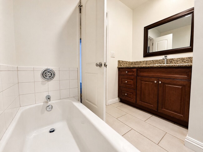
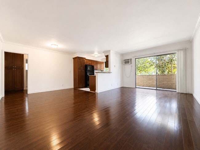
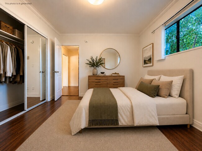
Apartment Features
High Speed Internet Access
Smoke Free
Oven
Range
- High Speed Internet Access
- Smoke Free
- Storage Space
- Oven
- Range
- Quartz Countertops
- Vinyl Flooring
- Balcony
Los Angeles sprawls across nearly 500 square miles between the Pacific Ocean and the San Gabriel Mountains, making it one of the few places where you can surf in the morning and hike through chaparral-covered hills by afternoon. Sunshine, open-air farmers markets, and a food scene that pulls from dozens of culinary traditions are a staple of living in the city.
Neighborhoods each have a distinct personality surrounding a particular focus, whether it be culture or nature. Westwood keeps residents close to entertainment at UCLA and the Hammer Museum's rotating art exhibitions. Koreatown is a cultural and food destination, known for authentic restaurants and shops paired with a bustling street energy and nightlife.
The city overflows with iconic landmarks, from natural to man-made. Griffith Park, one of the largest urban parks in the country, offers hiking trails, sweeping skyline views, and the iconic Griffith Observatory.
Learn more about living in Los Angeles- Laundry Facilities
- Security System
- Recycling
- Elevator
- Courtyard
- High Speed Internet Access
- Smoke Free
- Storage Space
- Oven
- Range
- Quartz Countertops
- Vinyl Flooring
- Balcony
| Monday | 12am - 12am |
|---|---|
| Tuesday | 12am - 12am |
| Wednesday | 12am - 12am |
| Thursday | 12am - 12am |
| Friday | 12am - 12am |
| Saturday | 12am - 12am |
| Sunday | 12am - 12am |
| Colleges & Universities | Distance | ||
|---|---|---|---|
| Colleges & Universities | Distance | ||
| Drive: | 7 min | 3.4 mi | |
| Drive: | 10 min | 6.7 mi | |
| Drive: | 16 min | 9.9 mi | |
| Drive: | 22 min | 11.0 mi |


View GreatSchools Rating Methodology
Data provided by GreatSchools.org © 2026. All rights reserved.
Transportation options available in Los Angeles include North Hollywood Station, located 5.1 miles from 14306 Riverside Dr. 14306 Riverside Dr is near Bob Hope, located 7.9 miles or 14 minutes away, and Los Angeles International, located 19.3 miles or 28 minutes away.
| Transit / Subway | Distance | ||
|---|---|---|---|
| Transit / Subway | Distance | ||
|
|
Drive: | 8 min | 5.1 mi |
|
|
Drive: | 9 min | 5.8 mi |
|
|
Drive: | 13 min | 8.7 mi |
|
|
Drive: | 13 min | 9.0 mi |
|
|
Drive: | 18 min | 12.3 mi |
| Commuter Rail | Distance | ||
|---|---|---|---|
| Commuter Rail | Distance | ||
|
|
Drive: | 8 min | 4.3 mi |
|
|
Drive: | 14 min | 7.9 mi |
| Drive: | 15 min | 8.8 mi | |
|
|
Drive: | 15 min | 8.8 mi |
|
|
Drive: | 17 min | 10.1 mi |
| Airports | Distance | ||
|---|---|---|---|
| Airports | Distance | ||
|
Bob Hope
|
Drive: | 14 min | 7.9 mi |
|
Los Angeles International
|
Drive: | 28 min | 19.3 mi |
Scores provided by
Traffic
-Airport
-Businesses
-Scores provided by
HowLoud What is a Sound Score Rating? A Sound Score Rating aggregates noise caused by vehicle traffic, airplane traffic and local sources. How It WorksTime and distance from 14306 Riverside Dr.
| Shopping Centers | Distance | ||
|---|---|---|---|
| Shopping Centers | Distance | ||
| Walk: | 10 min | 0.5 mi | |
| Walk: | 12 min | 0.6 mi | |
| Walk: | 14 min | 0.7 mi |
| Parks and Recreation | Distance | ||
|---|---|---|---|
| Parks and Recreation | Distance | ||
|
The Japanese Garden
|
Drive: | 6 min | 3.4 mi |
|
Los Encinos State Historic Park
|
Drive: | 6 min | 3.7 mi |
|
Sepulveda Basin Wildlife Reserve
|
Drive: | 10 min | 3.8 mi |
|
Skirball Cultural Center
|
Drive: | 9 min | 5.4 mi |
|
Sooky Goldman Nature Center
|
Drive: | 15 min | 5.4 mi |
| Hospitals | Distance | ||
|---|---|---|---|
| Hospitals | Distance | ||
| Walk: | 8 min | 0.4 mi | |
| Drive: | 5 min | 3.0 mi | |
| Drive: | 7 min | 3.6 mi |
| Military Bases | Distance | ||
|---|---|---|---|
| Military Bases | Distance | ||
| Drive: | 28 min | 21.9 mi | |
| Drive: | 50 min | 38.7 mi | |
| Drive: | 53 min | 40.9 mi |
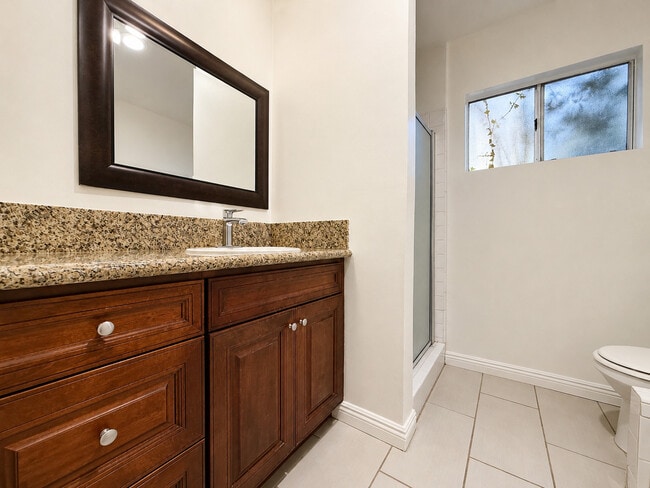
14306 Riverside Dr Photos
Nearby Apartments
Within 50 Miles of 14306 Riverside Dr Los Angeles, CA 91423
-
Windward Isle
14543 Burbank Blvd
Sherman Oaks, CA 91411
$2,495 - $2,545
2 Br 1.1 mi
-
Aspire Apartments
9131 Darby Ave
Northridge, CA 91325
$2,395 - $3,695
1-2 Br 7.5 mi
-
Campus Crossing Apartments
9151 Darby Ave
Northridge, CA 91325
$2,395 - $3,125
1-2 Br 7.5 mi
-
Maravilla Apartments at CSUN
18418 Dearborn St
Northridge, CA 91325
$2,995 - $3,475
2 Br 7.5 mi
-
Chateau Dearborn
18415 Dearborn St
Northridge, CA 91325
$2,295 - $2,895
1-2 Br 7.6 mi
-
Northpoint Apartments at CSUN
9850 Zelzah Ave
Northridge, CA 91325
$2,795 - $2,935
2 Br 7.8 mi
While 14306 Riverside Dr does not provide in‑unit laundry, on‑site laundry facilities are available for shared resident use.
Select utilities are included in rent at 14306 Riverside Dr, including water and trash removal. Residents are responsible for any other utilities not listed.
Parking is available at 14306 Riverside Dr. Contact this property for details.
14306 Riverside Dr has one to two-bedrooms with rent ranges from $2,175/mo. to $2,795/mo.
14306 Riverside Dr does not allow pets, though service animals are always welcome in accordance with applicable laws.
A good rule of thumb is to spend no more than 30% of your gross income on rent. Based on the lowest available rent of $2,175 for a one-bedroom, you would need to earn about $87,000 per year to qualify. Want to double-check your budget? Calculate how much rent you can afford with our Rent Affordability Calculator.
14306 Riverside Dr is not currently offering any rent specials. Check back soon, as promotions change frequently.
While 14306 Riverside Dr does not offer Matterport 3D tours, renters can request a tour directly through our online platform.

14306 Riverside Dr
Los Angeles, CA 91423
Property Manager Responded