
Rogers Park Apartments
2000-2006 W Fargo Ave,
Chicago, IL 60645
$1,750 - $1,800
2 Beds
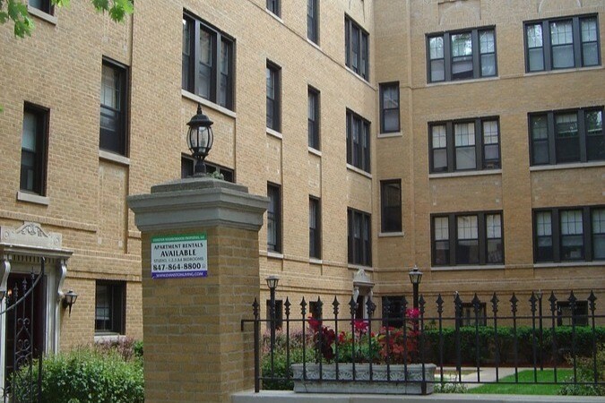
3 Story Vintage walk up property located directly across from Northwestern Ryan Field football stadium 1 bedroom and 2 bedroom apartments with hardwood floors and granite style finishes Heat, water and trash included Dogs and Cats are welcomed, 40 lb weight limit Limited parking spaces 2 block walk to Metro and Purple line, short distance to North Shore Hospital and within a mile to grocery shopping No Security Deposit
1416 Central Ave is an apartment community located in Cook County and the 60201 ZIP Code. This area is served by the Evanston Central Consolidated School District 65 attendance zone.
Unique Features
Laundry Facilities
Controlled Access
Recycling
24 Hour Access
Air Conditioning
Dishwasher
Hardwood Floors
Walk-In Closets
Located along Lake Michigan's shoreline just north of Chicago, Evanston combines city convenience with tree-lined neighborhoods. Home to Northwestern University, this city of 78,110 residents offers a rich cultural scene and strong educational heritage. The downtown area near the Davis Street Metra and CTA stations features independent shops and restaurants. Current rental rates show one-bedroom apartments averaging $1,823 per month and two-bedroom units at $2,437, reflecting a year-over-year increase of 2.1% and 1.7% respectively.
Evanston's outdoor spaces include several Lake Michigan beaches, the Ladd Arboretum, and parks throughout its neighborhoods. The Grosse Point Lighthouse, a National Historic Landmark, stands as a reminder of the city's maritime history. Housing options include newer developments downtown, classic apartments near campus, and residences along Central Street and the Main-Dempster Mile.
Learn more about living in Evanston| Colleges & Universities | Distance | ||
|---|---|---|---|
| Colleges & Universities | Distance | ||
| Drive: | 4 min | 1.6 mi | |
| Drive: | 11 min | 5.7 mi | |
| Drive: | 12 min | 6.3 mi | |
| Drive: | 15 min | 7.0 mi |


Transportation options available in Evanston include Central Station (Purple Line), located 0.3 mile from 1416 Central Ave. 1416 Central Ave is near Chicago O'Hare International, located 14.9 miles or 28 minutes away, and Chicago Midway International, located 26.3 miles or 40 minutes away.
| Transit / Subway | Distance | ||
|---|---|---|---|
| Transit / Subway | Distance | ||
|
|
Walk: | 6 min | 0.3 mi |
|
|
Walk: | 16 min | 0.8 mi |
|
|
Walk: | 16 min | 0.9 mi |
|
|
Drive: | 2 min | 1.4 mi |
|
|
Drive: | 3 min | 1.9 mi |
| Commuter Rail | Distance | ||
|---|---|---|---|
| Commuter Rail | Distance | ||
|
|
Walk: | 7 min | 0.4 mi |
|
|
Drive: | 2 min | 1.4 mi |
|
|
Drive: | 3 min | 1.8 mi |
|
|
Drive: | 4 min | 2.2 mi |
|
|
Drive: | 5 min | 3.0 mi |
| Airports | Distance | ||
|---|---|---|---|
| Airports | Distance | ||
|
Chicago O'Hare International
|
Drive: | 28 min | 14.9 mi |
|
Chicago Midway International
|
Drive: | 40 min | 26.3 mi |
Scores provided by
Traffic
-Airport
-Businesses
-Scores provided by
HowLoud What is a Sound Score Rating? A Sound Score Rating aggregates noise caused by vehicle traffic, airplane traffic and local sources. How It WorksTime and distance from 1416 Central Ave.
| Shopping Centers | Distance | ||
|---|---|---|---|
| Shopping Centers | Distance | ||
| Walk: | 16 min | 0.9 mi | |
| Drive: | 3 min | 1.7 mi | |
| Drive: | 3 min | 1.8 mi |
| Parks and Recreation | Distance | ||
|---|---|---|---|
| Parks and Recreation | Distance | ||
|
Grosse Point Lighthouse
|
Walk: | 15 min | 0.8 mi |
|
Dearborn Observatory
|
Drive: | 2 min | 1.2 mi |
|
Ladd Arboretum and Evanston Ecology Center
|
Drive: | 3 min | 1.2 mi |
|
Shakespeare Garden
|
Drive: | 2 min | 1.3 mi |
|
Merrick Rose Garden
|
Drive: | 3 min | 2.0 mi |
| Hospitals | Distance | ||
|---|---|---|---|
| Hospitals | Distance | ||
| Walk: | 9 min | 0.5 mi | |
| Drive: | 5 min | 3.3 mi | |
| Drive: | 13 min | 7.1 mi |
| Military Bases | Distance | ||
|---|---|---|---|
| Military Bases | Distance | ||
| Drive: | 29 min | 16.4 mi | |
| Drive: | 31 min | 22.7 mi |
What Are Walk Score®, Transit Score®, and Bike Score® Ratings?
Walk Score® measures the walkability of any address. Transit Score® measures access to public transit. Bike Score® measures the bikeability of any address.
What is a Sound Score Rating?
A Sound Score Rating aggregates noise caused by vehicle traffic, airplane traffic and local sources.

1416-1422 Central St
Evanston, IL 60201


