

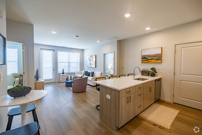
$2,150 / Month
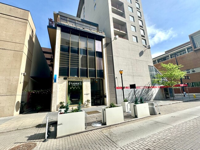
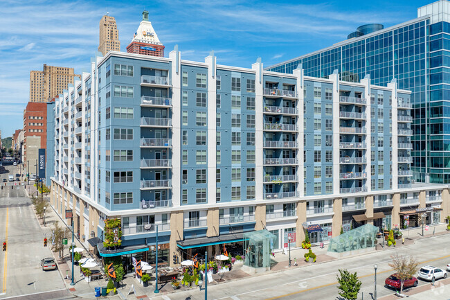
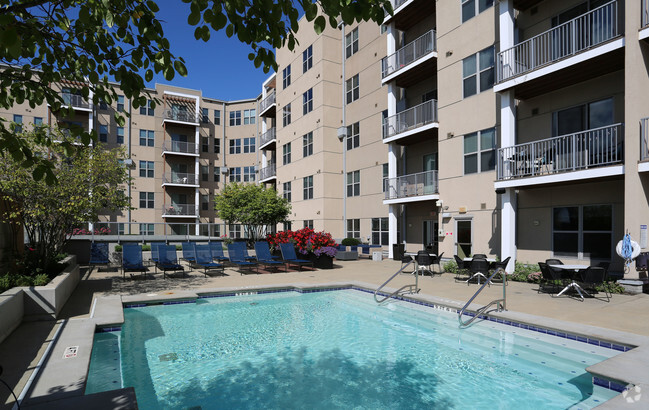
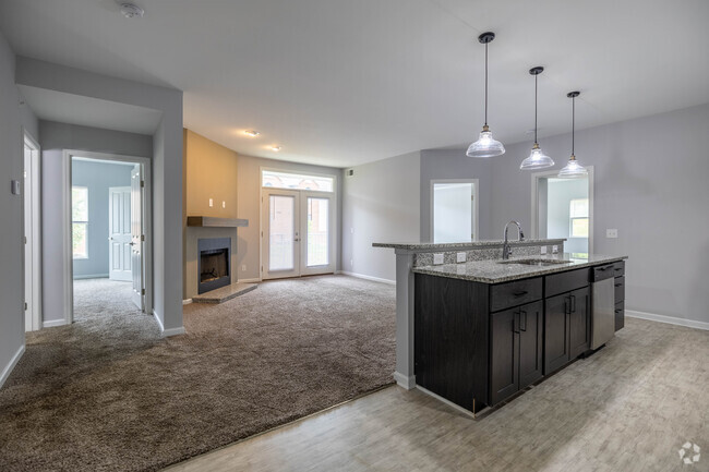
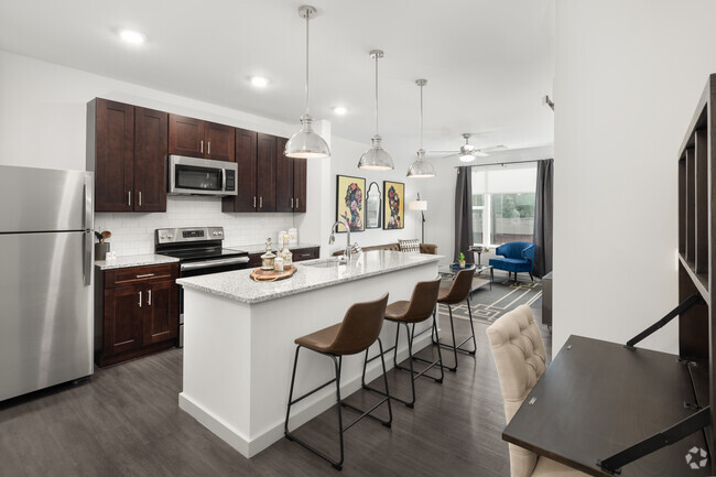
14 Garfield Pl Unit 2
Cincinnati, OH 45202
Today
Favorites
513-417-3729
-
Bedrooms
2
-
Bathrooms
2
-
Square Feet
1,662 sq ft
-
Available
Available Jun 1
14 Garfield Pl Unit 2

Favorites
Contact
- Listed by Panthera Property Consultants | Panthera Property Consultants
- Phone Number
- Contact
Location
Get Directions
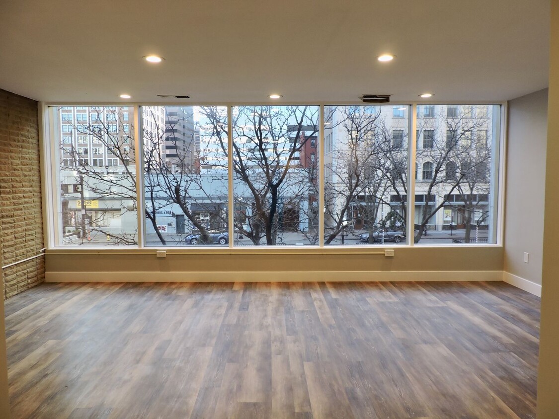
Cincinnati’s City Center is the central business district of this thriving metropolis. It’s home to an array of entertainment options, from the Taft Theatre to Fountain Square. Although Cincinnati is a major metro area, City Center is rather quiet for a downtown district. It has a quaint charm to it that’s adored by residents. Locals appreciate the variety of apartments available in the area, ranging from affordable to upscale. City Center features views of the Ohio River and is home to several stadiums, including the Great American Ball Park and Paul Brown Stadium. Light rail stations can be found along all major streets in City Center, making commuting simple. For additional travel benefits, Cincinnati’s City Center offers proximity to Interstates 75, 71, and 471.
Learn more about living in City Center
Education
| Colleges & Universities | Distance | ||
|---|---|---|---|
| Colleges & Universities | Distance | ||
| Drive: | 7 min | 2.4 mi | |
| Drive: | 8 min | 2.7 mi | |
| Drive: | 11 min | 4.8 mi | |
| Drive: | 12 min | 4.9 mi |
14 Garfield Pl Unit 2 is within 7 minutes or 2.4 miles from University of Cincinnati. It is also near Univ. of Cincinnati, Medical and Cincinnati State.
Transportation options available in Cincinnati include Public Library Station, 9Th & Walnut, located 0.1 mile from 14 Garfield Pl Unit 2. 14 Garfield Pl Unit 2 is near Cincinnati/Northern Kentucky International, located 14.4 miles or 27 minutes away.
| Transit / Subway | Distance | ||
|---|---|---|---|
| Transit / Subway | Distance | ||
| Walk: | 2 min | 0.1 mi | |
| Walk: | 3 min | 0.2 mi | |
| Walk: | 4 min | 0.2 mi | |
| Walk: | 4 min | 0.2 mi | |
| Walk: | 5 min | 0.3 mi |
| Commuter Rail | Distance | ||
|---|---|---|---|
| Commuter Rail | Distance | ||
|
|
Drive: | 5 min | 1.6 mi |
| Airports | Distance | ||
|---|---|---|---|
| Airports | Distance | ||
|
Cincinnati/Northern Kentucky International
|
Drive: | 27 min | 14.4 mi |
Time and distance from 14 Garfield Pl Unit 2.
| Shopping Centers | Distance | ||
|---|---|---|---|
| Shopping Centers | Distance | ||
| Walk: | 5 min | 0.3 mi | |
| Drive: | 4 min | 1.3 mi | |
| Drive: | 5 min | 1.8 mi |
14 Garfield Pl Unit 2 has 3 shopping centers within 1.8 miles, which is about a 5-minute walk. The miles and minutes will be for the farthest away property.
| Parks and Recreation | Distance | ||
|---|---|---|---|
| Parks and Recreation | Distance | ||
|
John G. & Phyllis W. Smale Riverfront Park
|
Walk: | 18 min | 0.9 mi |
|
William H. Taft National Historic Site
|
Drive: | 4 min | 1.3 mi |
|
OMNIMAX Theater
|
Drive: | 5 min | 1.6 mi |
|
Theodore M. Berry Friendship Park
|
Drive: | 5 min | 1.7 mi |
|
Newport Aquarium
|
Drive: | 6 min | 1.9 mi |
14 Garfield Pl Unit 2 has 5 parks within 1.9 miles, including John G. & Phyllis W. Smale Riverfront Park, William H. Taft National Historic Site, and Theodore M. Berry Friendship Park.
| Hospitals | Distance | ||
|---|---|---|---|
| Hospitals | Distance | ||
| Drive: | 5 min | 1.4 mi | |
| Drive: | 8 min | 3.0 mi | |
| Drive: | 8 min | 3.1 mi |
14 Garfield Pl Unit 2 has 3 hospitals within 3.1 miles, the nearest is Christ Hospital which is 1.4 miles away and a 5 minute drive.
| Military Bases | Distance | ||
|---|---|---|---|
| Military Bases | Distance | ||
| Drive: | 72 min | 55.3 mi | |
| Drive: | 78 min | 60.3 mi | |
| Drive: | 80 min | 63.6 mi |
14 Garfield Pl Unit 2 has 3 military bases within 63.6 miles, the nearest is Gentile Air Force Station which is 55.3 miles away and a 72 minute drive.
You May Also Like
Similar Rentals Nearby


What Are Walk Score®, Transit Score®, and Bike Score® Ratings?
Walk Score® measures the walkability of any address. Transit Score® measures access to public transit. Bike Score® measures the bikeability of any address.
What is a Sound Score Rating?
A Sound Score Rating aggregates noise caused by vehicle traffic, airplane traffic and local sources
14 Garfield Pl
Cincinnati, OH 45202