$2,350
/ Month
13901 King George Way
Upper Marlboro, MD 20772
2 Weeks Ago
Favorites
13901 King George Way

Favorites
Check Back Soon for Upcoming Availability
| Beds | Baths | Average SF |
|---|---|---|
| 2 Bedrooms 2 Bedrooms 2 Br | 1.5 Baths 1.5 Baths 1.5 Ba | — |
About This Property
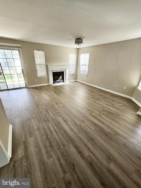
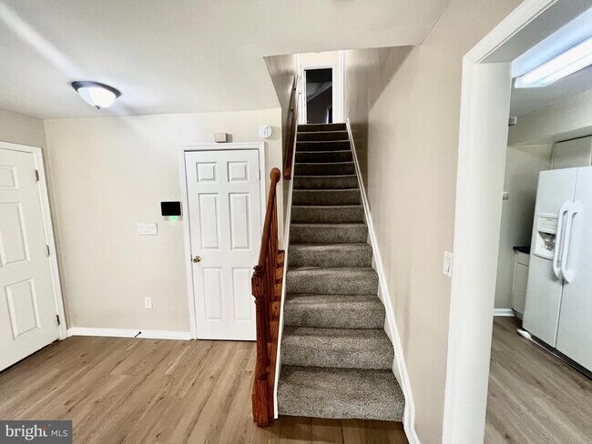
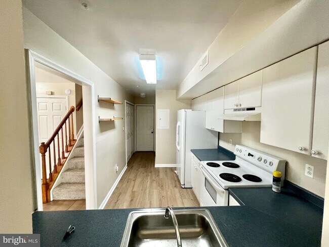
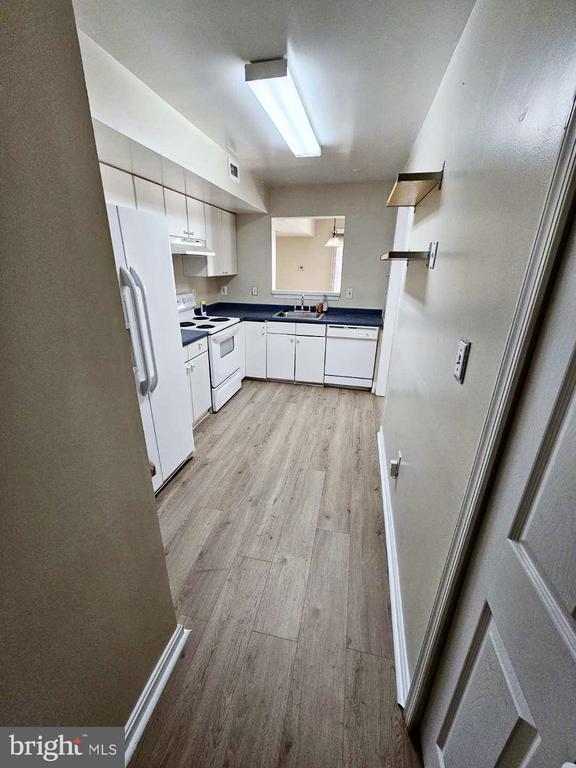
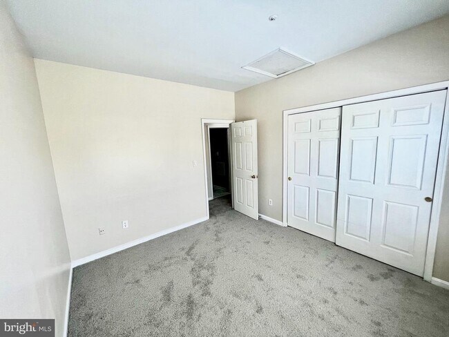
Welcome home! Here is your wonderful opportunity to rent a nicely maintained 2 bedroom 1.5 bath Condo nestled in a desired Upper Marlboro neighborhood with a one-car garage. This home comes with hardwood floors. on main level, open foyer, living room, and dining room. The second level offers 2 large bedrooms, both with spacious closets. Immediate occupancy! Located minutes from Andrews Air Force Base, UM Capital Region Medical Center, Washington, D.C., National Harbor, Baltimore, Annapolis, and retail, dining, and entertainment outlets.
13901 King George Way is a townhome located in Prince George's County and the 20772 ZIP Code. This area is served by the Prince George's County Public Schools attendance zone.
Townhome Features
- Fireplace
Location
Get Directions
Popularly known as a government district in Prince George’s County in the state of Maryland, Upper Marlboro offers residents a small-town vibe. Lined with an assortment of businesses, Main Street provides immediate access to the courthouse and county administrative building.
You'll find a combination of busy thoroughfares within the city and a quiet atmosphere in the residential suburbs. To the west of downtown are residential homes on quiet streets with mostly single-family homes, parks, and civic centers. Take a short walk from Main Street to access the Prince George’s County Public system. Aside from the few grocery stores and big-box retailers, the rural nature of the area is the biggest draw for residents. But it also means you might have to head to surrounding areas for more shopping and restaurant options.
Learn more about living in Greater Upper MarlboroBelow are rent ranges for similar nearby apartments
Amenities
- Fireplace
Education
| Colleges & Universities | Distance | ||
|---|---|---|---|
| Colleges & Universities | Distance | ||
| Drive: | 16 min | 6.9 mi | |
| Drive: | 19 min | 9.7 mi | |
| Drive: | 30 min | 17.3 mi | |
| Drive: | 29 min | 17.6 mi |
13901 King George Way is within 16 minutes or 6.9 miles from Prince George's Comm. Coll.. It is also near Univ. of Md. Univ. Coll. and Gallaudet University.
Schools


Public Elementary School
Grades PK-5
746 Students
Attendance Zone
Public Middle School
Grades 6-8
873 Students
Attendance Zone
Public High School
Grades 9-12
2,257 Students
Attendance Zone
Private Elementary & Middle School
Grades PK-8
215 Students
Nearby
Private Middle & High School
Grades 6-12
120 Students
Nearby
School data provided by
 The GreatSchools Rating helps parents compare schools within a state based on a variety of school quality indicators and provides a helpful picture of how effectively each school serves all of its students. Ratings are on a scale of 1 (below average) to 10 (above average) and can include test scores, college readiness, academic progress, advanced courses, equity, discipline and attendance data. We also advise parents to visit schools, consider other information on school performance and programs, and consider family needs as part of the school selection process.
View GreatSchools Rating Methodology
Data provided by GreatSchools.org © 2025. All rights reserved.
View GreatSchools Rating Methodology
Data provided by GreatSchools.org © 2025. All rights reserved.
Transportation options available in Upper Marlboro include Morgan Boulevard, located 8.6 miles from 13901 King George Way. 13901 King George Way is near Ronald Reagan Washington Ntl, located 21.0 miles or 36 minutes away, and Baltimore/Washington International Thurgood Marshall, located 33.2 miles or 51 minutes away.
| Transit / Subway | Distance | ||
|---|---|---|---|
| Transit / Subway | Distance | ||
|
|
Drive: | 19 min | 8.6 mi |
|
|
Drive: | 19 min | 9.1 mi |
|
|
Drive: | 19 min | 9.7 mi |
|
Capitol Heights, Blue/Silver Line Center Platform
|
Drive: | 21 min | 10.5 mi |
|
|
Drive: | 20 min | 12.0 mi |
| Commuter Rail | Distance | ||
|---|---|---|---|
| Commuter Rail | Distance | ||
| Drive: | 25 min | 13.4 mi | |
|
|
Drive: | 25 min | 13.4 mi |
|
|
Drive: | 25 min | 13.7 mi |
|
|
Drive: | 31 min | 16.2 mi |
|
Bowie State Marc Sb
|
Drive: | 29 min | 17.6 mi |
| Airports | Distance | ||
|---|---|---|---|
| Airports | Distance | ||
|
Ronald Reagan Washington Ntl
|
Drive: | 36 min | 21.0 mi |
|
Baltimore/Washington International Thurgood Marshall
|
Drive: | 51 min | 33.2 mi |
Time and distance from 13901 King George Way.
| Shopping Centers | Distance | ||
|---|---|---|---|
| Shopping Centers | Distance | ||
| Walk: | 13 min | 0.7 mi | |
| Drive: | 6 min | 2.7 mi | |
| Drive: | 6 min | 2.7 mi |
13901 King George Way has 3 shopping centers within 2.7 miles, which is about a 6-minute walk. The miles and minutes will be for the farthest away property.
| Parks and Recreation | Distance | ||
|---|---|---|---|
| Parks and Recreation | Distance | ||
|
School House Pond
|
Drive: | 3 min | 1.5 mi |
|
Cheltenham Wetlands Park
|
Drive: | 7 min | 3.3 mi |
|
Watkins Nature Center
|
Drive: | 12 min | 7.3 mi |
|
Rosaryville State Park
|
Drive: | 15 min | 7.8 mi |
|
Mount Calvert Historical and Archaeological Park
|
Drive: | 23 min | 9.2 mi |
13901 King George Way has 5 parks within 9.2 miles, including School House Pond, Cheltenham Wetlands Park, and Watkins Nature Center.
| Hospitals | Distance | ||
|---|---|---|---|
| Hospitals | Distance | ||
| Drive: | 21 min | 11.1 mi |
13901 King George Way is 11.1 miles and a 21 minute drive from MedStar Southern Maryland Hospital Center.
| Military Bases | Distance | ||
|---|---|---|---|
| Military Bases | Distance | ||
| Drive: | 17 min | 9.4 mi | |
| Drive: | 27 min | 15.8 mi |
13901 King George Way is 9.4 miles from Andrews Airforce Base, and is convenient to other military bases, including Washington Navy Yard.
You May Also Like
Similar Rentals Nearby


What Are Walk Score®, Transit Score®, and Bike Score® Ratings?
Walk Score® measures the walkability of any address. Transit Score® measures access to public transit. Bike Score® measures the bikeability of any address.
What is a Sound Score Rating?
A Sound Score Rating aggregates noise caused by vehicle traffic, airplane traffic and local sources

13901 King George Way
Upper Marlboro, MD 20772