
Pacific Bay Vistas
2 Pacific Bay Cir,
San Bruno, CA 94066
$3,000 - $4,582 Total Monthly Price
Studio - 2 Beds
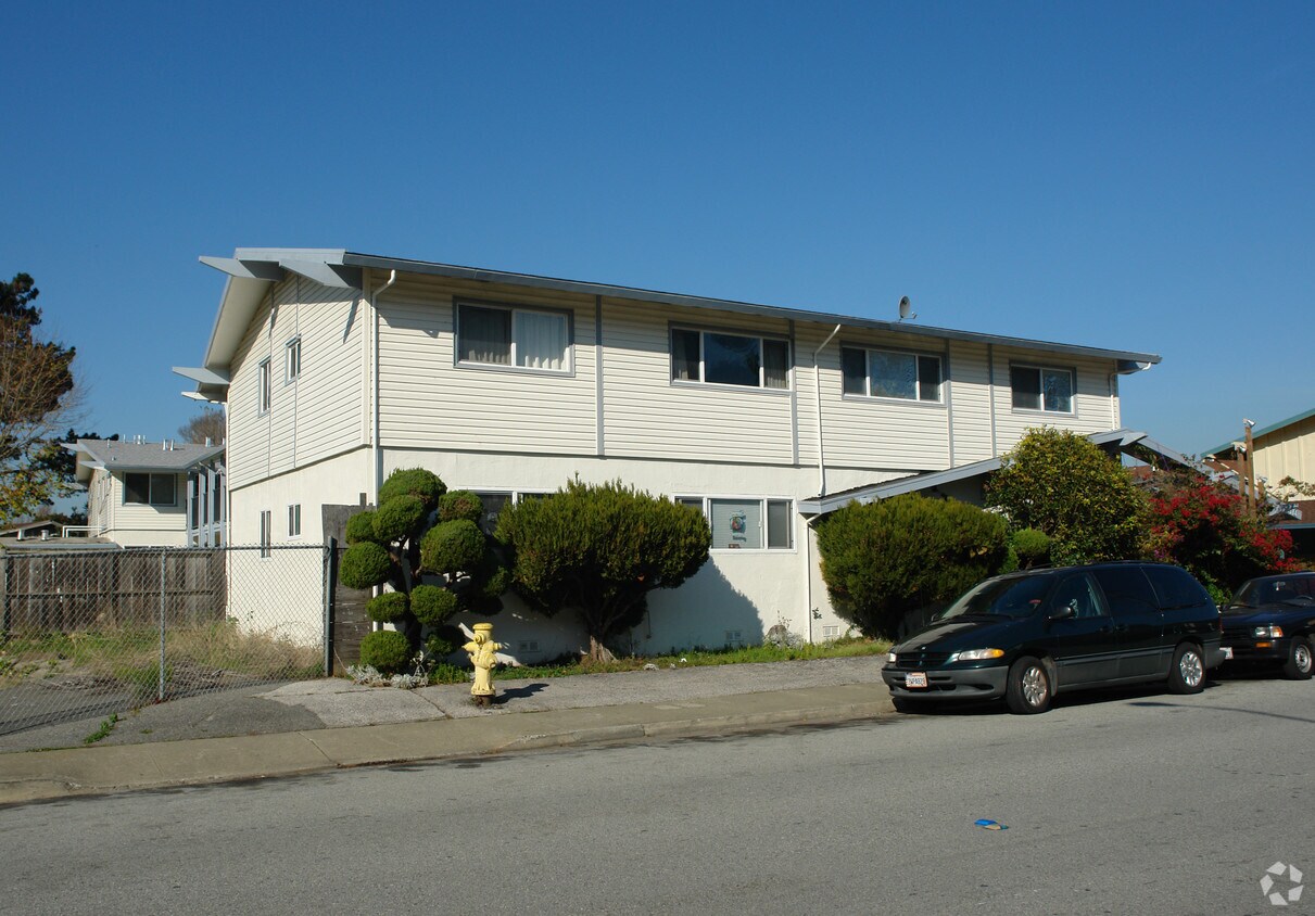
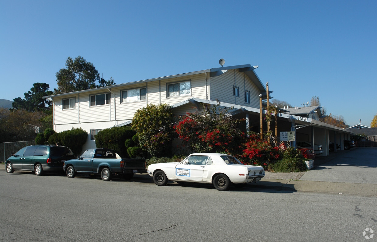

Thanks for your interest in 1384 Adobe Dr in Pacifica, CA. This property is situated in the Linda Mar area of Pacifica. From amenities to floor plan options, the professional leasing staff is ready to help you find your dream apartment. Experience a better way of living at 1384 Adobe Dr. Contact us or stop in to discuss your new apartment.
1384 Adobe Dr is an apartment community located in San Mateo County and the 94044 ZIP Code. This area is served by the Pacifica School District attendance zone.
Perched along the San Mateo County coastline between San Francisco and Half Moon Bay, Pacifica trades city noise for crashing waves and fog-laced hillsides. Daily life here revolves around the outdoors — whether that’s surfing at Rockaway Beach, hiking the trails of San Pedro Valley Park, or exploring the ridgelines of Sweeney Ridge, where an expedition first spotted San Francisco Bay in 1769. The arts scene punches above its weight for a city this size, with live music, theater, and gallery events throughout the year.
Shops and eateries are woven through Pacifica’s distinct pockets, including the beach-adjacent Rockaway Beach neighborhood and the more residential Sharp Park area. San Francisco is a quick 20-minute drive north on Interstate 280, putting a world-class city within easy reach for commuting and nights out.
Learn more about living in PacificaCompare neighborhood and city base rent averages by bedroom.
| Linda Mar | Pacifica, CA | |
|---|---|---|
| Studio | - | $2,883 |
| 1 Bedroom | $897 | $2,775 |
| 2 Bedrooms | $1,856 | $3,299 |
| 3 Bedrooms | $1,882 | $2,456 |
| Colleges & Universities | Distance | ||
|---|---|---|---|
| Colleges & Universities | Distance | ||
| Drive: | 12 min | 5.8 mi | |
| Drive: | 20 min | 11.7 mi | |
| Drive: | 19 min | 12.1 mi | |
| Drive: | 31 min | 20.0 mi |


Transportation options available in Pacifica include San Bruno Station, located 9.0 miles from 1384 Adobe Dr. 1384 Adobe Dr is near San Francisco International, located 12.0 miles or 23 minutes away, and Metro Oakland International, located 36.7 miles or 53 minutes away.
| Transit / Subway | Distance | ||
|---|---|---|---|
| Transit / Subway | Distance | ||
|
|
Drive: | 17 min | 9.0 mi |
|
|
Drive: | 20 min | 10.9 mi |
|
|
Drive: | 22 min | 11.5 mi |
|
|
Drive: | 22 min | 11.7 mi |
| Drive: | 22 min | 11.8 mi |
| Commuter Rail | Distance | ||
|---|---|---|---|
| Commuter Rail | Distance | ||
| Drive: | 17 min | 9.3 mi | |
| Drive: | 19 min | 9.9 mi | |
| Drive: | 23 min | 12.2 mi | |
| Drive: | 24 min | 13.9 mi | |
| Drive: | 26 min | 15.0 mi |
| Airports | Distance | ||
|---|---|---|---|
| Airports | Distance | ||
|
San Francisco International
|
Drive: | 23 min | 12.0 mi |
|
Metro Oakland International
|
Drive: | 53 min | 36.7 mi |
Scores provided by
Traffic
-Airport
-Businesses
-Scores provided by
HowLoud What is a Sound Score Rating? A Sound Score Rating aggregates noise caused by vehicle traffic, airplane traffic and local sources. How It WorksTime and distance from 1384 Adobe Dr.
| Shopping Centers | Distance | ||
|---|---|---|---|
| Shopping Centers | Distance | ||
| Walk: | 2 min | 0.1 mi | |
| Walk: | 18 min | 0.9 mi | |
| Walk: | 19 min | 1.0 mi |
| Parks and Recreation | Distance | ||
|---|---|---|---|
| Parks and Recreation | Distance | ||
|
San Pedro Valley Park
|
Drive: | 5 min | 1.5 mi |
|
Pacifica State Beach
|
Drive: | 6 min | 2.7 mi |
|
Gray Whale Cove State Beach
|
Drive: | 7 min | 3.4 mi |
|
Montara State Beach
|
Drive: | 9 min | 4.7 mi |
|
Fitzgerald Marine Reserve
|
Drive: | 13 min | 6.6 mi |
| Hospitals | Distance | ||
|---|---|---|---|
| Hospitals | Distance | ||
| Drive: | 16 min | 8.0 mi | |
| Drive: | 14 min | 8.3 mi | |
| Drive: | 21 min | 12.3 mi |
| Military Bases | Distance | ||
|---|---|---|---|
| Military Bases | Distance | ||
| Drive: | 31 min | 16.2 mi | |
| Drive: | 33 min | 16.3 mi | |
| Drive: | 49 min | 31.2 mi |
What Are Walk Score®, Transit Score®, and Bike Score® Ratings?
Walk Score® measures the walkability of any address. Transit Score® measures access to public transit. Bike Score® measures the bikeability of any address.
What is a Sound Score Rating?
A Sound Score Rating aggregates noise caused by vehicle traffic, airplane traffic and local sources.


